Ticker for May 15, 2018
MESONET TICKER ... MESONET TICKER ... MESONET TICKER ... MESONET TICKER ...
May 15, 2018       May 15, 2018       May 15, 2018       May 15, 2018


Why the dry?


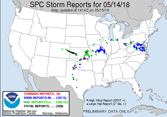
Mother Nature went SIS BOOM BA last night and things went a bit haywire. Nothing
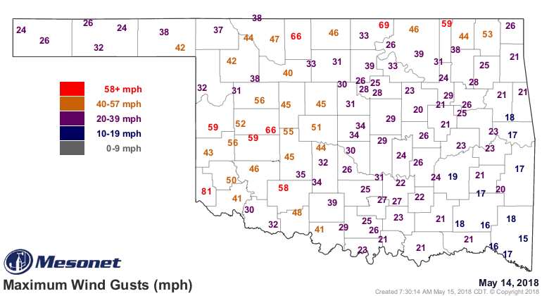
TOO bad, relatively speaking, but we did have some mighty powerful winds last
night that did some damage. The Mesonet topped out at 81mph in Hollis with a
storm that roared in last night. There were damage reports scattered about the
state, somewhat the norm for May. We got a bit lucky in that the twisters stayed
just to our north.


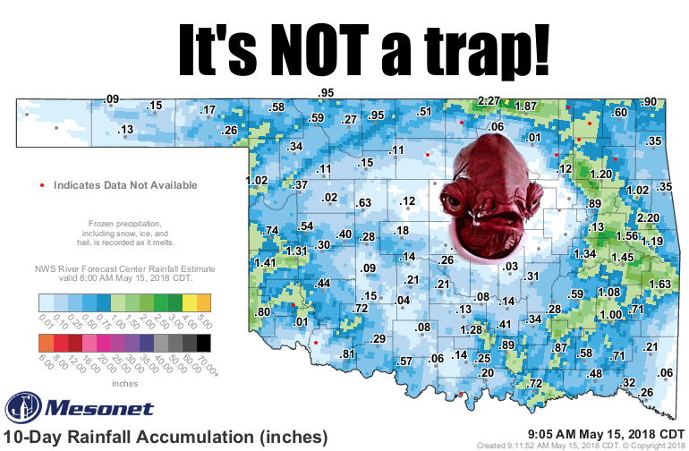
The good part is the rain, which continues to hit the driest parts of the state.
I know that doughnut hole looks a bit alarming on the 10-day rainfall map, and
last night's storms didn't help fill it in.


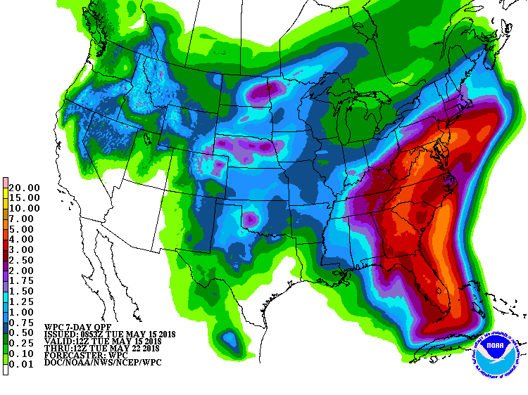
But it looks like there will be several more opportunities for rain over the next
week, if not longer, and that hole will likely start to disappear eventually.


That forecast is not a guarantee, of course. Yes, it will rain somewhere in the
state, and probably a bit too much in places. But when dealing with convective
precipitation (i.e., thunderstorms), it's tough to say just where those storms
are going to line up and start their march in whatever direction the winds
decide to take 'em.

Other than that...expect it to be more hot than mild.

Oh yeah, continue to concentrate all firepower on those Star Destroyers, if you
would.

Gary McManus
State Climatologist
Oklahoma Mesonet
Oklahoma Climatological Survey
(405) 325-2253
gmcmanus@mesonet.org
May 15 in Mesonet History
| Record | Value | Station | Year |
|---|---|---|---|
| Maximum Temperature | 104°F | GRA2 | 2022 |
| Minimum Temperature | 32°F | BOIS | 2011 |
| Maximum Rainfall | 5.38″ | KETC | 2020 |
Mesonet records begin in 1994.
Search by Date
If you're a bit off, don't worry, because just like horseshoes, “almost” counts on the Ticker website!