Ticker for April 9, 2018
MESONET TICKER ... MESONET TICKER ... MESONET TICKER ... MESONET TICKER ...
April 9, 2018 April 9, 2018 April 9, 2018 April 9, 2018
Here comes summer!
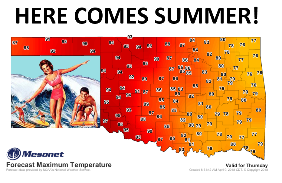
Some would say we deserve a bit of summer, given what occurred over the weekend...
the last two weekends, actually. A tough blow for the wheat crop I'm sure after
we saw some areas plunge into the teens for an extended period from Friday
through early yesterday.
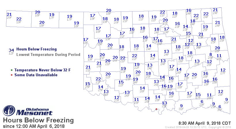
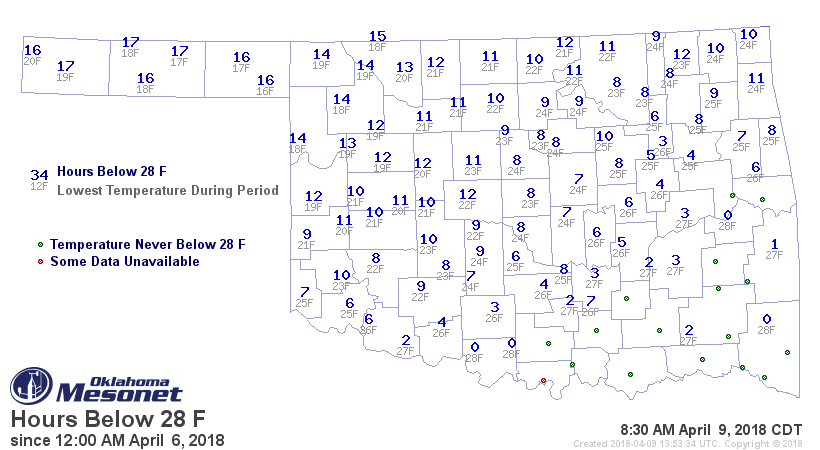
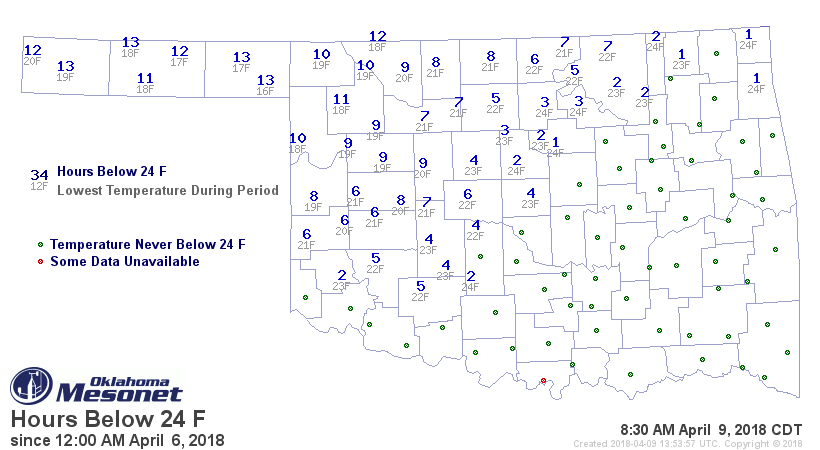
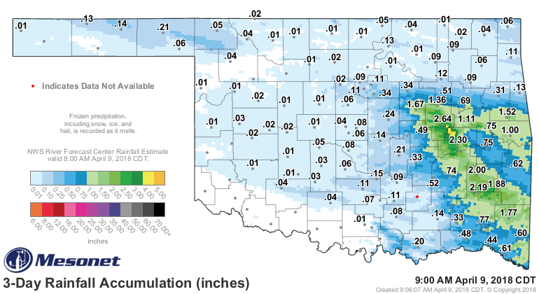
We had moisture...a very cold rain, freezing rain, sleet, a bit of snow, but not
enough to dampen the drought's impacts (pardon the pun). At least not in the
west where it mattered the most.
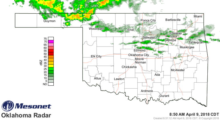
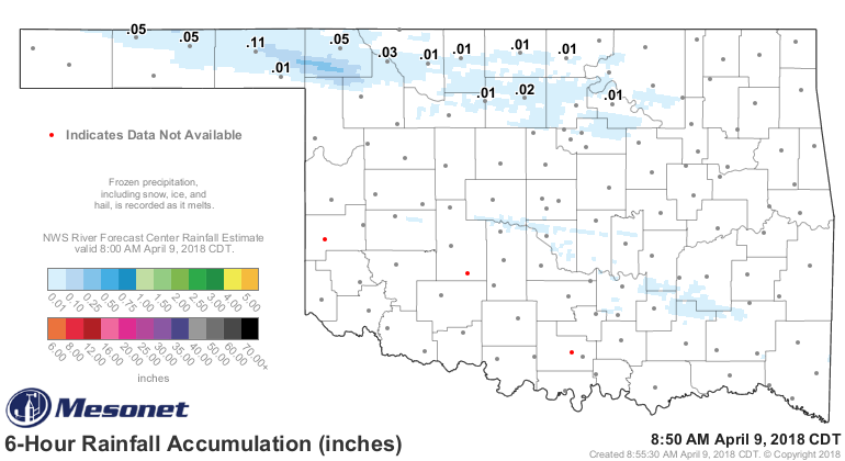
Same goes for the storms this morning up this way. It's welcome, but it ain't
gonna be enough.
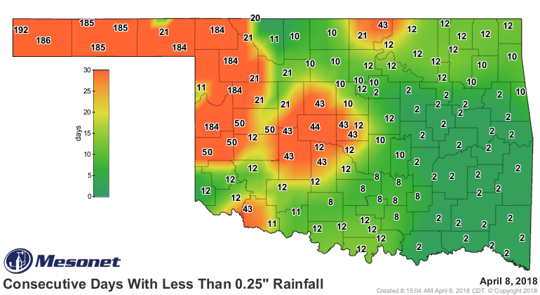
That's a dust-settler up in those parts that have gone half a year without
appreciable rainfall, at least in a single dose.
That brings us to this week, where conditions will return to summer after a
brief (way too brief?) brush with spring. By late this week, wildfire will be
the talk of the state as temperatures push into the 90s out west and the
humidity drops into "Blistex Medicated" on the chapped-lip scale.
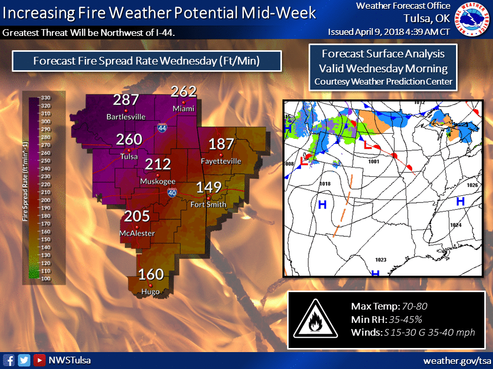
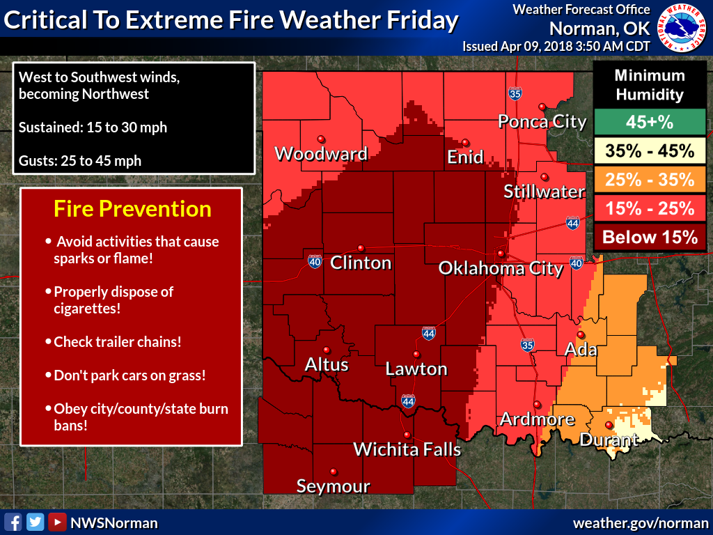
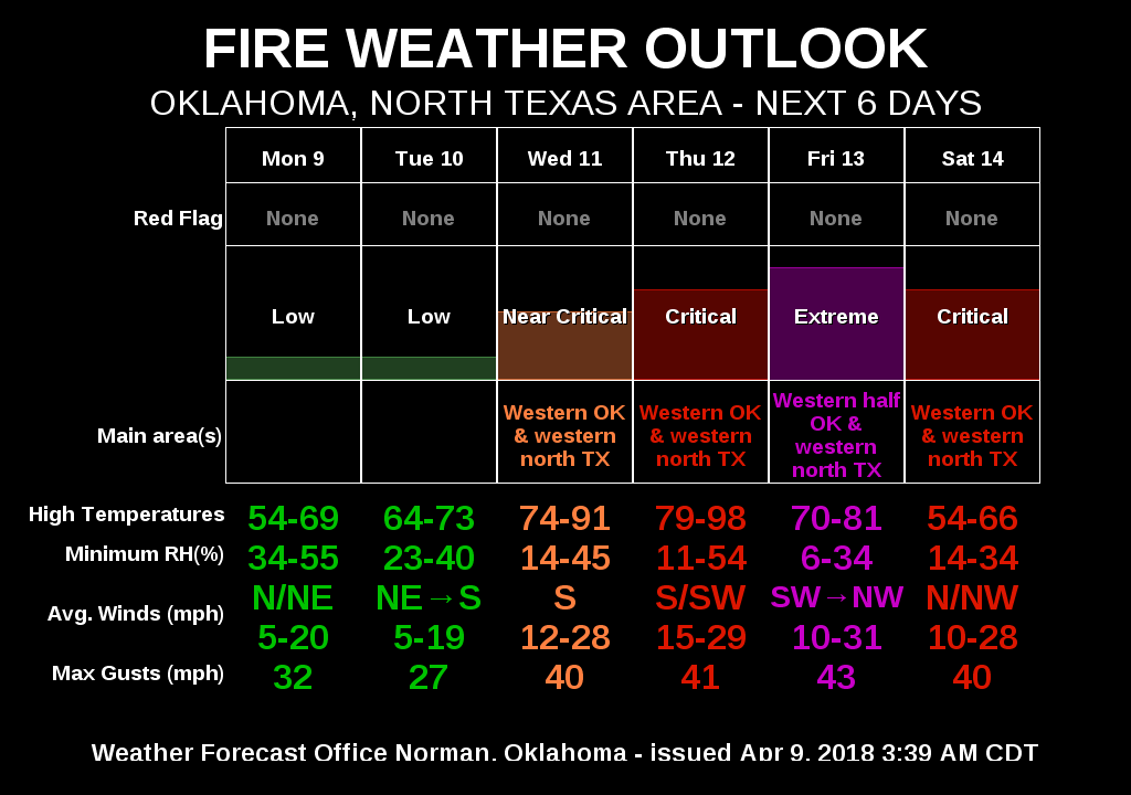
There will be a chance of storms with the same storm system that's going to
kick up the fire danger, but it ain't looking like much right now. Doesn't take
much to make a severe storm in spring, of course, but we're not seeing widespread
rains just yet.
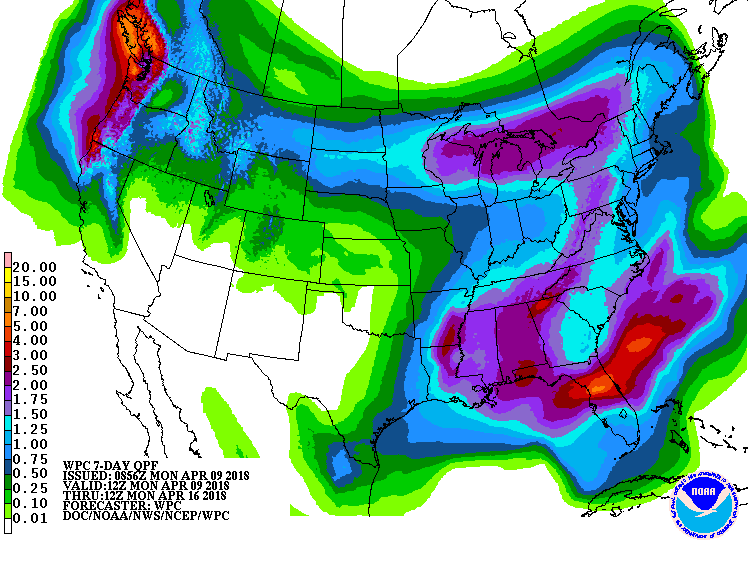
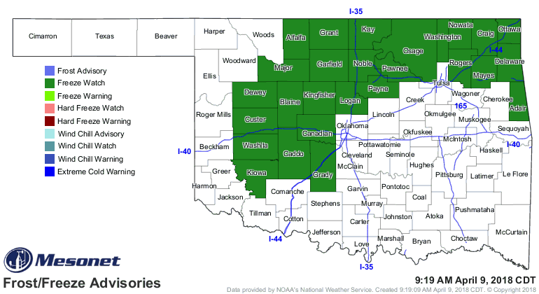
Before we get to all that fun, however, we have one more night to contend with
winter. OF COURSE WE DO, because this is Oklahoma.
Gary McManus
State Climatologist
Oklahoma Mesonet
Oklahoma Climatological Survey
(405) 325-2253
gmcmanus@mesonet.org
April 9 in Mesonet History
| Record | Value | Station | Year |
|---|---|---|---|
| Maximum Temperature | 100°F | HOLL | 2011 |
| Minimum Temperature | 18°F | KENT | 2013 |
| Maximum Rainfall | 4.69 inches | GUTH | 2008 |
Mesonet records begin in 1994.
Search by Date
If you're a bit off, don't worry, because just like horseshoes, “almost” counts on the Ticker website!