Ticker for January 25, 2018
MESONET TICKER ... MESONET TICKER ... MESONET TICKER ... MESONET TICKER ...
January 25, 2018 January 25, 2018 January 25, 2018 January 25, 2018
Ticking, but no licking
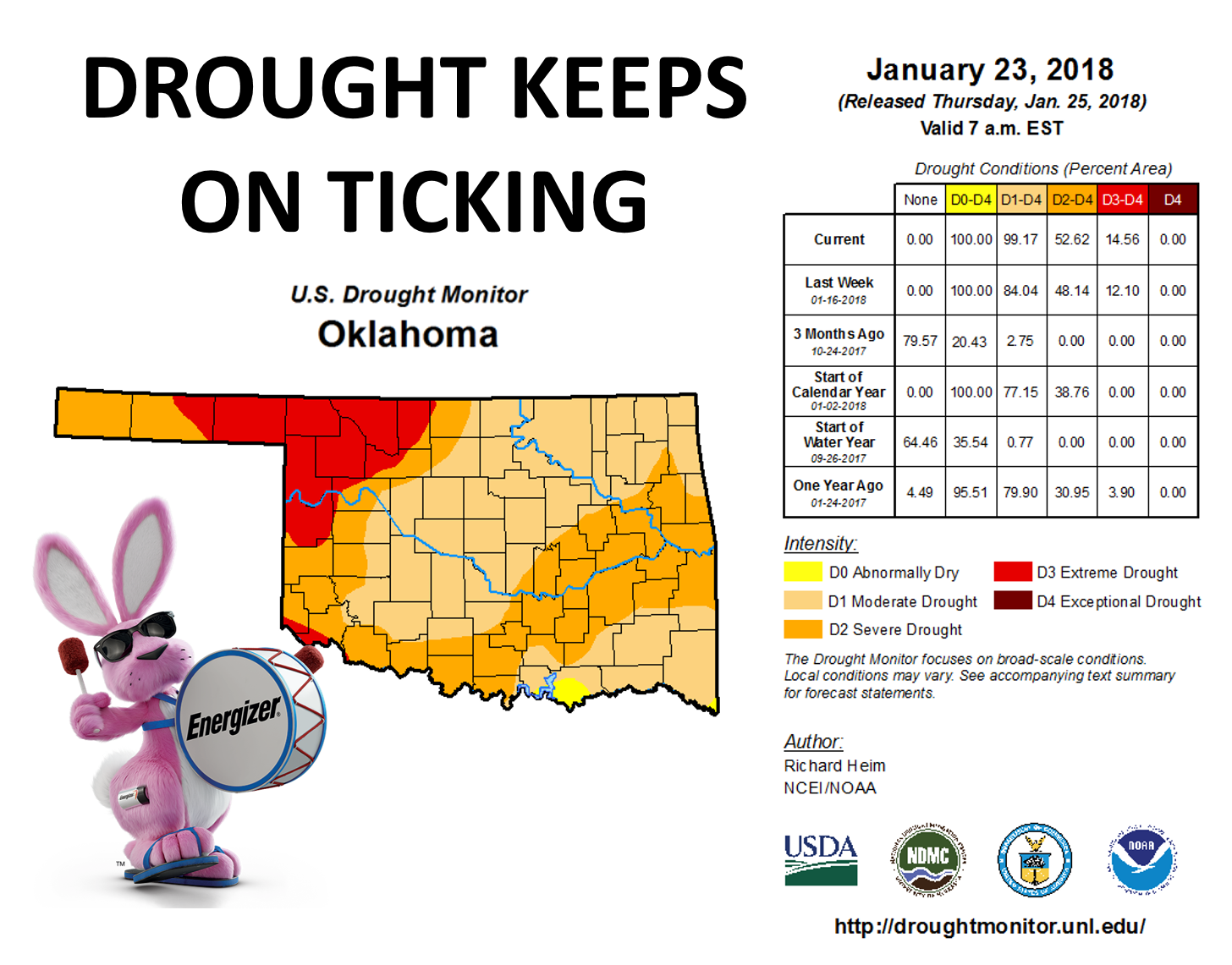
Like the title says, the drought keeps on ticking, but we still haven't tested it
after a licking yet. If so, it's been a very very dry licking. We're now at 99%
of the state in at least moderate drought. Here's a view of the Drought Monitor
map released this morning without our friend the Energizer Bunny.
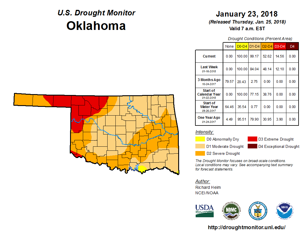
That's the most drought the state has seen since April 2, 2013, right smack dab
in the middle of the 2010-15 drought. We're also up to 53% of the state in at
least severe drought, but it was only a year ago on Jan. 10, 2017, when we
saw similar levels of that intensity. And to be fair, back in April 2013, 81% of
the state was in at least severe drought, and 53% was in at least exceptional
drought, compared to 15% today. But this drought is rather remarkable in that it
has almost wholly flourished during the cool season, in about the last 110 days
or so (a bit longer in the SE and NW). The maps are old hat now, but let's once
again take a look at the 90-day monstrosities.
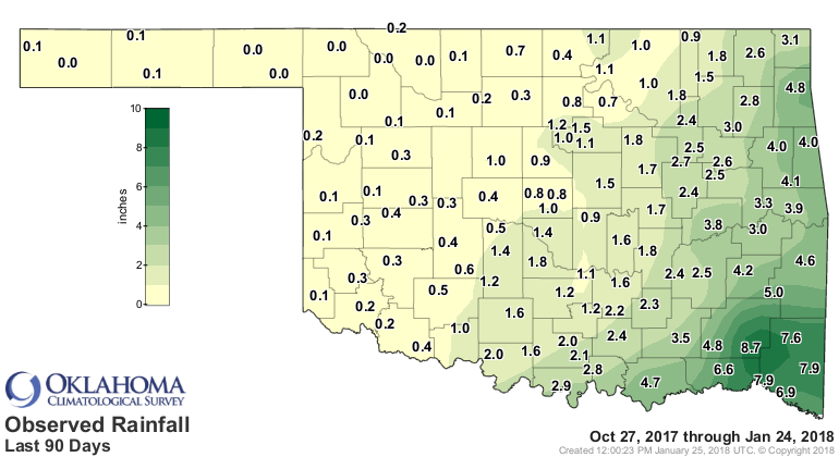
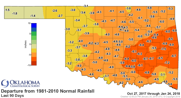
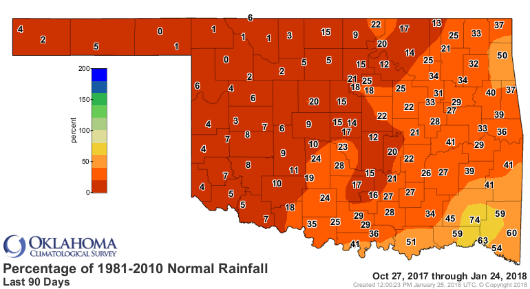
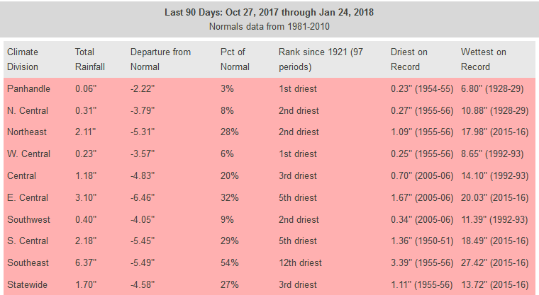
So the driest last 90 days since at least since 1921 for the Panhandle (which
also includes Harper and Ellis counties) and west central OK, and the 2nd-5th
driest for the rest, save for the SE which is boasting their 12th driest
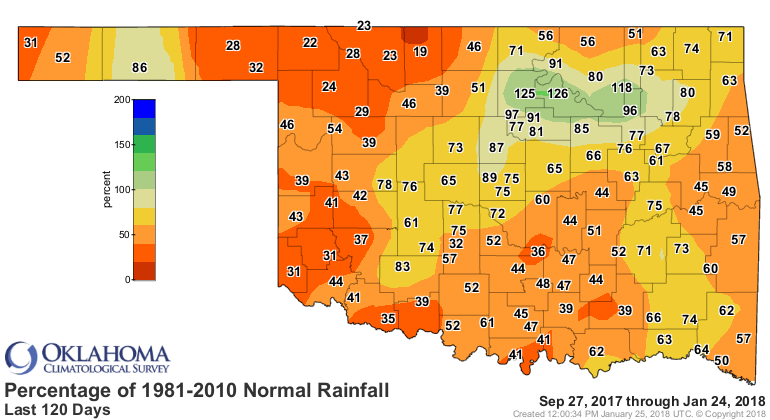
such period on record. But again, the drought extends to nearly 120 days now,
and when we breach that point, the 120 day rainfall maps, which look bad
enough already, are going to be dreadful.
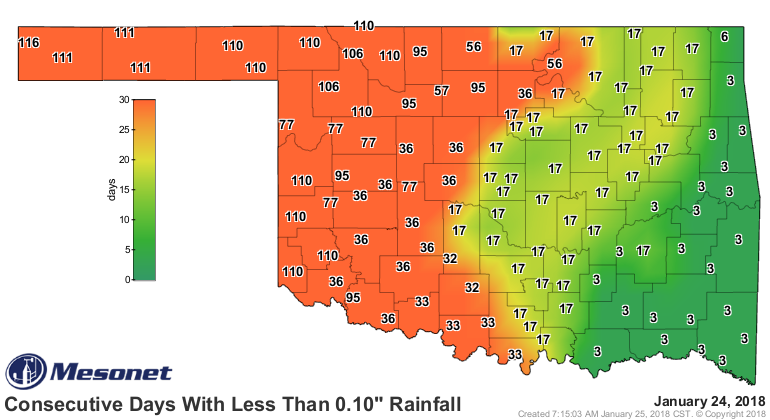
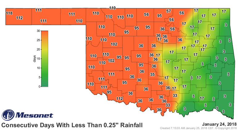
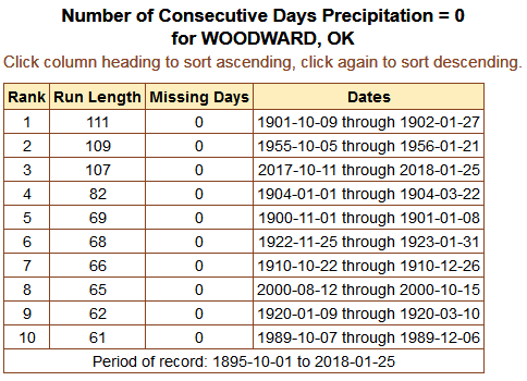
So places like Wooward, in NW OK, will see their rain free streaks eclipse
records set more than a century ago in a few more days.
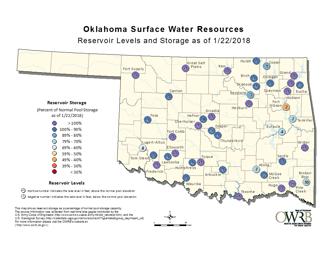
Our only saving grace is that it has occurred during the cool season, which is
also the driest time of the year in Oklahoma. So the impacts to water supply
and things of that nature aren't significant yet.
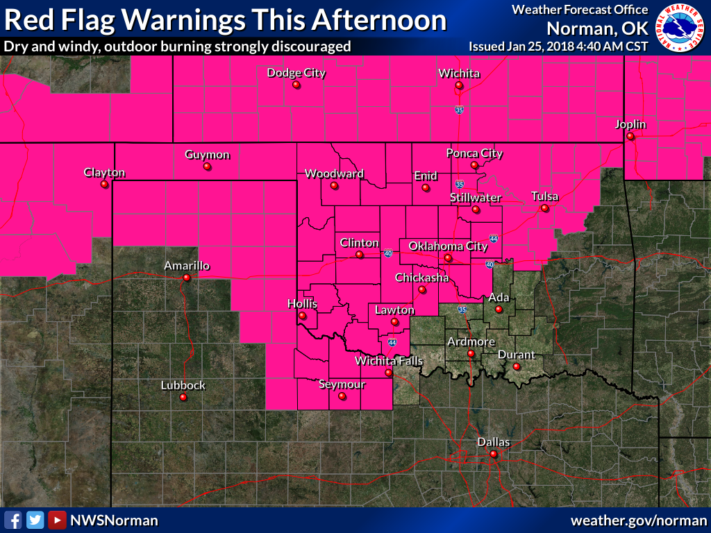
The impacts to agriculture and fire danger are significant, however. We're
getting a flood (no irony intended) of calls and e-mails from local and county
officials about dying or dead winter wheat, cattle selloffs due to lack of
grazing and feed, and desiccated soils. And the fire danger is now off the
charts every time we get a windy day, it seems. Like today.
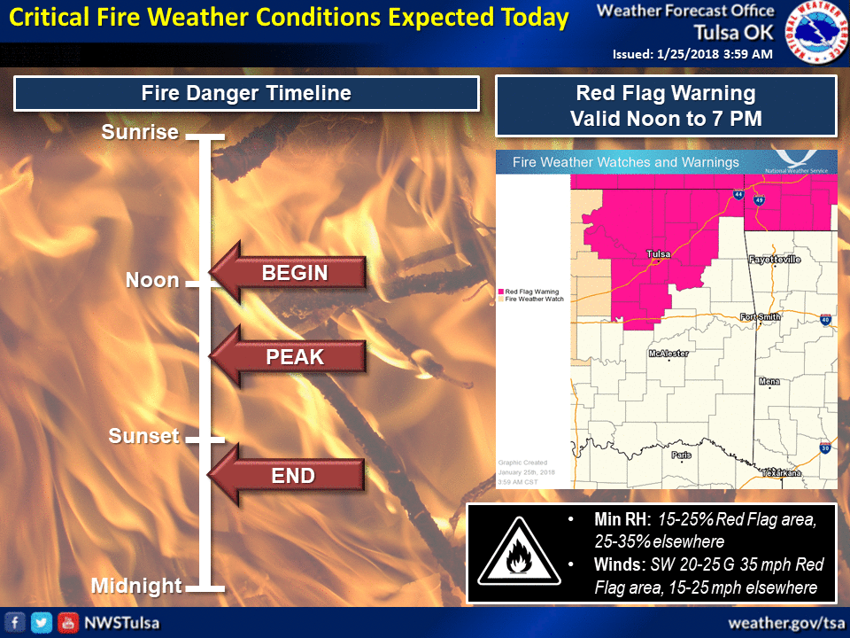
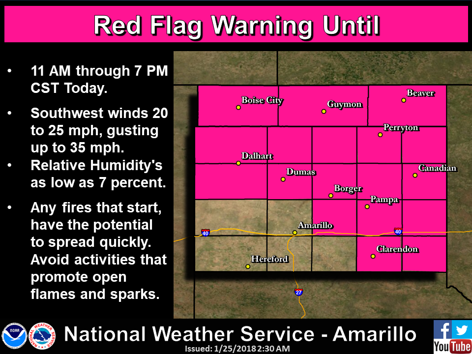
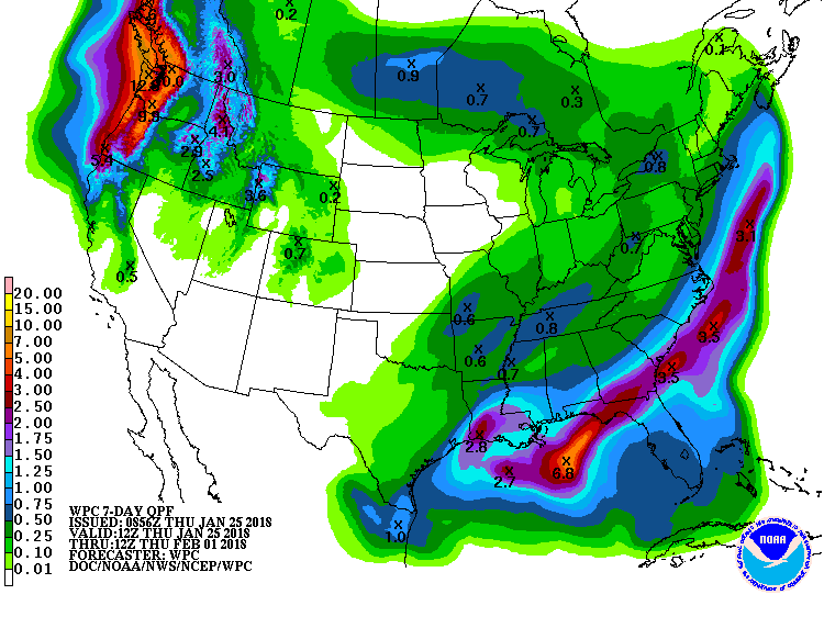
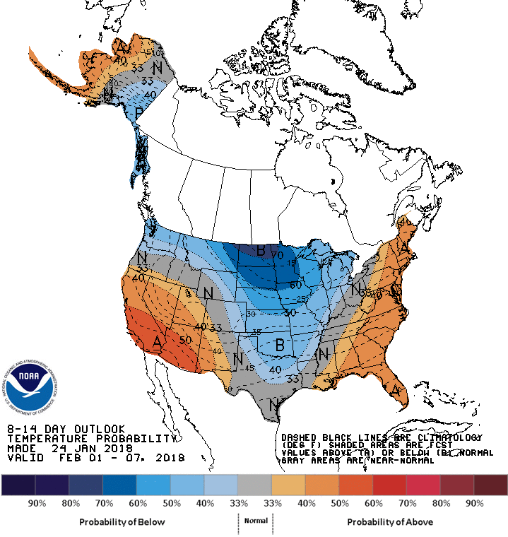
And prospects for the next 2 weeks or so look grim at best for western OK. You
can see hints on another cold air intrusion from the north with little moisture
to work with in the 8-14 day outlooks.

Where's the rain?!? But that's a parody of another old commercial, and a story
for another day.
Gary McManus
State Climatologist
Oklahoma Mesonet
Oklahoma Climatological Survey
(405) 325-2253
gmcmanus@mesonet.org
January 25 in Mesonet History
| Record | Value | Station | Year |
|---|---|---|---|
| Maximum Temperature | 77°F | MADI | 2005 |
| Minimum Temperature | 7°F | VINI | 2019 |
| Maximum Rainfall | 3.32 inches | MTHE | 2012 |
Mesonet records begin in 1994.
Search by Date
If you're a bit off, don't worry, because just like horseshoes, “almost” counts on the Ticker website!