Ticker for January 24, 2018
MESONET TICKER ... MESONET TICKER ... MESONET TICKER ... MESONET TICKER ...
January 24, 2018   January 24, 2018   January 24, 2018   January 24, 2018


Got another explanation?


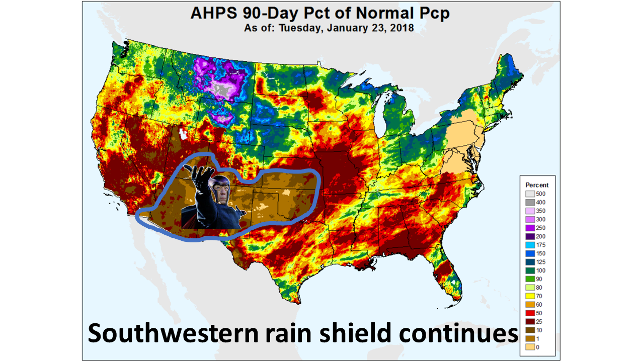
Well, our drought is probably not superhuman in nature, but more influenced by
La Nina. However, I thought it would be good to show you a more broad view of
the current rainfall deficit that is occurring in Oklahoma and the rest of the
Southwestern U.S. Misery loves company, as they say, but it also helps to know
you're not alone. That 90-day percent of normal precipitation map shows that
the Oklahoma and Texas Panhandles, along with the Desert Southwest, are ground
zero for drought. And in some cases, there has been literally ZERO precipitation
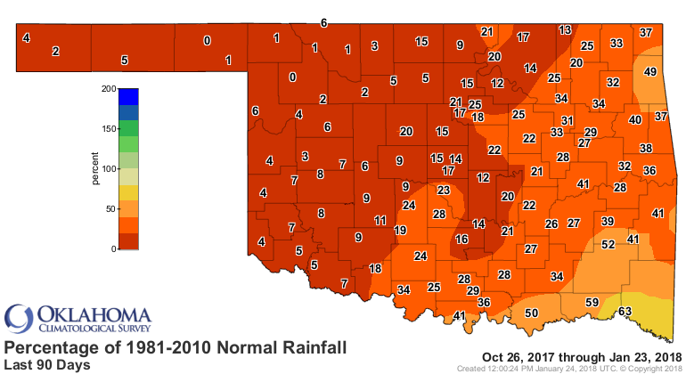
for more than 90 days. You've seen the Oklahoma map plenty of times


but the larger view shows the same thing occurring throughout the area. So still
no hope for the next 7 days.


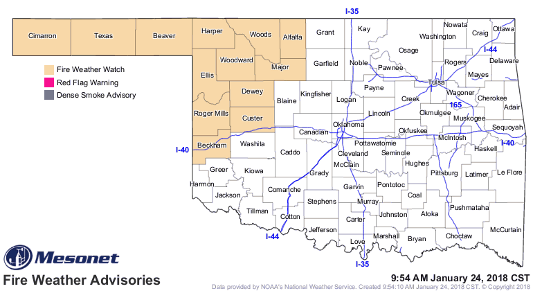
That leaves us in this boring pattern of occasional dry cold front passages with
lots of fire danger mixed in. Oh, fire danger? Coming right up!


Gary McManus
State Climatologist
Oklahoma Mesonet
Oklahoma Climatological Survey
(405) 325-2253
gmcmanus@mesonet.org
January 24 in Mesonet History
| Record | Value | Station | Year |
|---|---|---|---|
| Maximum Temperature | 80°F | WAL2 | 2017 |
| Minimum Temperature | -3°F | BRIS | 2014 |
| Maximum Rainfall | 1.81″ | DURA | 2012 |
Mesonet records begin in 1994.
Search by Date
If you're a bit off, don't worry, because just like horseshoes, “almost” counts on the Ticker website!