Ticker for December 11, 2017
MESONET TICKER ... MESONET TICKER ... MESONET TICKER ... MESONET TICKER ...
December 11, 2017 December 11, 2017 December 11, 2017 December 11, 2017
Luke Drywalker
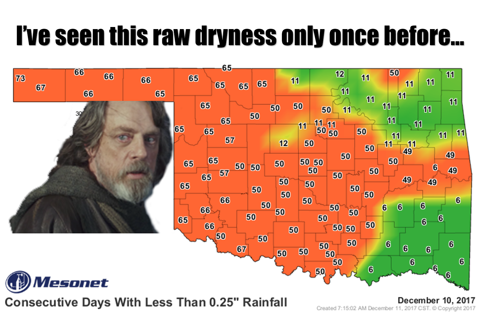
Yes, it's new Star Wars movie week...so you'll have to bear with us. And actually,
we've seen this type of dry weather before, and it wasn't pretty then, nor is it
pretty now. Nor is this map.
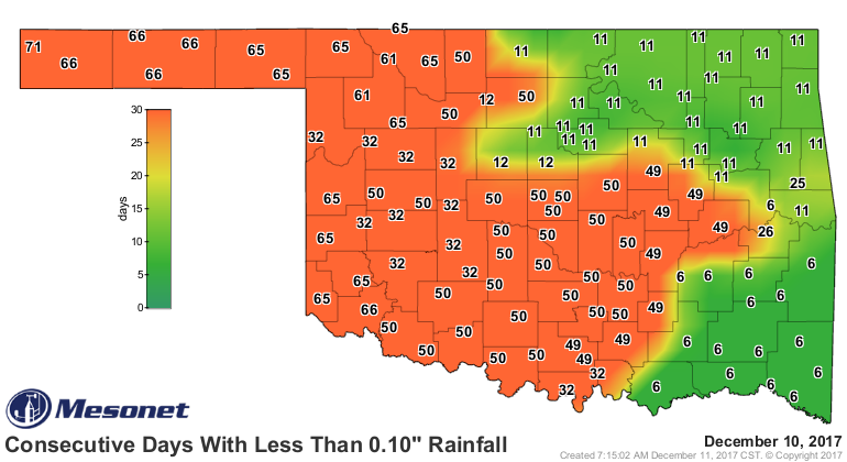
So what else can we say now that we haven't said in the last 30-60 days or so.
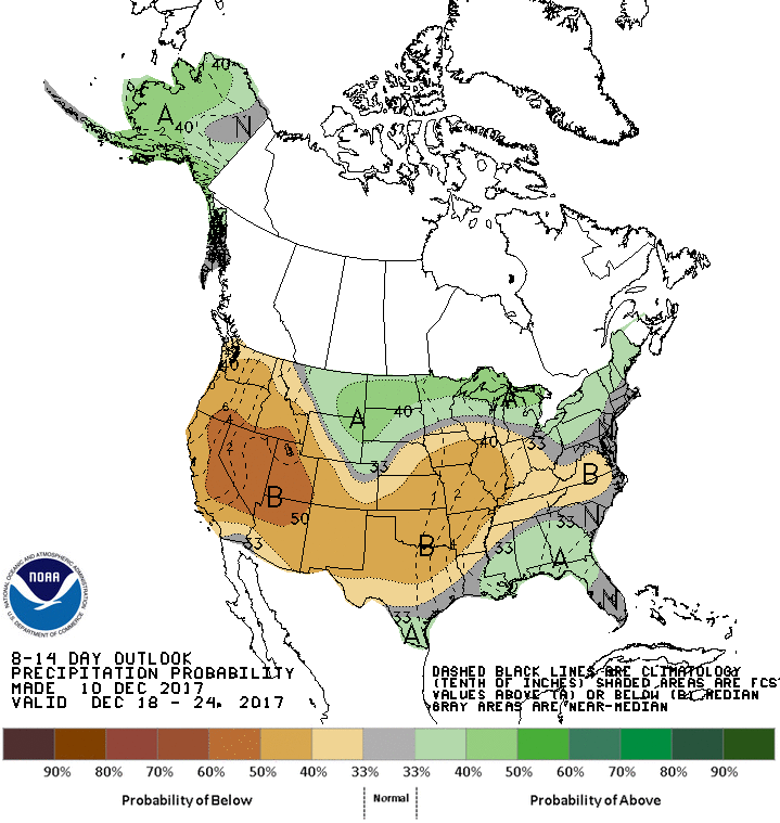
It's dry, and it looks like it's gonna stay that way for awhile. And the CPC
6-10 and 8-14 day outlooks aren't very encouraging either.

And we could show you all sorts of long-range weather model output that shows
this storm or that pending for Christmas or around that range, which is all the
rage on the internet right now, but those are fantasy-casts until they get within
a week or so. Don't let anybody tell you otherwise. They're fun to look at, but
other than that, take them for what they're worth.
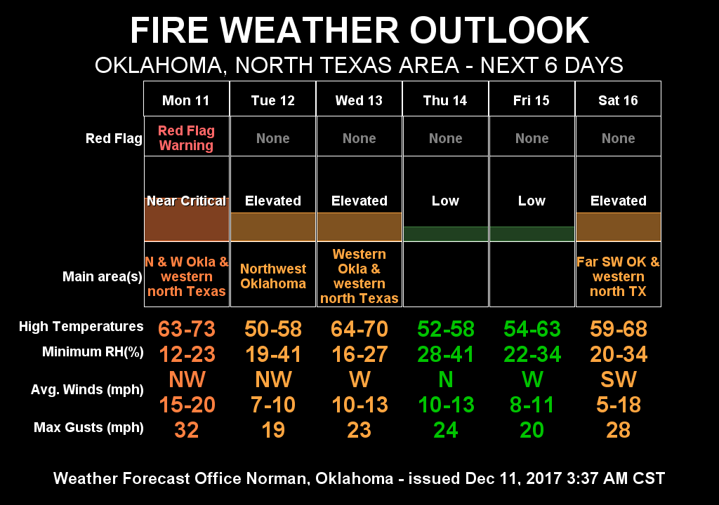
As for real-world implications the dry stretch has for us, other than a
withering winter wheat crop out in the field, look no further than the fire
danger we have in store for the next few days. We have a Red Flag Fire alert
for today
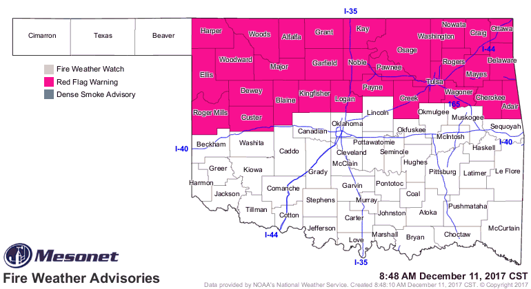
and more fire danger yet to come.

Keep watching those long-range forecasts. When you see something pop up on
about the 7th day or so, then get excited. Not TOO excited, but excited.
Gary McManus
State Climatologist
Oklahoma Mesonet
Oklahoma Climatological Survey
(405)325-2253
gmcmanus@mesonet.org
December 11 in Mesonet History
| Record | Value | Station | Year |
|---|---|---|---|
| Maximum Temperature | 84°F | BEAV | 2025 |
| Minimum Temperature | 3°F | BOIS | 2000 |
| Maximum Rainfall | 2.54″ | NRMN | 2007 |
Mesonet records begin in 1994.
Search by Date
If you're a bit off, don't worry, because just like horseshoes, “almost” counts on the Ticker website!