Ticker for November 29, 2017
MESONET TICKER ... MESONET TICKER ... MESONET TICKER ... MESONET TICKER ...
November 29, 2017  November 29, 2017  November 29, 2017  November 29, 2017


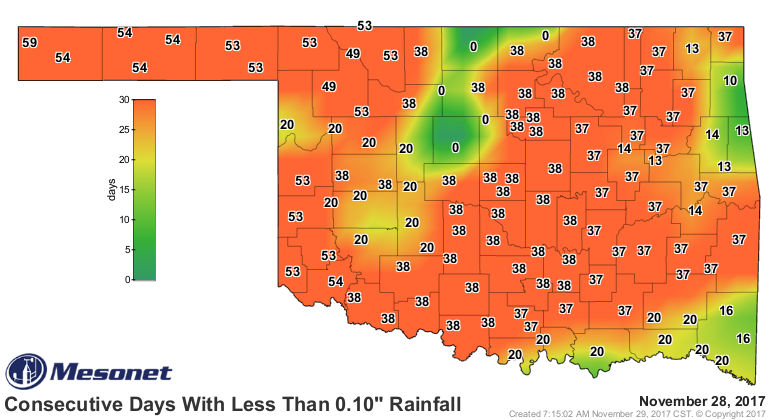
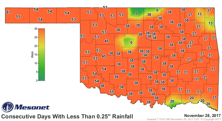
Color on the rain map!


Yeah, maybe not so fast there, Noah. Don't start gathering the animals just yet.
Send the lumber back. However, there are some nice colors on that map that we
just haven't seen in awhile. And darned if some places didn't go and get over an
inch of rain...both in the rain gauges and the radar-indicated amounts. Kudos to
the Jay Mesonet site for their 1.66 inches. Unfortunately, most of the state went
without significant moisture, but it's a start. And our stats for November look
a little better. We're no longer on pace for the driest November on record, at
least not statewide.


Some areas will break that record, especially across southeastern Oklahoma. But
again, it's a start. These maps will look marginally better when they update
tomorrow.


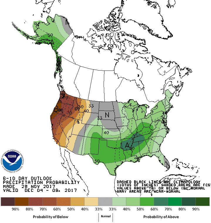
Our next hope comes next week with another front and a bout with more cold
air. No snowstorms showing up at this time, but maybe some moisture again.


Call it a pattern change, call it a return to the seasonable weather we're
supposed to be in, but it looks like next week might be mostly cool. It'd be
wrong to say we're done with the 60s and 70s for the rest of the year, though.
We tried to do that earlier this month and we ended up with record temperatures.

At any rate, we'll take the moisture next week as well.

It's a start.

Gary McManus
State Climatologist
Oklahoma Mesonet
Oklahoma Climatological Survey
(405) 325-2253
gmcmanus@mesonet.org
November 29 in Mesonet History
| Record | Value | Station | Year |
|---|---|---|---|
| Maximum Temperature | 84°F | ARNE | 2014 |
| Minimum Temperature | 8°F | TIPT | 2001 |
| Maximum Rainfall | 3.85″ | TALI | 2006 |
Mesonet records begin in 1994.
Search by Date
If you're a bit off, don't worry, because just like horseshoes, “almost” counts on the Ticker website!