Ticker for September 14, 2017
MESONET TICKER ... MESONET TICKER ... MESONET TICKER ... MESONET TICKER ...
September 14, 2017 September 14, 2017 September 14, 2017 September 14, 2017
Drought on the move!
Pretty simple Tick today (no Rocky Mountain spotted fever, thank goodness). Dry
conditions are on the rise across parts of the state, especially that northern
tier of counties along the KS border. The newest Drought Monitor says it all.
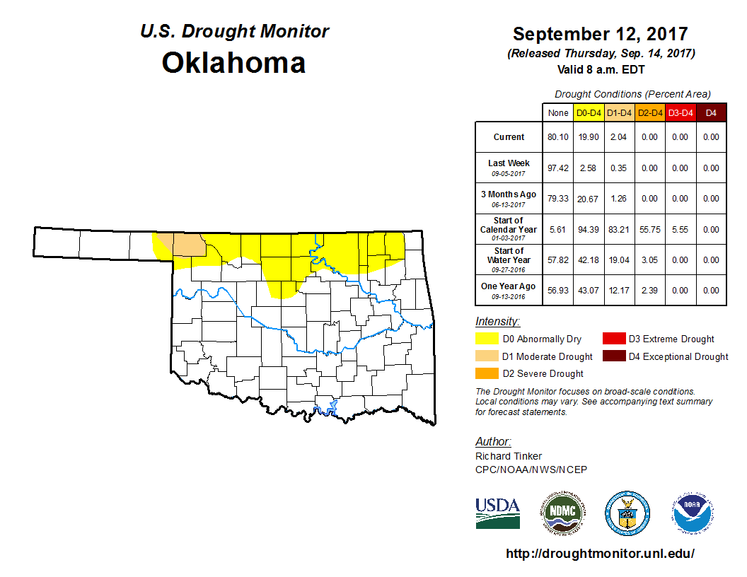
No, it's not much. Only 2% of the state in actual drought (moderate-D1), but we
now have an additional 18% in abnormally dry (D0) conditions. The abnormally dry
designation can mean an area either entering or leaving drought. In this case, I'm
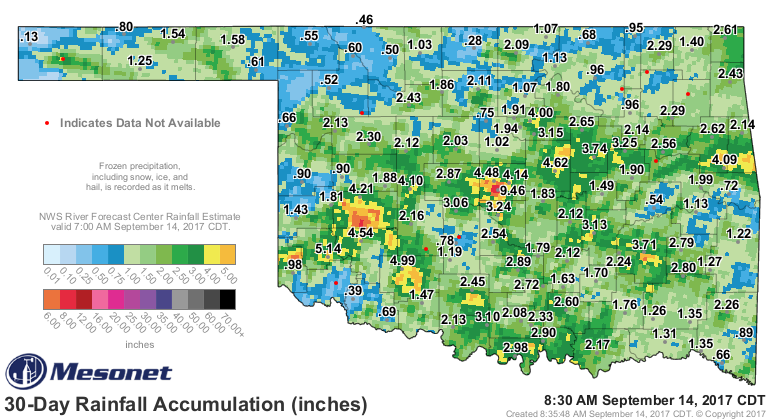
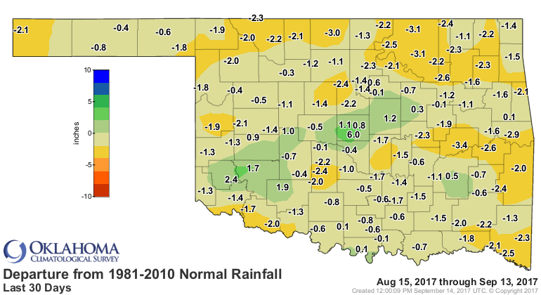
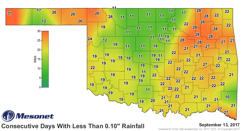
afraid it's the former. And this is really based on the last 30 days or so. The
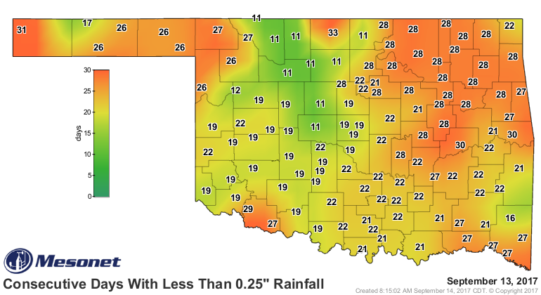
Mesonet rainfall maps tell the other part of the tale. Here's a core dump of
rainfall maps for your viewing displeasure!

When we get dry like this, things start to suffer, like soil moisture. And this
is a vital time for planting wheat. Some farmers will be "dusting in" that
seed (i.e., planting in dry soil and waiting for a good rain to soak in).
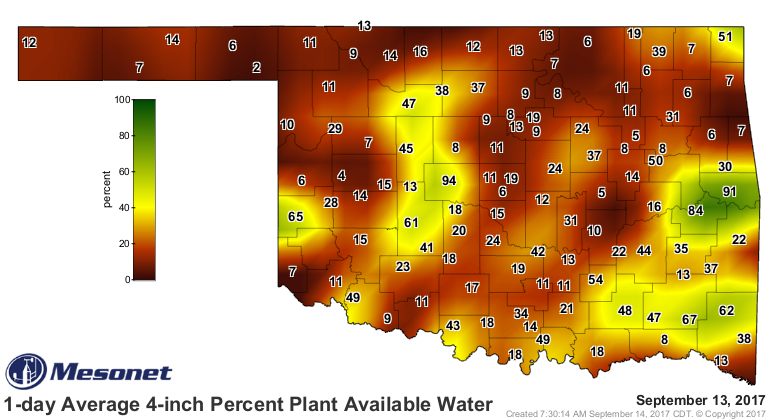
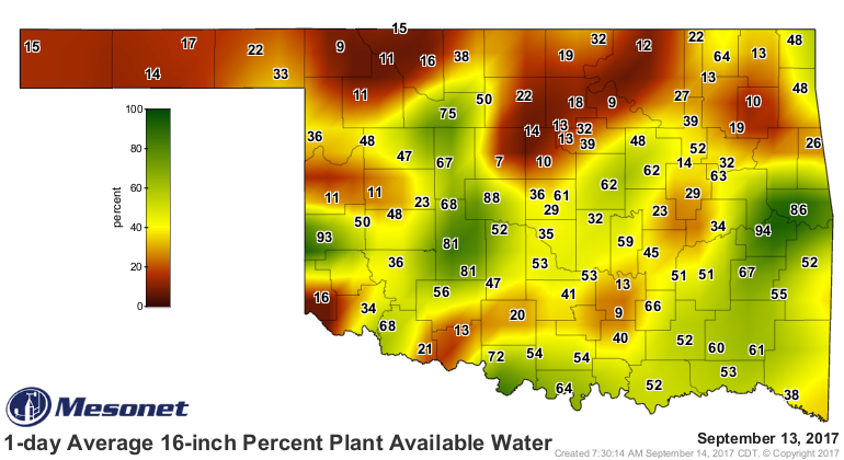
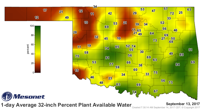
Speaking of a good rain...not much chance in the next week.
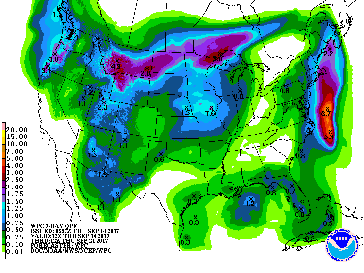
Farther out, we'll have to hope for a more favorable pattern - a dip in the
jet stream to bring some slower moving storm systems our way and allow for
some return of that Gulf moisture.
Gary McManus
State Climatologist
Oklahoma Mesonet
Oklahoma Climatological Survey
(405) 325-2253
gmcmanus@mesonet.org
September 14 in Mesonet History
| Record | Value | Station | Year |
|---|---|---|---|
| Maximum Temperature | 103°F | MANG | 2000 |
| Minimum Temperature | 39°F | KENT | 2012 |
| Maximum Rainfall | 3.64 inches | JAYX | 1998 |
Mesonet records begin in 1994.
Search by Date
If you're a bit off, don't worry, because just like horseshoes, “almost” counts on the Ticker website!