Ticker for August 10, 2017
MESONET TICKER ... MESONET TICKER ... MESONET TICKER ... MESONET TICKER ...
August 10, 2017 August 10, 2017 August 10, 2017 August 10, 2017
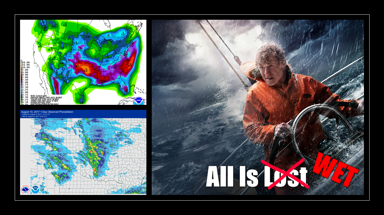
All Is Wet
The wettest August on record for Oklahoma, dating back to 1895 and based on the
statewide average, was 6.48 inches in 1915. If you were around back then,
congrats...you might get to repeat history. If you weren't, and I assume most
Ticker readers weren't, you might get to see history. We're already at 2.25 inches
across the state for the month's first 9 days and change

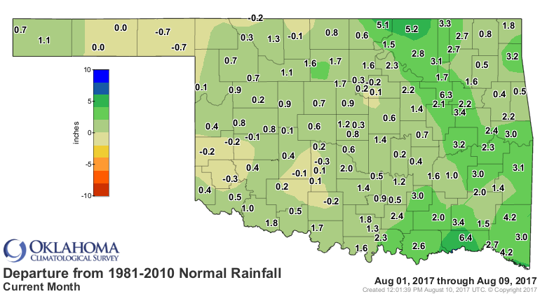

with the chance for more, as seen above.
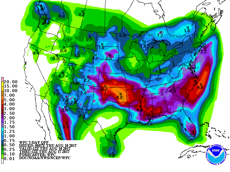
Now 2.25 inches isn't a grand total for most months, and it would only rank as
the 80th wettest August on record if the month ended today. And boy wouldn't it
be weird if the month DID end today! But I digress. However, it's the 8-inch
bullseye on that 7-day forecast map that gives us pause. An overly optimistic
forecast? Certainly possible. But given the amount of water vapor in the air,
with more rich Gulf moisture flowing north over the next few days, anything is
possible.
Watch for more MCS activity to build in NE Colorado and NW KS and blast down
this way, much like last night, as we stay in that northwesterly flow regime
for another 4-5 days or so. And tonight's weather might turn ugly as severe
weather will be possible. Tornadic potential doesn't appear high, but as Tulsa
found out, tornado season in Oklahoma starts January 1 and ends December 31.
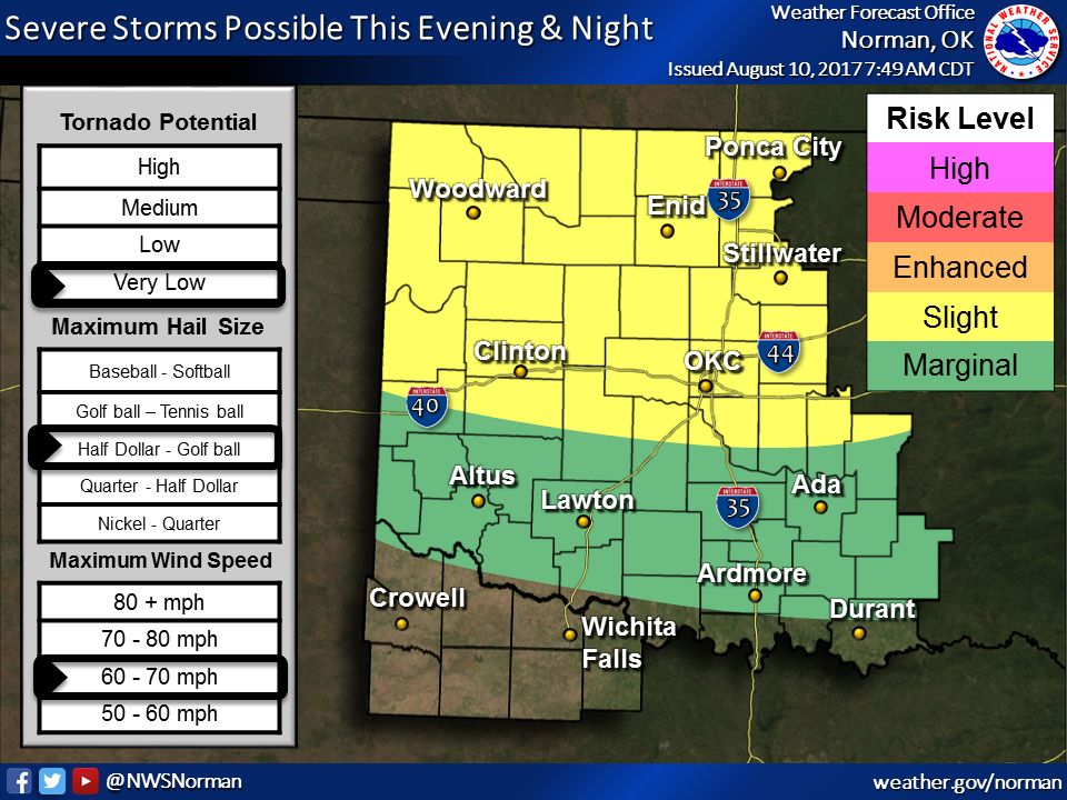

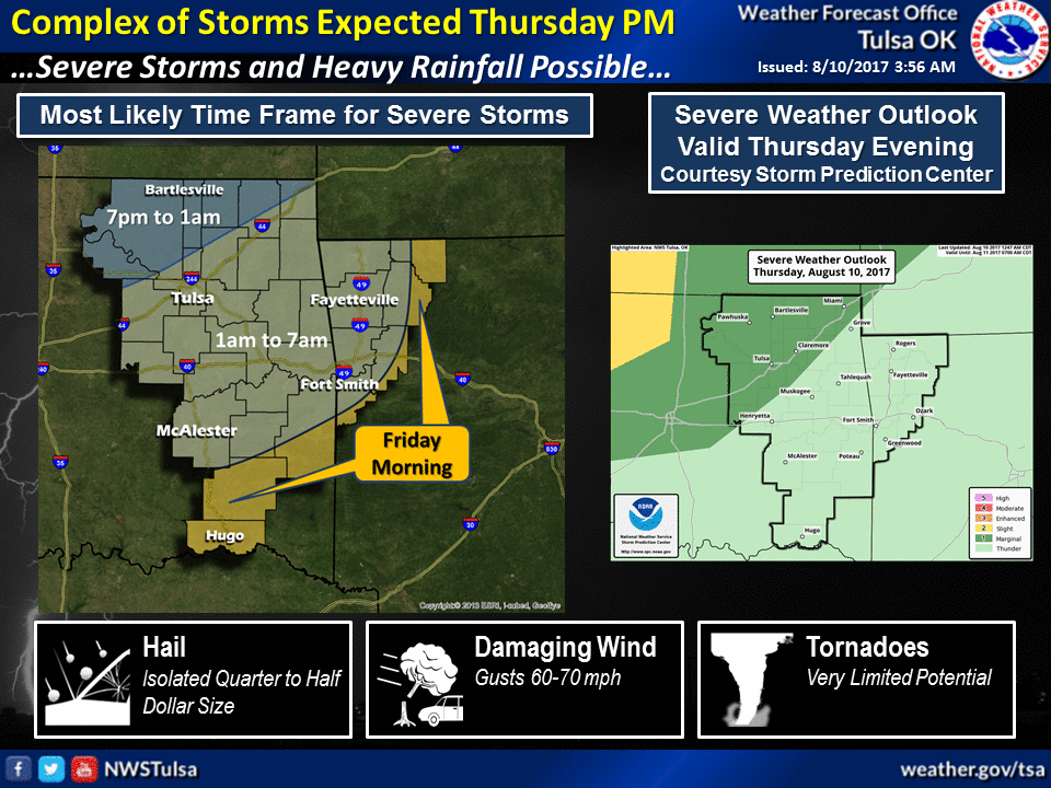
And then comes the flooding risk. And if we get the types of rainfall totals
being predicted, flooding will almost certainly occur.
As for the drought, meh. Yes, we still have some holdouts and some decent
deficits in place before the coming storms.

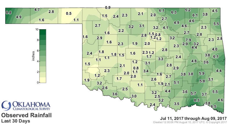
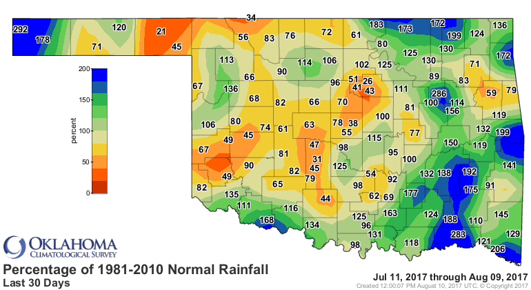
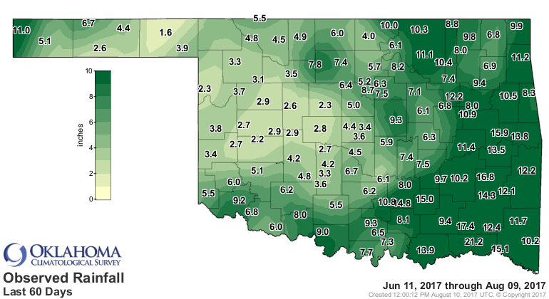
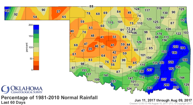
Let's be frank. Okay, you be Frank, I'll be Gary. It's tough to worry about
drought when old Bob Redford is sailing through your neighborhood yelling "ALL
IS LOST!"
Gary McManus
State Climatologist
Oklahoma Mesonet
Oklahoma Climatological Survey
(405) 325-2253
gmcmanus@mesonet.org
August 10 in Mesonet History
| Record | Value | Station | Year |
|---|---|---|---|
| Maximum Temperature | 109°F | GRA2 | 2011 |
| Minimum Temperature | 55°F | EVAX | 2024 |
| Maximum Rainfall | 4.20″ | CHIC | 2017 |
Mesonet records begin in 1994.
Search by Date
If you're a bit off, don't worry, because just like horseshoes, “almost” counts on the Ticker website!