Ticker for August 3, 2017
MESONET TICKER ... MESONET TICKER ... MESONET TICKER ... MESONET TICKER ...
August 3, 2017 August 3, 2017 August 3, 2017 August 3, 2017
V for Victory
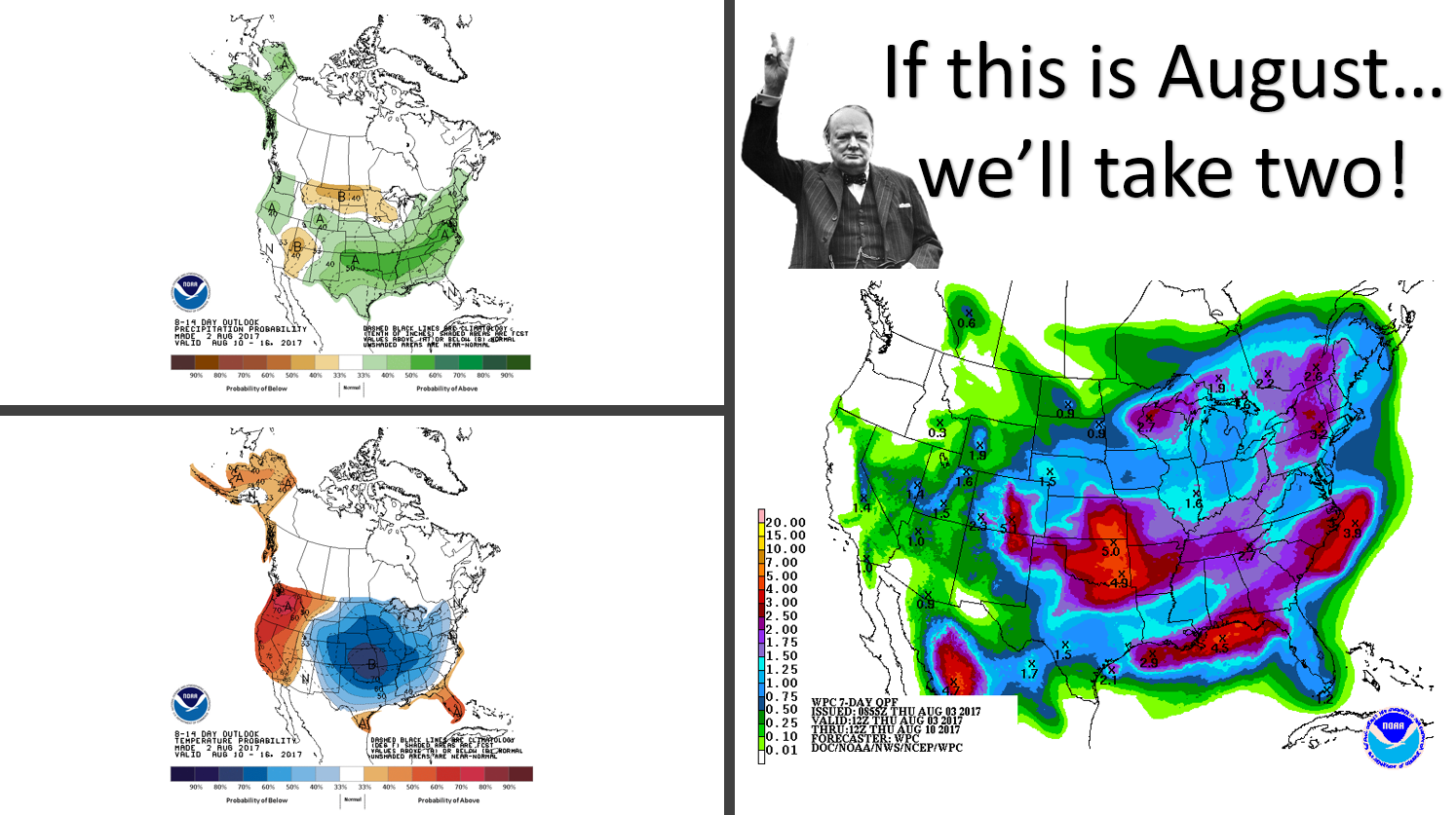
As our old pal Winston would tell us, with the milder and wetter weather we've
been seeing over the last week or so, we might be losing the drought battle for
now
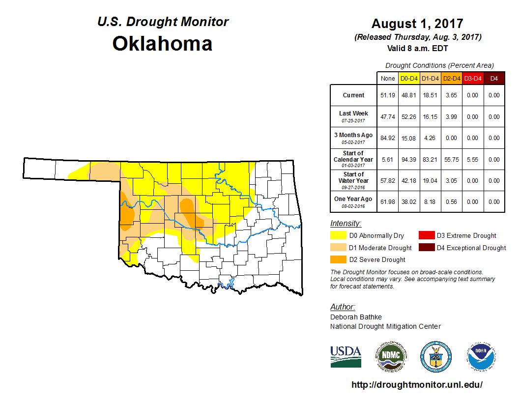
but we might very well win the war!
With a range of 3-5 inches for much of Oklahoma on the rainfall forecast map over
the next 7 days, that would do wonders for the types of deficits that have
transformed the flash drought into a regular old drought across the state.
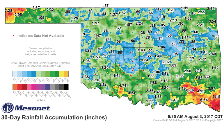
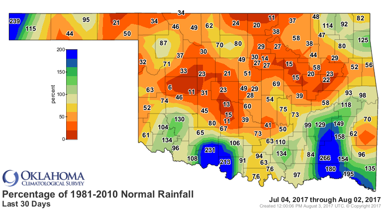
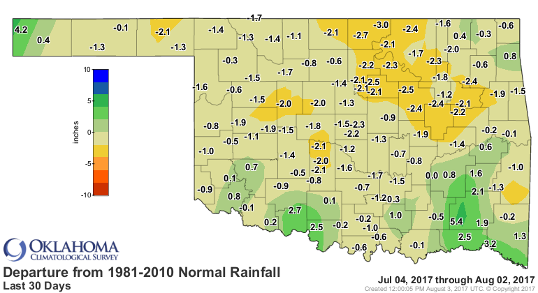
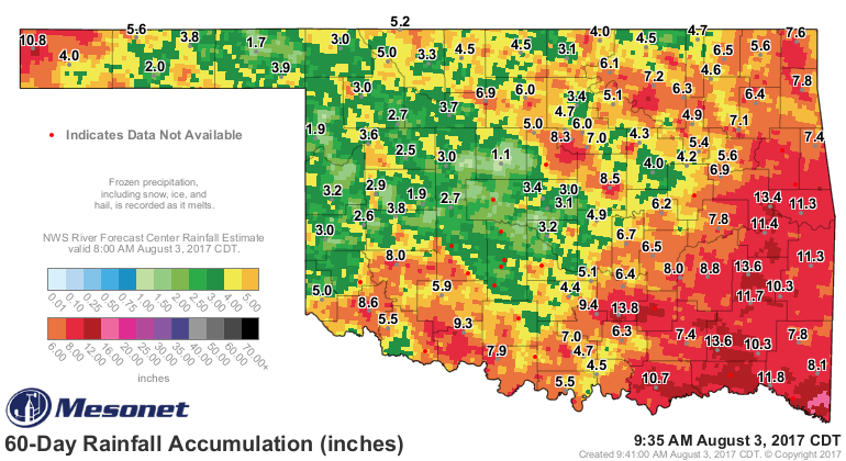
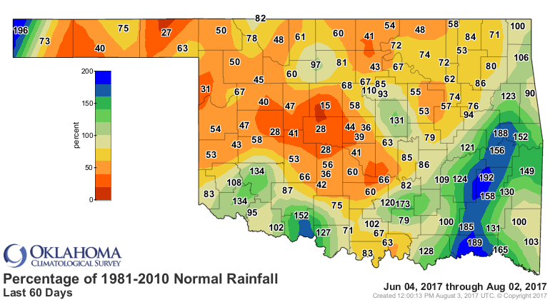
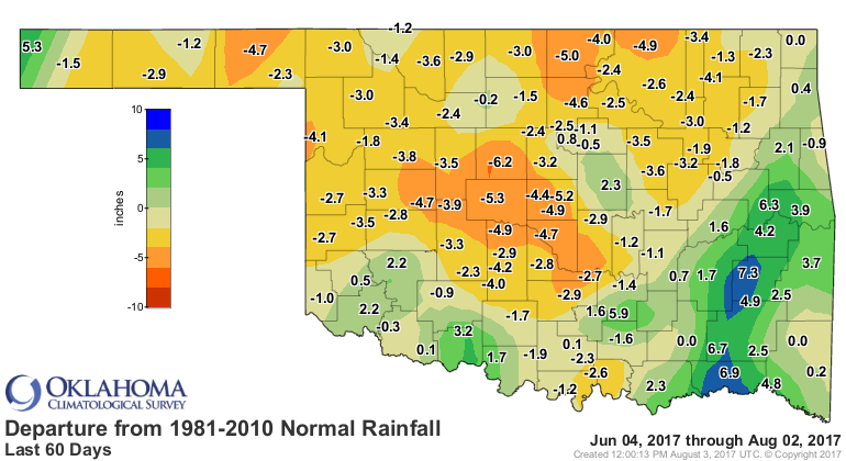
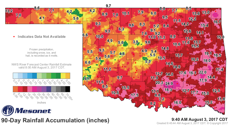
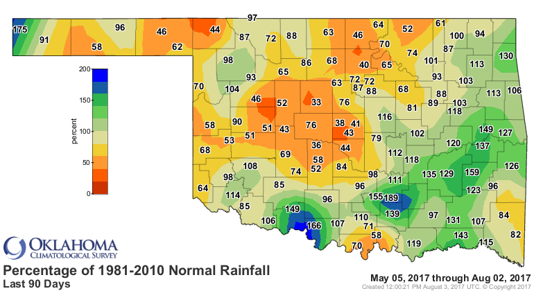

Way too much orange and red on those departure and percentage of normal maps.
This is a case where you don't want to fly your bedlam colors!
The setup for our August descent into early fall is a simple one...a big upper-
level trough over the eastern US has thrown us under northwesterly flow, meaning
that heat dome that baked us during July has been shifted westward. So we
get occasional cool fronts, chances of rain, especially this time of year in
this type of flow where those big Mesoscale Convective Systems (MCS) form to
our northwest in the lee of the Rockies and plunge to the southeast.

At any rate, we lost the battle for the most part that began raging in early
May, but the war is not over.
We shall defend our state, whatever the cost may be, we shall fight in the
soil moisture, we shall fight on the rivers, we shall fight in the
fields and in the farm ponds, we shall fight in the wheat belt; we shall never
surrender!
Gary McManus
State Climatologist
Oklahoma Mesonet
Oklahoma Climatological Survey
(405) 325-2253
gmcmanus@mesonet.org
August 3 in Mesonet History
| Record | Value | Station | Year |
|---|---|---|---|
| Maximum Temperature | 115°F | WILB | 2011 |
| Minimum Temperature | 53°F | CAMA | 2021 |
| Maximum Rainfall | 5.73 inches | CHER | 1995 |
Mesonet records begin in 1994.
Search by Date
If you're a bit off, don't worry, because just like horseshoes, “almost” counts on the Ticker website!