Ticker for July 31, 2017
MESONET TICKER ... MESONET TICKER ... MESONET TICKER ... MESONET TICKER ...
July 31, 2017 July 31, 2017 July 31, 2017 July 31, 2017
Jeptember
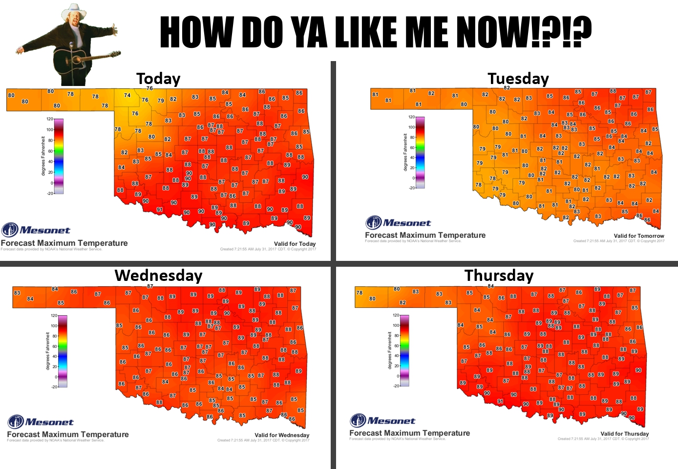
Uhhh, this is July? And the beginning of August? Historically, the hottest part
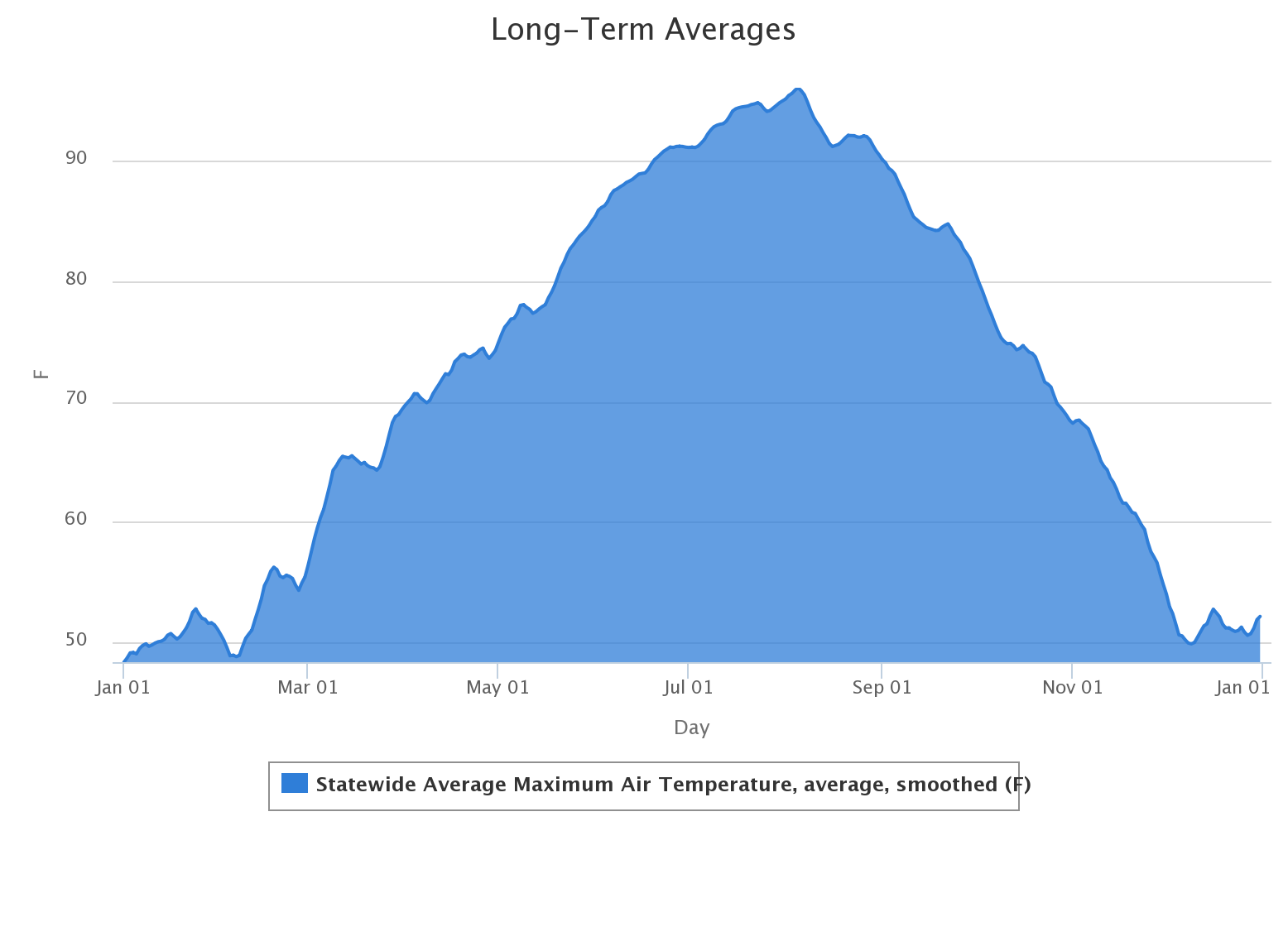
of the year in Oklahoma. In fact, based on the long-term averages (2002-2016)
from the Mesonet, August 5 is the big day with an average of 96.1 degrees
statewide.
But this? Highs in the 80s? 70s up northwest? This is more like early June or late
September. Jeptember? That might be a curse word in a foreign language, so
apologies to all foreigners reading today's Ticker. You know, Texans.
Now are we going to complain about this weather? No...heck no! Because we know
what's coming after, right? So we'll take this northwesterly flow with it's nice
relatively cool air and run with it.
How about rain? Well, unfortunately the big rains we were promised this week look
to have shifted farther south and west. But the western half of the state still
looks to get a decent soak this week. Farther east...not so much.
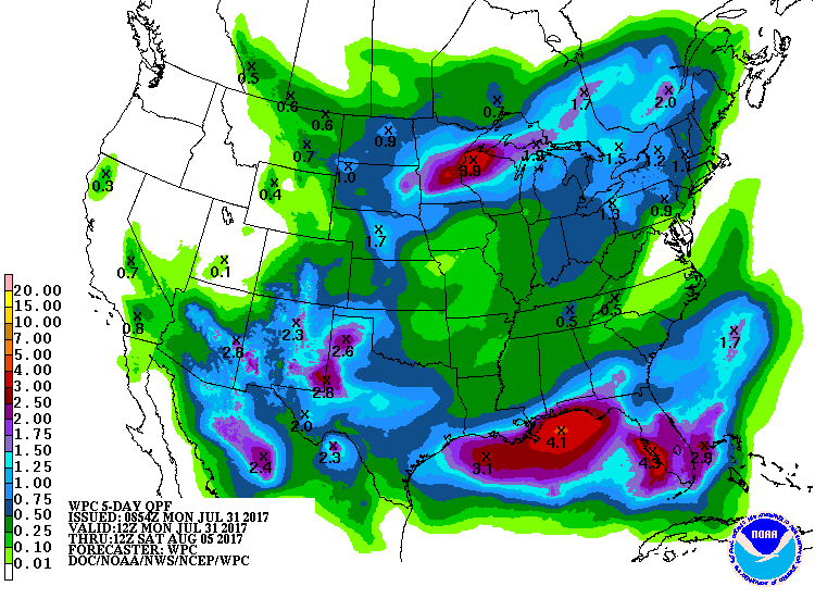
And we REALLY need that rainfall.
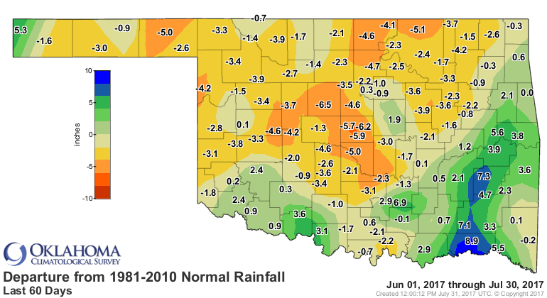
The only good news for those folks not getting significant rain is the cooler
weather will decelerate the speed of those drought impacts.
We'll enjoy that cooler weather now, of course. August is a long, LONG hot
month. We'll take it.
Gary McManus
State Climatologist
Oklahoma Mesonet
Oklahoma Climatological Survey
(405) 325-2253
gmcmanus@mesonet.org
July 31 in Mesonet History
| Record | Value | Station | Year |
|---|---|---|---|
| Maximum Temperature | 112°F | MANG | 2012 |
| Minimum Temperature | 50°F | BOIS | 2018 |
| Maximum Rainfall | 5.02 inches | CLAY | 2014 |
Mesonet records begin in 1994.
Search by Date
If you're a bit off, don't worry, because just like horseshoes, “almost” counts on the Ticker website!