Ticker for June 29, 2017
MESONET TICKER ... MESONET TICKER ... MESONET TICKER ... MESONET TICKER ...
June 29, 2017 June 29, 2017 June 29, 2017 June 29, 2017
Droughty World

The Ticker is on travel this week, so you've probably been missing our immaculate
prose...pausing for the laughter to die down. I can hear you, you know. But,
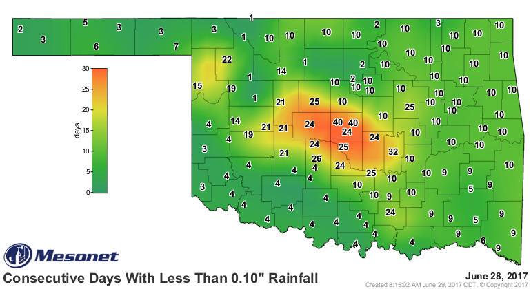
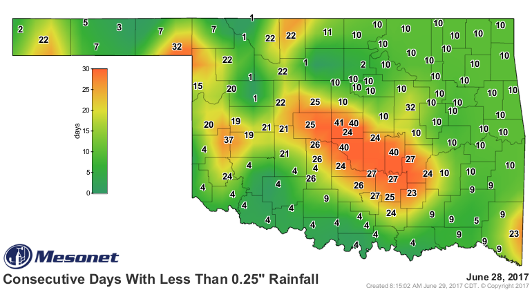
Oklahoma's weather woes could use a vacation too. To put it simply...FLASH
DROUGHT! Take a look at the last 30-60 days, the deficits that have accumulated,
the days without significant rainfall, then remember that this has all occurred
through the meat of Oklahoma's primary rainy season...May through mid-June.
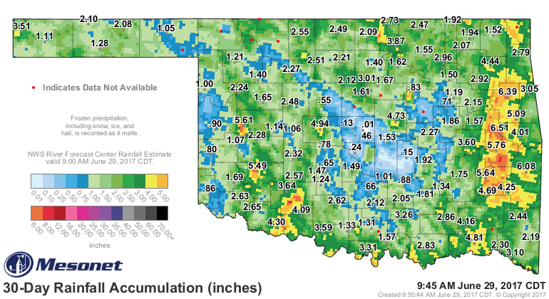

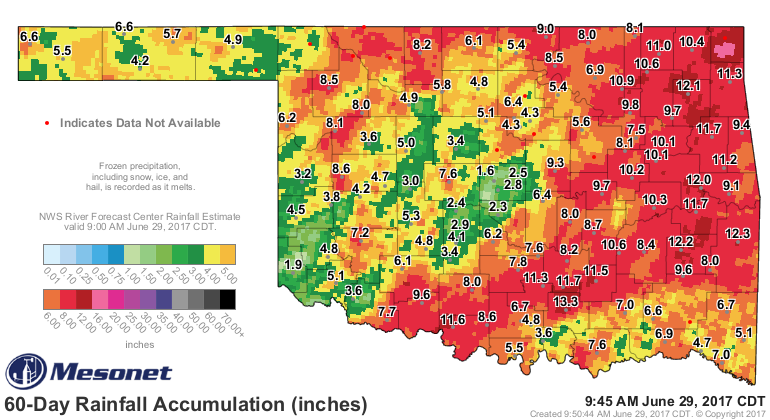
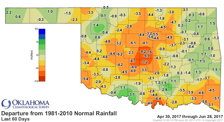
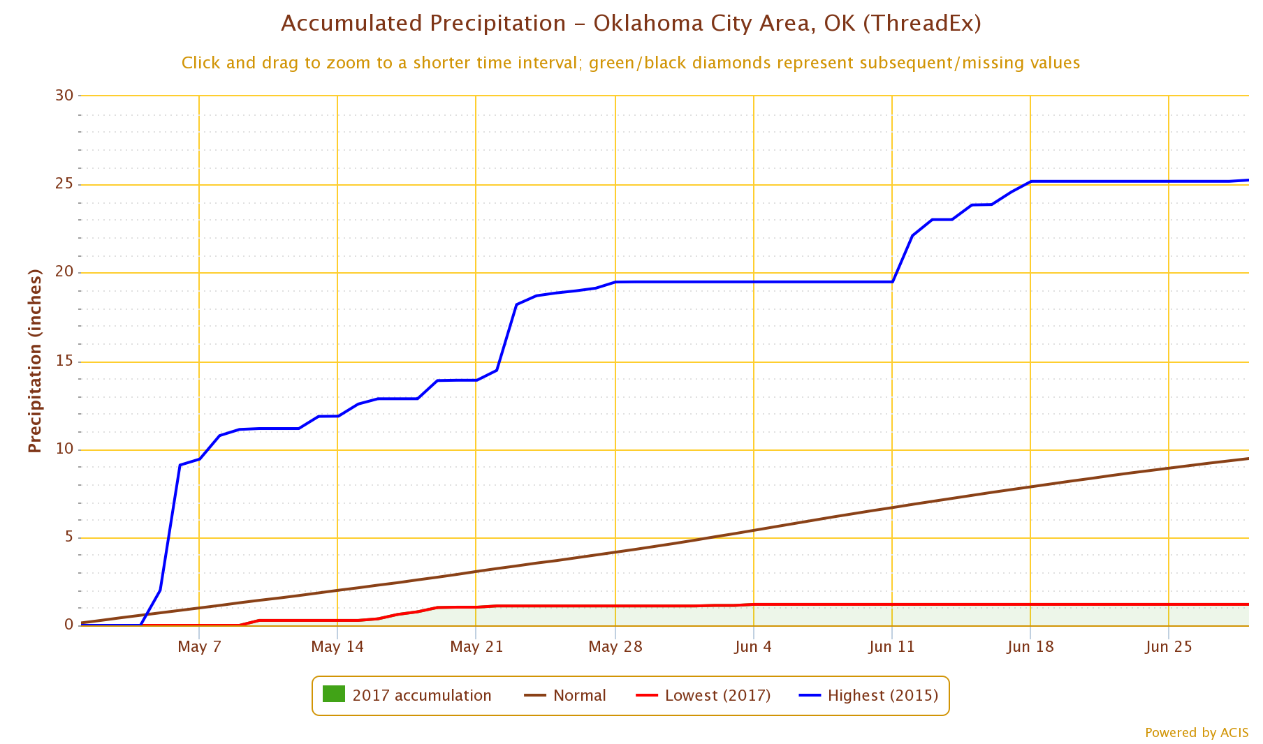
8 inches below normal in central OK over the last 60 days? Are you kidding me,
Pvt. Pyle? That's bad. Take the official OKC measuring station at Will Rogers
Airport, for instance. Since May 1, they've registered 1.19 inches of rain,
THE driest May 1-June 29th on record for OKC dating back to 1891.
And consider the rapid drying of the topsoil from around the state.
All the more reason why we need this rainfall forecast to become reality.
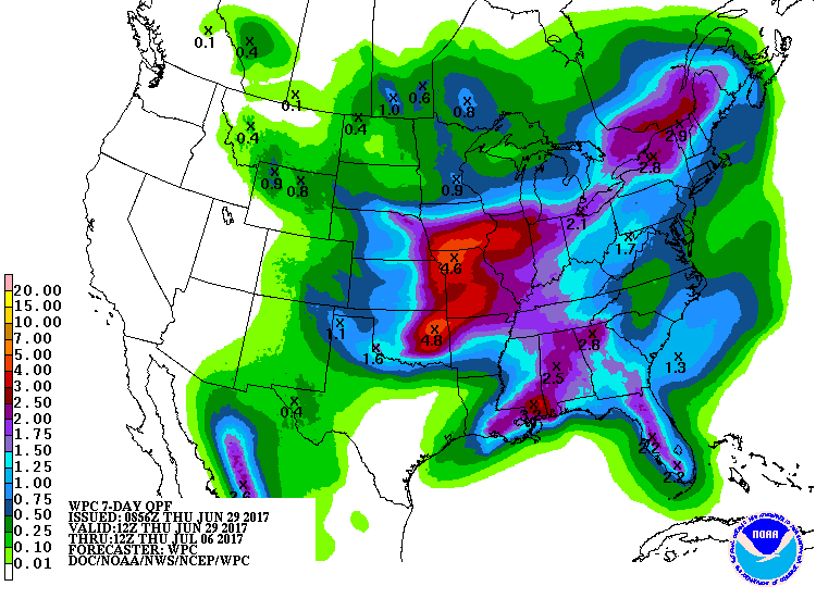
Flash droughts that begin early in summer have a way of becoming adult droughts
as the full strength of our summer climate arrives. So let's knock the drought
down a peg before next week.
Gary McManus
State Climatologist
Oklahoma Mesonet
Oklahoma Climatological Survey
(405) 823-9054
gmcmanus@mesonet.org
June 29 in Mesonet History
| Record | Value | Station | Year |
|---|---|---|---|
| Maximum Temperature | 111°F | HOOK | 1998 |
| Minimum Temperature | 47°F | GOOD | 2007 |
| Maximum Rainfall | 4.34 inches | CLAR | 1995 |
Mesonet records begin in 1994.
Search by Date
If you're a bit off, don't worry, because just like horseshoes, “almost” counts on the Ticker website!