Ticker for June 15, 2017
MESONET TICKER ... MESONET TICKER ... MESONET TICKER ... MESONET TICKER ...
June 15, 2017 June 15, 2017 June 15, 2017 June 15, 2017
FLASH DROUGHT!
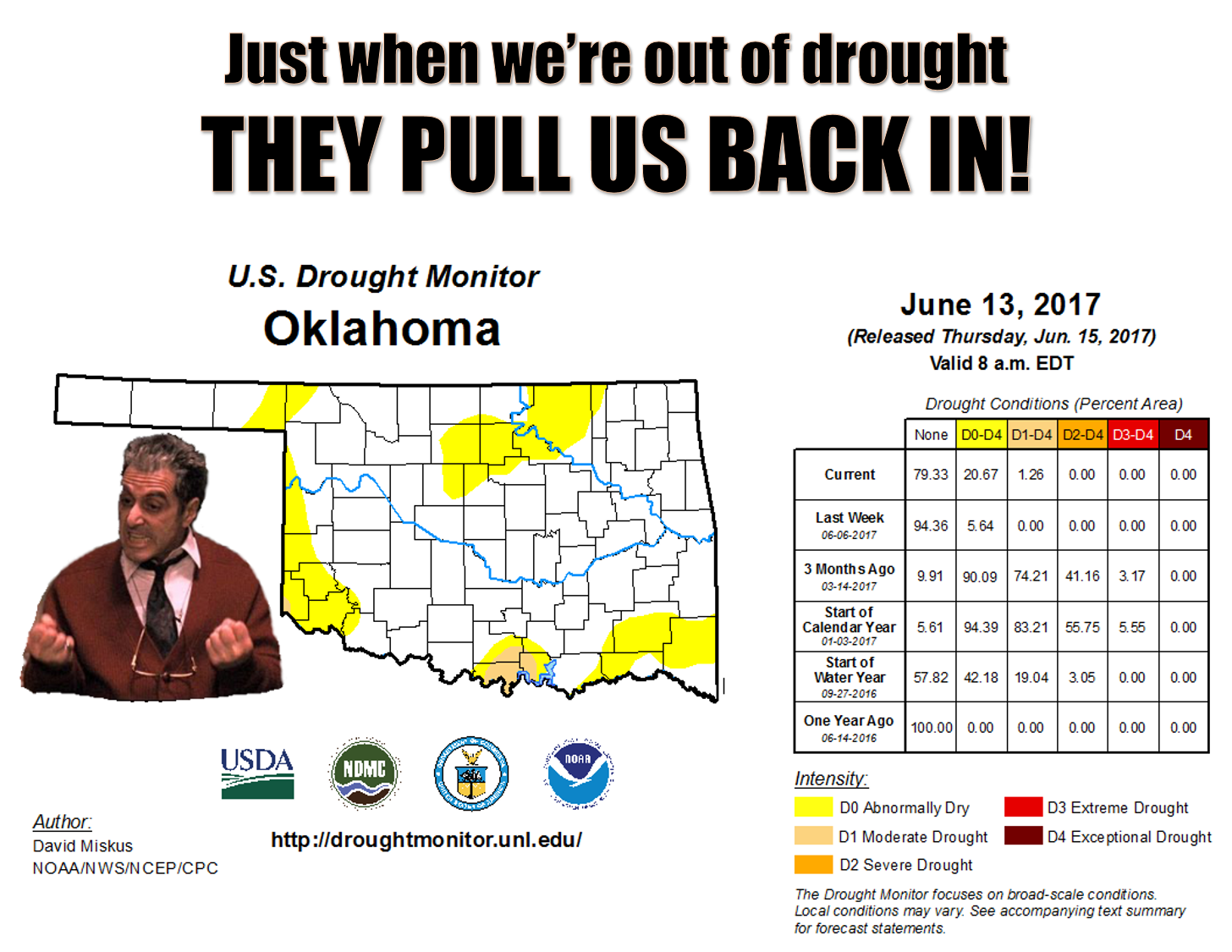
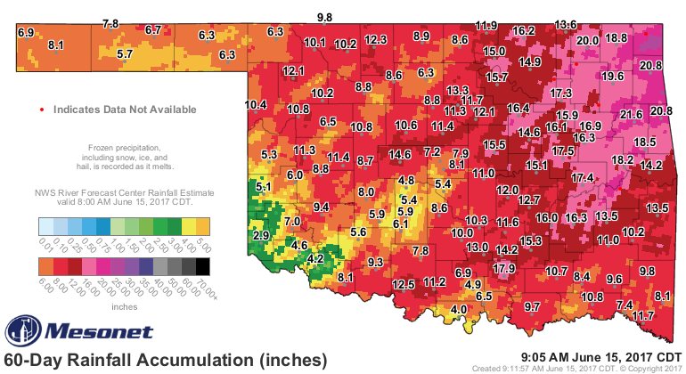
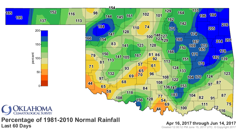
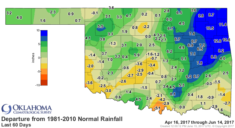
Oh, it's just a smidgen. Not even 2%. Think of it as "Skim Drought." But that's
how it starts, ain't it? You go a good two months with parts of the state having
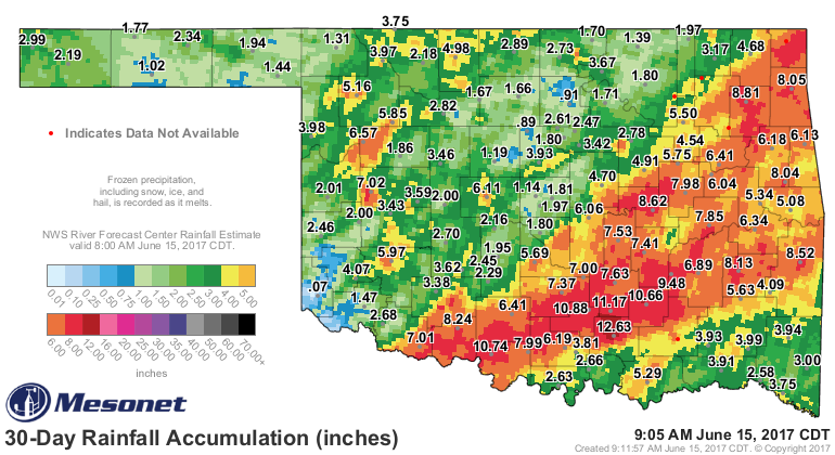
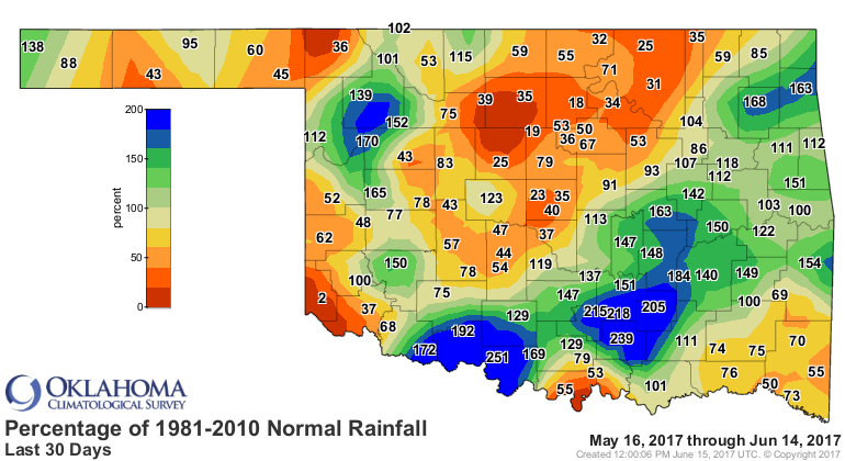
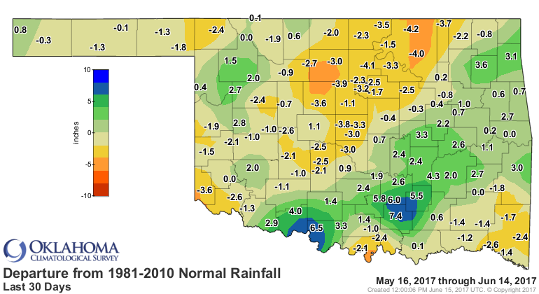
large deficits right before summer, missing out on the rainiest time of the year,
and then drought is off and running when you hit July. Even worse, the last 30
days, from mid-May to mid-June...THE rainiest part of the year for most of the
state...well those stats are even worse.
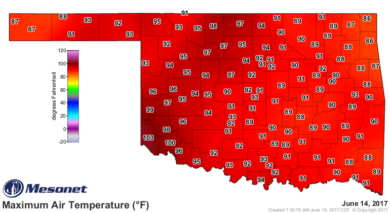
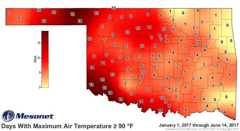
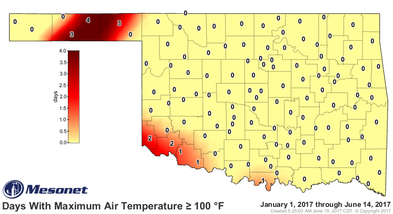
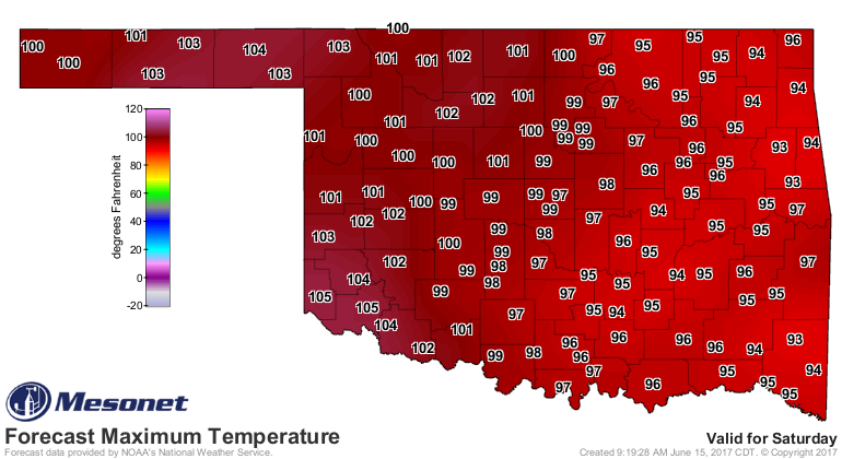
And this comes at a time when the temperatures have really started to ramp up with
90s and 100s becoming more numerous.
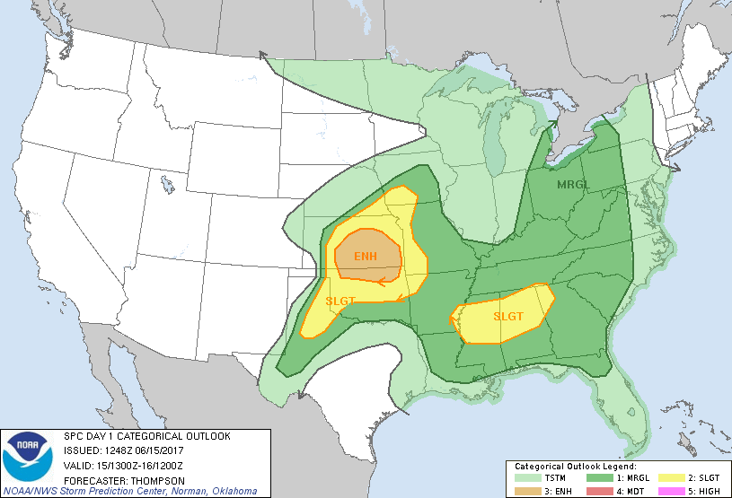
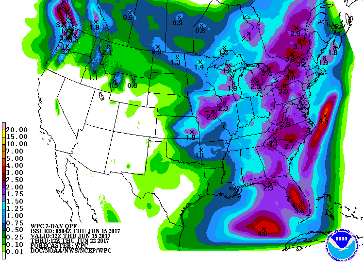
The good news? Well, it's raining now, and there will be a chance for storms
off an on for the next week or so.
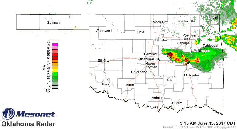
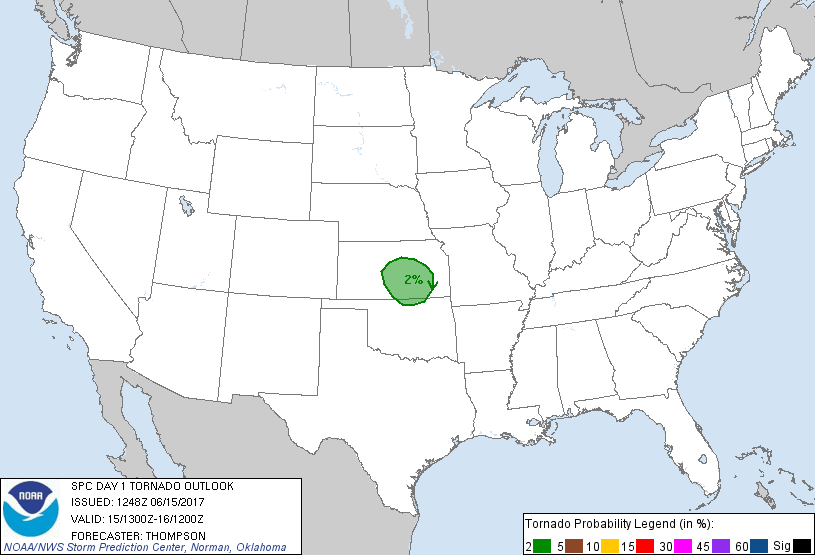
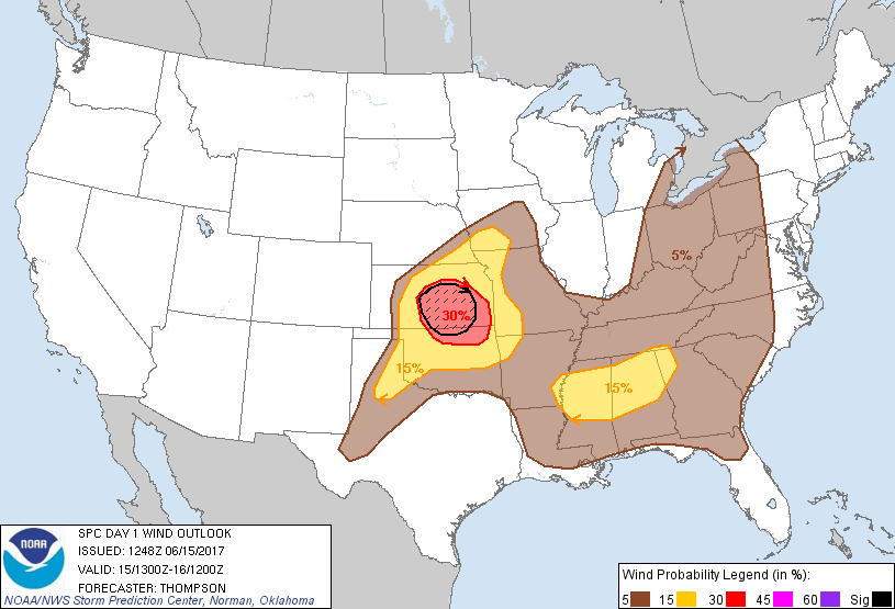
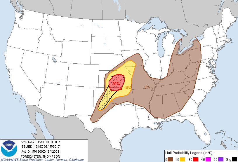
The bad news? Well, the storms are already severe, and more convection is
expected later today with even higher severe risks.
More bad news? We aren't talking drought-destroying rains here. Remember, this
time of year, the evapotranspiration (moisture evaporated by the sun/wind and
used by plants) is tremendous and normally outpaces precipitation...hence the
danger for flash drought.
Now for the good news/bad news scenario. The good news? It's almost the
weekend. The bad news? It's almost the weekend.

Here's one for the Dads!
Gary McManus
State Climatologist
Oklahoma Mesonet
Oklahoma Climatological Survey
(405) 325-2253
gmcmanus@mesonet.org
June 15 in Mesonet History
| Record | Value | Station | Year |
|---|---|---|---|
| Maximum Temperature | 104°F | ALTU | 2022 |
| Minimum Temperature | 42°F | KENT | 2001 |
| Maximum Rainfall | 5.22 inches | BYAR | 2007 |
Mesonet records begin in 1994.
Search by Date
If you're a bit off, don't worry, because just like horseshoes, “almost” counts on the Ticker website!