Ticker for June 5, 2017
MESONET TICKER ... MESONET TICKER ... MESONET TICKER ... MESONET TICKER ...
June 5, 2017 June 5, 2017 June 5, 2017 June 5, 2017
Oklahomaville
I hate summertime rainfall! Don't get me wrong, I love the moisture. But as we
transfer to the chaos of May convection to the tropical air mass thunderstorms
of June, things get very unfamiliar to this Panhandle boy. You know what I'm
talking about...these little popcorn style storms that go up, don't move, OR
MOVE IN THE WRONG DIRECTION (SW??? Really?), then collapse like they never
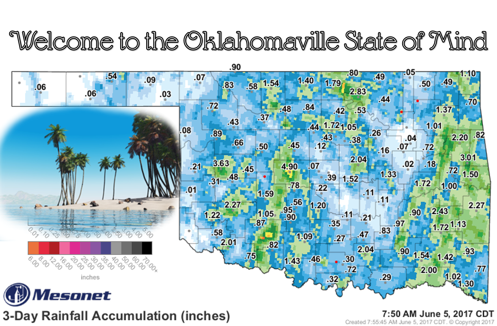
existed. Does that map above look like a proper rainfall map for Oklahoma? Should
El Reno get 5 inches of rain and Oklahoma City North get .07 inches?? Somebody
in Kay County got 5-7 inches and their neighbor a few miles away got 0.8 inches.
Ugh. Thunderstorms in Oklahoma are supposed to loom over the horizon, attacking
your position in a blitzkrieg of wind, hail and furious bolts of lightning.
Wait a minute, maybe these summer storms aren't so bad! But it would have been
nice for some folks to get a bit more rain.
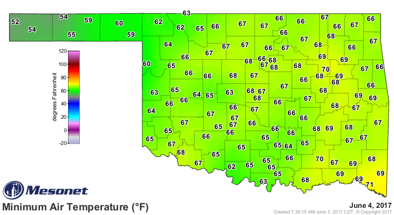
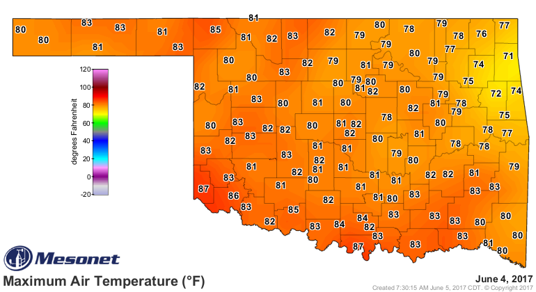
How about that air mass, by the way? You like this kind of stuff? You know what
I'm talking about (I've said that twice...if you don't know what I'm talking
about, just look at the pretty pictures), the air is muggy, almost greasy, choked
with moisture. The lows get down to about 70 and the highs get up to about 80.
Again, as a Panhandle boy, I need my highs in the 90s and lows in the 50s. THAT
makes for a nice evening of dry, refreshing air. You should be able to feel the
air as it goes into your lungs!
What now? Well, as this air mass and upper level storm pulls off to the east,
we should start to see a glimpse of summer. Flirtations with rainfall in
the middle of the week, then some heat. From the Norman NWS forecast discussion:
By the end of the week into the weekend models show another
transition in the upper air pattern, to a more southwest mid-level
flow. This will result in a more substantial warm-up with highs in
the 90s becoming more widespread, along with breezy south winds.
Now, we need thunderstorms! We need some good SW-to-NE movers. No more rain maps
that look like Mother Nature threw up her dinner.
It's mid-May somewhere.
Gary McManus
State Climatologist
Oklahoma Mesonet
Oklahoma Climatological Survey
(405) 325-2253
gmcmanus@mesonet.org
June 5 in Mesonet History
| Record | Value | Station | Year |
|---|---|---|---|
| Maximum Temperature | 106°F | ALTU | 2006 |
| Minimum Temperature | 42°F | BOIS | 1998 |
| Maximum Rainfall | 4.30 inches | LAHO | 2008 |
Mesonet records begin in 1994.
Search by Date
If you're a bit off, don't worry, because just like horseshoes, “almost” counts on the Ticker website!