Ticker for March 30, 2017
MESONET TICKER ... MESONET TICKER ... MESONET TICKER ... MESONET TICKER ...
March 30, 2017 March 30, 2017 March 30, 2017 March 30, 2017
The drought illusion
The Drought Monitor process is never-ending, it seems. Except when there is no
drought. But then again I have to go search data and field reports in order to
prove there is no drought, so that in and of itself is another part of the
drought process. And then when there is no drought, we remain in constant
vigilance to make sure drought doesn't creep back in without us knowing about it.
Hmmm, let me say it again...the Drought Monitor process is never-ending. One of
the curiosities of the process is the Tuesday morning 6am cutoff time for
precipitation that can be considered in the new map released on Thursdays. The
national author has to complete the map by Wednesday, do the drought write-up,
and make sure everything is in order. You can't do that if you're still pouring
through data Wednesday afternoon. So that brings us to this week's oddity of a
map.
Despite all the HEAVY precip that fell over the last 2-3 days, this week's map
still shows fairly significant drought over much of the state.
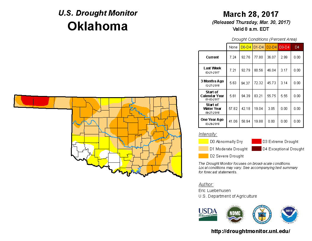
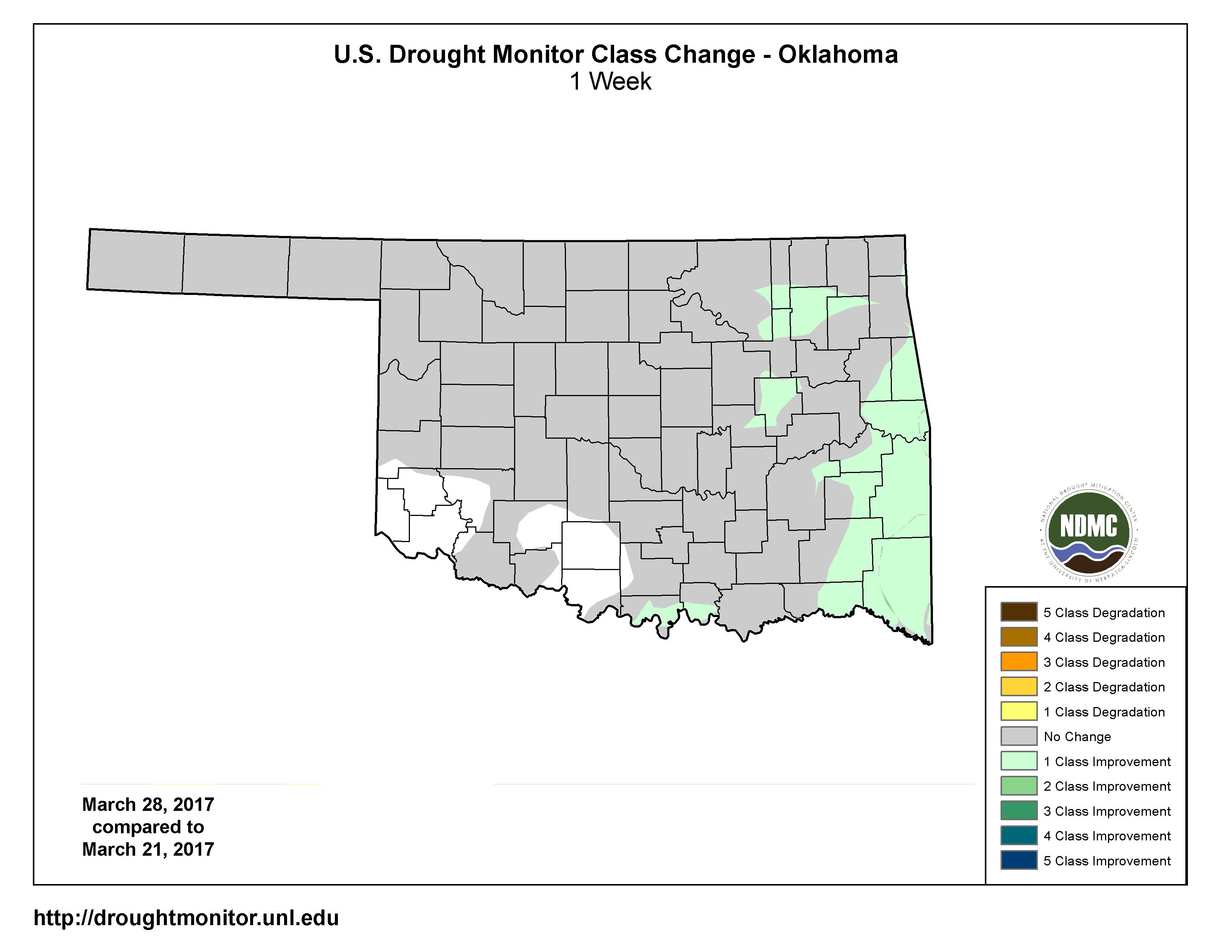
In fact, the only changes made on the map were some improvements across eastern
OK due to last week's rain. Those changes are illustrated on this 1-week change
map.
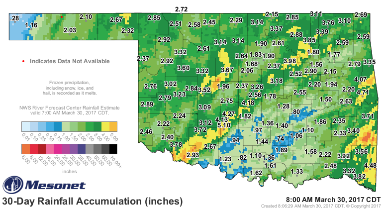
In reality, if you look at the rainfall map from the last couple days, if you see
lots of greens/yellows/oranges/reds, expect improvement on next week's map.
Unfortunately, unless SE OK gets their share before Tuesday, they'll not see
much improvement in next week's map, let alone their drought conditions.

Just the view of March's rainfall through today shows that despite that huge
slobberknocker of a storm, we still have work to do down in the southeast.
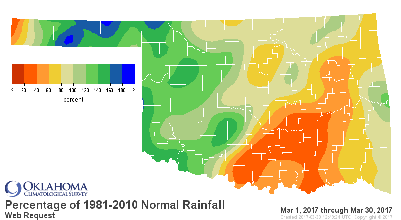
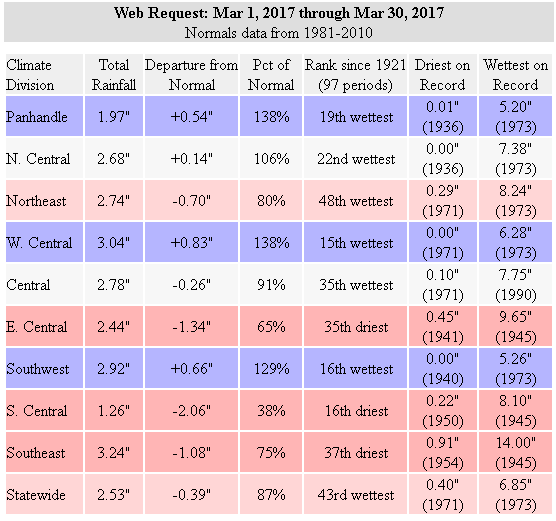
So we're going to end up with one of top 20 wettest Marches for western
Oklahoma, but not so much for the eastern half of the state or so.
There are prospects for rain starting this weekend, especially for SE OK.
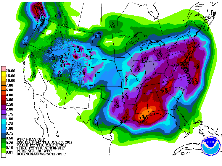
So the NW half of the state gets theirs this week, maybe the SE half gets theirs
next week? Following that, high and dry?
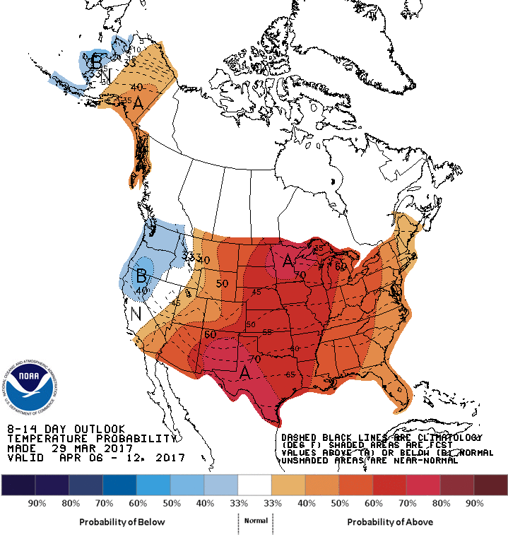
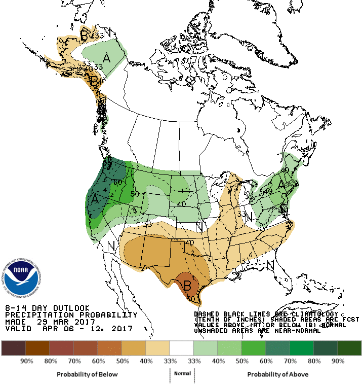
At least things should start to green up fairly quickly now, especially if we
get those warm conditions later next week.
Gary McManus
State Climatologist
Oklahoma Mesonet
Oklahoma Climatological Survey
(405) 325-2253
gmcmanus@mesonet.org
March 30 in Mesonet History
| Record | Value | Station | Year |
|---|---|---|---|
| Maximum Temperature | 92°F | ARNE | 2010 |
| Minimum Temperature | 20°F | ANTL | 2003 |
| Maximum Rainfall | 5.20″ | IDAB | 2002 |
Mesonet records begin in 1994.
Search by Date
If you're a bit off, don't worry, because just like horseshoes, “almost” counts on the Ticker website!