Ticker for March 29, 2017
MESONET TICKER ... MESONET TICKER ... MESONET TICKER ... MESONET TICKER ...
March 29, 2017 March 29, 2017 March 29, 2017 March 29, 2017
What the???
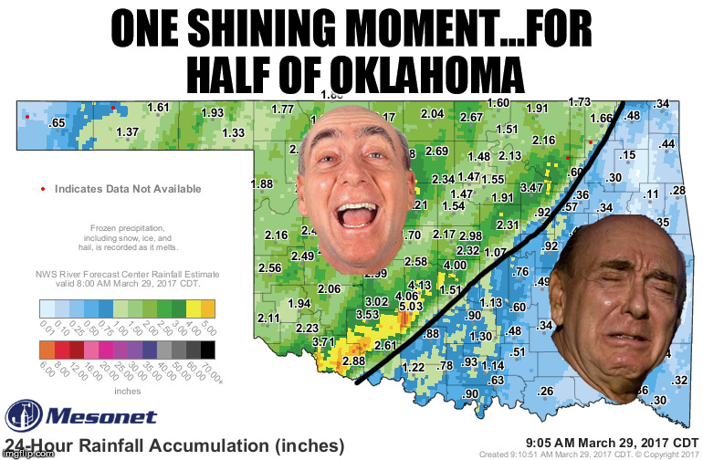
I haven't seen Dick Vitale that sad since the last foul called on the Duke Blue
Devils. (I wanted to say something about KU basketball, but I don't want to anger
our neighbors to the north.) Yesterday was about as exciting (and wet) as
advertised, at least for the NW half of the state or so. Here's a better look at
that rainfall total map.
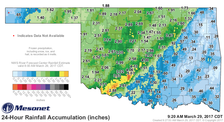
Some very hefty totals showing on the Mesonet/ARBFC gauge/radar-estimated map.
The big winner, as far as gauge measured totals go, was Acme with 5.03 inches,
but the surrounding area had from 3-5 inches according to the map. Maybe even
a bit more SW of Acme. There's a Wile E. Coyote joke there somewhere, but I won't
make it. That was the area where the storms trained over time and time again,
forming, moving to the NE and then forming again. The line refused to budge much
farther SE, however, and the rain totals diminish quite rapidly from there. All
the rain was much appreciated, but it did come with a cost.
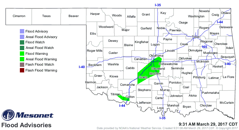
That map is a bit more tame than what it looked like last night, but areal
flooding advisories are still painting the map green. There may have been a
spin-up or two in Oklahoma...I'll let the svr wx experts figure that one out.
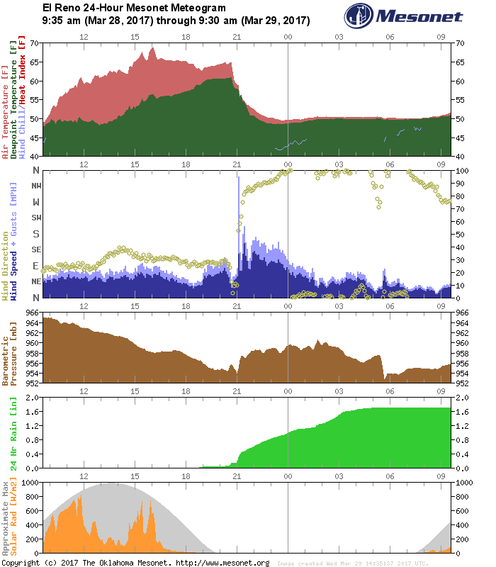
But mostly I saw wind and hail reports (and flooding!). The El Reno Mesonet site,
always one to show off during severe weather, came in with a 95mph wind gust
last night as the bow echo moved in from western Oklahoma. It shows up like a
hypodermic needle on the 24-hr meteogram.
It's still raining, so all hope for the SE is not lost just yet.
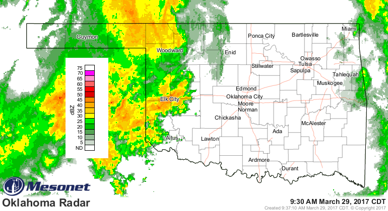
The big upper low is still churning this way, and that will allow another round
of storms across eastern OK later this afternoon...possibly severe.
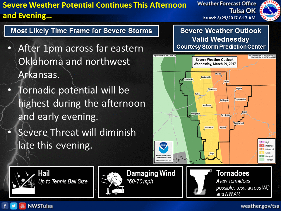
So, chance for storms today across most of the state as the upper low moves
east, bigger storms possible in eastern OK. More rain/storms possible on
Saturday.
More importantly, this rain will go a long way towards ending wildfire danger
across the state. With as warm as it has been, and now that we're approaching
April, we should see a rapid green up. We haven't seen our last wildfire, but
I'm betting we've seen the worst for this season.
Gary McManus
State Climatologist
Oklahoma Mesonet
Oklahoma Climatological Survey
(405) 325-2253
gmcmanus@mesonet.org
March 29 in Mesonet History
| Record | Value | Station | Year |
|---|---|---|---|
| Maximum Temperature | 94°F | HOLL | 2022 |
| Minimum Temperature | 16°F | BOIS | 2009 |
| Maximum Rainfall | 2.93″ | WATO | 2007 |
Mesonet records begin in 1994.
Search by Date
If you're a bit off, don't worry, because just like horseshoes, “almost” counts on the Ticker website!