Ticker for March 24, 2017
MESONET TICKER ... MESONET TICKER ... MESONET TICKER ... MESONET TICKER ...
March 24, 2017 March 24, 2017 March 24, 2017 March 24, 2017
Droughts are mortal
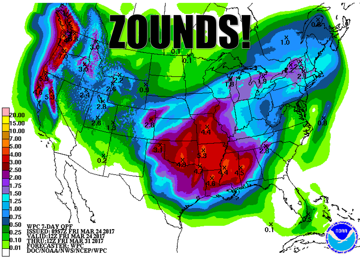
This ain't Thunderdome, ya know, although thunder will play a big part in
the current drought's possible demise. Two droughts enter, two droughts leave.
That 7-day rain forecast reflects the series of storms we Ticked about earlier
this week. The first round was last night and was kind of a dud, except for a
20-30 mile stretch of the far western Panhandle.
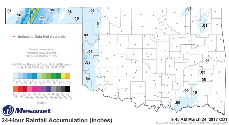
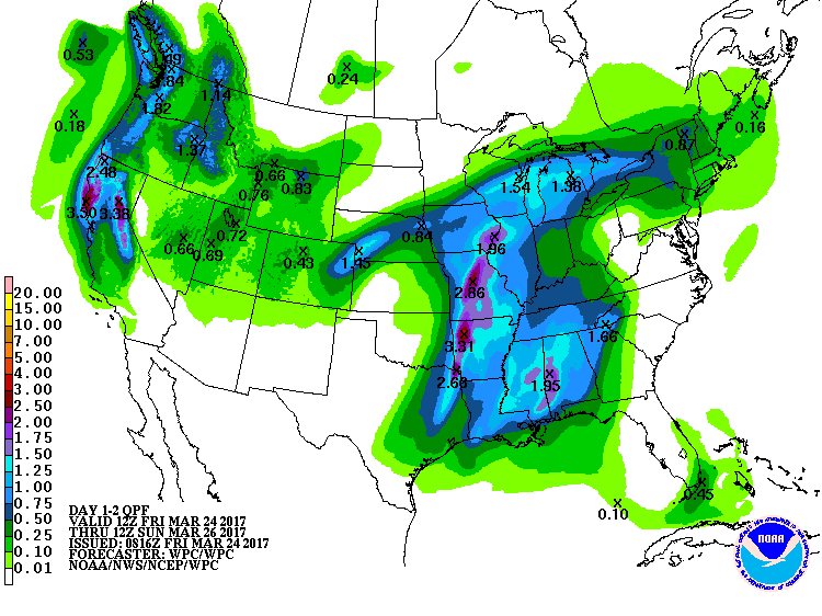
And I suspect tonight's round will be a dud for most of the state as well, with
good news possibly in store for far eastern Oklahoma.
Given the new Drought Monitor released yesterday, we are big need of a one-two
(or a one-four) punch.
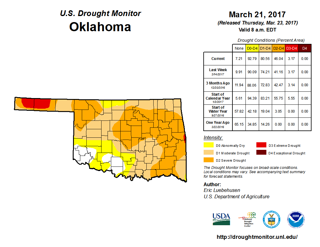
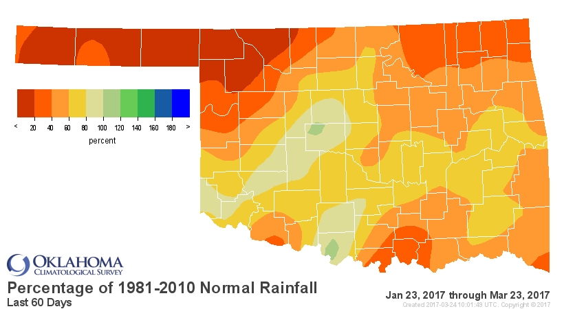
The biggest increase came across eastern and NW Oklahoma, obviously. We've
received plenty of reports of ailing farm ponds - mostly dry - and damaged
crops. The southwest is still "supposedly" okay, so hopefully those rainfall
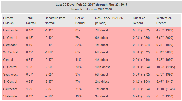
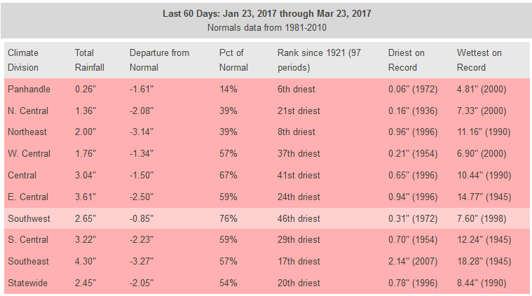
totals will arrive before any incredulous e-mails. The statistics are
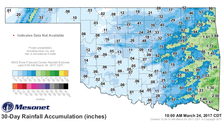
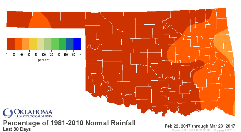
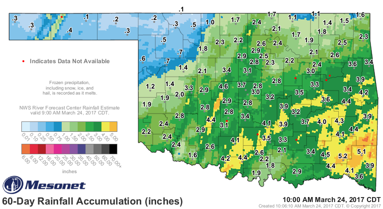
impressive, or in this case less than impressive, as well. The last 30/60 days
have been horrific at best.
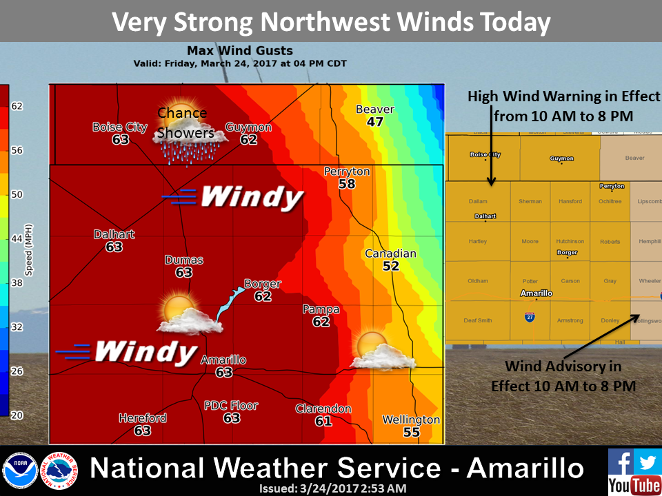
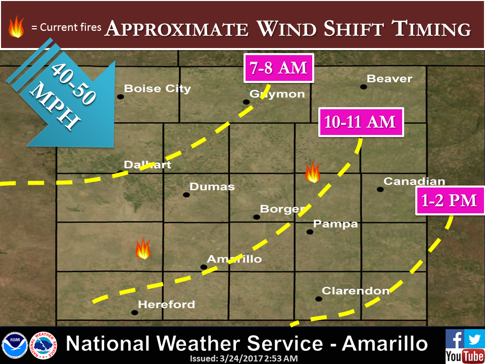
And today's pristine fire danger conditions won't help matters at all.
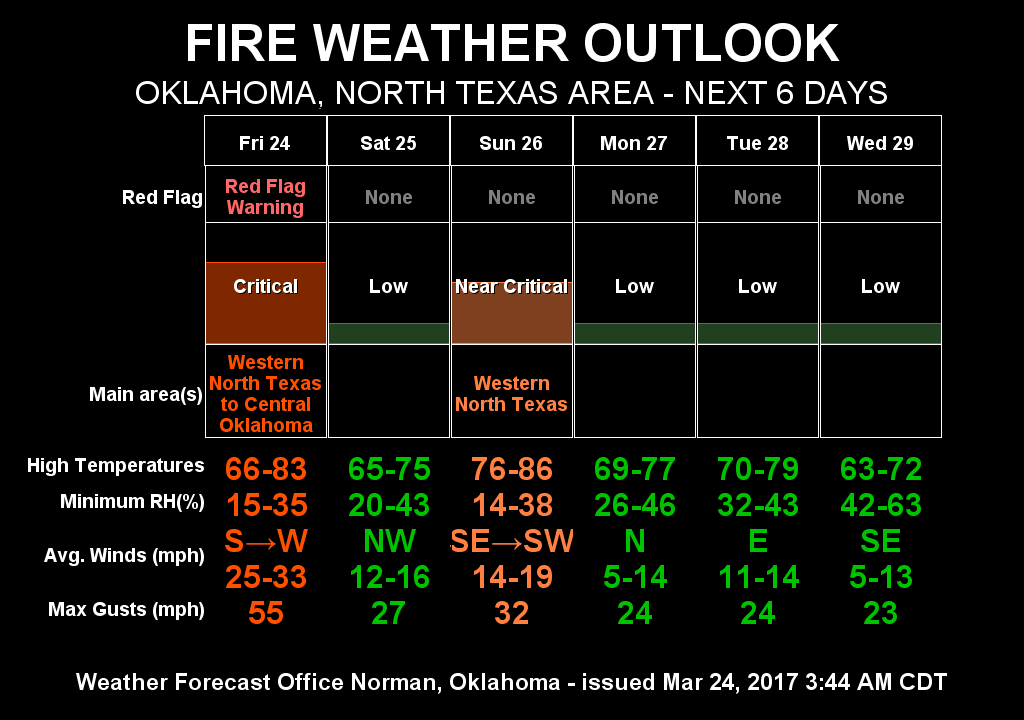
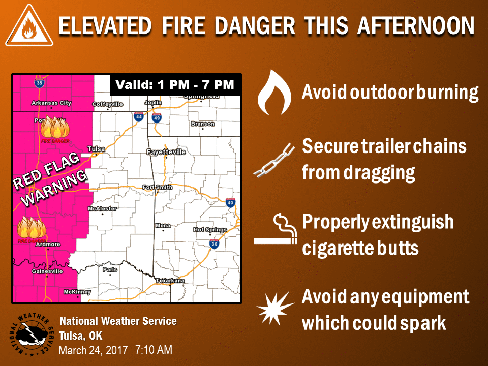
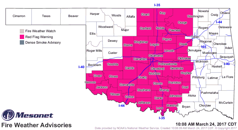
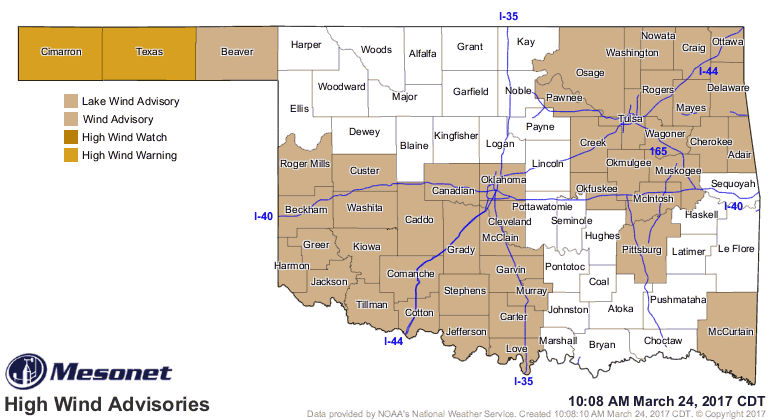
Chance of severe weather tonight and Sunday. Then we continue on with the
cavalcade of storms. And check this out.
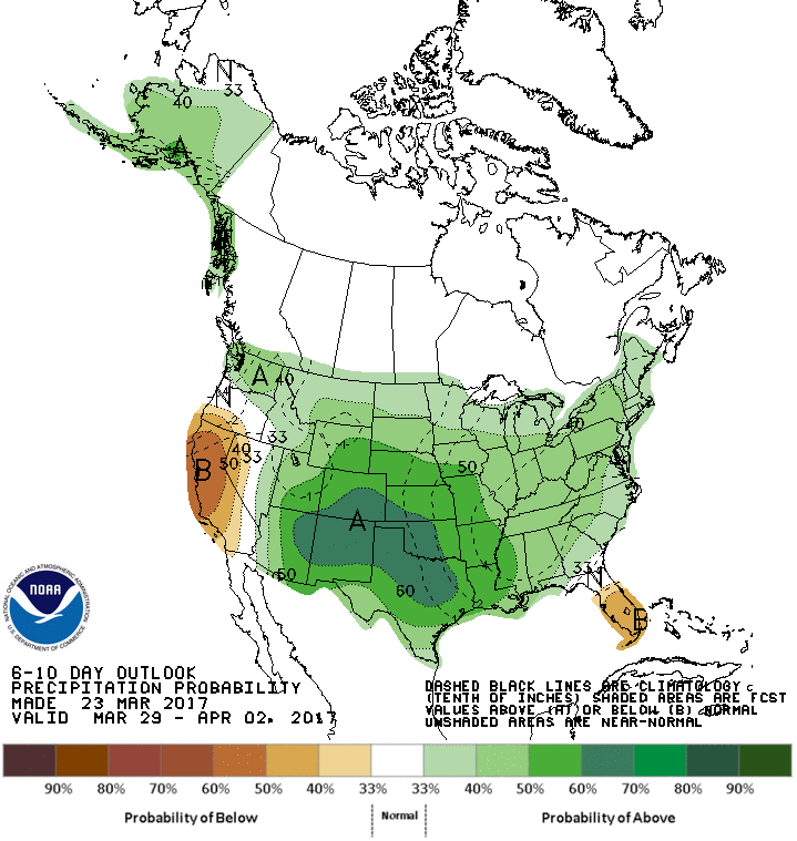
ZOUNDS!
Gary McManus
State Climatologist
Oklahoma Mesonet
Oklahoma Climatological Survey
(405) 325-2253
gmcmanus@mesonet.org
March 24 in Mesonet History
| Record | Value | Station | Year |
|---|---|---|---|
| Maximum Temperature | 88°F | ALTU | 2003 |
| Minimum Temperature | 12°F | KENT | 2013 |
| Maximum Rainfall | 5.00″ | CLAY | 2023 |
Mesonet records begin in 1994.
Search by Date
If you're a bit off, don't worry, because just like horseshoes, “almost” counts on the Ticker website!