Ticker for March 20, 2017
MESONET TICKER ... MESONET TICKER ... MESONET TICKER ... MESONET TICKER ...
March 20, 2017 March 20, 2017 March 20, 2017 March 20, 2017
Welcome to Sprummer!
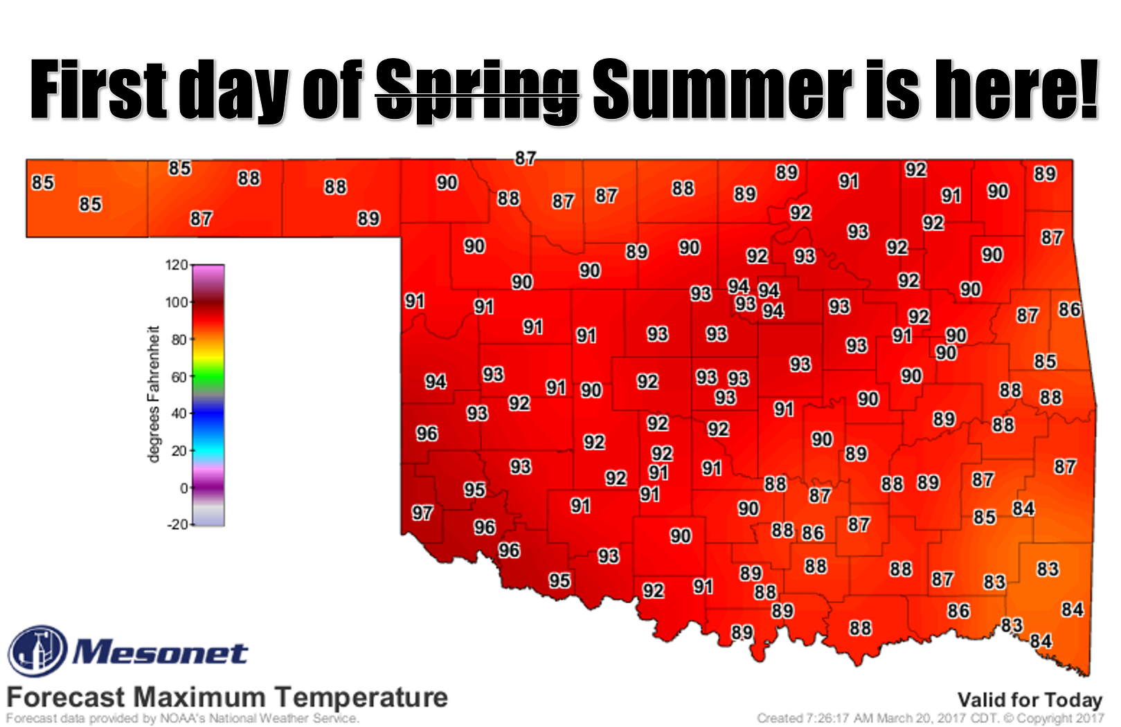
Sp(ring)ummer...Sprummer. Hmmm, have we used that one before. There have been so
many opportunities since last fall. Summing? Well that's a real word. Marly?
Sounds like a dog movie. Mune? Jarch? I better stop before I start cursing in a
foreign language. After that lovely spring break which gave us a taste of winter
then right on to summer, we're back into the frying pan for another day. Yesterday
was a doozy as well.
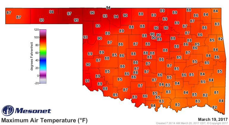
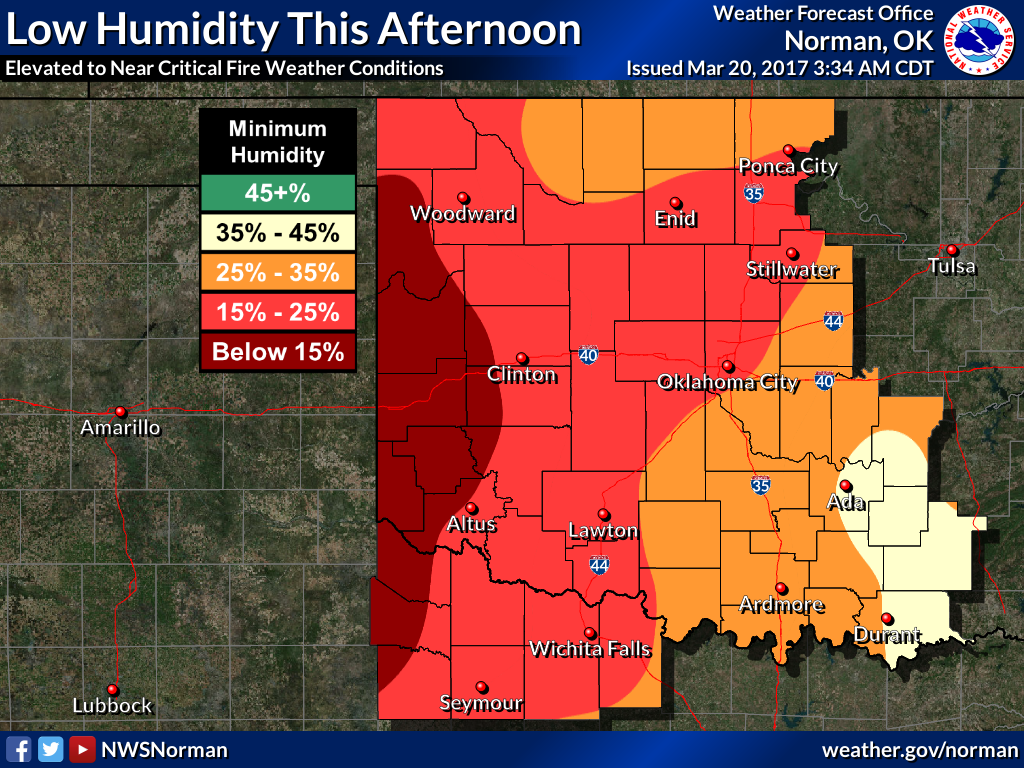
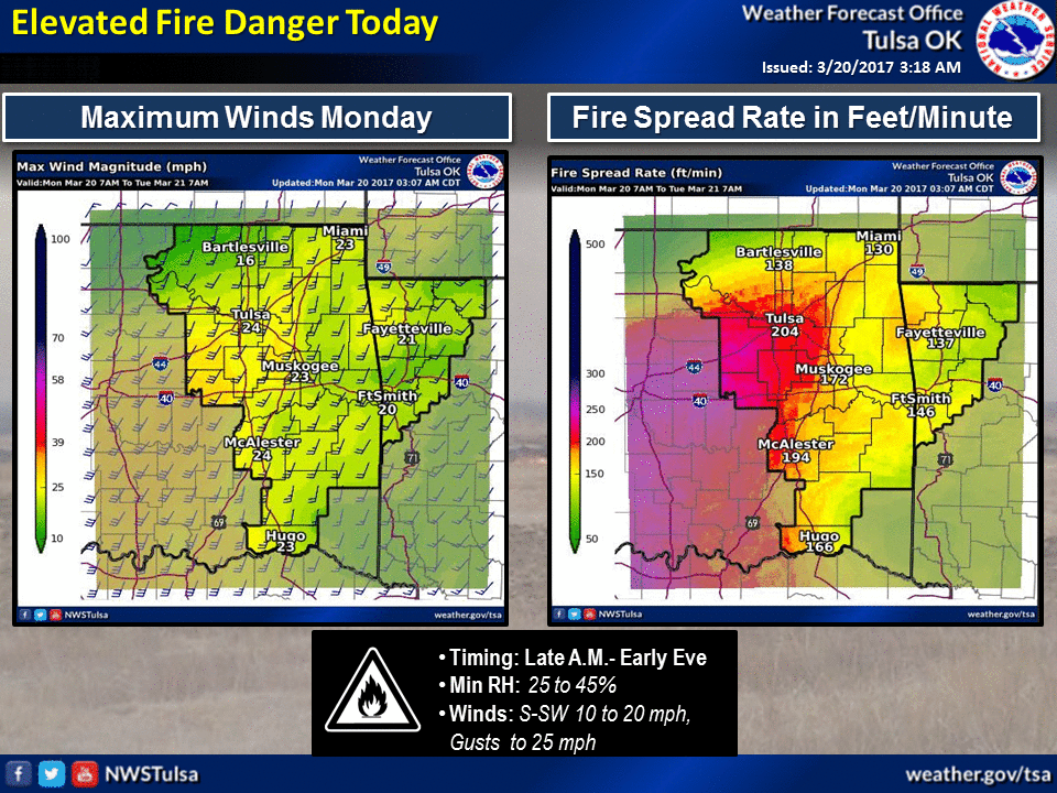
Other than the extreme heat, we have the same storylines continuing as before.
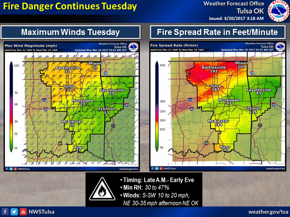
We have your extreme fire danger today and tomorrow, and then again later in
the week.
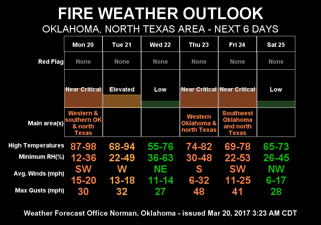
At least we'll be seeing chances of rain at the end of the week, and the
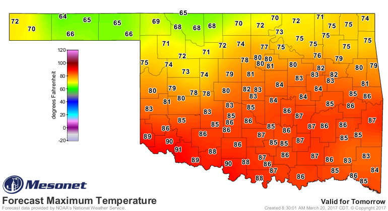
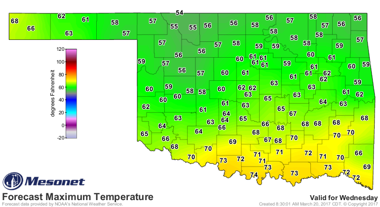
chances of severe weather will be there as well. A cool front tomorrow will
knock temperatures back down to seasonal norms in northern OK, and the rest of
the state will see relief for Wednesday.
There may be an odd shower or two with the front, but better chances will come
Thursday into Friday, and again on Sunday. We'll talk about those severe
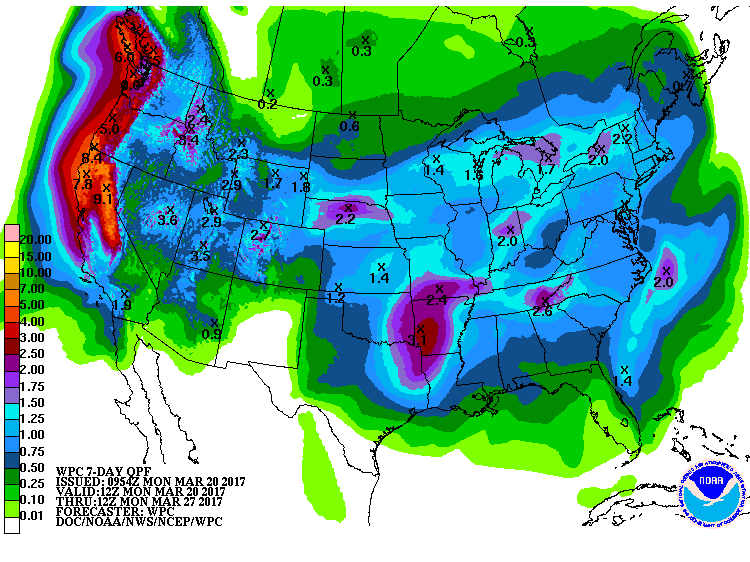
threats as they get closer. For now, we will just look at the 7-day rain
total forecast and hope.
Gary McManus
State Climatologist
Oklahoma Mesonet
Oklahoma Climatological Survey
(405) 325-2253
gmcmanus@mesonet.org
March 20 in Mesonet History
| Record | Value | Station | Year |
|---|---|---|---|
| Maximum Temperature | 98°F | BUTL | 2017 |
| Minimum Temperature | 8°F | KENT | 2016 |
| Maximum Rainfall | 5.14″ | FORA | 2007 |
Mesonet records begin in 1994.
Search by Date
If you're a bit off, don't worry, because just like horseshoes, “almost” counts on the Ticker website!