Ticker for February 1, 2017
MESONET TICKER ... MESONET TICKER ... MESONET TICKER ... MESONET TICKER ...
February 1, 2017 February 1, 2017 February 1, 2017 February 1, 2017
Of ice storms and drought
All good things must end...you know, like hair. And also warm January weather.
Yesterday was another gloriously mild day for most of us. Cue February and break
out the 40s and 50s (and 60s for your SE folks).
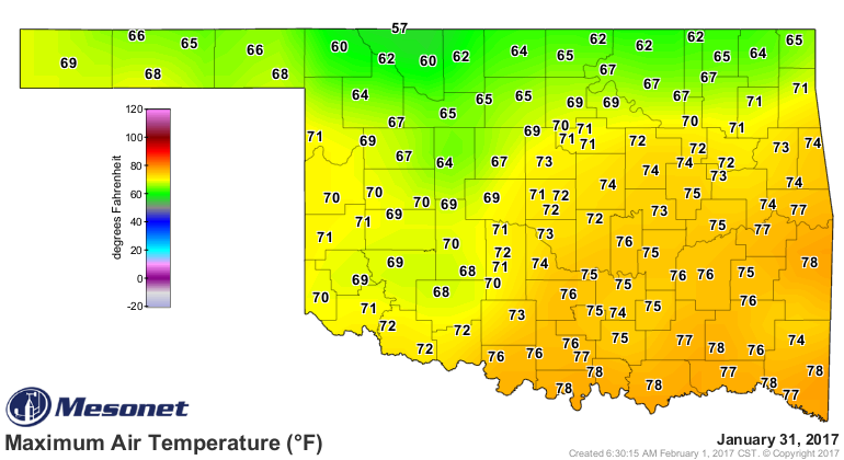
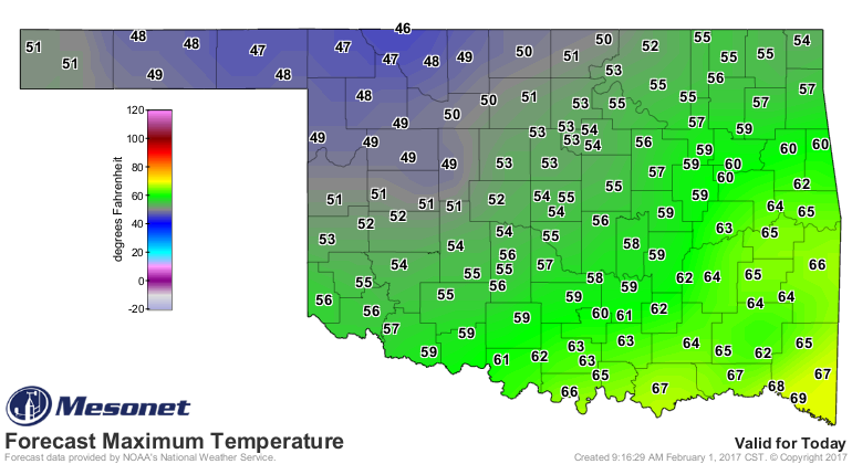
Still need rain, of course, even though January was a wet one...most of that rain
came with the big storm of Jan. 13-15. So we have been getting about one storm
a month. Let's hope this weekend's rain isn't our "big" storm for February.
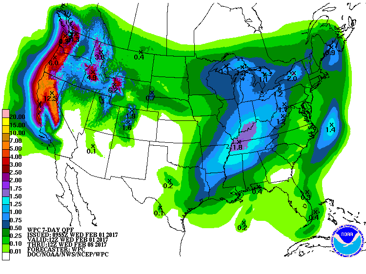
Warmer weather is ahead of early next week. Then, more February. But before we
get there, let's take a look back and a verrrrrrrrrrryyyyyy interesting January.
Very interesting indeed!
-------------------------------------------------------------------------------
Ice Storm Tops January Weather Headlines
Feb. 1, 2017
January 2017 would have been remembered as exceedingly warm and dull if not for
a visit from a powerful mid-month winter storm. The storm struck over the
weekend of Jan. 13-15 and prompted a State of Emergency declaration for all 77
counties by Oklahoma Gov. Mary Fallin. An unusually moisture-laden weather
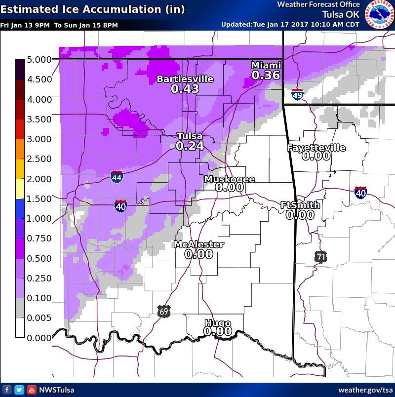
system for January, the storm left the northwestern half of the state encased
in ice and the southeastern half waterlogged. The freezing line meandered about
the I-44 corridor at the beginning of the storm before slowly retreating to the
northwest, bringing a mixed bag of impacts from southwestern through
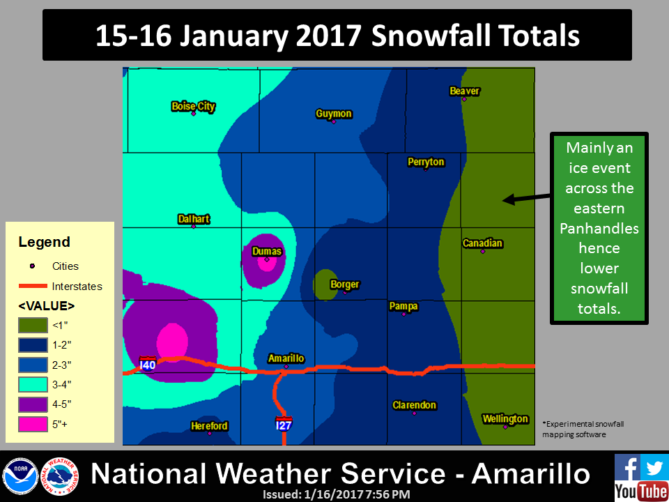
northeastern Oklahoma. Far northwestern Oklahoma and the eastern Panhandle were
particularly hard hit, with ice thicknesses up to 1.5 inches coating trees and
powerlines.
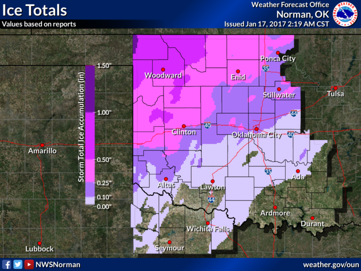
Catastrophic impacts occurred in that region with widespread tree and electric
utility infrastructure damage. At the height of the power outages, more than
23,000 customers were without service, many for several days. At month?s end,
there were still approximately 700 customers without electric service.
According to the Oklahoma Department of Emergency Management, 65 total injuries
were reported with the storm due to cuts, falls and automobile accidents. In
addition, two electrical linemen were electrocuted in Beaver County while
working to restore services, killing one.
The storm dumped 3-4 inches of moisture across the far northwest and south
central regions of the state, while 1-2 inches of precipitation fell across
most other areas. Another storm the following weekend added to those previous
totals to produce a decidedly wet January across Oklahoma.
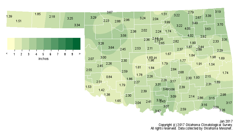
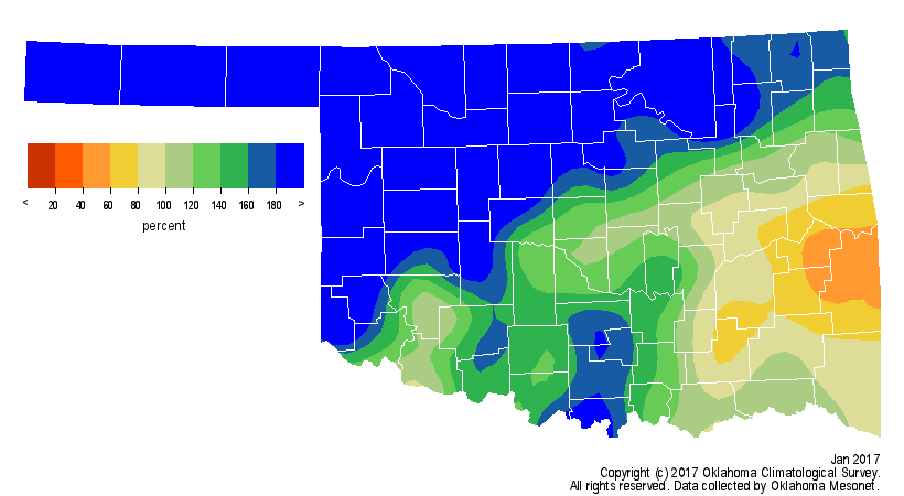
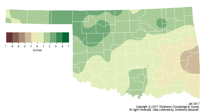
According to preliminary statistics from the Oklahoma Mesonet, the statewide
average was 2.52 inches of liquid precipitation, nearly an inch above normal
and the 13th wettest January on record. Those records date back to 1895.
January was the wettest on record for the Panhandle with an average of 2.4
inches, close to 2 inches above normal. North central and west central sections
each tallied their fourth highest totals on record. Skiatook led the Mesonet
with 4.05 inches of rain, although Tulsa was close on its heels at 4.02 inches.
The Mesonet?s lowest total of 0.84 inches came at Hobart. That was the only
Mesonet station that failed to record at least an inch of rain during the month.
Although the ice storm monopolized the headlines, the temperatures were
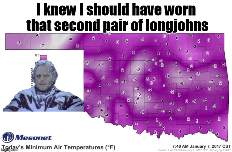
certainly noteworthy as well. An arctic blast on the sixth and seventh of the
month plunged Oklahoma into a frigid pool of air not seen in the state since
February 2011. Kenton reached minus 19 degrees on the seventh, and Kingfisher
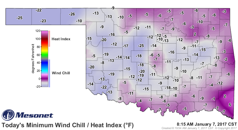
and Chickasha fell to minus 12 that same day. Wind chill temperatures dropped
into the minus teens to minus 20s over a broad region that morning. Forty-five
of the Mesonet?s 121 stations recorded lows below zero during that period and
only one station, Tulsa, remained in double-digits with a low of 11 degrees.
Several days later, many stations recorded highs in the 70s and 80s. Altus
reached 84 degrees on the 11th, January?s highest reading on the Mesonet.
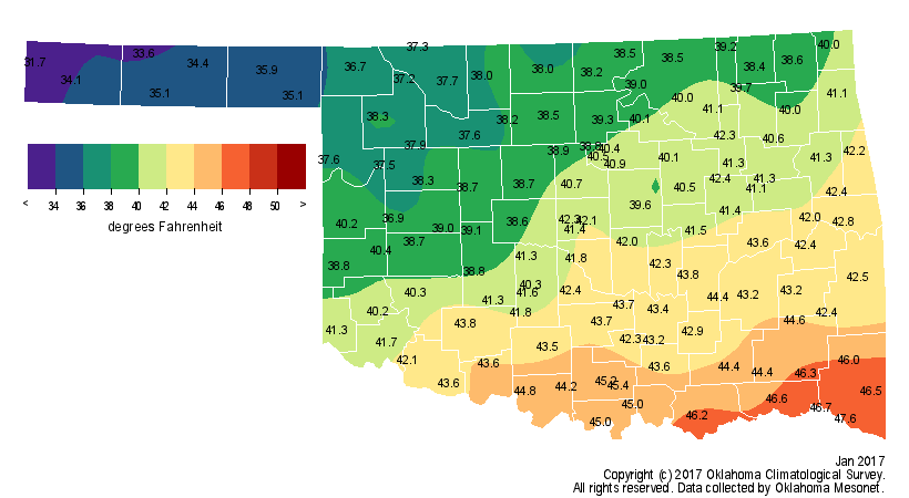
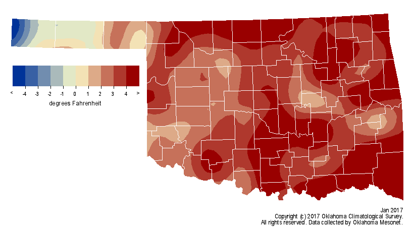
Overall, January was pleasantly mild with a statewide average of 40.6 degrees,
nearly 3 degrees above normal to rank as the 17th warmest on record.
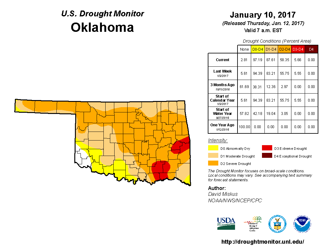
Before the mid-month deluge, drought had taken firm control over much of the
state. Accounts of empty farm ponds, flagging reservoirs, wildfire outbreaks
and distressed wheat crops and grasslands were being reported from all areas of
Oklahoma. By January 10, the U.S. Drought Monitor had 88 percent of the state
affected by drought, with 58 percent of that being severe-to-extreme. The
Drought Monitor?s intensity scale slides from moderate-severe-extreme-
exceptional, with exceptional being the worst classification.
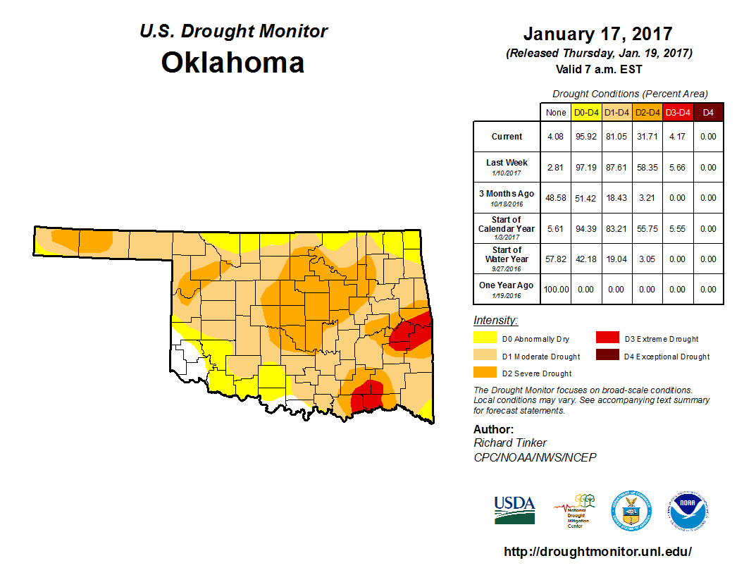
The month?s final map reflected a reduction in drought to about 80 percent of
the state. The severe-to-extreme drought coverage had dropped from 58 percent
to 31 percent. About 49 percent was considered ?moderate? on the month?s final
map.
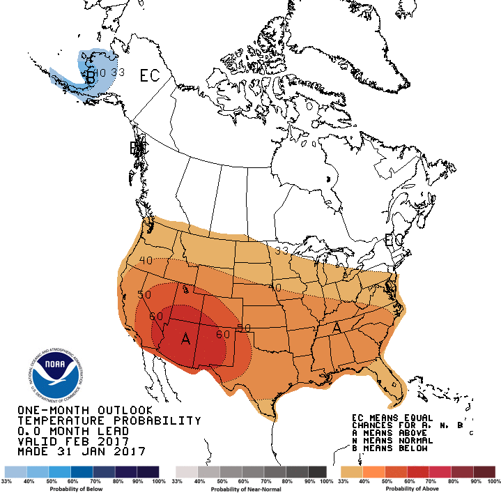
The Climate Prediction Center?s (CPC) February temperature outlook shows
greatly increased odds of above normal temperatures across much of the United
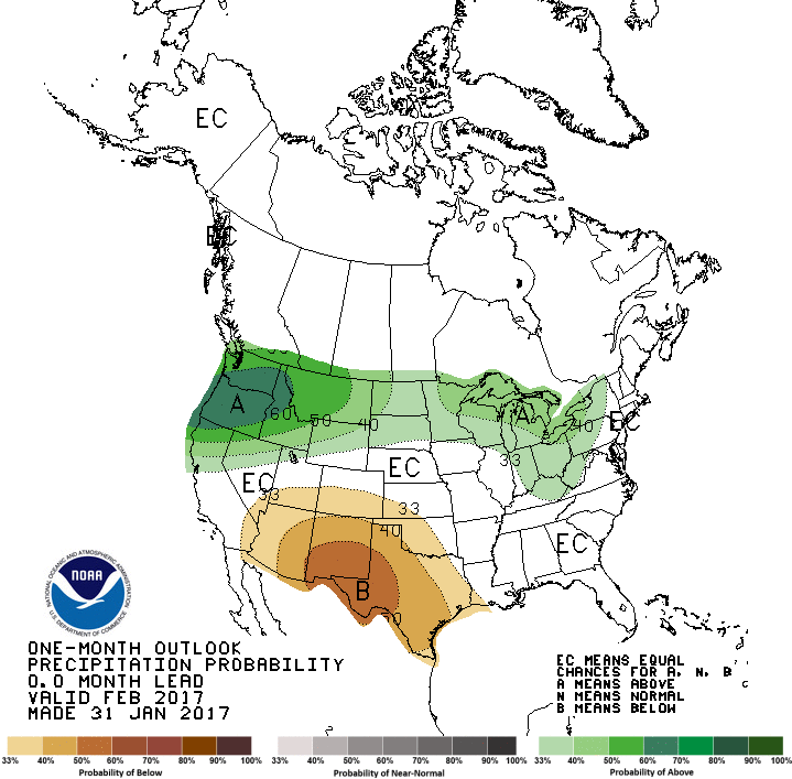
States, including Oklahoma. The precipitation outlook shows slightly increased
odds of below normal precipitation across the western two-thirds of the state.
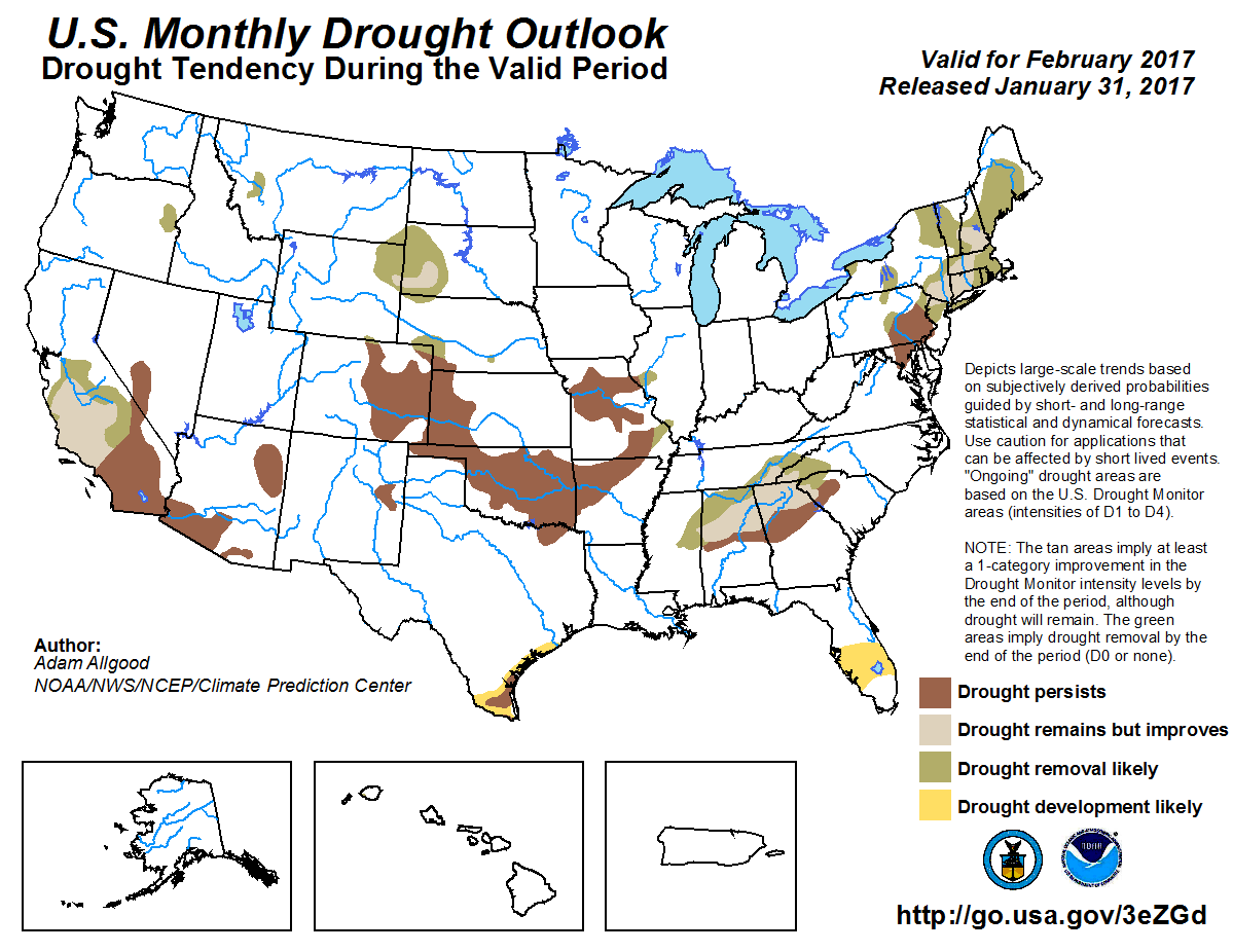
With those two outlooks in mind, and combined with long-range computer modeled
precipitation forecasts, CPC?s February Drought Outlook indicates a persistence
of drought across Oklahoma where it existed at the end of January. No further
development is expected during February, however.
Gary McManus
State Climatologist
Oklahoma Mesonet
Oklahoma Climatological Survey
(405) 325-2253
gmcmanus@mesonet.org
February 1 in Mesonet History
| Record | Value | Station | Year |
|---|---|---|---|
| Maximum Temperature | 81°F | SLAP | 2003 |
| Minimum Temperature | -7°F | BOIS | 2011 |
| Maximum Rainfall | 1.61″ | MTHE | 2011 |
Mesonet records begin in 1994.
Search by Date
If you're a bit off, don't worry, because just like horseshoes, “almost” counts on the Ticker website!