Ticker for January 19, 2017
MESONET TICKER ... MESONET TICKER ... MESONET TICKER ... MESONET TICKER ...
January 19, 2017 January 19, 2017 January 19, 2017 January 19, 2017
But how?
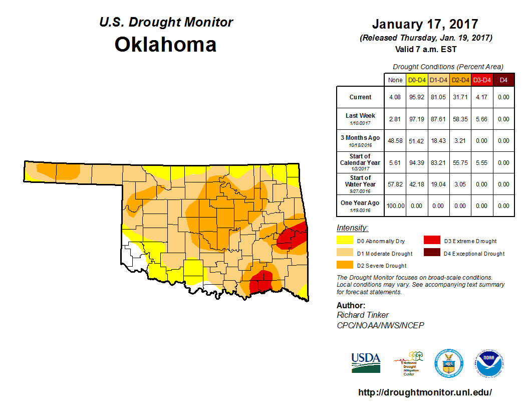
Uhhhhhh, 81% of the state still in drought? Do the Drought Monitor folks not
realize we had a majorly wet winter storm last weekend? Just look at these
moisture amounts!
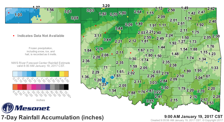
Wow, 3 inches in the far NW (a lot of that in the form of ice, ugh), 3 inches
down south, 2+ inches up in the NE. And a good 1-2 inches elsewhere. You'd think
that would have wiped drought out across the state. So why is it still on the
Drought Monitor map?
1) The U.S. Drought Monitor process discourages/frowns upon/nearly forbids (get
the picture?) improving or intensifying drought by more than one category in a
week. Upon rare occasions, in extreme circumstances, you can see drought jump
back or forwards 2 categories, but again, very rare. And that's because drought
is a very slow process, and its assessment relies upon its impacts, or the changes
in those impacts from week to week.
2) That was a lot of rain in places, and those places did see improvement
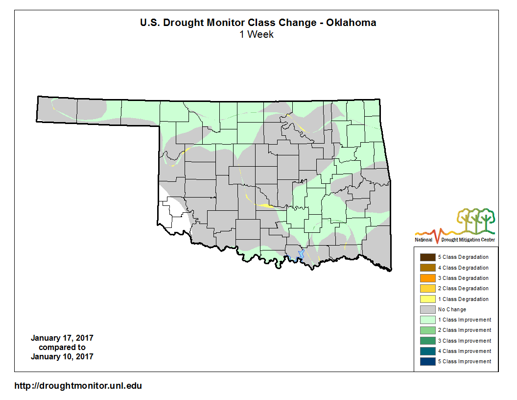
But still, what about the other places with 1-2 inches? Well, in one aspect, we
felt the Drought Monitor picture was somewhat underplaying the actual drought
impacts our office was seeing. So with this rainfall, maybe we now have a more
accurate picture. Additionally, we are still running big deficits across much
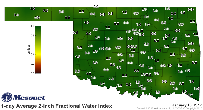
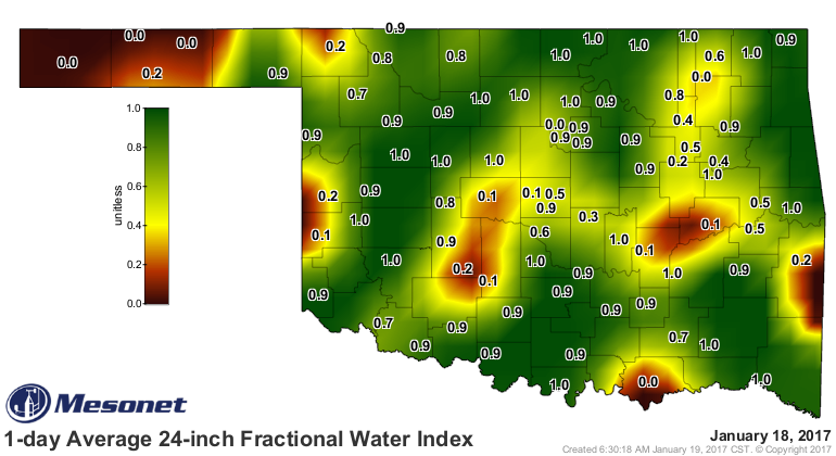
of the state on multiple timelines. So short-term drought impacts improved, but
long-term impacts are still giving us trouble.
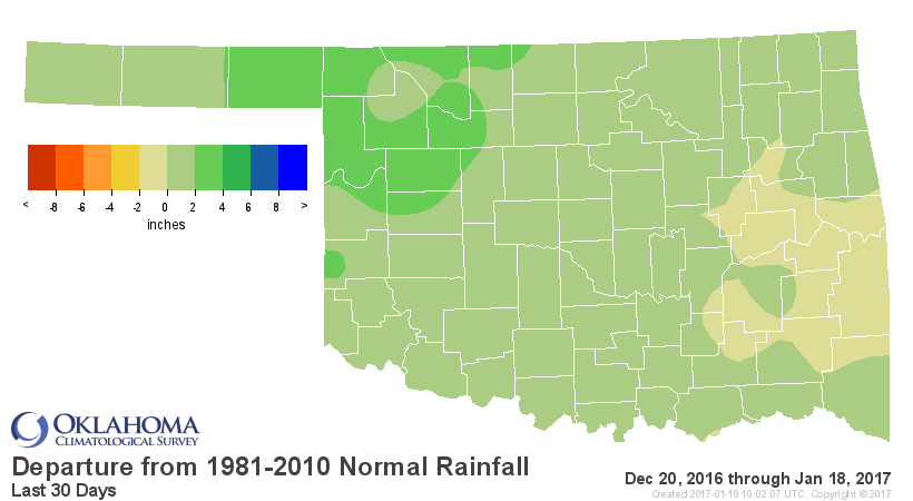
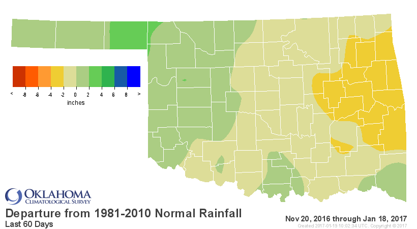
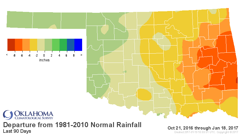
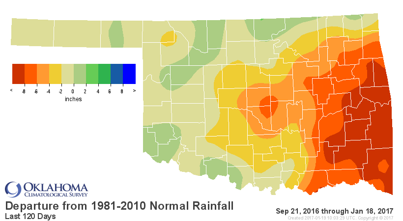
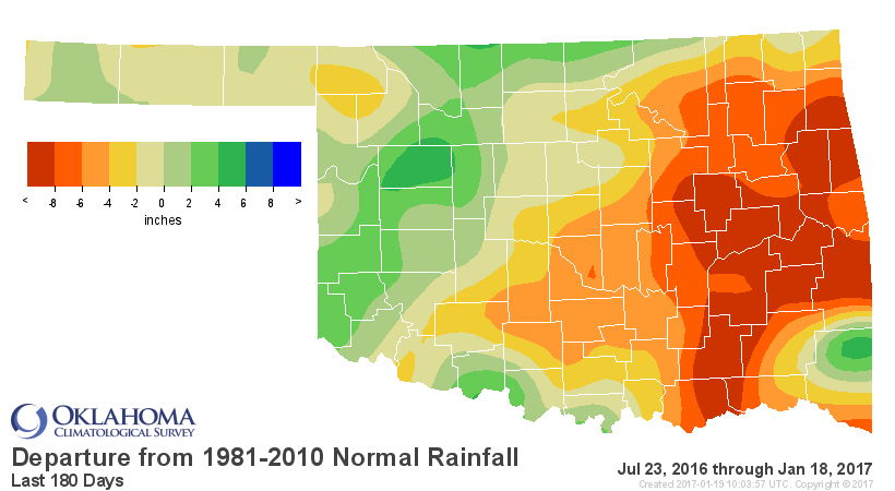
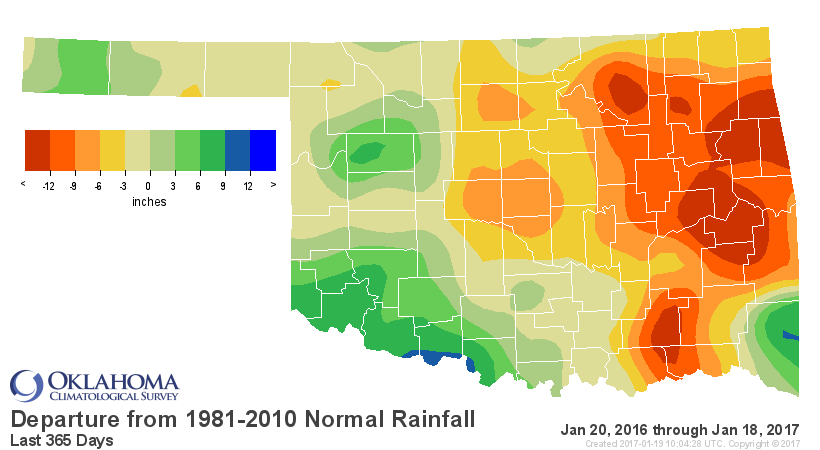
So short-term impacts like upper-layer soil moisture have been improved.

And long-term impacts like deep-layer soil moisture and reservoir levels are
still suffering.
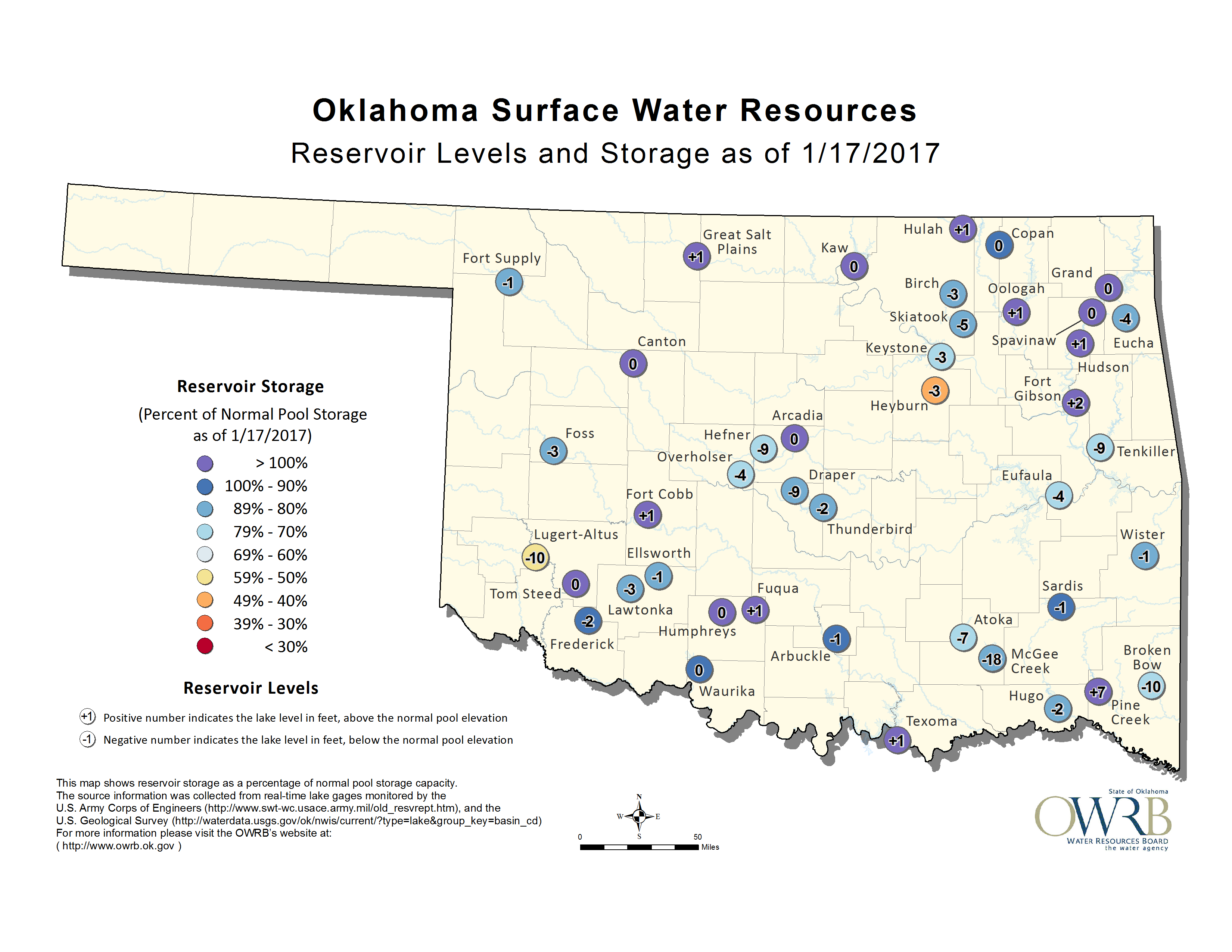
Those lake level could still go up a bit due to last week's event as water
travels the streams and tributaries in those drainage basins, but the levels
will still be below normal. Other impacts, like damage to crops and grasses
are either irreversible (such as in failed wheat crops), or too early in the
season to repair (pastures don't grow during the winter, for the most part).
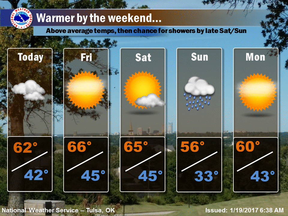
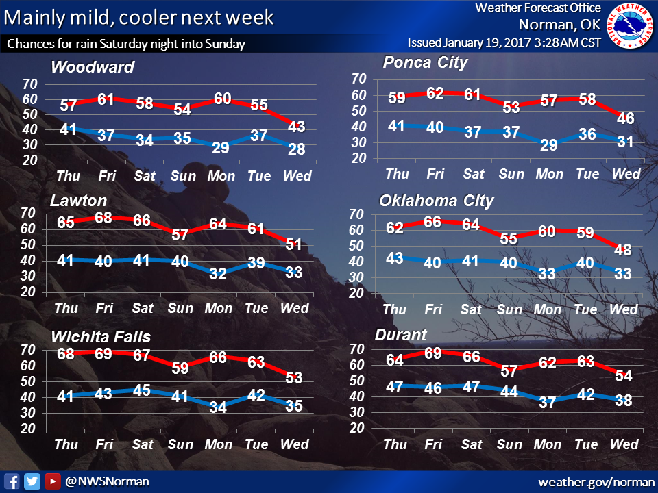
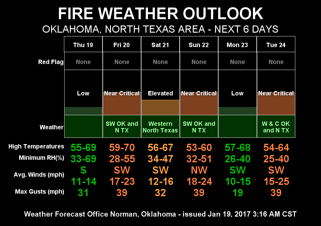
We do have some chances of rain coming up in the next week
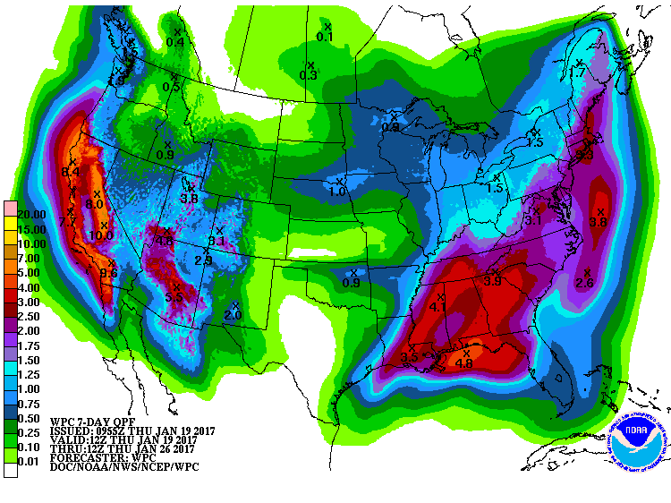
but also a reprieve of sorts from winter, and fire danger to boot.
Gary McManus
State Climatologist
Oklahoma Mesonet
Oklahoma Climatological Survey
(405) 325-2253
gmcmanus@mesonet.org
January 19 in Mesonet History
| Record | Value | Station | Year |
|---|---|---|---|
| Maximum Temperature | 77°F | BURN | 1999 |
| Minimum Temperature | -4°F | BOIS | 2025 |
| Maximum Rainfall | 0.66″ | COOK | 2019 |
Mesonet records begin in 1994.
Search by Date
If you're a bit off, don't worry, because just like horseshoes, “almost” counts on the Ticker website!