Ticker for January 13, 2017
MESONET TICKER ... MESONET TICKER ... MESONET TICKER ... MESONET TICKER ...
January 13, 2017 January 13, 2017 January 13, 2017 January 13, 2017
Ice Wars
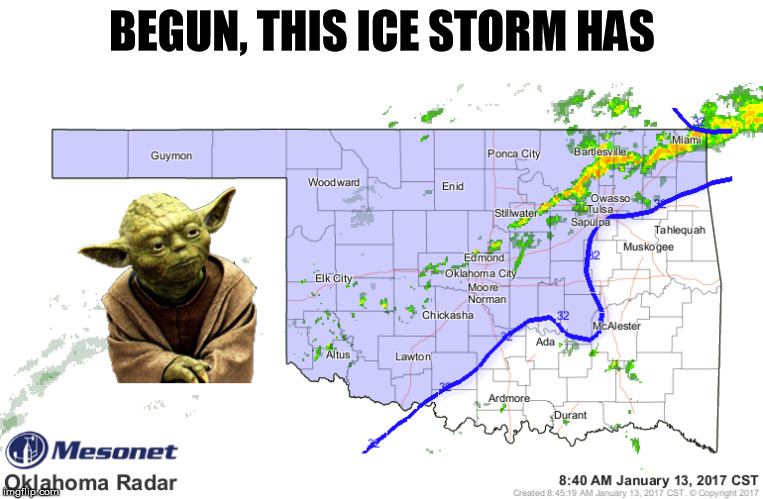
Everything is going as planned, EXCEPT that freezing line has pushed a bit farther
southeast than originally planned this morning. Tells the story this latest
radar image does.
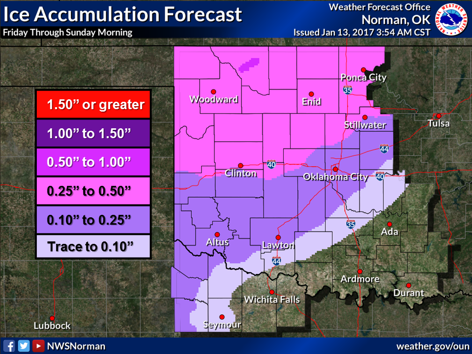
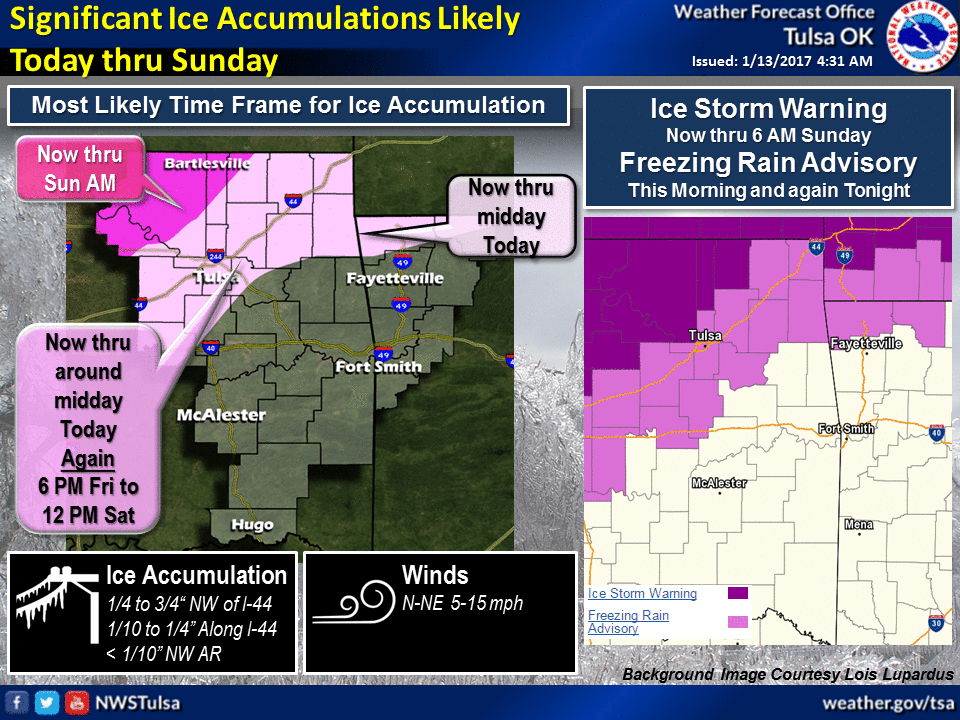
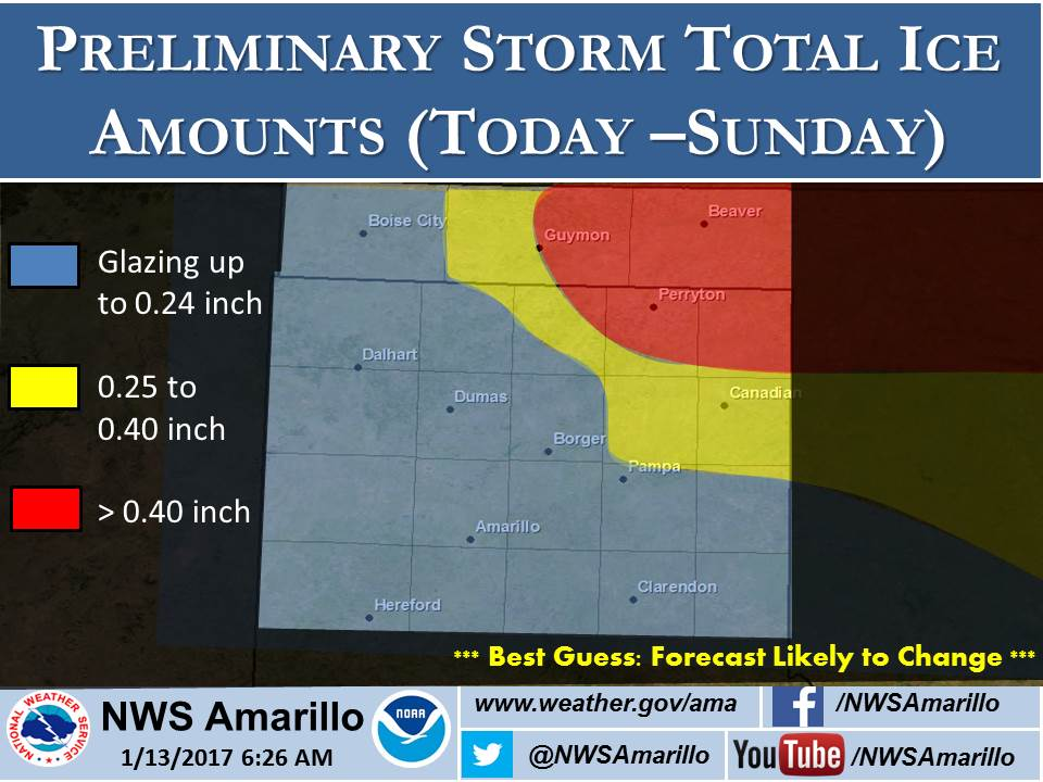
The storm hasn't changed much...maybe some refinements in the ice accumulation
amounts. Still seeing significant ice accumulation impacts getting worse the
farther north and west you go. Freezing rain should hit in several waves, with
this morning's relatively light stuff being a preview.
The freezing line will meander a bit here and there, so it is probably still the
most important map of the whole shebang!
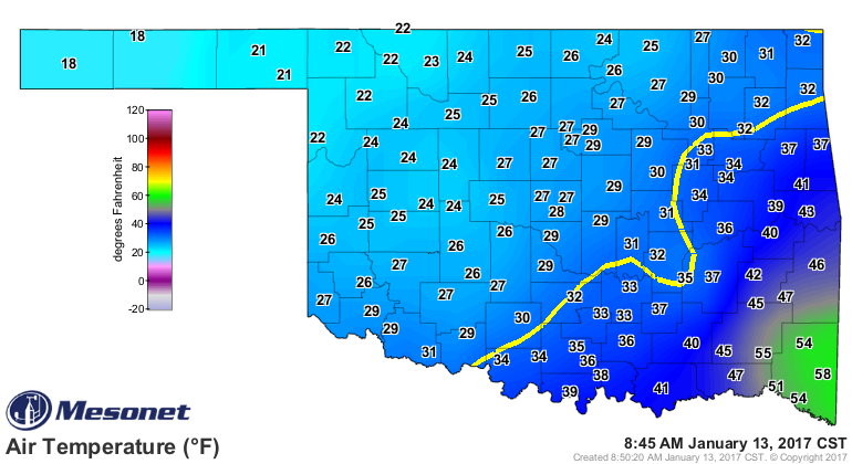
Yowsa, that line is farther southeast than feared! Keep your eyes on these two
maps throughout the weekend (as well as on your favorite NWS/media source, of
course). However, you too can be a "nowcaster" with these two maps.
http://www.mesonet.org/index.php/weather/map/air_temperature
http://www.mesonet.org/index.php/weather/map/oklahoma_radar/radar
Still have the freezing rain advisory and the ice storm warning, so be prepared.
Still time to get to Braum's if you drive really, really slow.
Gary McManus
State Climatologist
Oklahoma Mesonet
Oklahoma Climatological Survey
(405) 325-2253
gmcmanus@mesonet.org
January 13 in Mesonet History
| Record | Value | Station | Year |
|---|---|---|---|
| Maximum Temperature | 76°F | WAUR | 2022 |
| Minimum Temperature | -6°F | KENT | 2024 |
| Maximum Rainfall | 3.48″ | WIST | 1995 |
Mesonet records begin in 1994.
Search by Date
If you're a bit off, don't worry, because just like horseshoes, “almost” counts on the Ticker website!