Ticker for January 5, 2017
MESONET TICKER ... MESONET TICKER ... MESONET TICKER ... MESONET TICKER ...
January 5, 2017 January 5, 2017 January 5, 2017 January 5, 2017
Wobble wobble
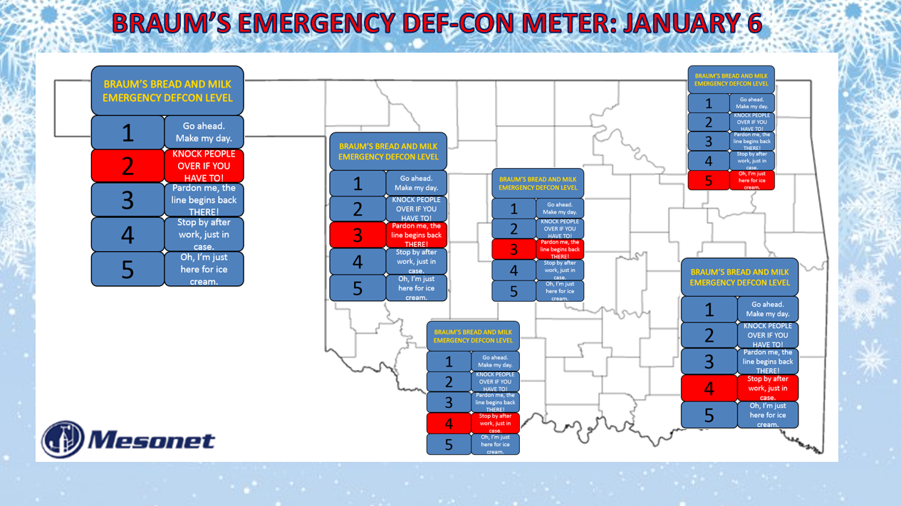
Oh, winter weather. How everybody loves you, except the forecasting part! Yes,
the storm system has changed its trajectory just a tad and also strengthened just
a bit, so this is the latest solution and therefore necessary change in your
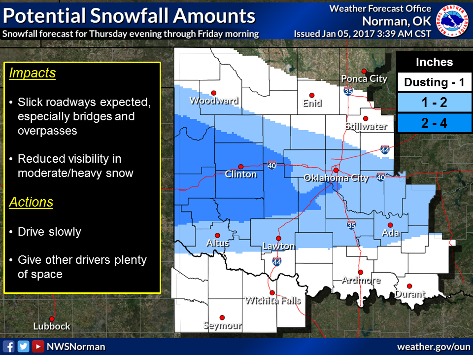
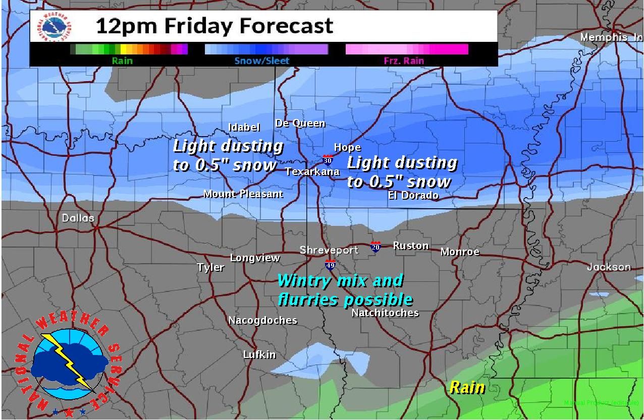
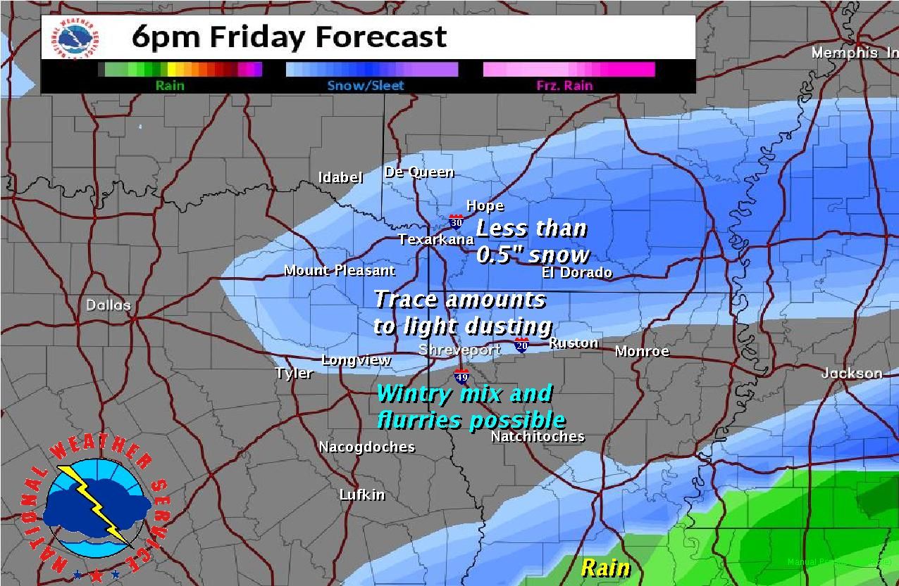
BRAUM'S BREAD AND MILK DEF-CON LEVELS. Let's look at the latest totals being
projected by our NWS friends as of this morning.
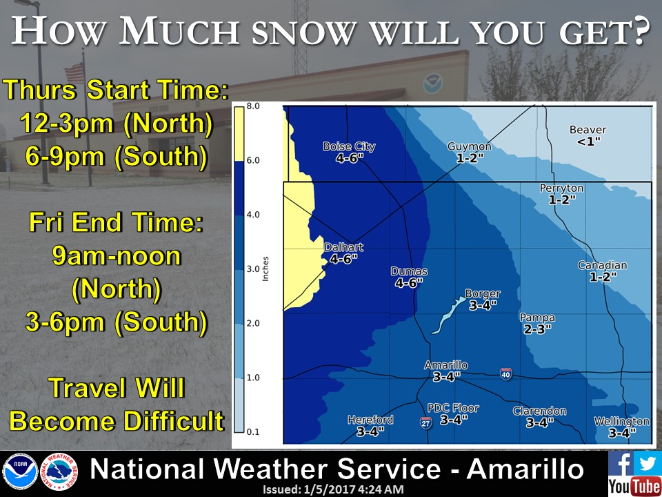
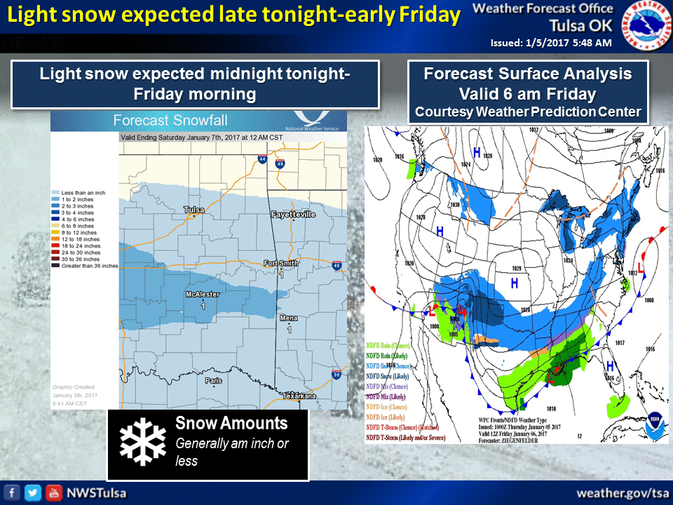
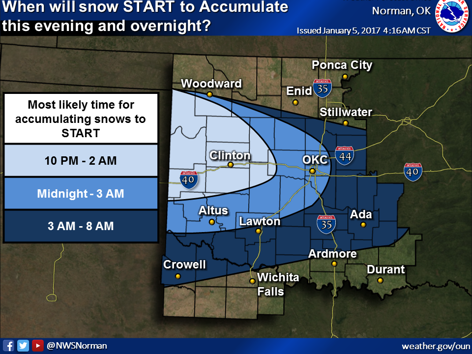
And also timing:
Okay, so 4-6 inches in the western Panhandle with diminishing returns across
northern OK as you go east. 2-4 inches from west central through central OK with
diminishing returns as you go east. A dusting to 1-inch surrounding those main
impact areas with northeastern Oklahoma going snowless. That is the CURRENT-BUT-
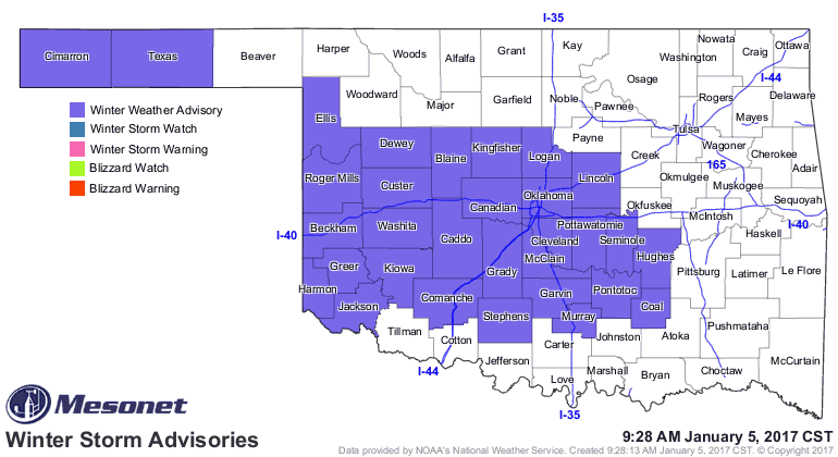
COULD-CHANGE forecast. There are enough impacts that the NWS offices have issued
winter weather advisories for slick roads (basically a traveler's advisory).
Watch for this area to possibly expand as more forecast data comes in, with a
chance of an upgrade to a winter storm warning in the Panhandle. it runs through
noon tomorrow, starting at 10pm tonight.
It doesn't seem like that much of a problem, but here's why it is. First, most
of this snow will fall overnight and into the morning, so not as many cars
driving on it to begin with so the morning could yield a nasty, slippery commute
for folks. Second, it's so danged cold! And the snow will be falling with it's
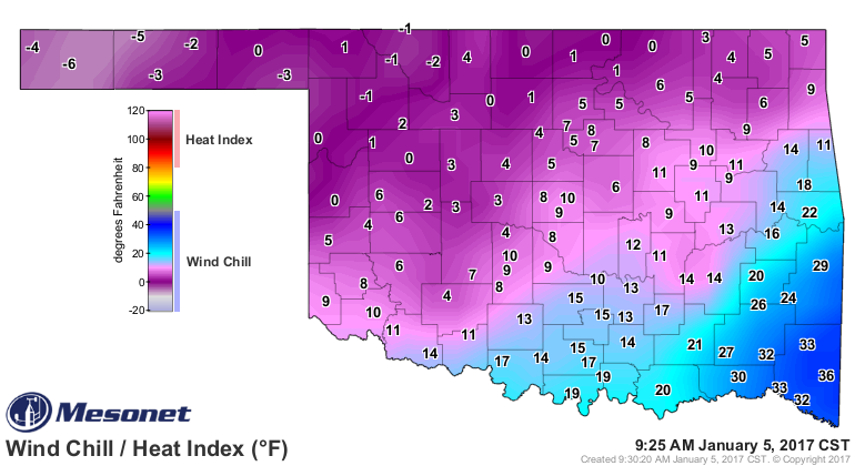
even dangedier cold overnight. We have a cold front pushing through the front
right now with reinforcing AND COLDER arctic air as we speak. Temperatures have
already fallen into the teens across NW OK and wind chills are below zero. The
Panhandle is under a windchill advisory through noon for windchills 5 to 15
degrees below zero.


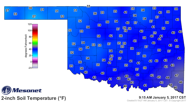
And the ground is cold, and will be getting colder during the day. Bridges and
overpasses (aren't they the same thing??) will freeze up mighty fast when the
white stuff starts falling.
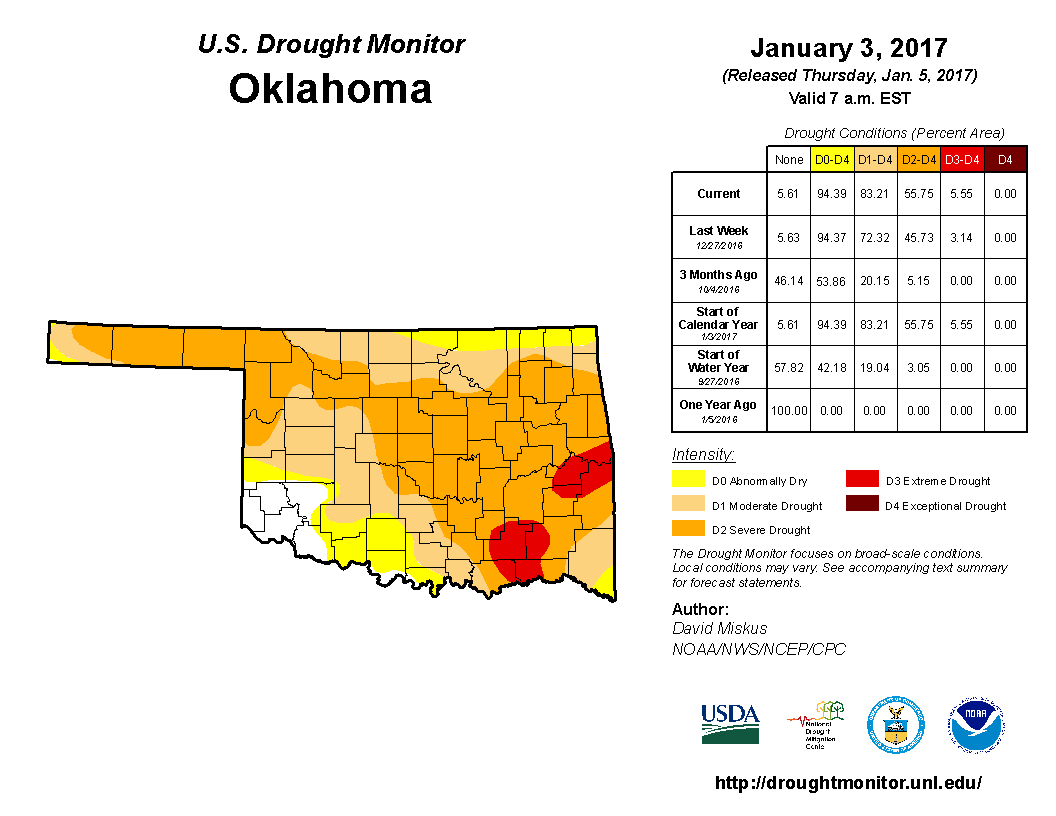
And last but not least, drought. The amount of severe-extreme drought increased
10 percent this week as more and more impact reports (dead pastures and crops,
dry farm ponds, etc.) pour in. That leaves 83 percent of the state in drought
and climbing.
The amount of moisture from this snow, while welcomed, will be rather meaningless
up against the deficit the state is now facing. Pick your time frame for the
unfortunate results.
http://climate.ok.gov/index.php/drought/last_30_days/drought_wildfire
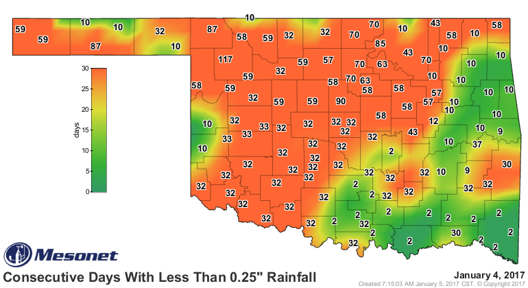
This amount of moisture just ain't gonna do it.

Gary McManus
State Climatologist
Oklahoma Mesonet
Oklahoma Climatological Survey
(405) 325-2253
gmcmanus@mesonet.org
January 5 in Mesonet History
| Record | Value | Station | Year |
|---|---|---|---|
| Maximum Temperature | 79°F | WAUR | 2008 |
| Minimum Temperature | -3°F | KENT | 2014 |
| Maximum Rainfall | 2.19 inches | JAYX | 2005 |
Mesonet records begin in 1994.
Search by Date
If you're a bit off, don't worry, because just like horseshoes, “almost” counts on the Ticker website!