Ticker for January 2, 2017
MESONET TICKER ... MESONET TICKER ... MESONET TICKER ... MESONET TICKER ...
January 2, 2017 January 2, 2017 January 2, 2017 January 2, 2017
December, 2016 and the next few days
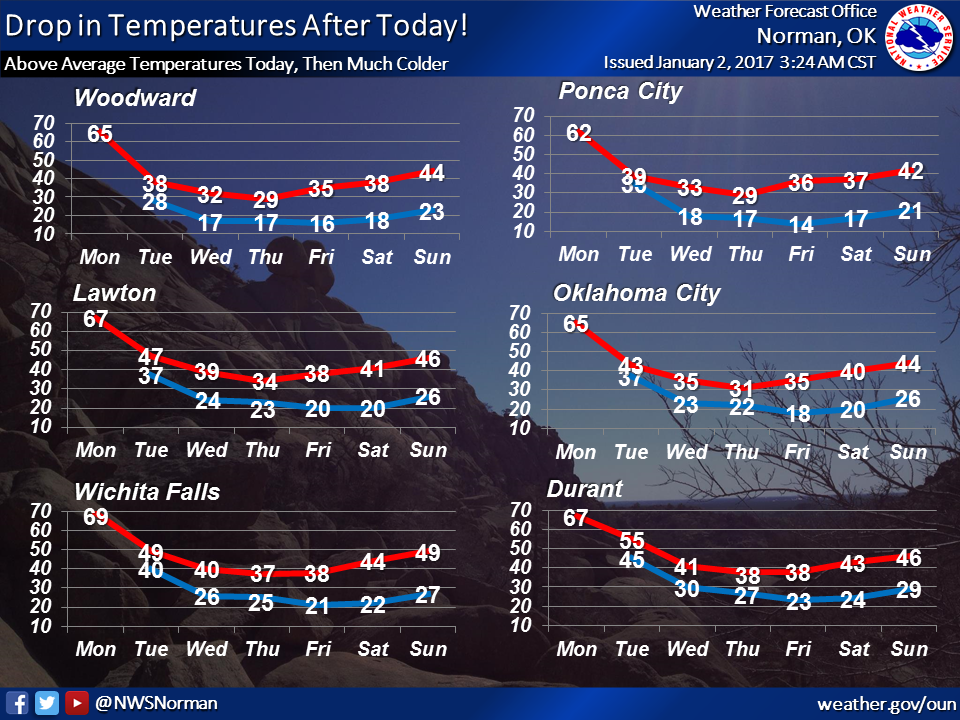
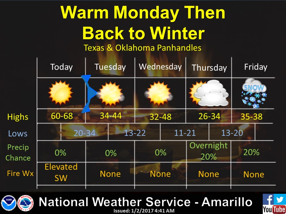
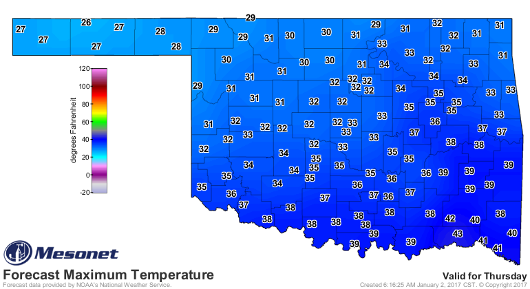
The worst kept secret in the state is that it's going to turn cold again tomorrow
and remain that way for the rest of the week. Nothing like December's cold snap,
but a return to winter nonetheless.

A real secret, unless you were awakened by thunder...it rained! And it's still
raining!


Okay, one last series of secrets. Did you know:
December was cold and dry? That drought exploded during the month? That we had
our coldest weather since February 2011? That southeastern OK was actually much
WARMER than normal? That 2016 was much drier than normal? That SW OK was
actually much WETTER than normal? We were darned near normal for tornadoes?
Well read on, pardner! We've got all those statistics and more in the December
and 2016 annual summary below!
------------------------------------------------------------------------------
2016 Ends With Memorable December
December was a cold month for many Oklahomans, a dry month for most, and a
memorable one for all. Normally, snow would be the big news during the first
month of winter, but drought intensification, one of the more memorable cold snaps
in recent memory, and one of the warmest Christmas Days on record stole the
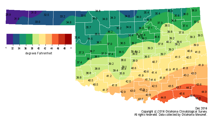
headlines this year. According to preliminary data from the Oklahoma Mesonet, the
statewide average temperature was 38.4 degrees, 0.5 degrees below normal and the
50th coolest December since records began in 1895.

The frigid air was a more persistent visitor to the northwestern third of the
state while the southeastern third managed to keep the cold at bay for the most
part. The Panhandle fell over 2 degrees below normal for their 28th coolest
December on record. On the opposite side of the state, southeastern Oklahoma
was 2.2 degrees above normal to rank as their 36th warmest. The first two weeks
were generally cool-to-cold, but it was the last two weeks that featured the
thermometer roller coaster ride.
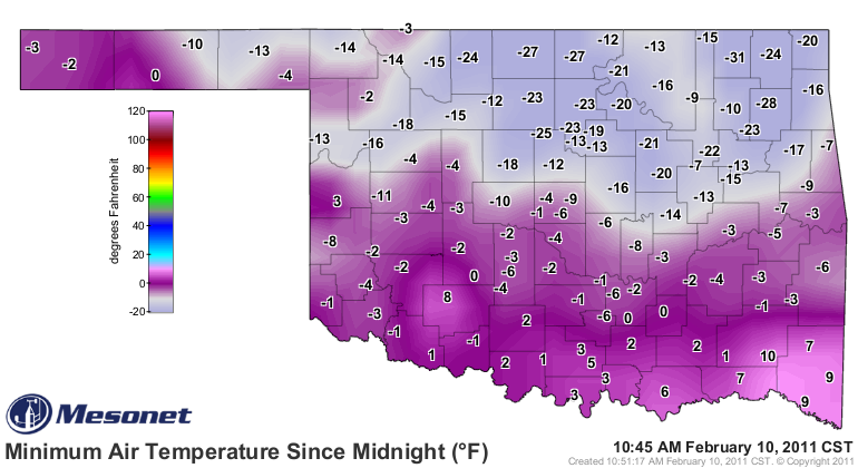
A powerful blast of arctic air entered northwestern Oklahoma on the 16th and
ushered in the coldest weather experienced by the state since February 2011.
Many areas saw their temperatures drop 50-70 degrees in a 24-hour period after
the front?s passage.
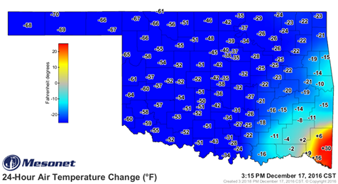
Lows ranged from the single digits to below zero the 17th through the 19th
while high temperatures struggled to escape the 20s. Winds gusting to 40-60 mph
combined with the frosty air to produce wind chills from near zero degrees to
the minus 30s on the 18th. The Mesonet sites at Eva and Hooker recorded lows of
minus 18 degrees on the 18th and wind chills of minus 36 degrees and minus 35
degrees, respectively.
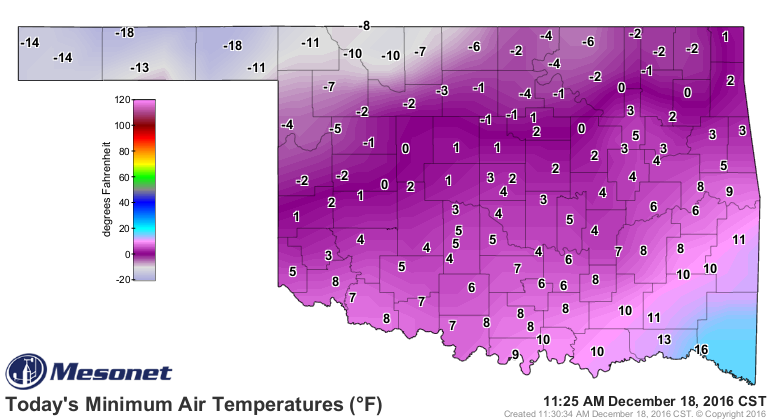
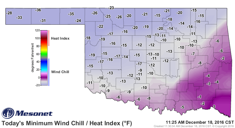
All are the lowest such readings in the state since Feb. 10, 2011.
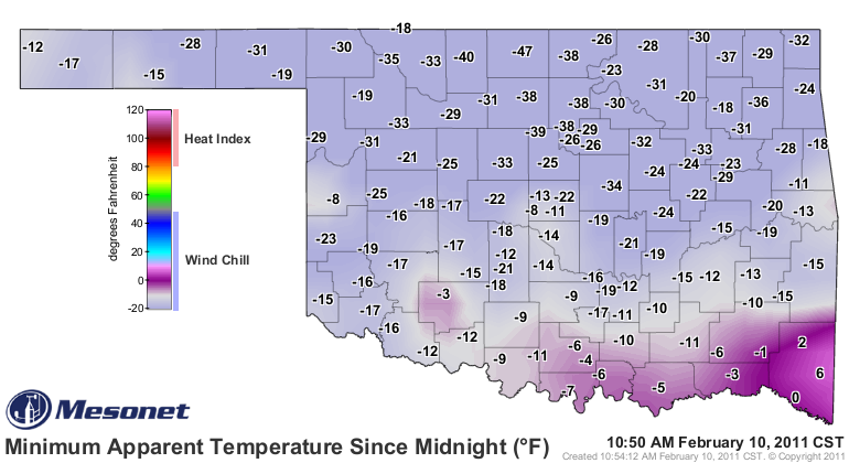
Temperatures quickly moderated into the 50s and 60s following the arctic
intrusion and remained that way through the rest of the month. The warmth
culminated on Christmas Day with widespread 60s and 70s.
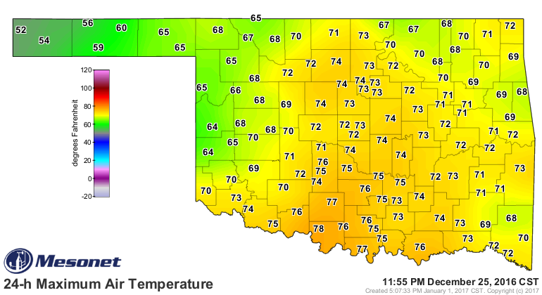
Oklahoma City went from a record low of 4 degrees on the 18th to its highest
temperature of the month, 73 degrees, on the 25th. That mark also tied their
record high for Christmas Day, first set back in 1922. Similarly, Tulsa rose
from a record low of 3 degrees on the 18th to its monthly high of 71 degrees on
the 25th. The month?s highest temperature, 81 degrees, was recorded at Altus
and Hollis on the 16th.

The statewide average for 2016 was 62.3 degrees, 2.4 degrees above normal and
the third warmest year on record for the state. Oklahoma?s warmest year came
in 2012 at 63.2 degrees.
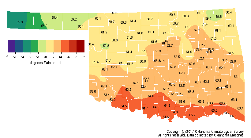
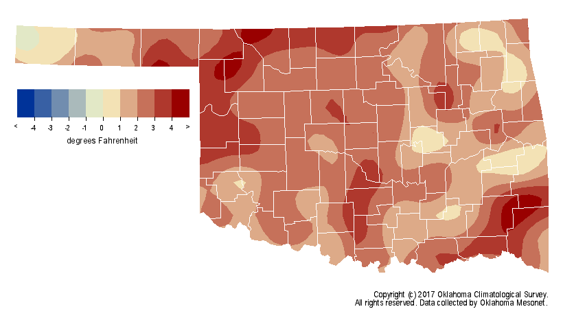
The year?s highest temperature of 108 degrees was recorded at Goodwell on July
11, although Bixby recorded a humidity-aided heat index of 118 degrees on June
15.
Not only was Christmas Day warm, it was also the wettest day of a very dry
month. A narrow band of strong-to-severe thunderstorms formed in western
Oklahoma and marched across the state, producing wind gusts to nearly 70 mph
and brief heavy downpours. Amounts were light, generally less than a quarter-
inch, although several stations managed to receive more than half an inch.
Those totals did little to alleviate the month?s deficit, however. According to
the Mesonet, the statewide average was 0.82 inches, 1.24 inches below normal to
rank as the 26th driest December on record. Broken Bow led all 121 Mesonet
sites with 2.4 inches. Boise City came in with 0.12 inches for the lowest total.
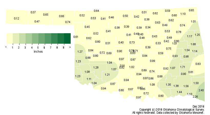
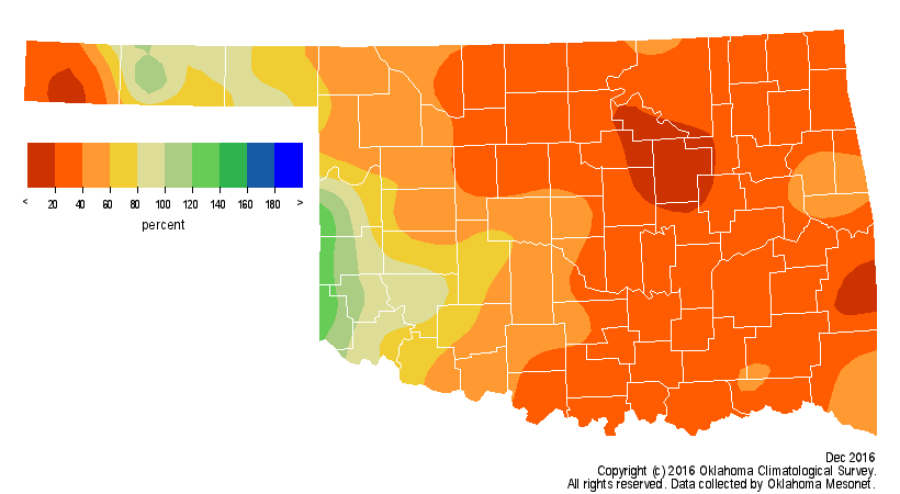
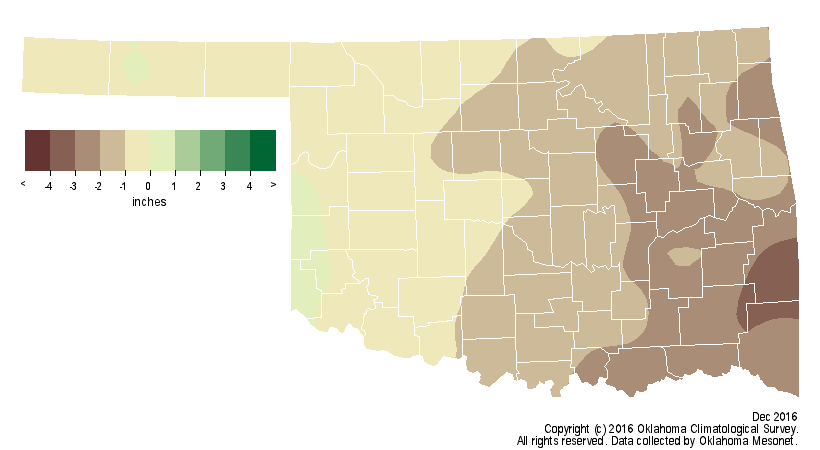
Eighty-eight Mesonet sites recorded less than an inch of moisture during
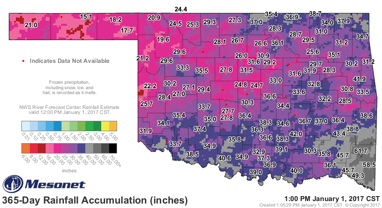
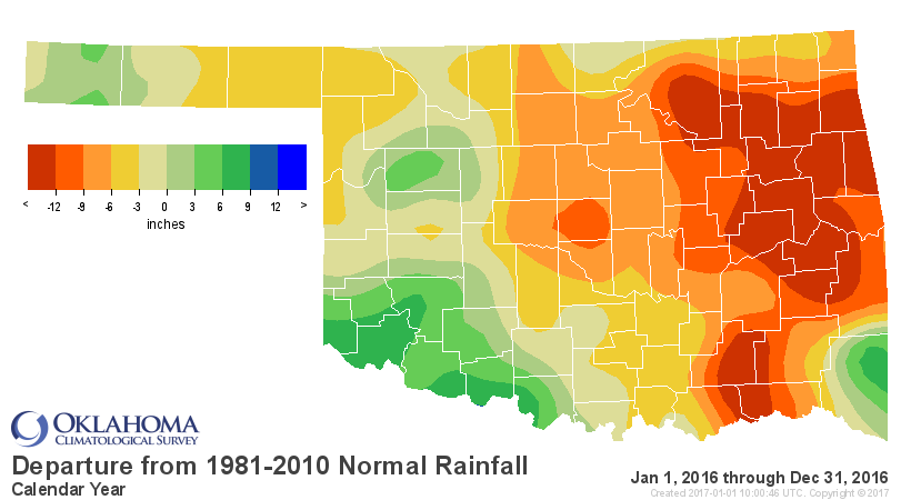
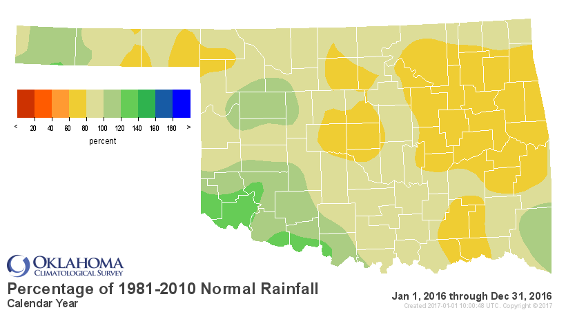
December. The year finished as the 44th driest on record with an average
statewide deficit of 5.14 inches, and an average total of 31.36 inches. Fortunes
varied across the state, however. Southwestern Oklahoma, which bore the brunt
of the 2010-15 drought, finished with an average of 32.91 inches, more than 2.5
inches above normal and the 28th wettest year for that region. East central
Oklahoma had the worst outcome with an average of 34.5 inches, 11.64 inches
below normal and a rank of 20th driest. Hooker had the driest 2016 with a total
of 15.1 inches. Mt. Herman led the state with 61.7 inches.
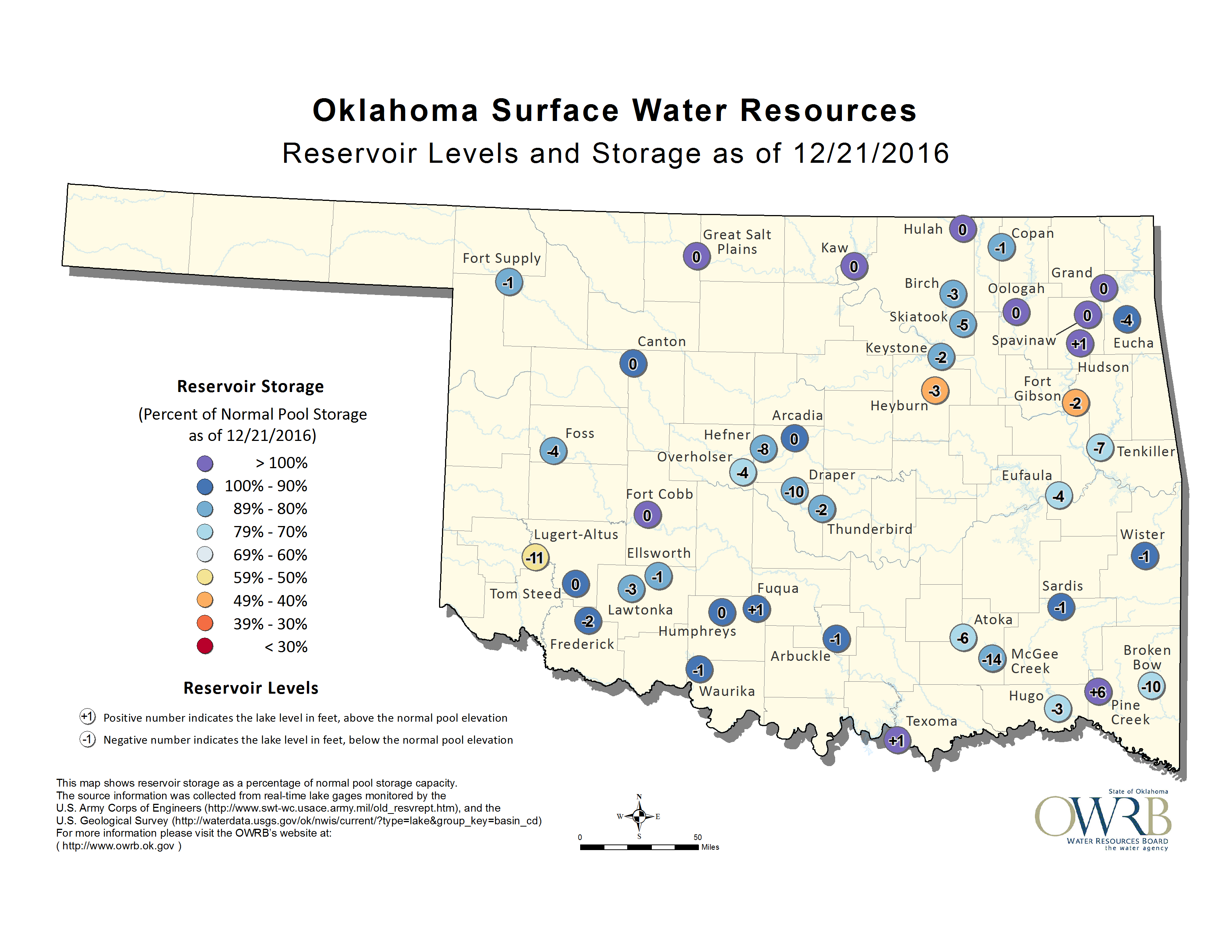
Drought continued to intensify throughout December. Oklahoma Mesonet personnel
received reports of failed crops and pastures, dry stock ponds and flagging
state reservoirs.
According to the U.S. Drought Monitor, the hazard increased from 57 percent of
the state at the end of November to 72 percent at the end of December.


Severe-to-extreme drought increased from 18 percent to 46 percent. The Drought
Monitor?s intensity scale slides from moderate-severe-extreme-exceptional, with
exceptional being the worst classification. Oklahoma was drought free as late
as June 21, 2016.
According to preliminary numbers from the National Weather Service (NWS),
Oklahoma saw a total of 57 tornadoes during 2016, one more than the
1950-2015 average of 56. All but one of those tornadoes occurred during the
primary severe weather season of March-May. The other twister touched down near
Stillwater on July 3. Two people were killed and 13 injured due to tornadoes
according to NWS reports. The strongest tornado was an EF4 that touched down on
May 9 near the town of Katie in Garvin County, killing one. The other fatality
occurred with an EF3 twister southeast of Connerville in Johnston County.
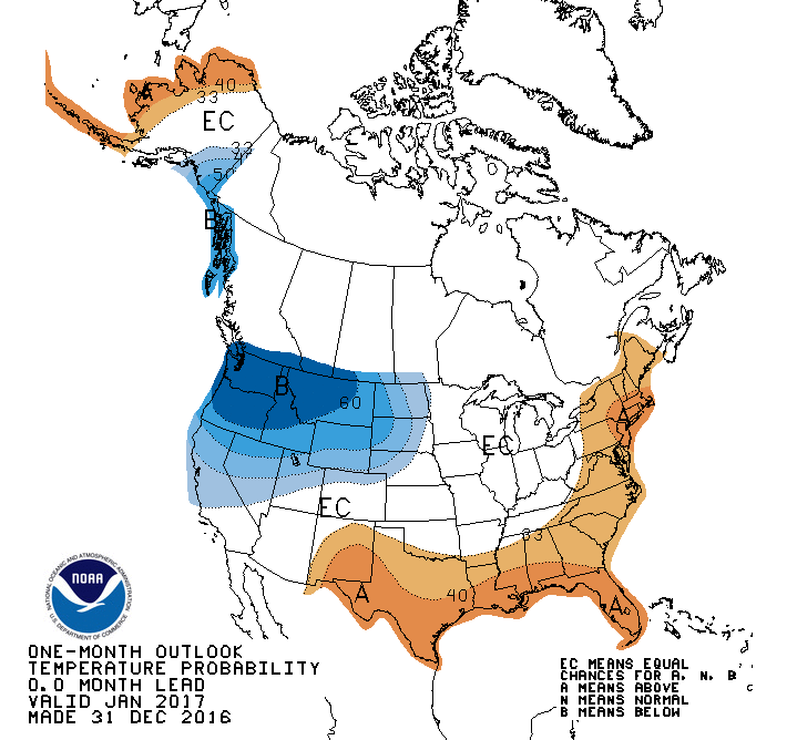
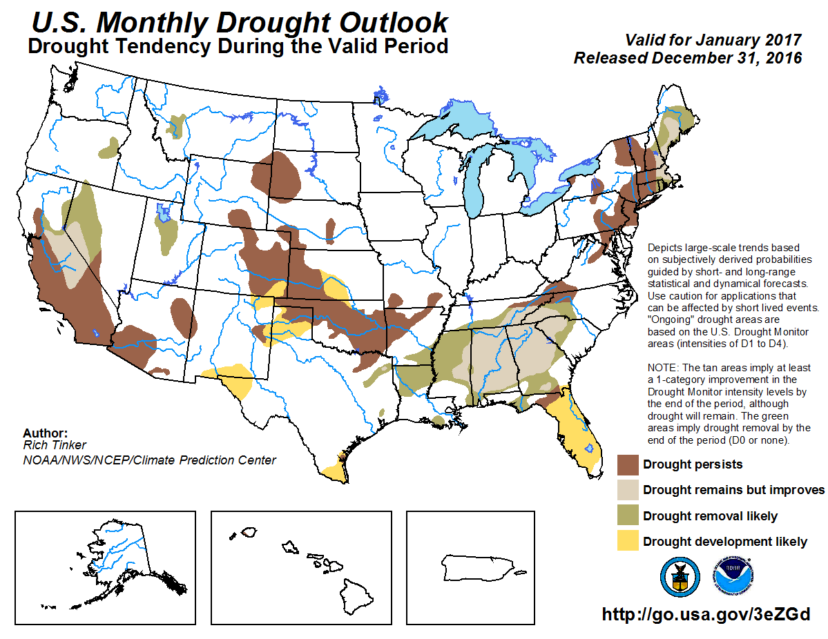
The January temperature and precipitation outlooks from the Climate Prediction
Center (CPC) are mostly benign for Oklahoma, although there is a slightly
increased chance of above normal temperatures across far southern Oklahoma.

Drought is also expected to persist across the state through January where it
currently exists, with development likely in north central Oklahoma and the
far western Panhandle.
Gary McManus
State Climatologist
Oklahoma Mesonet
Oklahoma Climatological Survey
(405) 325-2253
gmcmanus@mesonet.org
January 2 in Mesonet History
| Record | Value | Station | Year |
|---|---|---|---|
| Maximum Temperature | 80°F | BURN | 2004 |
| Minimum Temperature | -10°F | KENT | 2013 |
| Maximum Rainfall | 2.55 inches | CLOU | 2005 |
Mesonet records begin in 1994.
Search by Date
If you're a bit off, don't worry, because just like horseshoes, “almost” counts on the Ticker website!