Ticker for December 29, 2016
MESONET TICKER ... MESONET TICKER ... MESONET TICKER ... MESONET TICKER ...
December 29, 2016 December 29, 2016 December 29, 2016 December 29, 2016
The Cream of the Extremes
Some might think Oklahoma's climate in 2016 to be pretty boring. Dry, then wet for
a bit during spring, then dry again, and warm all over until the first three
weeks of December. Then, dry and warm again. Of course, to climatologists, seeing
one of the warmest years and autumns is at least a bit exciting. But even during
the most "boring" of years for climate, the WEATHER is often but. And we have
the 2016 Mesonet Extremes map to prove it.
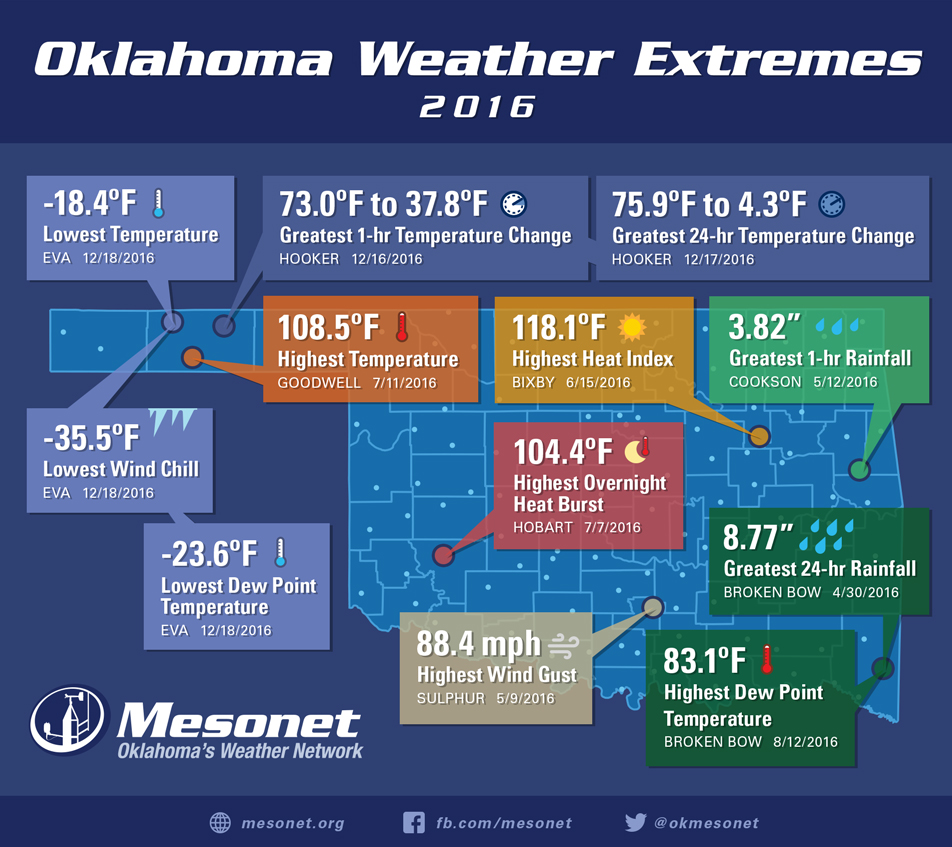
Granted, the map would have been a bit more boring without that December mega-
monster arctic front on Dec. 16 that led to five of the extremes on the map.
*Lowest Temp: Eva, -18.4F
*Greatest 1-hr temperature change: Hooker, 73.0F to 37.8F (ZOUNDS!)
*Greatest 24-hr temperature change: Hooker, 75.9F to 4.3F (ZOUNDS ZOUNDS!)
For more on that frigid snap (cold snap just won't do it), here's a recap:
http://ticker.mesonet.org/select.php?mo=12&da=19&yr=2016
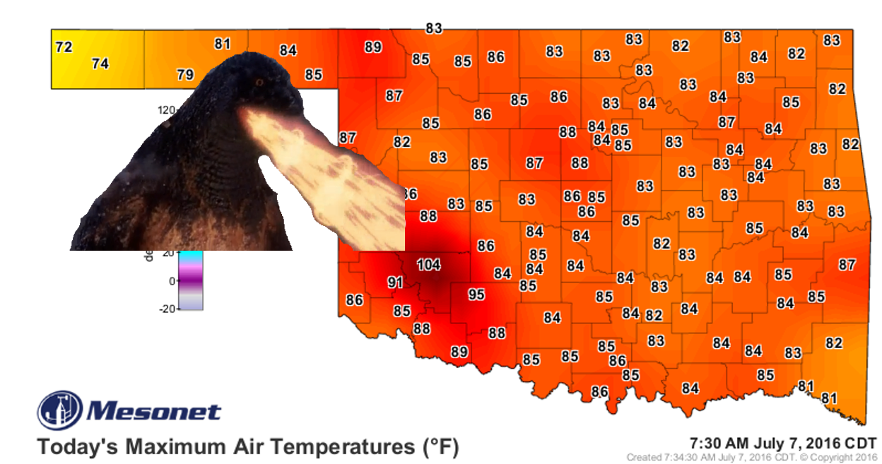
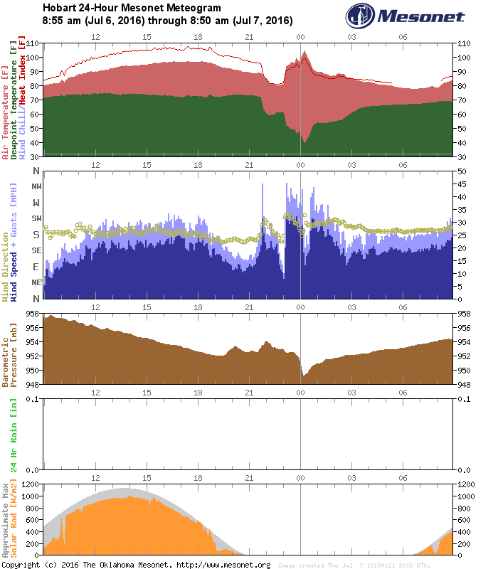
The 104F heat burst at Hobart on July 7 was a real doozy as well. Another recap,
and a graphic or two:
http://ticker.mesonet.org/select.php?mo=07&da=07&yr=2016
Now speaking of extremes, our drought is becoming more extreme, and it's
probably the most extreme map of the year as well.
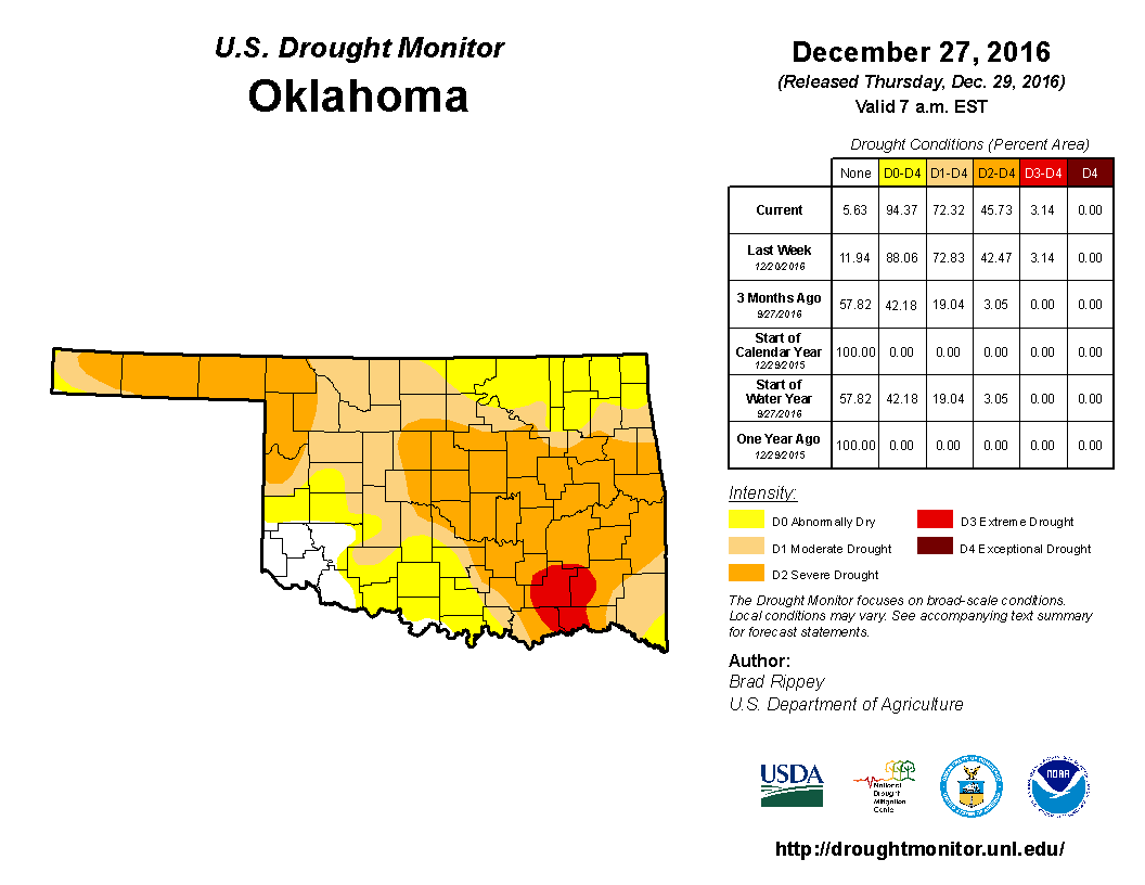
The amount of total drought (D1-D4) stayed about the same, but we did see an
expansion of D2 (Severe Drought) of about 3.5 percent, and I think that was
a bit conservative of an expansion due to the Holiday. My guess is that next
week we will see an even larger expansion of drought of different intensity
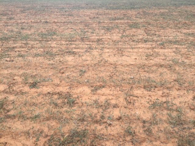
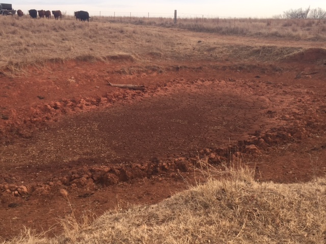
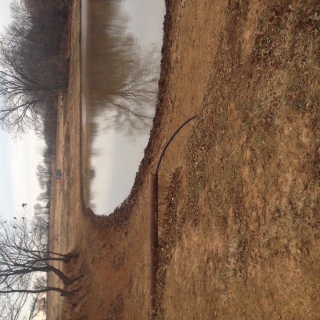
across the state. Seeing pictures like these coming in from farms and ranches
(go check out your neighborhood ponds and you'll likely see the same thing)
are eye-popping:
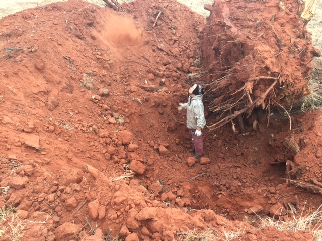
And here's my favorite...send your wife down into a hole where a tree is being
removed, grab some dirt from a deep layer of the soil, and have her throw it
in the air. Unfortunately (but fortunately for her) it was so dry it disappeared
in a great POOF of a dust cloud. Again from Logan County.
And those pictures certainly make these types of maps make sense:
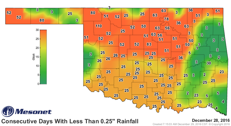
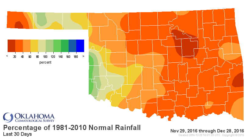
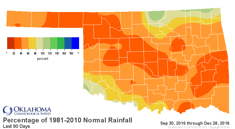
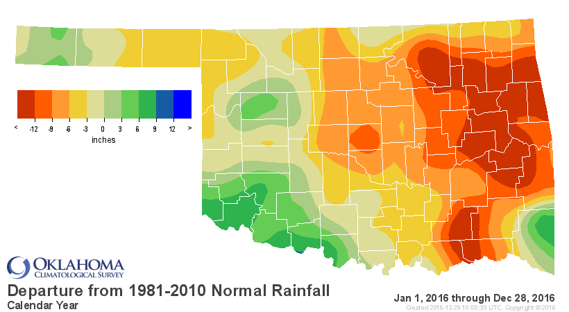
So we desperately need rain, but it appears there will be little relief in the
next 7-10 days.
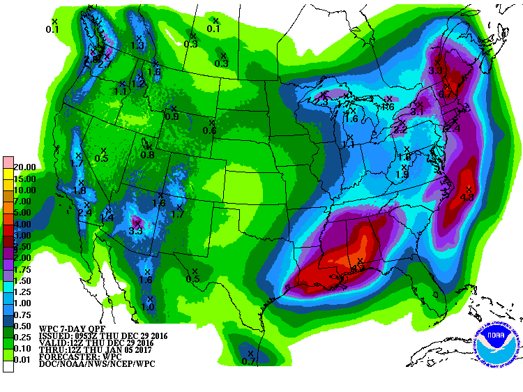
At least it's green over Oklahoma, but we need those blues and purples! Speaking
of blues and purples, that comes early next week. Ugh.
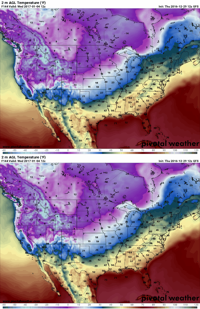
Stay tuned for the next few days as we finalize December and the year's final
numbers. It'll be extreme, we promise!
Gary McManus
State Climatologist
Oklahoma Mesonet
Oklahoma Climatological Survey
(405) 325-2253
gmcmanus@mesonet.org
December 29 in Mesonet History
| Record | Value | Station | Year |
|---|---|---|---|
| Maximum Temperature | 75°F | EVAX | 2017 |
| Minimum Temperature | -2°F | EVAX | 2018 |
| Maximum Rainfall | 4.14 inches | HUGO | 2006 |
Mesonet records begin in 1994.
Search by Date
If you're a bit off, don't worry, because just like horseshoes, “almost” counts on the Ticker website!