Ticker for August 10, 2016
MESONET TICKER ... MESONET TICKER ... MESONET TICKER ... MESONET TICKER ...
August 10, 2016 August 10, 2016 August 10, 2016 August 10, 2016
Gold medal weekend!
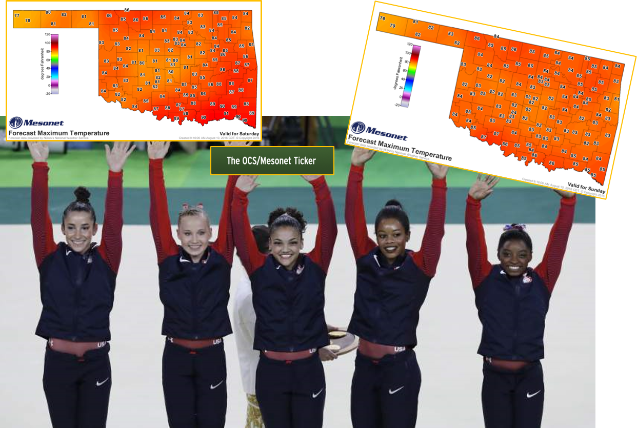
What, the Final Five are giving a shout out to our first big front of the summer
(or at least following the onset of the REAL summer heat)?? I'm a bit shocked at
that. And Ticker fans too? Well, we appreciate Laurie Hernandez giving us props,
at least.
Okay, all kidding aside, as the Ticker swells with Olympic pride, we're happy
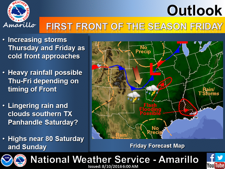
to see Mother Nature turn the tide, as (insert phrase here about front and then
something that rhymes with "tide"). This graphic from the Amarillo NWS office
gives us a pretty good assessment, at least pictorially, of what we can expect
starting on Friday.
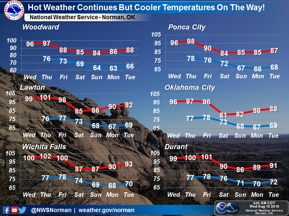
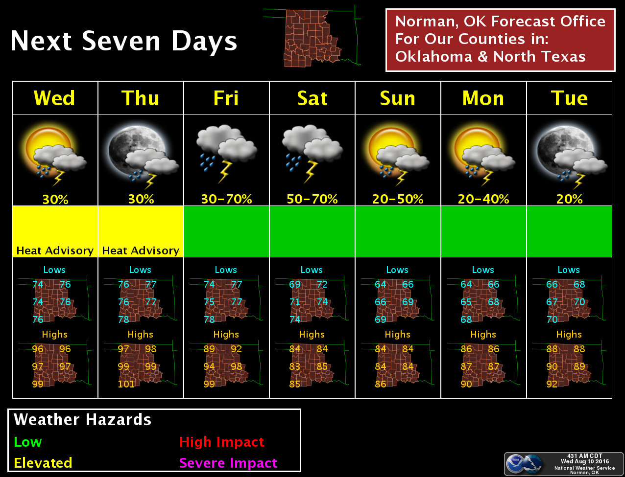
And this view of plunging high temperatures from the Norman office is none too
shabby either.
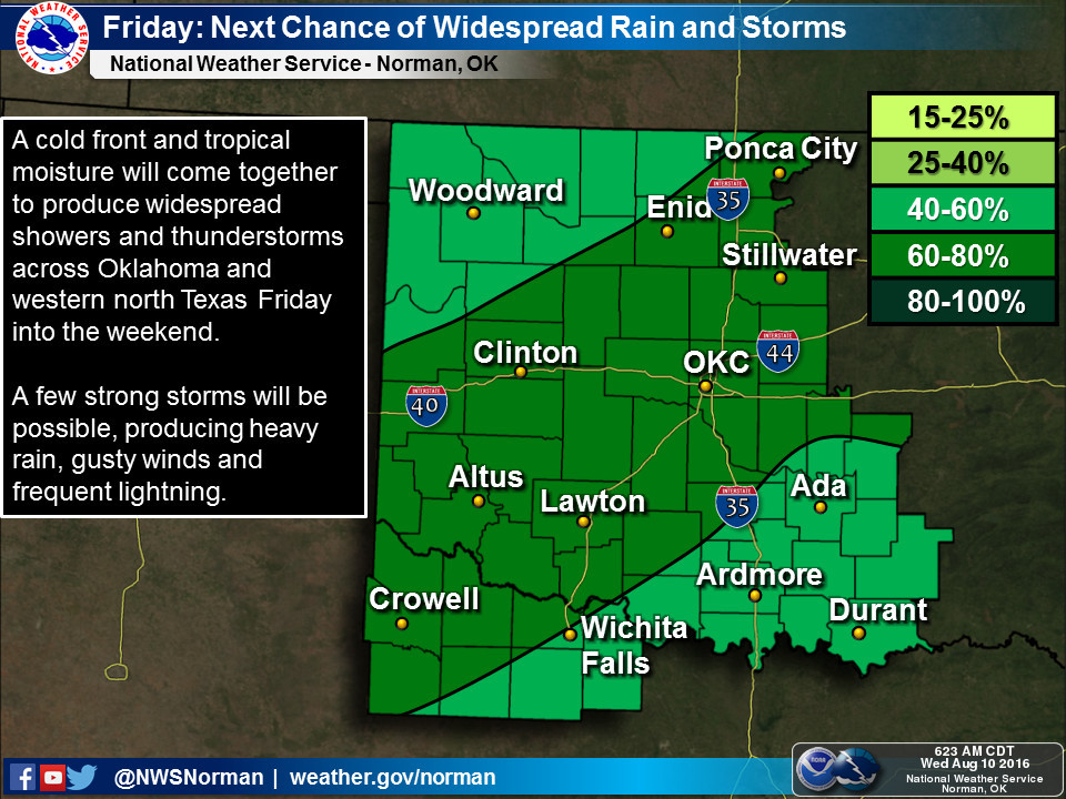
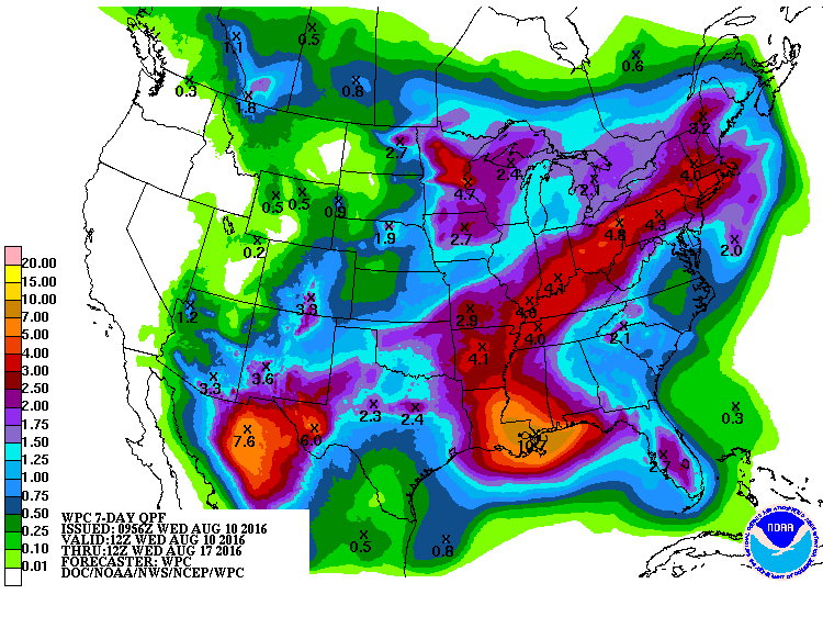
With the front and cooler weather comes a chance of the wet stuff, starting
on Friday for reals and lasting through the weekend. And a nice chunk of moisture
at that.
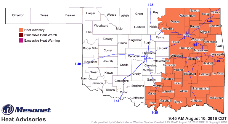
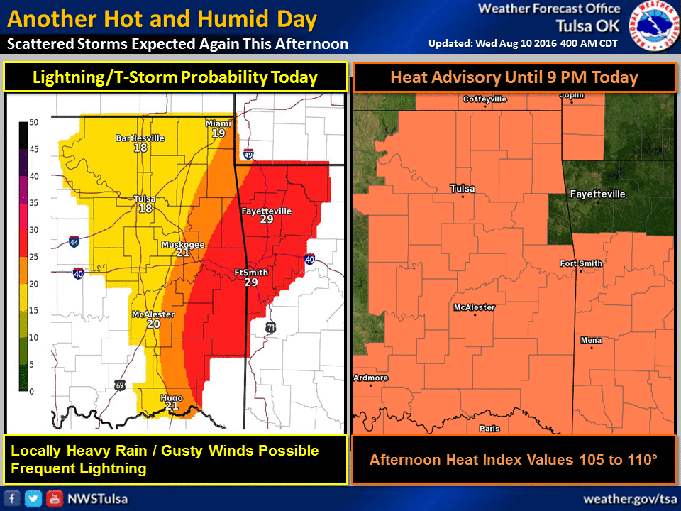
Until that, we have a couple more days of heat.
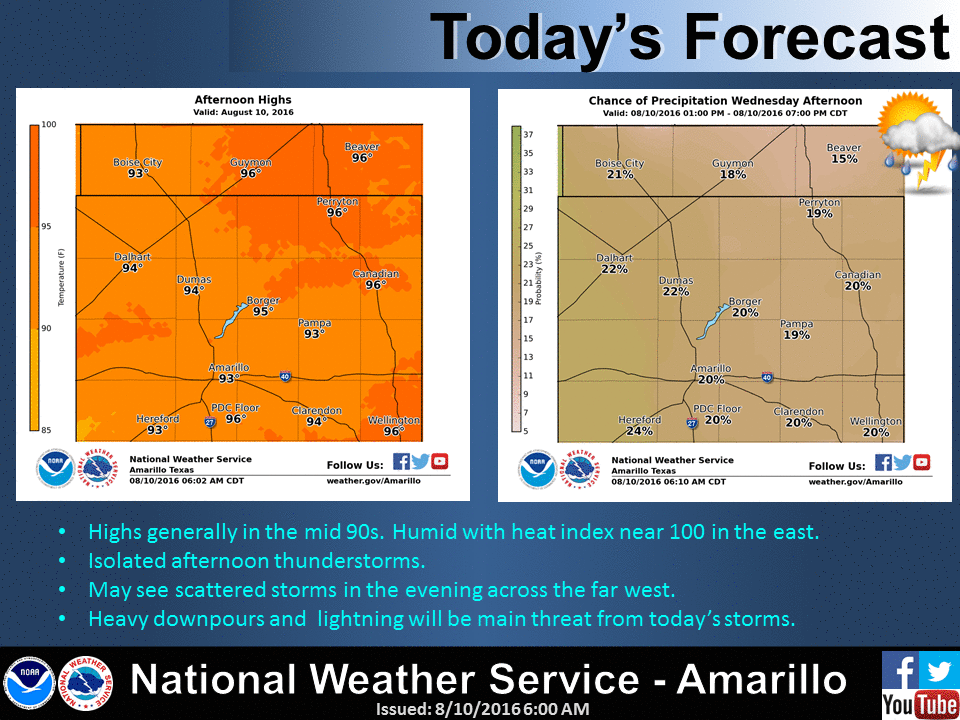
So just hold on for two more days, and things will go your way. Imagine Sunday
morning to help you along.

Gary McManus
State Climatologist
Oklahoma Mesonet
Oklahoma Climatological Survey
(405) 325-2253
gmcmanus@mesonet.org
August 10 in Mesonet History
| Record | Value | Station | Year |
|---|---|---|---|
| Maximum Temperature | 109°F | GRA2 | 2011 |
| Minimum Temperature | 55°F | EVAX | 2024 |
| Maximum Rainfall | 4.20 inches | CHIC | 2017 |
Mesonet records begin in 1994.
Search by Date
If you're a bit off, don't worry, because just like horseshoes, “almost” counts on the Ticker website!