Ticker for June 22, 2016
MESONET TICKER ... MESONET TICKER ... MESONET TICKER ... MESONET TICKER ...
June 22, 2016 June 22, 2016 June 22, 2016 June 22, 2016
Don't complain, winter is only 6 months away
Before we get to winter, however, we've got summer and summer part 2 (fall to the
layperson) to get through first. The beginning to summer has been fairly brutal
thus far, with statewide average temperatures since the beginning of June running
about 2.2 degrees above normal according to Oklahoma Mesonet data.
-***-
Statewide average temperatures, June 1-June 21
Avg. High Avg. Low Avg.
Mesonet 88.9F 66.3F 77.6F
Normal 86.6F 64.3F 75.4F
Depart 2.3F 2.0F 2.2F
-****-
So Highs AND lows about 2 degrees above normal for the month thus far, but that
doesn't factor in the heat indices. It's also a bit misleading for recent fortunes
considering that the first week or so of the month was fairly cool. So really
we're talking about the last 2 weeks, and it has been relatively brutal. The
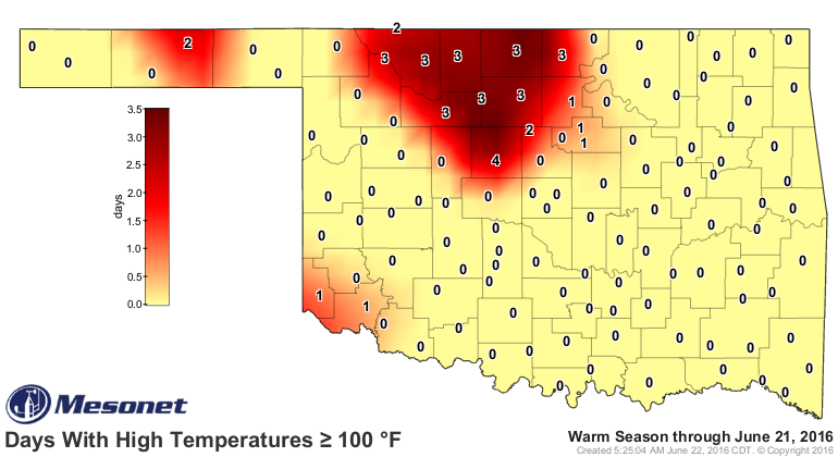
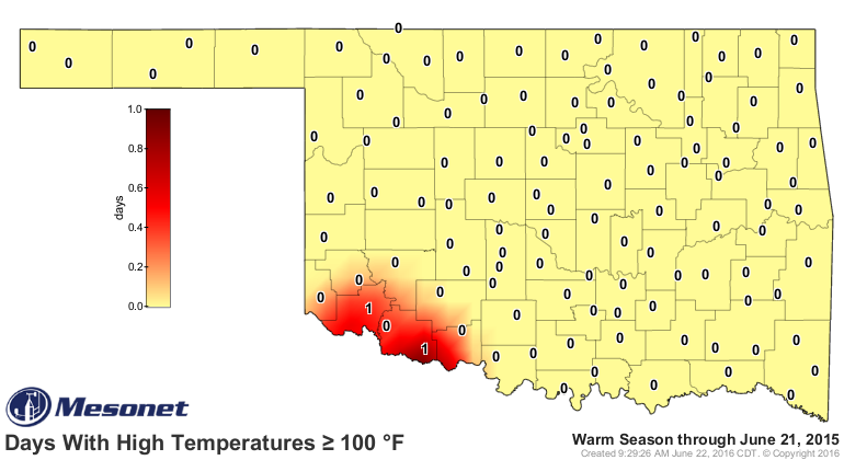
number of 100 degree days has started to ramp up, especially up across NC OK
where harvested ground is laid somewhat bare for the sun to work its magic
on. Kingfisher leads the state with 4 days at or above 100 thus far. That's
fairly wimpy, however, when you compare it to this same time frame back during
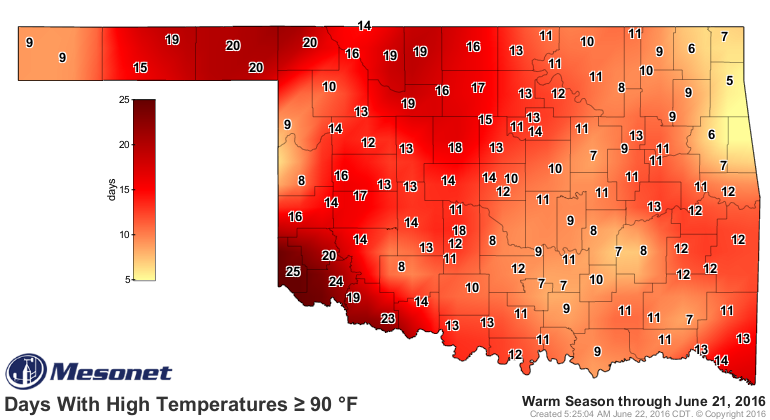
the brutal summer of 2011. Even the days at or above 90 are not even close.
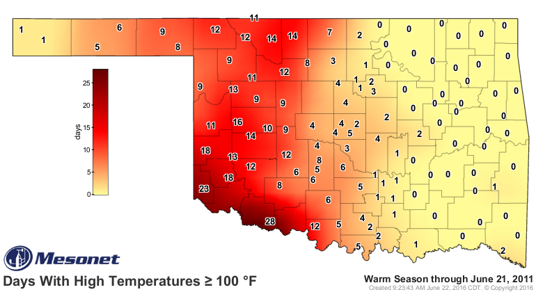

But that's comparing our current misery to the most extreme summer in the history
of our state (and for any state in the U.S., to be exact).
Certainly more extreme than last year and more comparable to 2014, although the
southwest's abundant moisture this spring and summer has helped keep them a
bit cooler than expected.


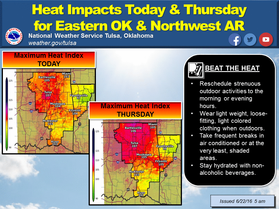
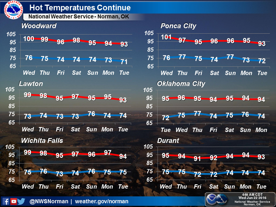
The bad news is we can expect this heat wave to continue for a bit longer,
especially today which is shaping up to be the hottest day of the week.

There is a bit of good news, however. The ridge of high pressure over us keeping
the state in the pressure cooker is forecast to shift to the west in a few days
which should put us in line for some more favorable conditions (i.e., SEASONABLE
temps for this time of year) with a chance for some rain.
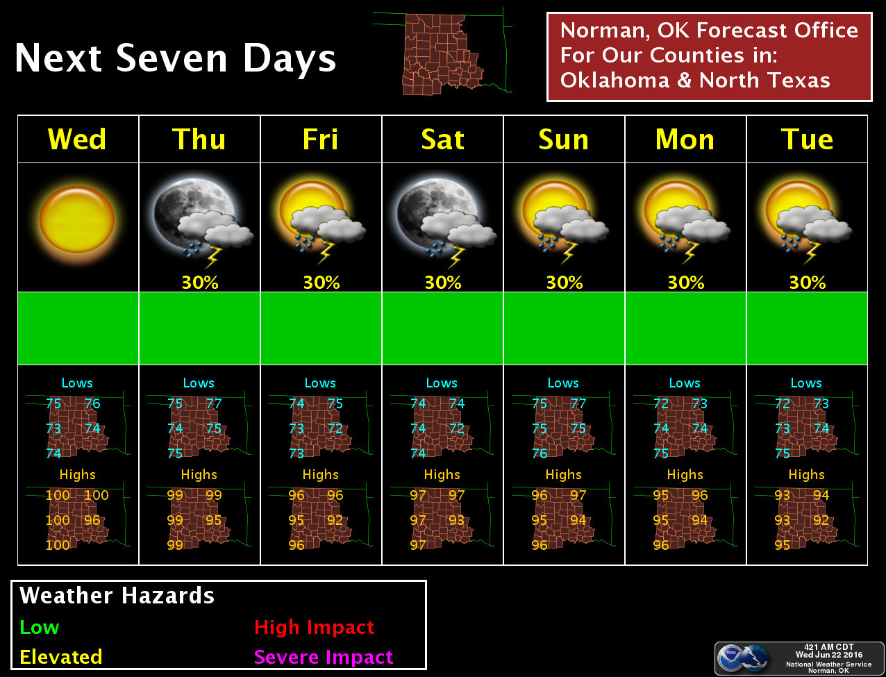
It still doesn't look like a big soaking period for the state, but this is the
kind of pattern when you can see one of those big complexes of storms form
somewhere to our NW and blast through the state. Any rain at this point will be
good in that it will stave off our threat of flash drought.
So hooray for normal, and hooray for the off chance of one of those big
complexes of storms forming somewhere to our NW and blasting through the state.
Then we have July and August. Be afraid, be very afraid? Nah, not yet.
Gary McManus
State Climatologist
Oklahoma Mesonet
Oklahoma Climatological Survey
(405) 325-2253
June 22 in Mesonet History
| Record | Value | Station | Year |
|---|---|---|---|
| Maximum Temperature | 104°F | TIPT | 1998 |
| Minimum Temperature | 49°F | BOIS | 2004 |
| Maximum Rainfall | 4.73 inches | MANG | 1999 |
Mesonet records begin in 1994.
Search by Date
If you're a bit off, don't worry, because just like horseshoes, “almost” counts on the Ticker website!