Ticker for May 17, 2016
MESONET TICKER ... MESONET TICKER ... MESONET TICKER ... MESONET TICKER ...
May 17, 2016 May 17, 2016 May 17, 2016 May 17, 2016
Mayrch is back
Yeah, that's heavily edited and I know what's going through your head, so you
should immediately go wash your brain out with soap. But I HAVE had it with this
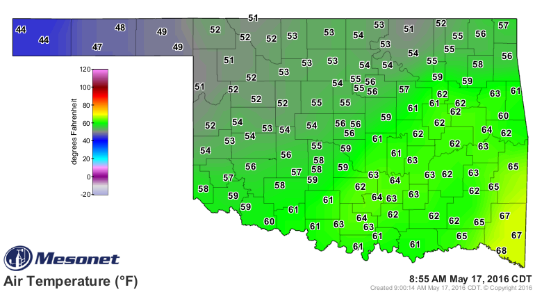
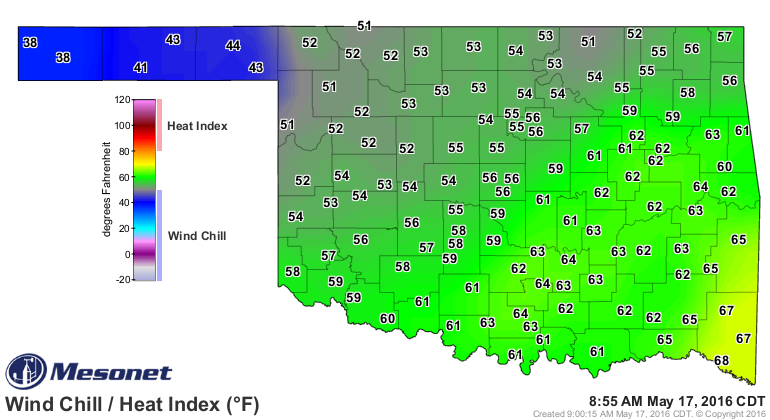
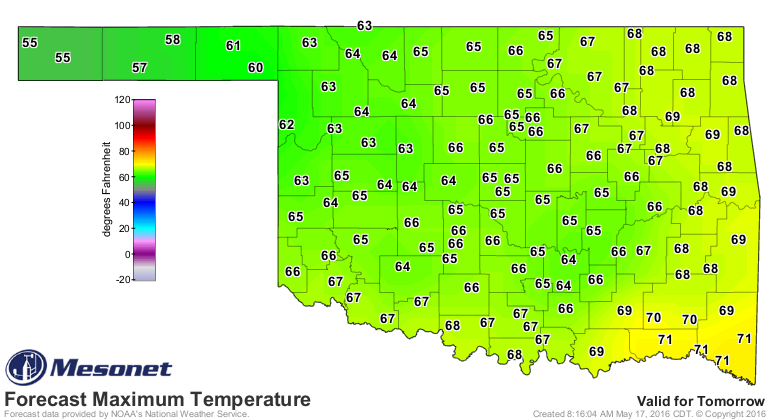
sudden jump back to March. AGAIN. We have wind chills in the 30s out in the
Panhandle, we have 50s and 60s across the rest of the state, halfway through May.
And it's not like we're going to be basking in early summer temperatures any time
soon.
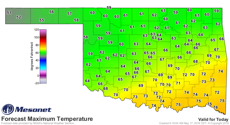
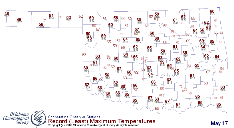
And if you think this isn't unusual for this part of May, well, you're a few weeks
late. Check out the record low maximum temperatures for May 17. We're dangerously
close to matching records for the coolest May 17 in history for many locations.
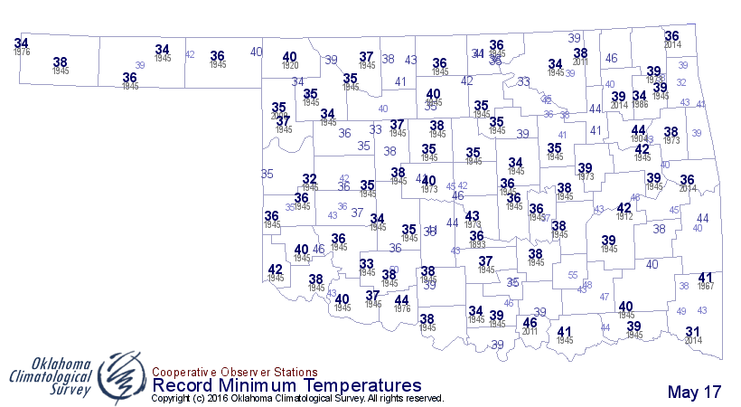
We're safe on the record cold minimums, thank goodness!
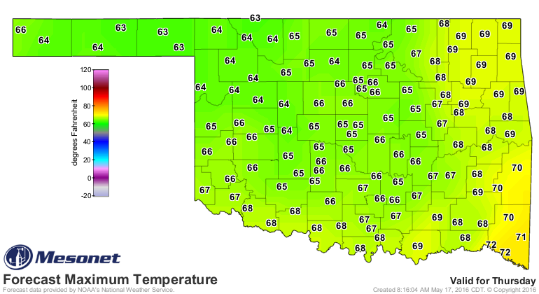
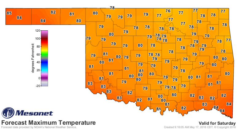
And finally, we get a reprieve with more May-like temps on Saturday.
Other than that, we will remain in this active May weather pattern with chances
of showers and storms for the next 7 days at least. This is from the Norman
NWS office, but it should be fairly representative of the entire state.
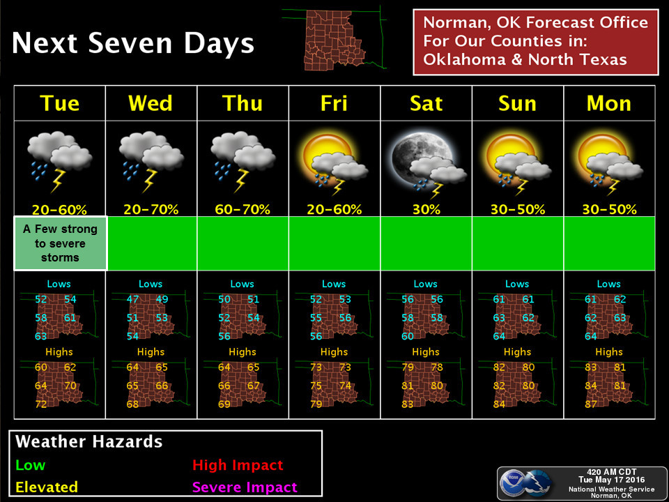
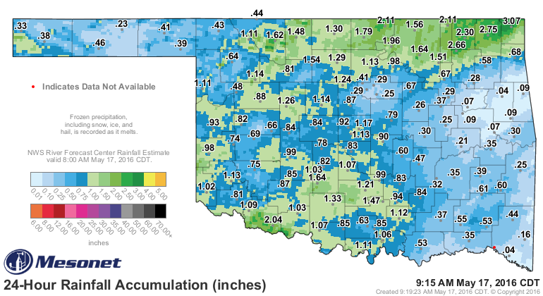
So many of us will continue to enjoy our rain
and not enjoy our severe weather
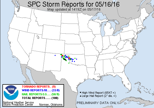
AAAAANNNNDDDD hopefully stop adding to the now confirmed total of 42 tornadoes
that have touched down in the state. That number will increase after yesterday,
by the way.
Gary McManus
State Climatologist
Oklahoma Mesonet
Oklahoma Climatological Survey
(405) 325-2253
gmcmanus@mesonet.org
May 17 in Mesonet History
| Record | Value | Station | Year |
|---|---|---|---|
| Maximum Temperature | 101°F | HOLL | 2022 |
| Minimum Temperature | 37°F | CAMA | 2009 |
| Maximum Rainfall | 3.66 inches | PORT | 2002 |
Mesonet records begin in 1994.
Search by Date
If you're a bit off, don't worry, because just like horseshoes, “almost” counts on the Ticker website!