Ticker for April 4, 2016
MESONET TICKER ... MESONET TICKER ... MESONET TICKER ... MESONET TICKER ...
April 4, 2016 April 4, 2016 April 4, 2016 April 4, 2016
Goodness gracious!
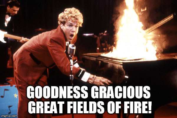
Sorry, but yes, I did have to go with the movie version of Jerry Lee Lewis playing
the flaming piano for this meme. But hey, Dennis Quaid will have to do (and better
than Randy Quaid, no?). The fire danger that we've seen oscillate between just
elevated to downright cataclysmic since about mid-February is still at it, and
we're about to see another one of "those" days tomorrow. Today is no slouch either.
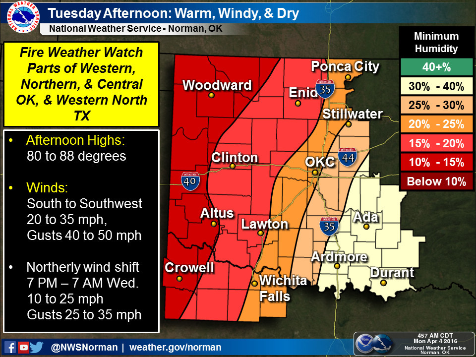
We currently have Red Flag Warnings out for the Panhandle and a Fire Weather Watch
for much of western Oklahoma, as well as a wind advisory for the western half of
the state.


As per usual this winter and spring, don't be shocked if those Red Flag Warnings
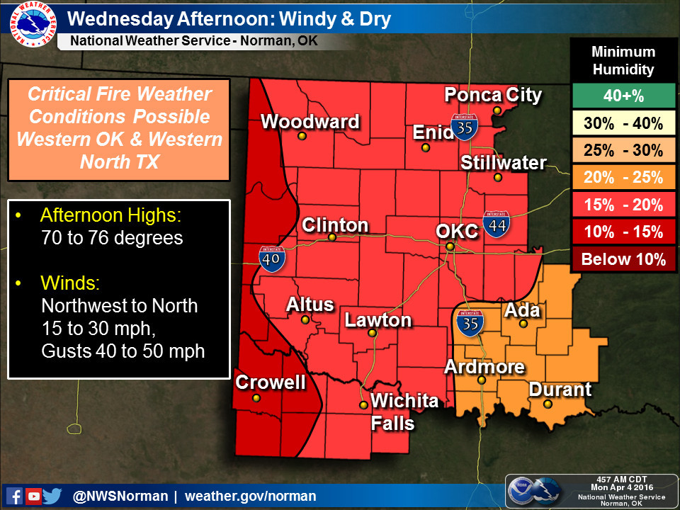
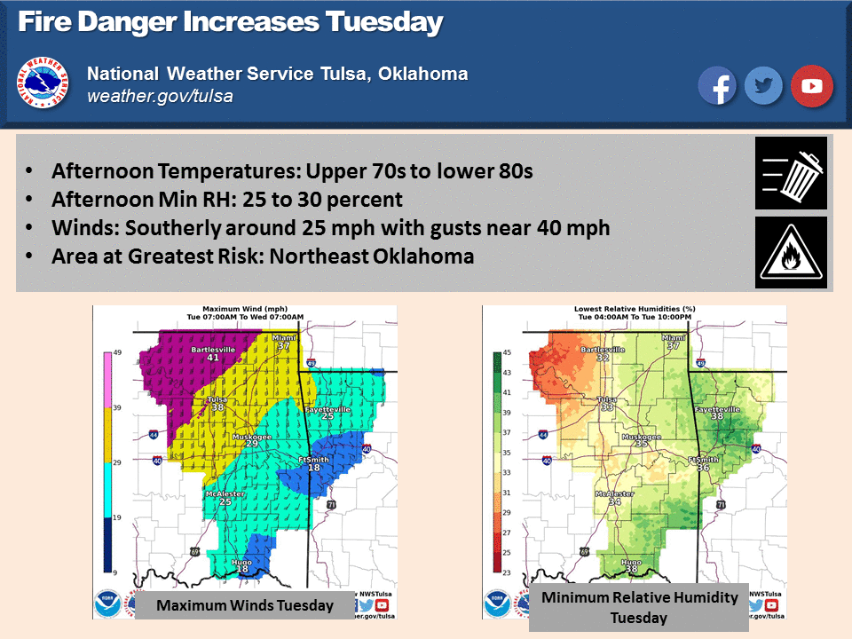
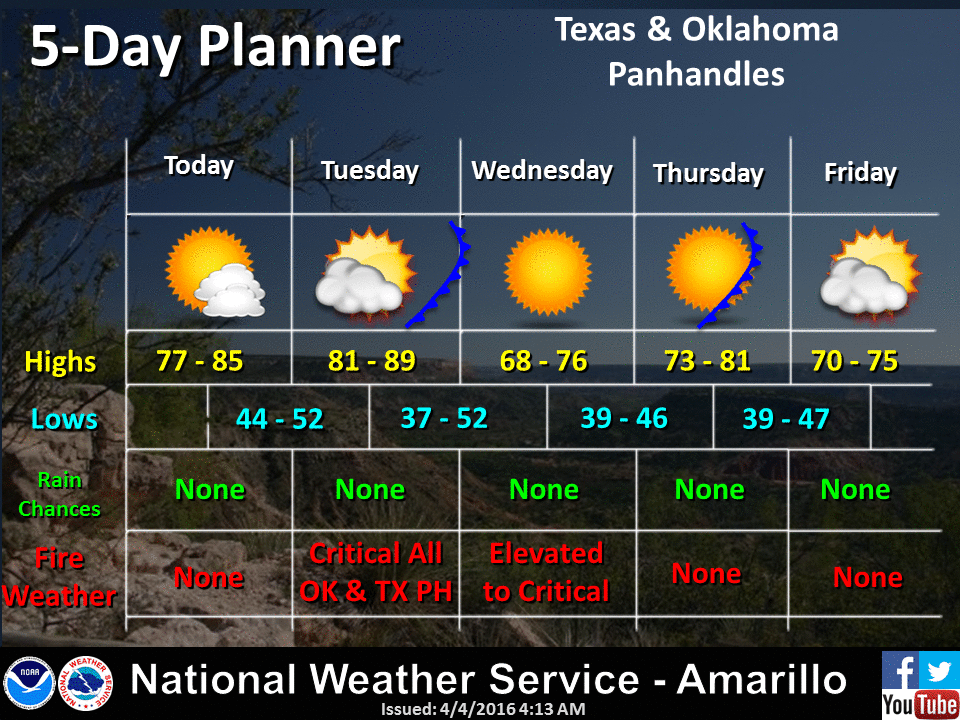
start to spread to the east. Here's how out NWS offices see the situation now:

And here's the Oklahoma Forestry Service's take:
"Warm temperatures and low relative humidity will continue to promote
dry and receptive fuels stalling green-up in the grass and brush fuel
models across Oklahoma. East-northeast winds will fall under critical
criteria limiting rate of fire spread offering opportunity for
successful initial attack today in many areas. The highest fire danger
today will lie west of I-35 where relative humidity values are expected
to fall below 20%. Most of western Oklahoma has not experienced a
wetting rain in seven days with sizeable sections in excess of twenty-
five days departure from wetting rains (Roger Mills and Cimarron
Counties are in excess of 100 days departure). Fire danger in the
Panhandle and northwestern Oklahoma, and extending in to broader areas
of Oklahoma, have observed a setback in seasonal green-up given the
lack of moisture and a series of successive frost/freeze events in
recent days."
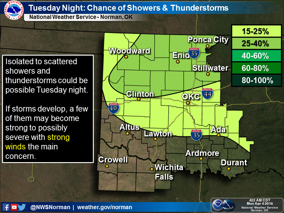
Now for the mediocre news...there is a chance of rain with this cold front that
will be traveling through the state on Tuesday, but the amount of rainfall that
could generate looks pretty paltry.
Until we see otherwise (and I have been given at least SOME assurances from our
Federal forecast partners that there is a pattern change for the wetter coming
in about a week or so), we will continue to see drought advance and fire weather
dominate. There could be more burn bans in the offing if we do continue long
term with this warm, dry and windy weather, so keep in tune with the burn
ban map to make sure your county isn't pegged.
http://www.forestry.ok.gov/burn-ban-information
Right now we're limited to Cimarron, Texas and Harper counties. I'd have expected
Woods County to be in there but I don't think there's anything left to burn.
Gary McManus
State Climatologist
Oklahoma Mesonet
Oklahoma Climatological Survey
(405) 325-2253
gmcmanus@mesonet.org
April 4 in Mesonet History
| Record | Value | Station | Year |
|---|---|---|---|
| Maximum Temperature | 94°F | ALTU | 2023 |
| Minimum Temperature | 16°F | BUFF | 2018 |
| Maximum Rainfall | 4.31 inches | TALI | 2025 |
Mesonet records begin in 1994.
Search by Date
If you're a bit off, don't worry, because just like horseshoes, “almost” counts on the Ticker website!