Ticker for January 19, 2016
MESONET TICKER ... MESONET TICKER ... MESONET TICKER ... MESONET TICKER ...
January 19, 2016 January 19, 2016 January 19, 2016 January 19, 2016
Welcome to the Autobahn
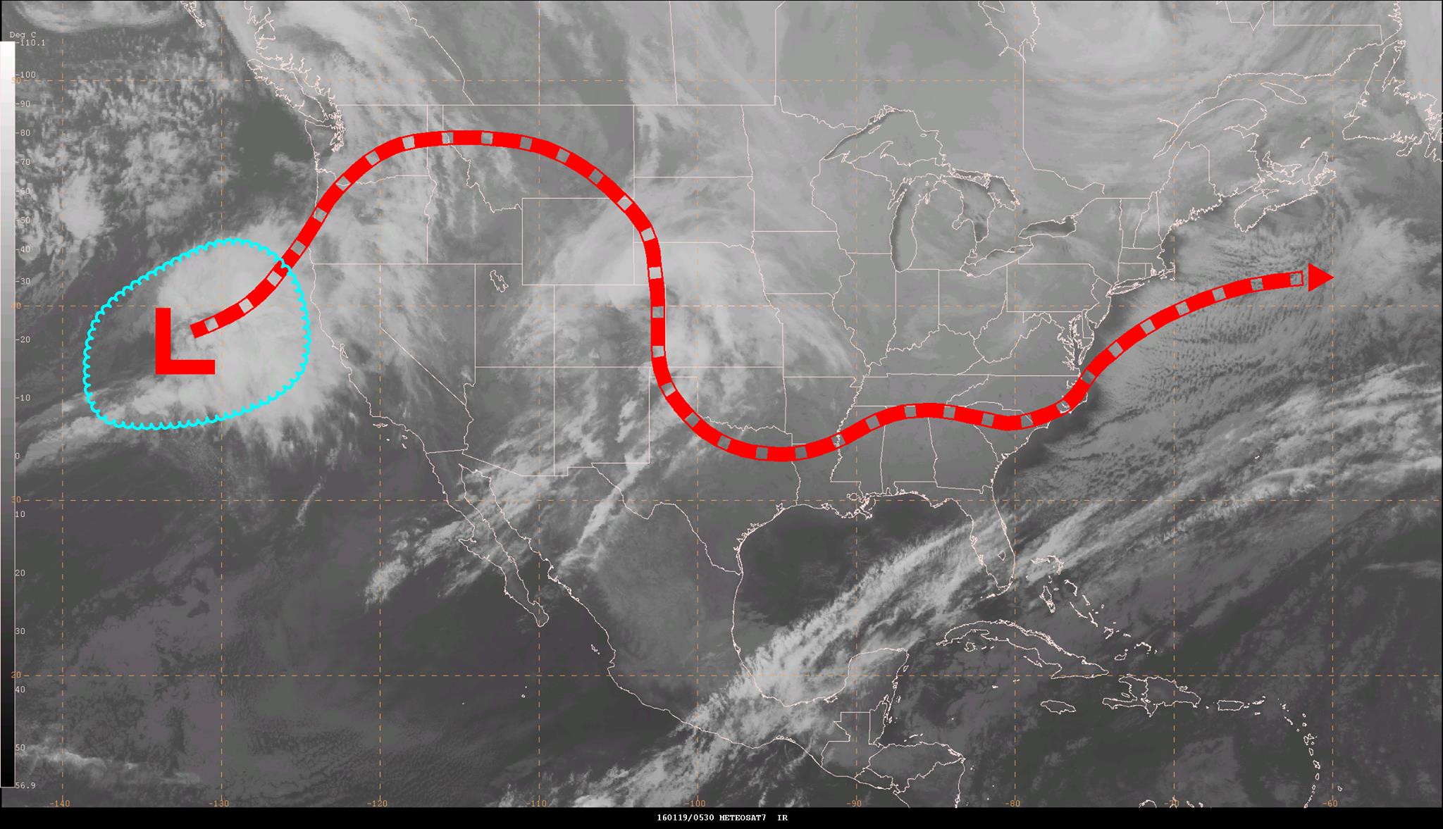
You've probably heard the buzz by now that the East Coast is expecting a huge
snowstorm into this weekend. If you haven't, consider yourself "buzzed!" But you
can also see that along its circuitous route, it takes a dip down along the lee
of the Rockies and into N Texas before making its way to the east. What's that
mean for us? Well, not heavy snow. Why not? Well, like the rest of the storm
systems that have crossed our state since December ended, it's simply moving too
fast to allow for enough moisture return (and the time to interact with that
moisture) to allow for one of those November/December type storm systems. Here's
the Tulsa NWS forecaster's take on the storm from this morning:
"What is expected to become a major system for the eastern United
States will begin to organize across our area on Thursday as it
heads east. The system is still west of the U.S. observational
network...and will be for another 24 hours. So until it gets a
little closer we will paint the situation with a broad brush. But
accumulating snow is possible for parts of the areas...especially
in Arkansas. But for the moment surface temps beneath the cold air
aloft look marginal and the organizing nature of the system in our
area suggests the moisture and lift patterns may still be evolving
and not solid enough to result in a solid precip shield. Forecasts
this time tomorrow will begin to have a chance to capture more
details."
Again, as with many of these systems lately, they're really bigger players for
eastern OK (and into Arkansas) since as described above, that's when things
start to come together a little better. So the system we're dealing with today
and tonight, then the one for Wednesday/Thursday, are just sort of disorganized
messes while they're over us...but with enough oomph to give us some impacts.
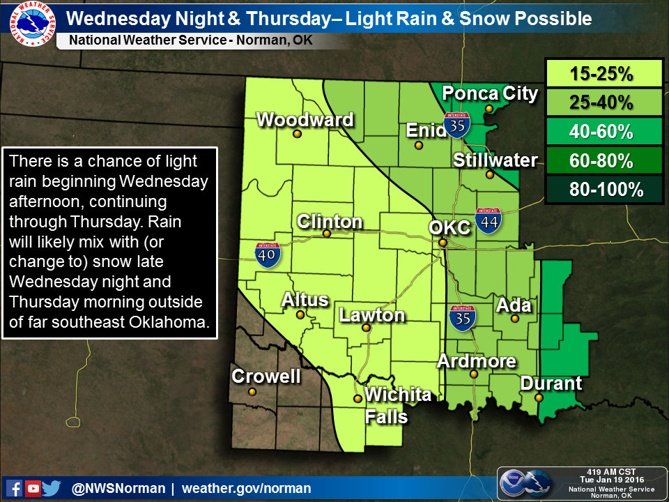
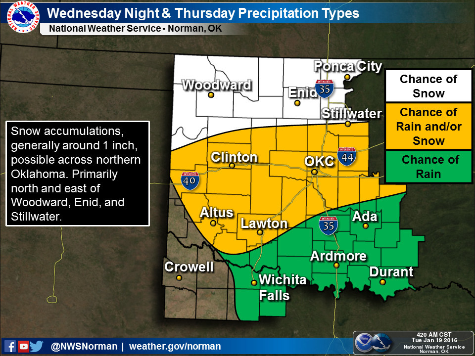
Here are some graphics from the local NWS offices detailing some of those
impacts. You'll notice several uses of the word "light" in dealing with
the precipitation.
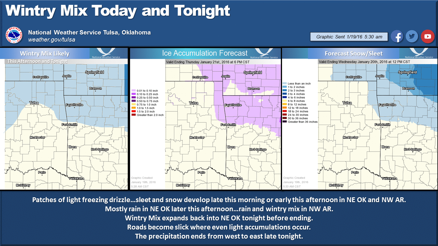
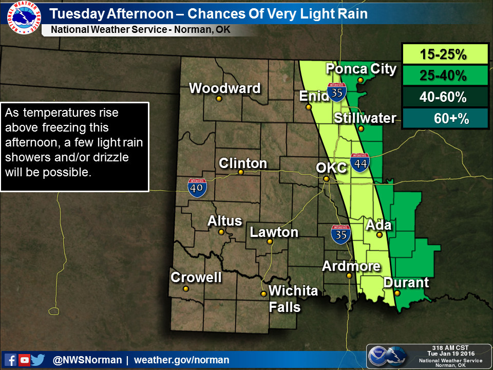
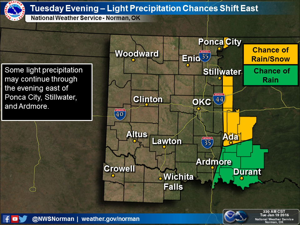
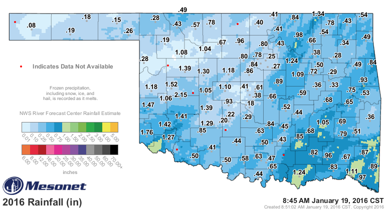
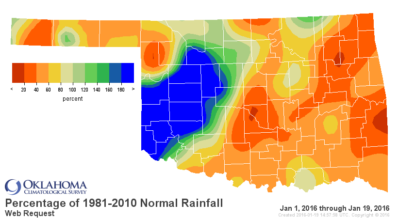
Our January has been sorta normal-ish as far as Januaries go thus far. A few
storm systems, wet here, dry there, cold, boring...
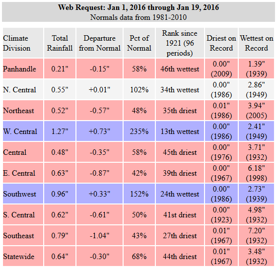
El Nino is giving us an energized southerly jet stream, the only problem is the
storm systems think they're on the turnpike. Give it time...one of them will
slow down to check us out eventually.
Gary McManus
State Climatologist
Oklahoma Mesonet
Oklahoma Climatological Survey
(405) 325-2253
gmcmanus@mesonet.org
January 19 in Mesonet History
| Record | Value | Station | Year |
|---|---|---|---|
| Maximum Temperature | 77°F | BURN | 1999 |
| Minimum Temperature | -4°F | BOIS | 2025 |
| Maximum Rainfall | 0.66″ | COOK | 2019 |
Mesonet records begin in 1994.
Search by Date
If you're a bit off, don't worry, because just like horseshoes, “almost” counts on the Ticker website!