Ticker for December 17, 2015
MESONET TICKER ... MESONET TICKER ... MESONET TICKER ... MESONET TICKER ...
December 17, 2015 December 17, 2015 December 17, 2015 December 17, 2015
The Warmth Awakens
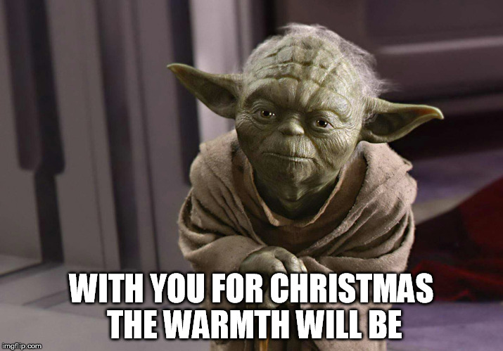
I felt a great disturbance in the Warmth, as if over a hundred Mesonet stations
suddenly cried out in terror and were suddenly colder. I fear something terrible
has happened.
Well, yes, that "something terrible" if you're a winter-hater like myself was
that idiotic cold front yesterday. Lows have plummeted into seasonal average
territory, if even a bit below that the last few days! The horror! In fact,
we've seen the coldest lows of the season over the last two days for some areas,
especially up in the snow-packed Panhandle. In fact, Kenton got down to zero
degrees this morning.
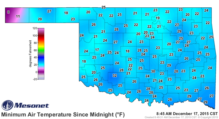
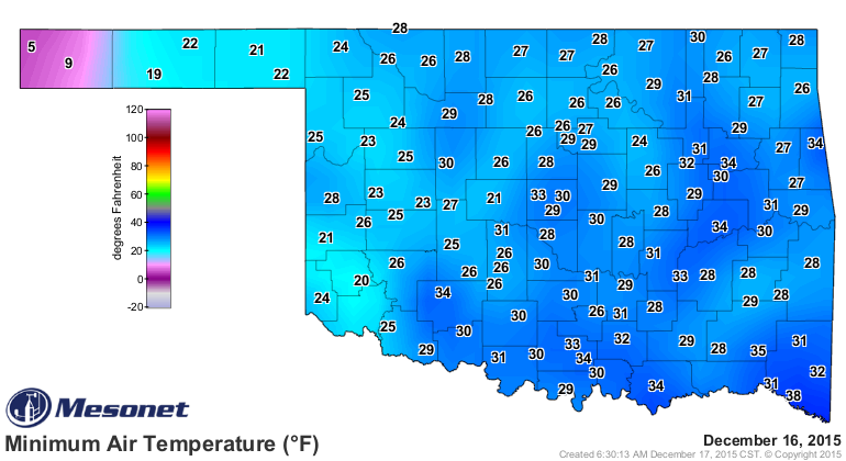
That's the lowest temp recorded by the Mesonet since Tipton and Kingfisher
recorded -1 degrees back on March 5. In fact (again), that zero is the 5th
lowest minimum recorded in all of 2015. Boise City has the lowest reading of -6
degrees back on January 4.
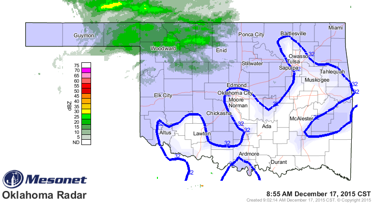
We have definitely had a distinct lack of cold weather this season, despite
the massive ice storm and the two blizzards up in the Panhandle AND the mildly
snowy weather up in the NW today. Notice that the radar image has the Mesonet's
freezing line superimposed upon it.
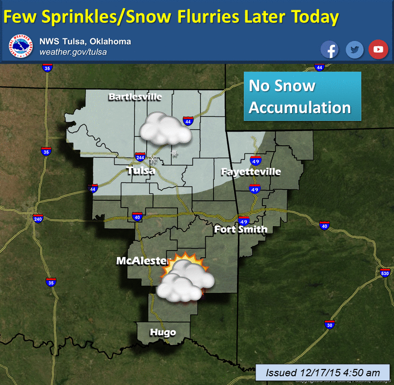
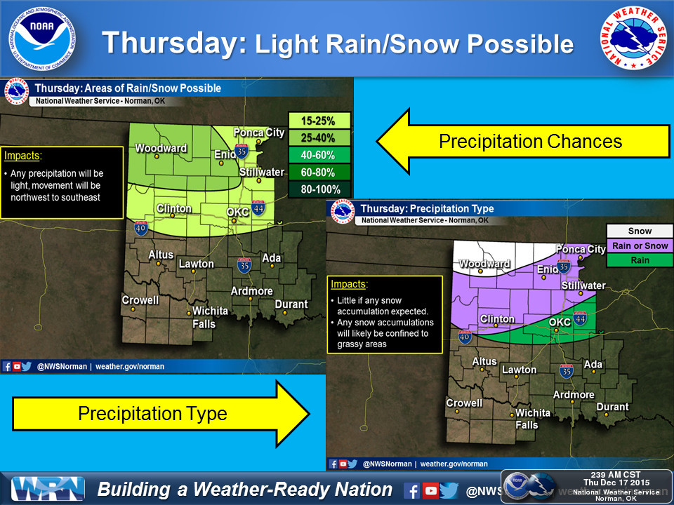
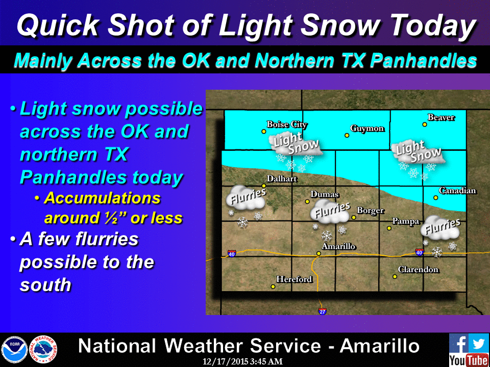
Just look at the number of hours below zero we've had so far this season, as
measured by the Mesonet. For comparison, check out what we suffered through in
the same time period last year (which was somewhat mild) and 2013, which was
downright cold (12th coolest Oct.-Dec. on record).
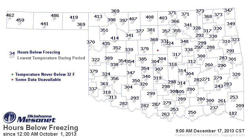
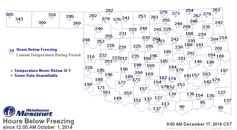
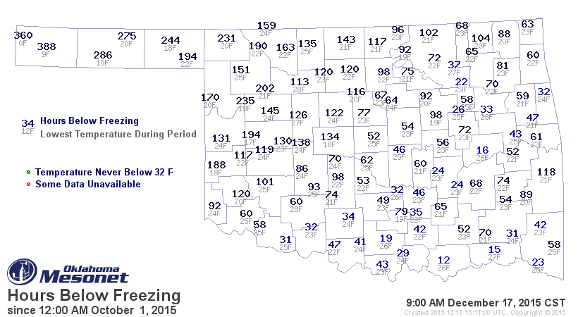
One of the more interesting things on those maps is the lowest temp recorded for
each station. By this time in 2013 and 2014, most stations had already seen
single digits or teens for lows. This season, however, I see lots of 20s as
the lowest temperature recorded. Only in Cimarron County do we see those single
digits, and only a few teens elsewhere.
Bear with Mother Nature, we're not long for these seasonal temps. In a couple of
days, we'll be basking in lovely 50s and 60s again.
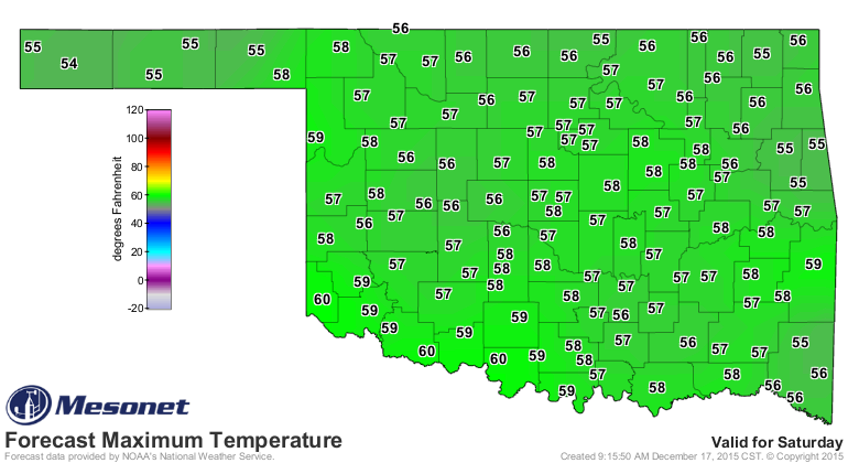
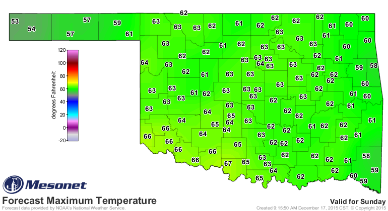
And those above normal readings should continue into next week, with a few bumps
here and there.
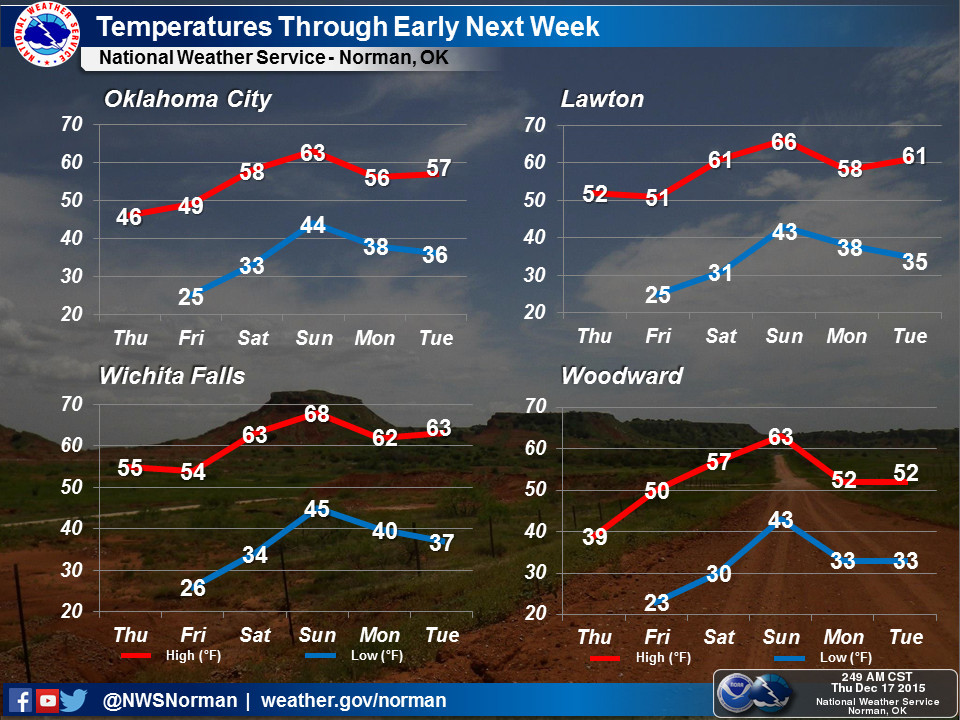
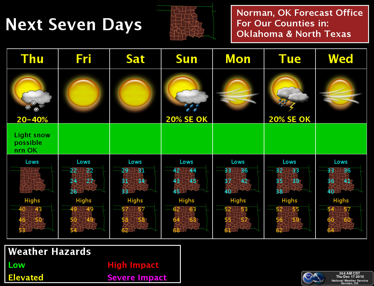
So that gets us out to Dec. 23, and all indications are the warm weather will
last right through Christmas Day. No White Christmas this year. Don't believe
me? The NWS Tulsa forecaster this morning guaranteed it (so you'll know who to
blame if things go kerflooey...or for most of you who probably want snow,
wonderfully):
"It is still beyond the range of this forecast, but confidence is
quite high that Christmas Day will feature much above normal
temperatures across eastern Oklahoma and northwest Arkansas. The
ECMWF is most extreme, suggesting possible record highs that day.
It is guaranteed that we will have to wait at least another year
for any chance at a White Christmas."
So there you have it. I wouldn't be shocked to see some 70s around Christmas
time, maybe the 26th or 27th? We're definitely headed toward one of our warmest
Decembers on record here in Oklahoma. With the warm weather forecast through
Christmas, and considering what we've seen for December thus far, that will just
be UNFROZEN gravy. Here are the statewide averages via the Mesonet vs. normal
for the month so far.
-***-
Highs Lows Mean Avgs
Statewide avg 61.2F 34.9F 48.1F
Normal 51.7F 28.5F 40.1F
Departure 9.5F 6.4F 8.0F
-****-
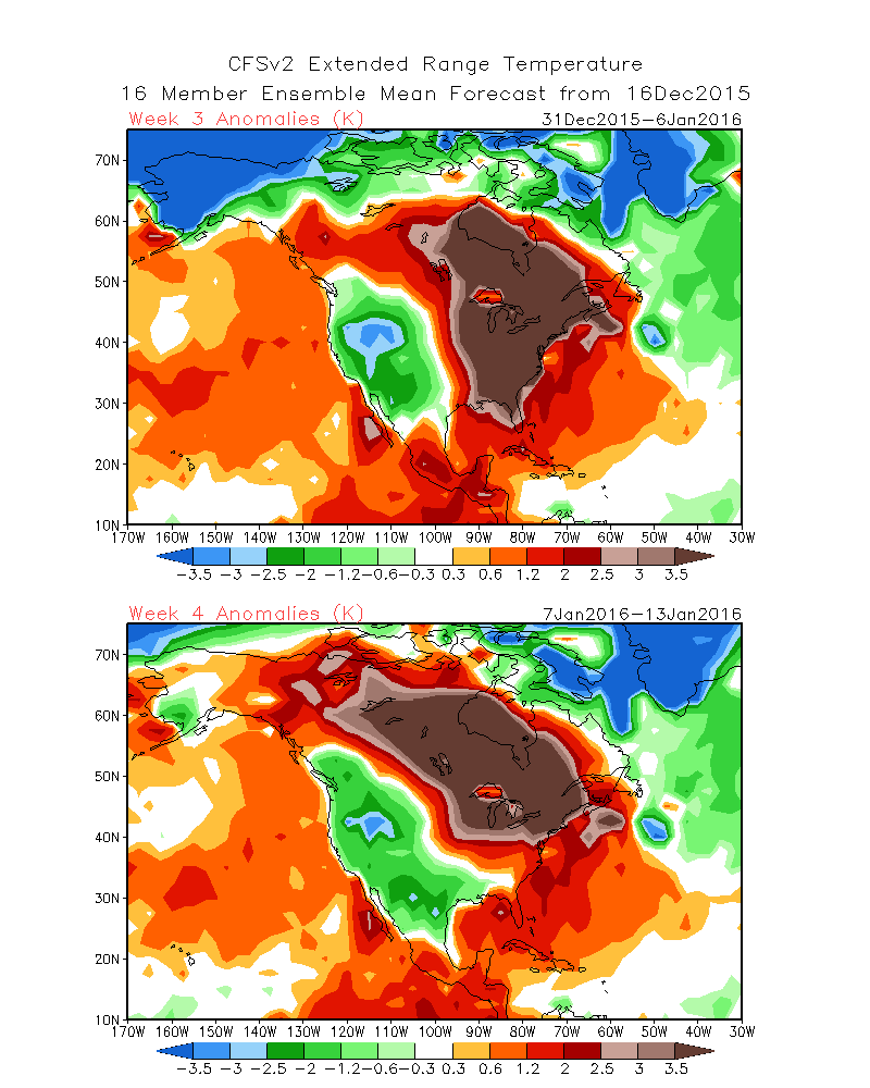
Will there be a pattern change after that? Possibly. The latest long-range models
show the eastern half of the country being much much MUCH above normal as we
get into the first couple of weeks of January, while the western half is below
normal. That doesn't necessarily mean arctic-like conditions, but below normal
in January is enough to generate snow and ice and that sort of thing. But notice
on this output from those models that Oklahoma is walking a precarious line
between the two regimes. So any type of forecast that far out is iffy to begin
with, but particularly lacking in confidence right now.
So enjoy it, hate it...whichever suits your fancy. Remember, this is what
a lot of the Southern Hemisphere gets during Christmas and they never complain.
As for me, I'll just say "May the warmth be with you. Always."
Gary McManus
State Climatologist
Oklahoma Mesonet
Oklahoma Climatological Survey
(405) 325-2253
gmcmanus@mesonet.org
December 17 in Mesonet History
| Record | Value | Station | Year |
|---|---|---|---|
| Maximum Temperature | 79°F | RING | 2021 |
| Minimum Temperature | -14°F | EVAX | 2016 |
| Maximum Rainfall | 3.06 inches | COOK | 2021 |
Mesonet records begin in 1994.
Search by Date
If you're a bit off, don't worry, because just like horseshoes, “almost” counts on the Ticker website!