Ticker for December 15, 2015
MESONET TICKER ... MESONET TICKER ... MESONET TICKER ... MESONET TICKER ...
December 15, 2015 December 15, 2015 December 15, 2015 December 15, 2015
Christmas snow? Sadly, no.
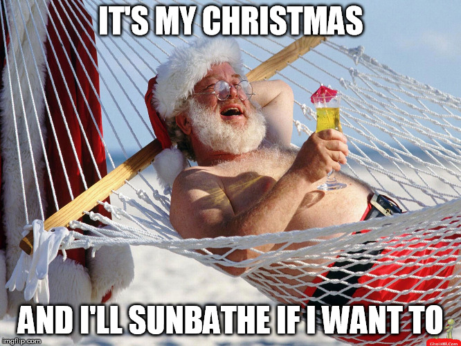
I know this time of year we all try our darnedest to create a White Christmas in
places where it's fairly rare to begin with...like Oklahoma. The parameters for
a white Christmas are generally agreed upon by the meteorological community...at
least an inch of snow on the ground on Dec. 25. This map from NCEI shows the
historical probability (from the 1981-2010 normals data)of that White Christmas
across the country.
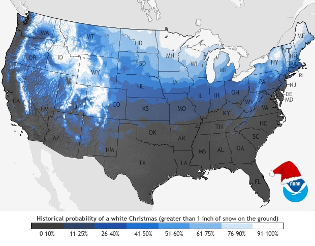
Now if you're up around the Center of the Universe, Buffalo, OK, then your chances
are a big greater. Above 11%, at least. But for the rest of the state, the chances
are 10% or less, and if I recall the finer points of the statistics, less than 5%
in actuality. Almost nil down south close to the Red River. And I fear this year
those chances will be close to nil for most of the state, at least from what I
can gather from 10 days out. Let's look at a few indicators and see what we got.
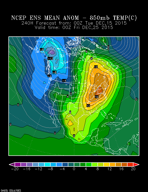
First, how about the 850 millibar mean temperature anomaly (in Celsius) for 6pm
on Dec. 24. Now this isn't at the surface but at the 850mb level, but it can be
a guide for what's going on at the surface. As you can see from this plot from
the NCEP ensemble mean forecast, the temperature anomalies for the eastern
half to two-thirds of the country are above normal (and INCREDIBLY above normal
for the Northeast).
How about the surface temperature for Christmas Day, this time from the
GFS forecast model?
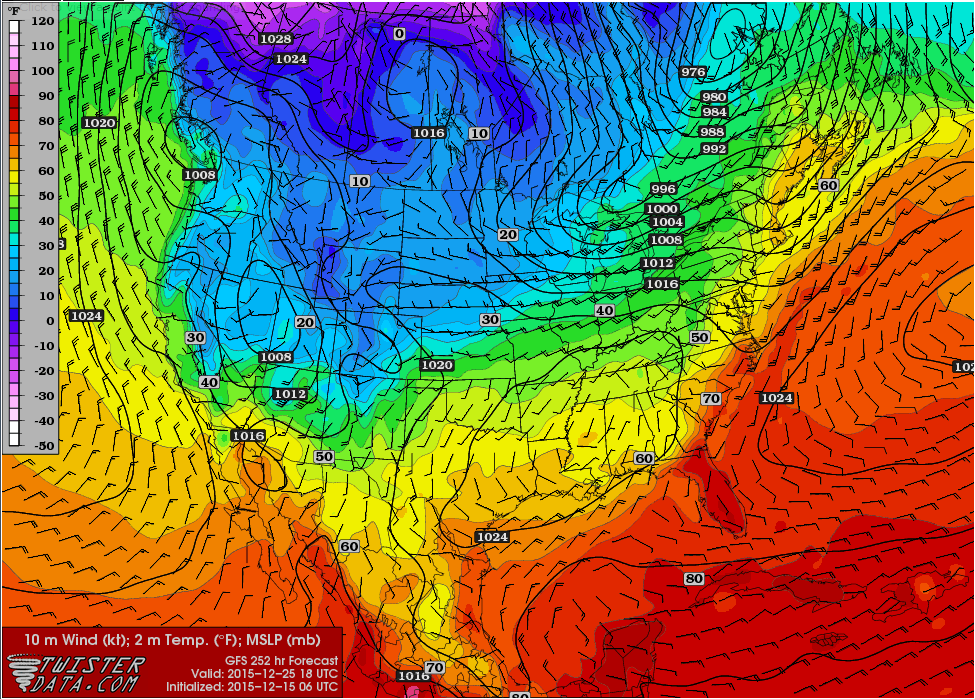
Here you see temps in the 40s at noon, and probably into the 50s a bit later.
Now maybe there will be a bit of cold air that plunges down into the High Plains
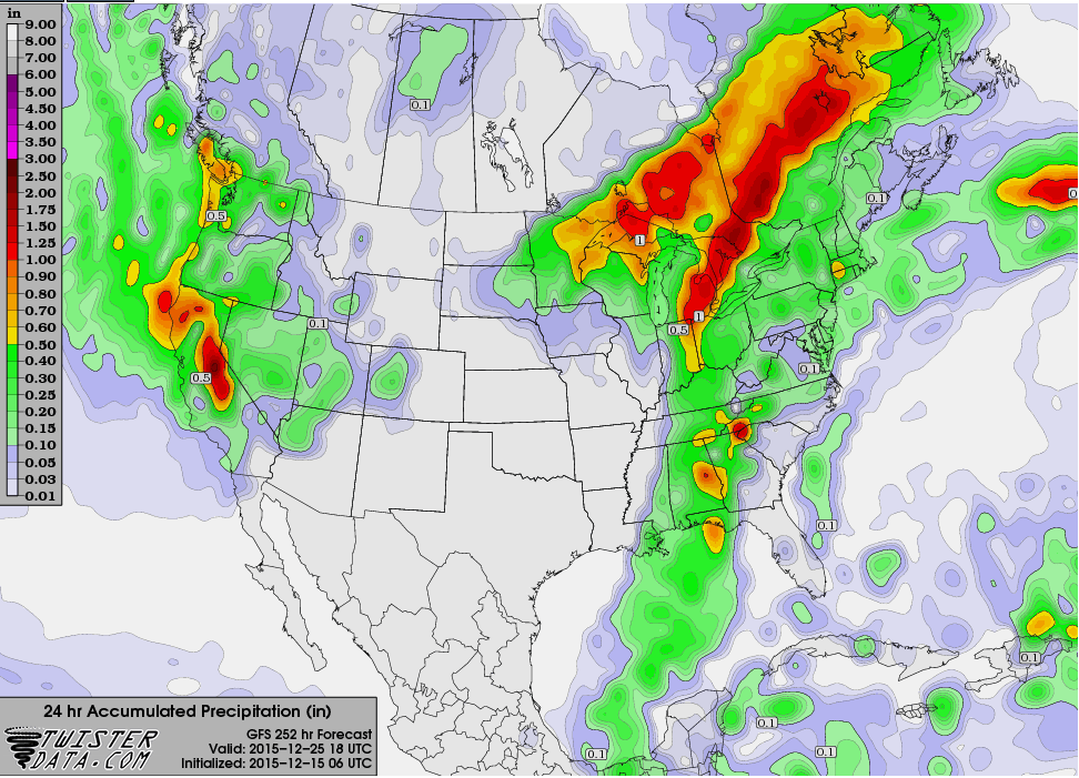
around the 24th or the morning of the 25th, but even at that point, no moisture
is showing up, as shown in this 24-hour accumulated precip map from noon once
again on Christmas Day (it doesn't change later that night either).
What do the local forecasters say? They aren't too optimistic either, although
they do leave folks with a tiny, tiny bit of hope. From the NWS Tulsa forecast
discussion:
"For those of you hoping for a white Christmas, the latest data
does not look promising, with well above normal temperatures
looking much more likely than snow. However, model consistency at
that time range has not been great, so that allows you to hang
onto your hope for at least a little while longer."
Now that's sort of like when you ask for the Dallas Cowboys version of electric
football but you know you're gonna get the Green Bay Packer's vs. the Steelers
instead. Better luck next year, kid.
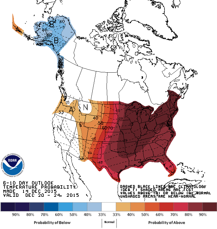
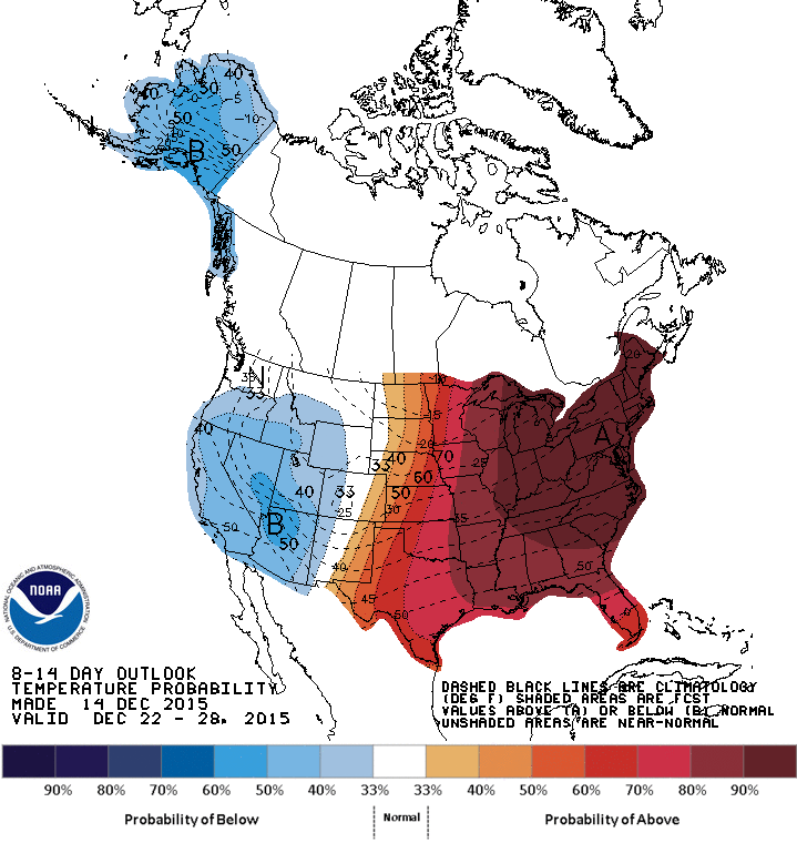
The medium term anomaly maps from CPC aren't much help either. You do see
increased odds of below normal temps for the West, but not for Oklahoma. Doesn't
mean you can't eek out a quick cold front amongst all that heat, but it would
have to be a quick one. And the snow obviously wouldn't last long.
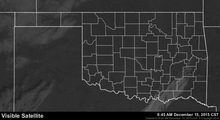
So if you want a White Christmas, your best bet is to schedule it for the next
few hours somewhere in the western Panhandle while this snow is still on the
ground (notice the Beaver River valley in that pic?).
But a White Christmas in Oklahoma on the actual day of? Miracles do happen. But
so do the Packers vs. the Steelers electric football games. Our only hope now is
that by my proclaiming our hopes dead, a blizzard with ensue.
Gary McManus
State Climatologist
Oklahoma Mesonet
Oklahoma Climatological Survey
(405) 325-2253
gmcmanus@mesonet.org
December 15 in Mesonet History
| Record | Value | Station | Year |
|---|---|---|---|
| Maximum Temperature | 83°F | SEIL | 2021 |
| Minimum Temperature | 2°F | KENT | 2008 |
| Maximum Rainfall | 1.99″ | BBOW | 2001 |
Mesonet records begin in 1994.
Search by Date
If you're a bit off, don't worry, because just like horseshoes, “almost” counts on the Ticker website!