Ticker for October 29, 2015
MESONET TICKER ... MESONET TICKER ... MESONET TICKER ... MESONET TICKER ...
October 29, 2015 October 29, 2015 October 29, 2015 October 29, 2015
I'd like to report a murder

Sigh. Look, it's not MY fault you don't know who Columbo is. Google it, youngsters,
or at least get TV Land! And yes, this map is about to get massacred, at least
in southern Oklahoma.

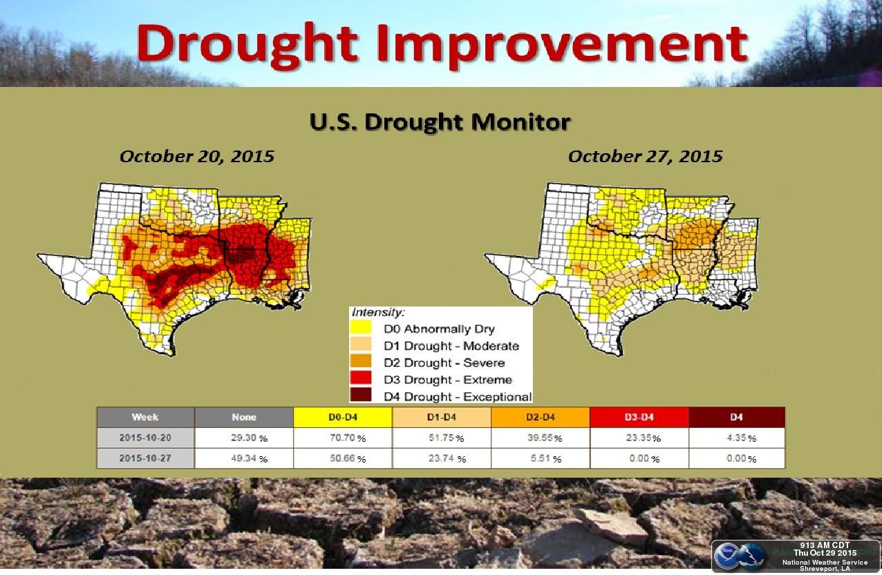
That's right, the flash drought has now become a flash in the pan for the most
part. Here's what this map looked like just last week, with 36 percent of the
state in at least moderate drought, which has now dropped to 18 percent.
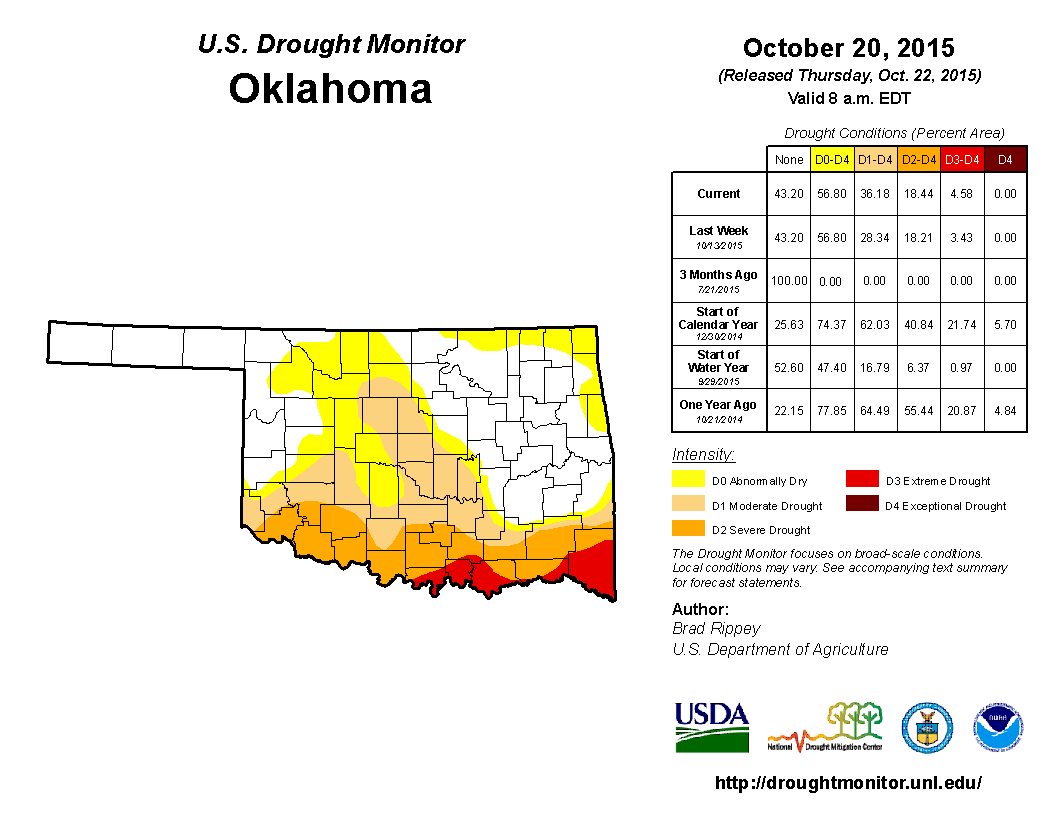
Oh, we still have a problem, however. Despite some good rains along the southern
tier of the state, where the drought was at its greatest intensity, northern
Oklahoma has not shared in the good moisture. Heck, most of the state is still
well below normal for October, but especially northern OK.


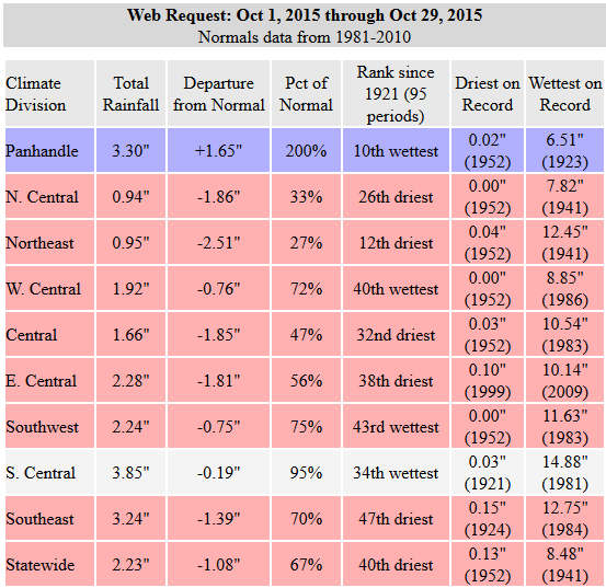
Yikes! Even I thought October was wetter than that, and I look at this stuff
every day. The big problem we have is that area in north central OK that has
received around a half inch or less is one of the biggest wheat growing areas
in the state. Word I have received from county officials in those areas is that
they need rain, and fast, or the wheat that was "dusted in" (i.e., planted in
dry conditions and hoping for a good rain to allow it to get established) is
going to go nowhere.
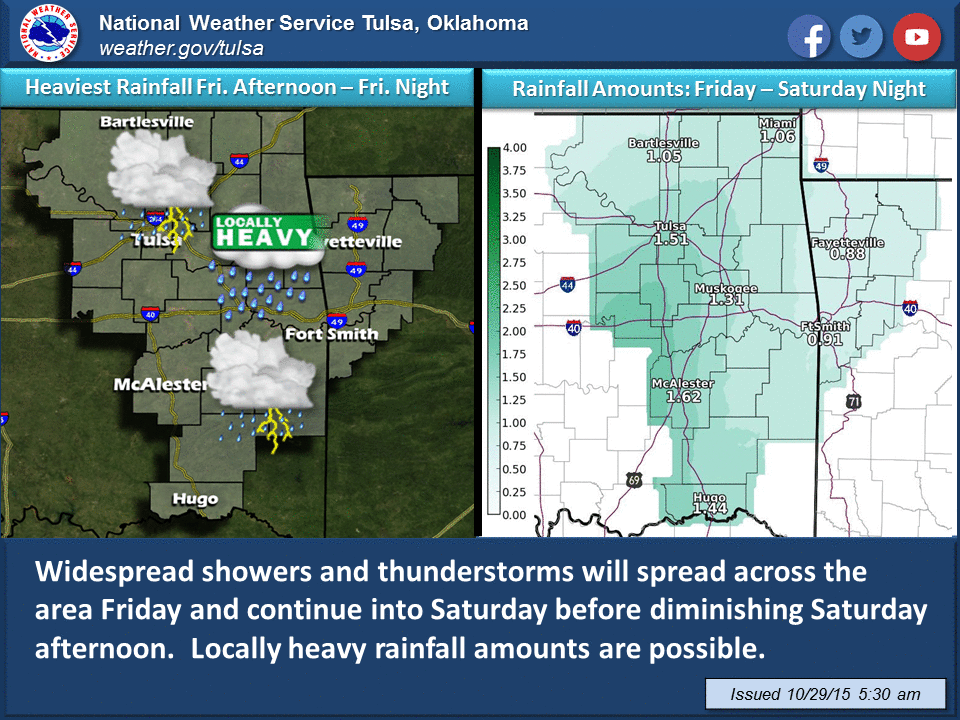
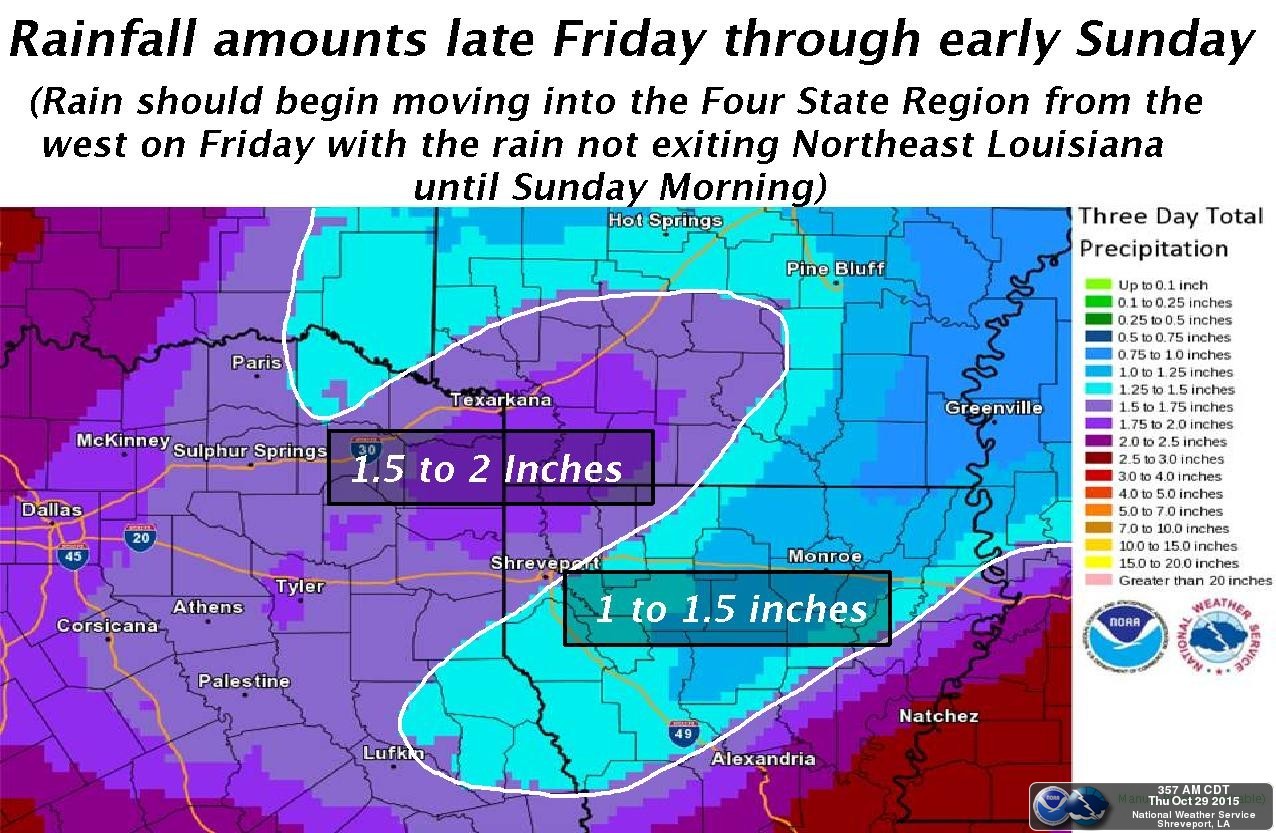
The good news is there is rain in the forecast. The bad news is the heaviest
rain again appears to be headed for southern Oklahoma, where they've had like
10 kazillion inches already in 2015.
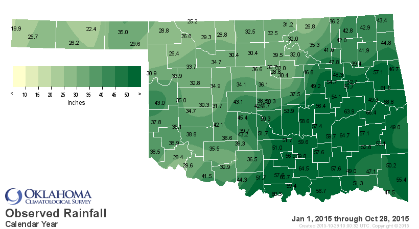
Come on, Tishomingo...64.5 inches already? How about sharing some?? Wait, I'm
getting word from Tishomingo that McAlester has had 64.7 inches so I should
have shamed them instead. And also...well that was rude! I won't repeat that one.
The problem again, however, is the best rains appear to be diving south once
again.
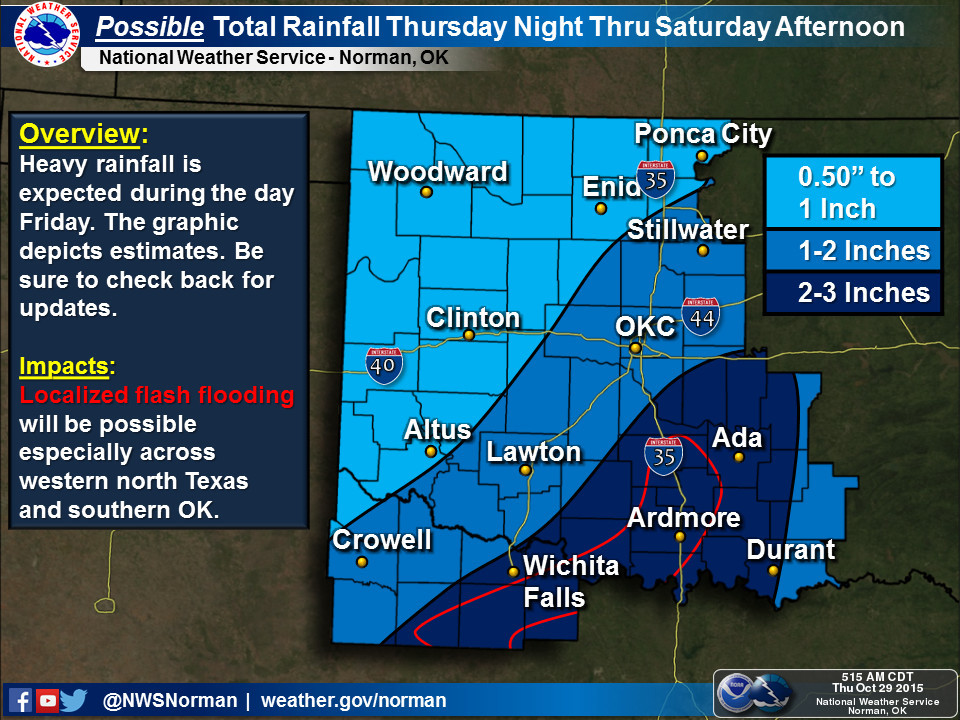
This is what the bigger picture looks like.
I'll say this again...we can't attribute each of these individual storm systems
to El Nino. That's a climate no-no. But in my opinion, when we start seeing
them start to line up when we get into late fall, that's looks very El Nino'ish
to me. Just look at these rainfall totals for the past two weeks across the
Southern Plains and the Southeast. Widespread totals of 10-20 inches across
Texas, LA and MS (I was too lazy to spell those states out...sorry), and 2-6
inches fanning out from there.
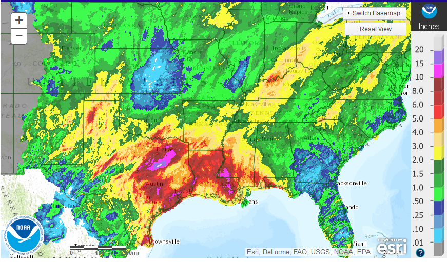
Part of that was from the remnants of pacific hurricane Patricia, but one of
El Nino's impacts is to increase pacific tropical activity. So maybe...just
maybe. ANDDDDDDD, that has allowed much of this Southern Plains flash drought
to meet an ugly (or pretty) demise.
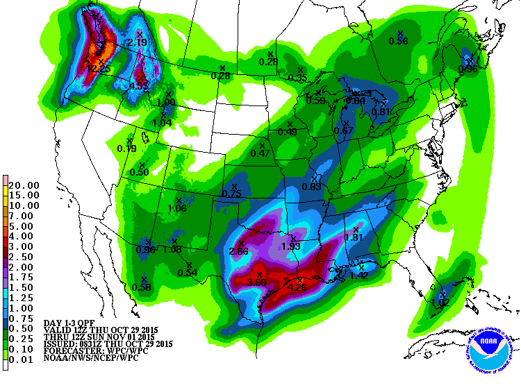
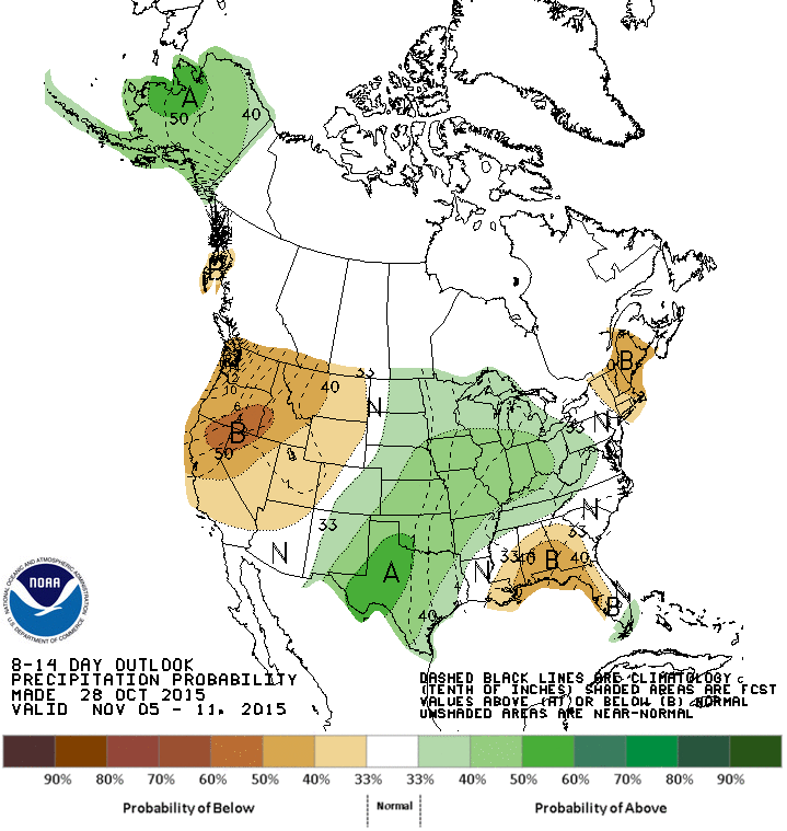
And don't look now, but the next week or two might bring the same type of
storm system. Both the 6-10 and 8-14 day precip outlooks from the CPC show
increased odds of above normal precip.

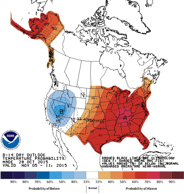
Still no sign of any really cold air just yet, however.
Gary McManus
State Climatologist
Oklahoma Mesonet
Oklahoma Climatological Survey
(405) 325-2253
gmcmanus@mesonet.org
October 29 in Mesonet History
| Record | Value | Station | Year |
|---|---|---|---|
| Maximum Temperature | 94°F | BUFF | 2016 |
| Minimum Temperature | 13°F | BEAV | 2019 |
| Maximum Rainfall | 2.84 inches | PAWN | 2009 |
Mesonet records begin in 1994.
Search by Date
If you're a bit off, don't worry, because just like horseshoes, “almost” counts on the Ticker website!