Ticker for October 20, 2015
MESONET TICKER ... MESONET TICKER ... MESONET TICKER ... MESONET TICKER ...
October 20, 2015 October 20, 2015 October 20, 2015 October 20, 2015
Drought eraser
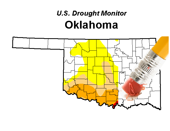
The latest U.S. Drought Monitor map (from last Thursday) was definitely ugly, and
given that the new on on Thursday only considers what happened up through Tuesday
morning (a whole lot of nothing!), you can expect it to look worse. But it will
*probably* be raining heavily at that time...especially across western Oklahoma.
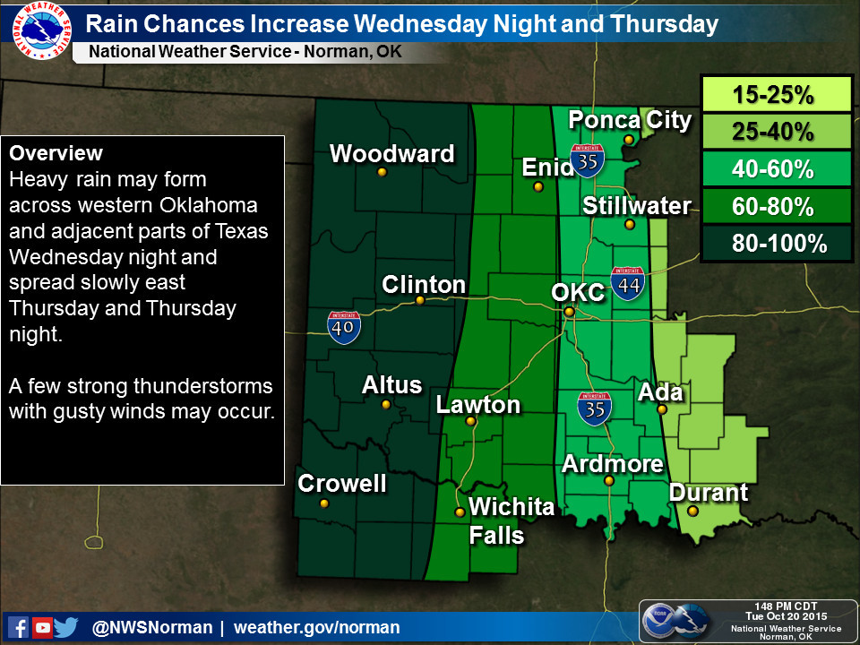
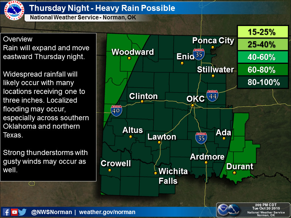
For the western and central portions of the state, that should be the bulk of
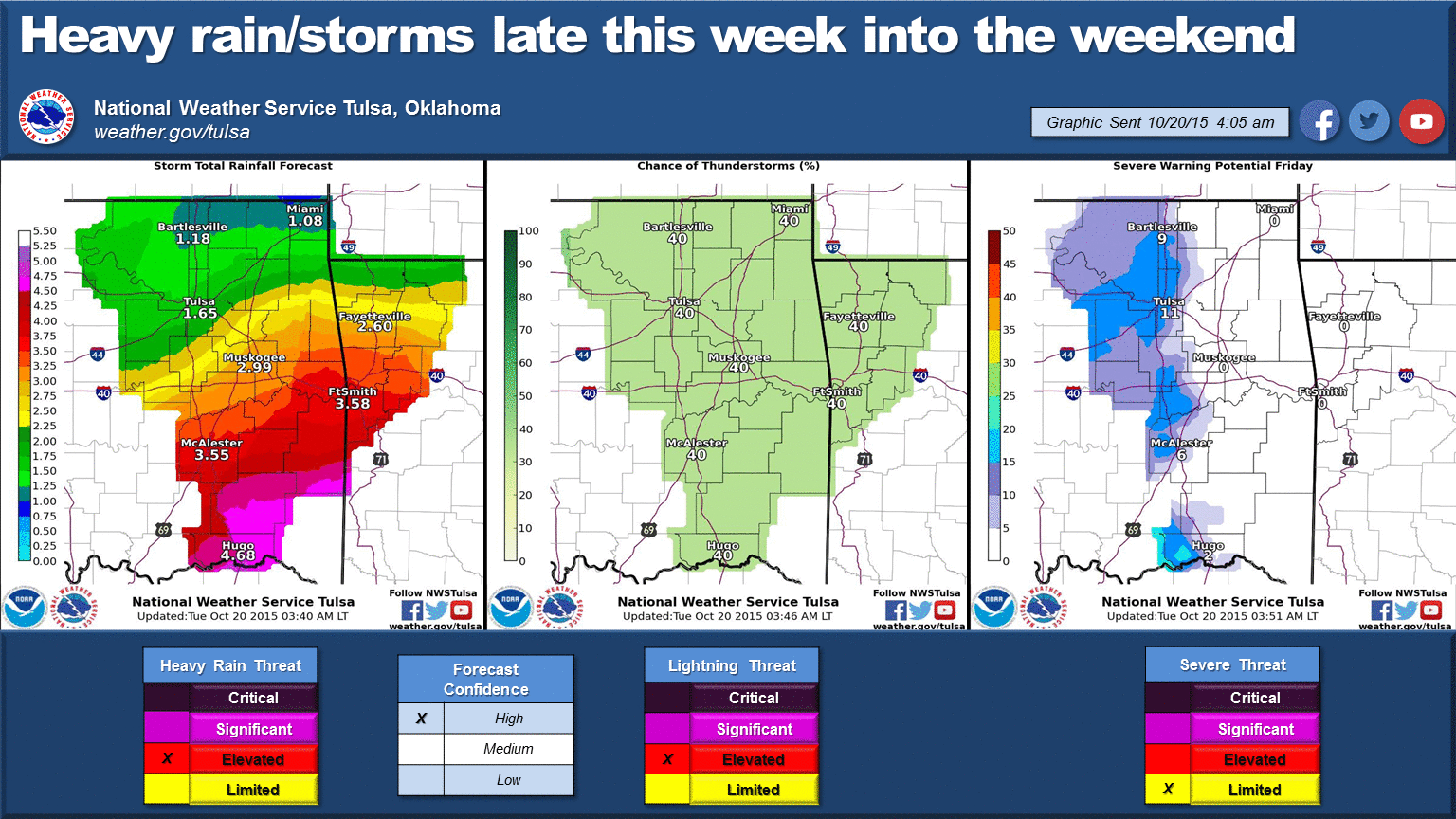
the precip. Check out the rainfall total map just released by WPC for now through
Friday.
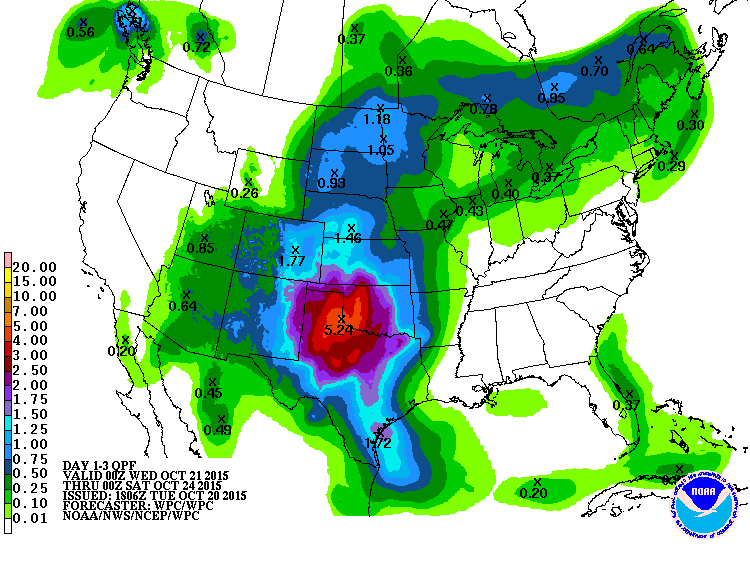
ZOUNDS!! 5 inches across western OK and NW Texas? What is this, May? There will
be a definite flooding threat with that type of rainfall.
After that, the focus shifts further to the east where a frontal boundary should
stall out and interact with that Gulf moisture, allowing for possible drought
ease-ification later into the weekend.
The point, which I rarely approach, is that it's going to rain after a long,
LONG hiatus for significant portions of the state. So be prepared for heavy
rainfall, and also be prepared to ignore the new Drought Monitor map that comes
out on Thursday.
Just in case.
Gary McManus
State Climatologist
Oklahoma Mesonet
Oklahoma Climatological Survey
(405) 325-2253
gmcmanus@mesonet.org
October 20 in Mesonet History
| Record | Value | Station | Year |
|---|---|---|---|
| Maximum Temperature | 96°F | CAMA | 2003 |
| Minimum Temperature | 23°F | NOWA | 2011 |
| Maximum Rainfall | 3.10 inches | LANE | 1996 |
Mesonet records begin in 1994.
Search by Date
If you're a bit off, don't worry, because just like horseshoes, “almost” counts on the Ticker website!