Ticker for October 5, 2015
MESONET TICKER ... MESONET TICKER ... MESONET TICKER ... MESONET TICKER ...
October 5, 2015 October 5, 2015 October 5, 2015 October 5, 2015
A River Runs Through It (South Carolina)
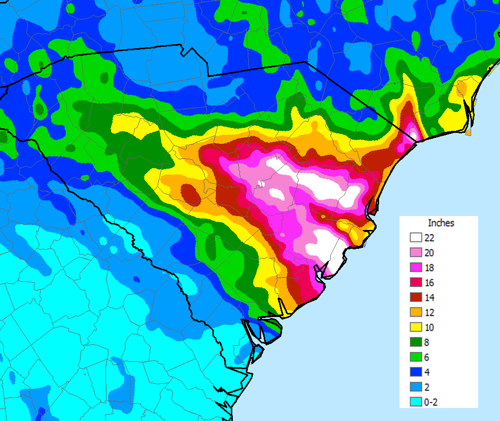
We look at these South Carolina 5-day rainfall totals with amazement, especially
considering these were NOT associated (well, everything in the atmosphere is
associated, as the one big fluid it is) with Hurricane Joaquin. This was simply
a matter of an cut-off upper-level low pressure system that got mired in the
flow (or lack thereof) off the East Coast. Joaquin never got close to the
East Coast. Some of the moisture plume, or fetch, is associated with Joaquin,
but again, this ain't Joaquin.
http://www.weather.com/storms/hurricane-central/joaquin-2015/AL112015
Now we've seen rainstorms like that before, but maybe not in that short of a time
frame. Remember April, MAY, June and July? All of those were pretty incredible
when the monthly totals were tallied. And May did end up as the wettest month in
Oklahoma history.
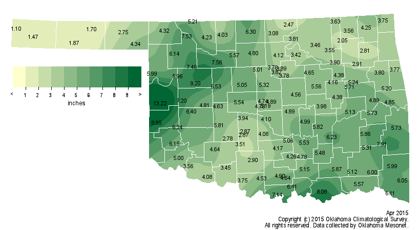
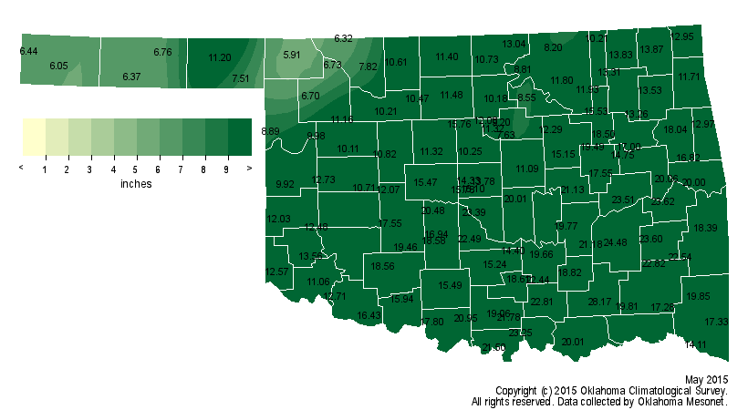
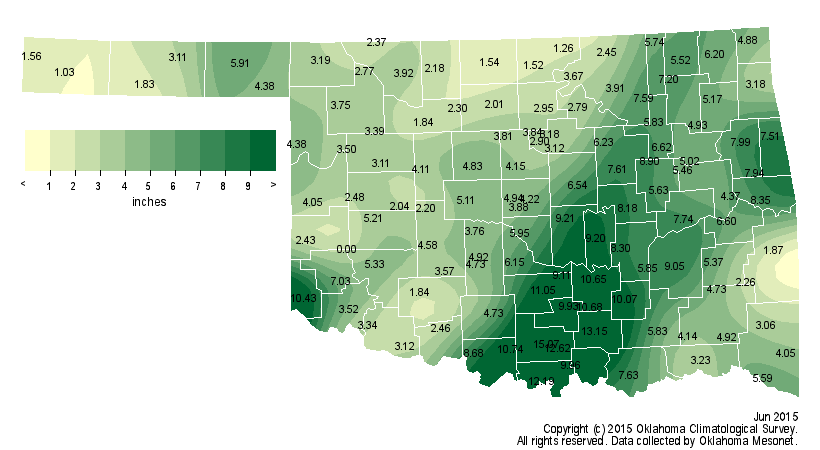
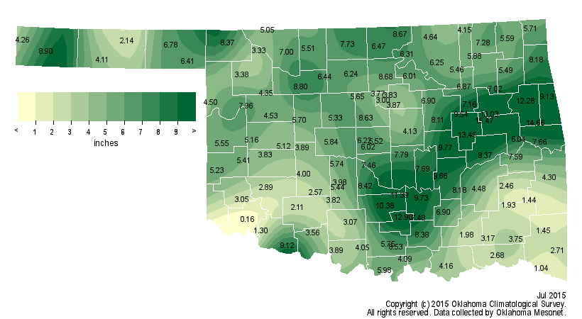
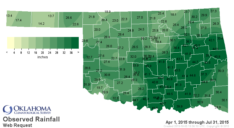
And the totals, really from mid-April through mid-July, are what has brought
Oklahoma to one of its top give wettest years on record thus far.
The highest 5-day total we can find for Oklahoma this year came from the Ardmore
Mesonet site from June 15-19 with a total of 15.8 inches, so some of those 22+
inch amounts are still incredible when put into that perspective. Our spring
rains were historic in their own regard, obviously.
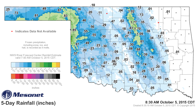
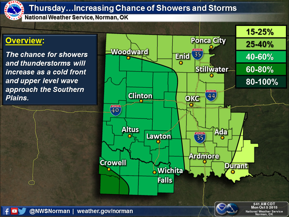
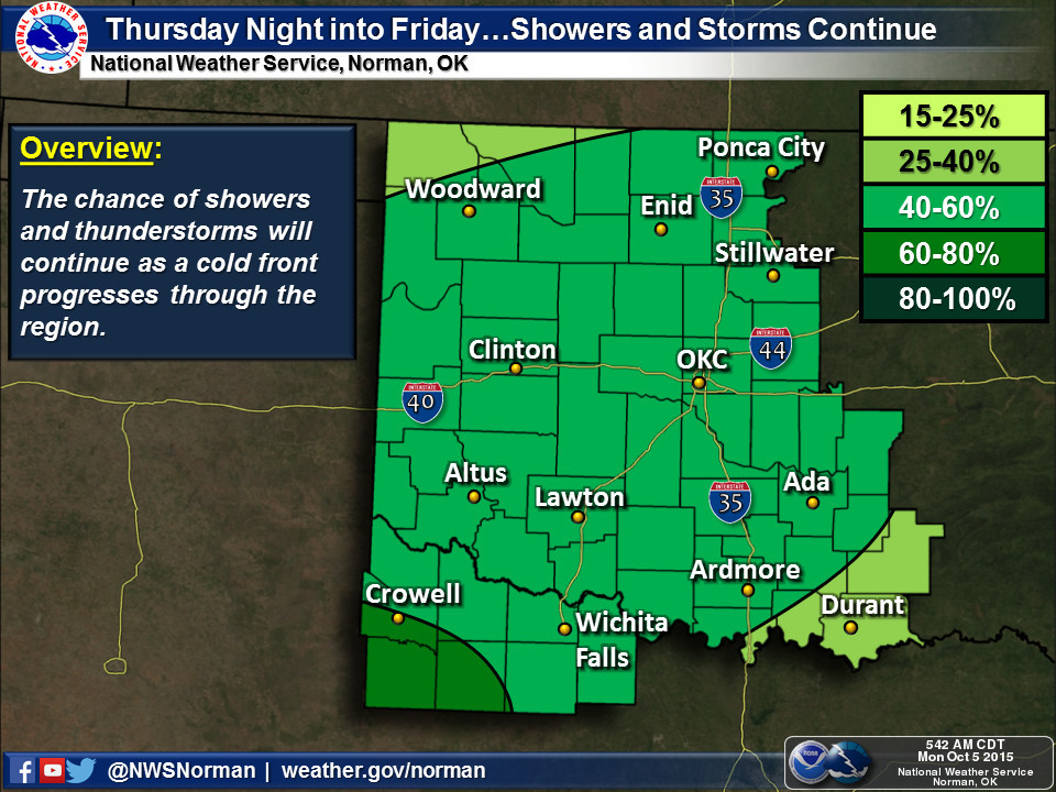
Now this is sort of a letdown, considering all of what was just talked about,
but it is raining in Oklahoma!
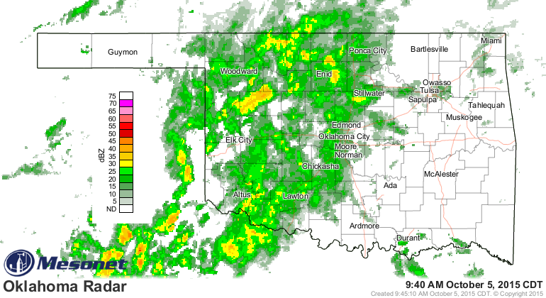
With the dry spell we've been having, the totals are impressive regardless of
what they're compared against. Mostly out west, but we saw some nice totals in
NC Oklahoma as well.
Aaaaand, we can expect a bit more rain this week into the weekend, but don't
expect any deluges.

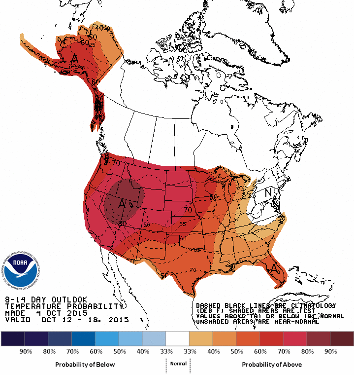
As far as temps go, don't be looking for our first frost anytime soon. This week
will be a roller coaster with a front or two that will bring us back down close
to normal, but next week looks right back into the heat. At least for mid-
October.
Gary McManus
State Climatologist
Oklahoma Mesonet
Oklahoma Climatological Survey
(405) 325-2253
gmcmanus@mesonet.org
October 5 in Mesonet History
| Record | Value | Station | Year |
|---|---|---|---|
| Maximum Temperature | 96°F | HOOK | 2018 |
| Minimum Temperature | 31°F | KENT | 2016 |
| Maximum Rainfall | 5.92 inches | PRYO | 1998 |
Mesonet records begin in 1994.
Search by Date
If you're a bit off, don't worry, because just like horseshoes, “almost” counts on the Ticker website!