Ticker for May 20, 2015
MESONET TICKER ... MESONET TICKER ... MESONET TICKER ... MESONET TICKER ...
May 20, 2015 May 20, 2015 May 20, 2015 May 20, 2015
Moving on up!

Okay, "Rocky 5?" Now I'm just getting desperate. But here's the reason why.
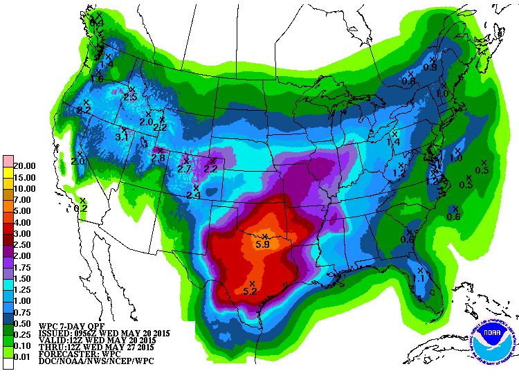
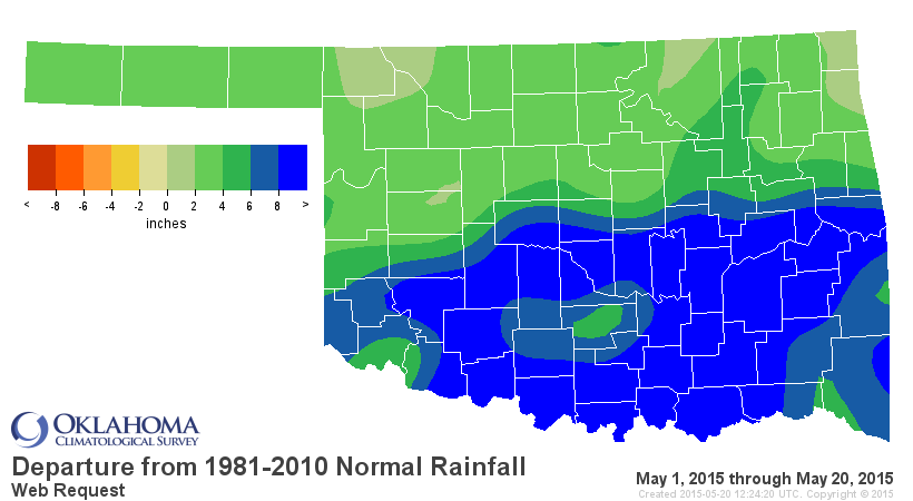
Has that stupid map even changed at all throughout May? Looks nearly the same
every time.
Last night's rainfall was gargantuan in proportions across southern and central
Oklahoma. You can see the streaks of higher rainfall amounts where the more
intense storms moved slowly across the state.
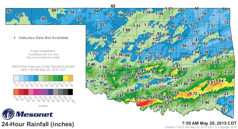
I mean, come on, this is getting a bit ridiculous, right?
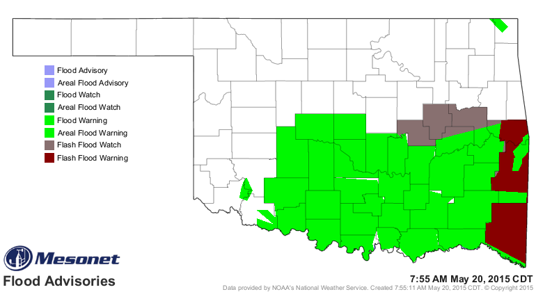
No, the bell hasn't rung. May's march (not that March) up the rankings in its
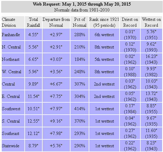
quest to become the wettest May and/or month in state history. The statewide
average now stands at 8.79" according to preliminary Oklahoma Mesonet data
through this morning, placing May 2015 solidly in the #5 spot all-time for May
precipitation totals.
1957: 10.54"
1982: 10.38"
1943: 9.66"
1902: 9.14"
2015: 8.79
That also places May 2015 in 8th place in the wettest months all-time for any
month in Oklahoma, with Oct. 1941's 10.75" in the top spot.
Oct 1941: 10.75"
May 1957: 10.54"
May 1982: 10.38"
May 1943: 9.66"
Jun 2007: 9.51"
May 1902: 9.14"
Jul 1950: 9.07"
May 2015: 8.79"
A quick note: the running total given for May 2015 is based upon Oklahoma
Mesonet data. The official data is kept at the National Climatic Data Center
(NCDC) and is generally released soon after the end of each month. Those data
are a combination of NWS COOP, Oklahoma Mesonet and FAA observing stations. The
Mesonet has proven to provide a fairly close estimate to those final NCDC values
in the past.
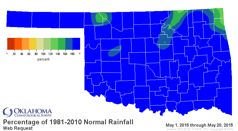
Here's where we stand for May thus far via the maps and stats table.
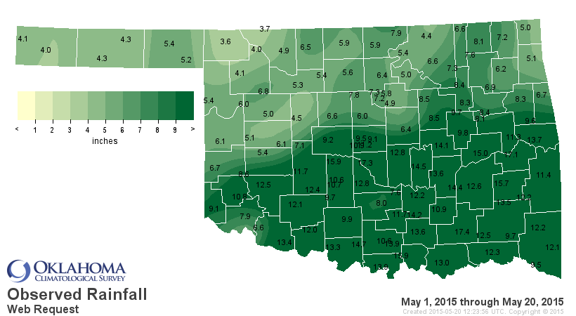
Norman has had 17.3 inches of rain in May thus far.
Did you hear what I said (and if you did, that would be really REALLY weird,
since I'm writing this, not talking).
NORMAN HAS HAD 17.3 INCHES OF RAIN IN MAY THUS FAR! The highest total I can
find for any month for either the NWS COOP or Mesonet station in Norman is 16.5
inches from the COOP station in October 1983.
That's not the highest total...the Lane Mesonet site has had 17.4 inches. I'm
not sure this is prize either wants to win. And Stigler is right behind them
with 17.1 inches. Here are all the totals above 14 inches for May so far.
Lane 17.4
Norman 17.3
Stigler 17.1
Madill 16.0
Minco 15.9
Wilburton 15.7
Eufaula 15.0
Ringling 14.7
Bowlegs 14.5
Stuart 14.4
Fittstown 14.2
Okemah 14.1
Ardmore 14.0
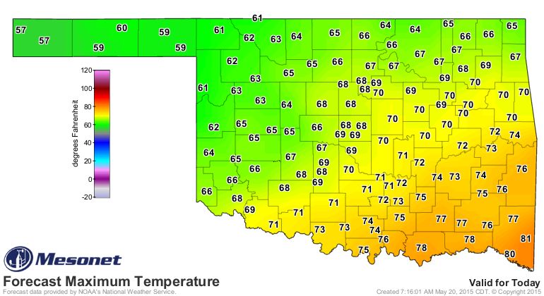
And let's not forget it has been a bit cool as well. On a day like today, this
late into May with forecast highs in the 50s to low 70s, we could easily see
some record low maximum temperatures set today.
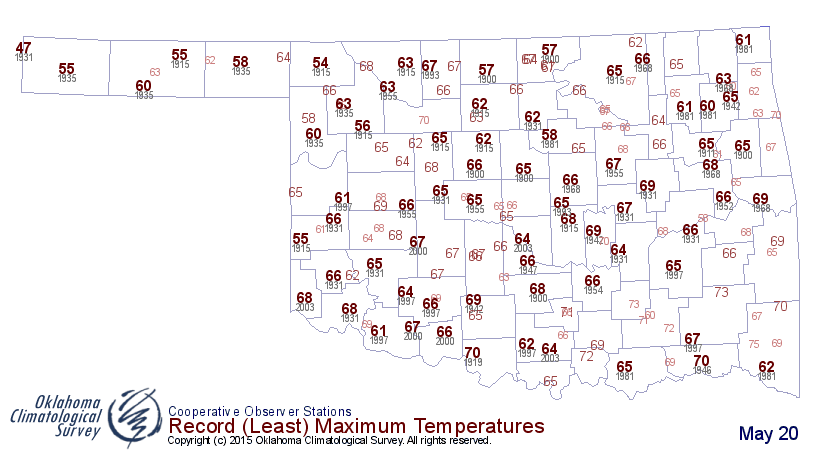
I don't know what else to say. May hasn't heard the bell, but the drought is
nearly down for the count. And Mickey ain't gonna be there to yell at it to
get back up.
Ding ding!
Gary McManus
State Climatologist
Oklahoma Mesonet
Oklahoma Climatological Survey
(405) 325-2253
gmcmanus@mesonet.org
May 20 in Mesonet History
| Record | Value | Station | Year |
|---|---|---|---|
| Maximum Temperature | 104°F | ALTU | 2006 |
| Minimum Temperature | 35°F | EVAX | 2017 |
| Maximum Rainfall | 6.44 inches | SKIA | 2019 |
Mesonet records begin in 1994.
Search by Date
If you're a bit off, don't worry, because just like horseshoes, “almost” counts on the Ticker website!