Ticker for May 1, 2015
MESONET TICKER ... MESONET TICKER ... MESONET TICKER ... MESONET TICKER ...
May 1, 2015 May 1, 2015 May 1, 2015 May 1, 2015
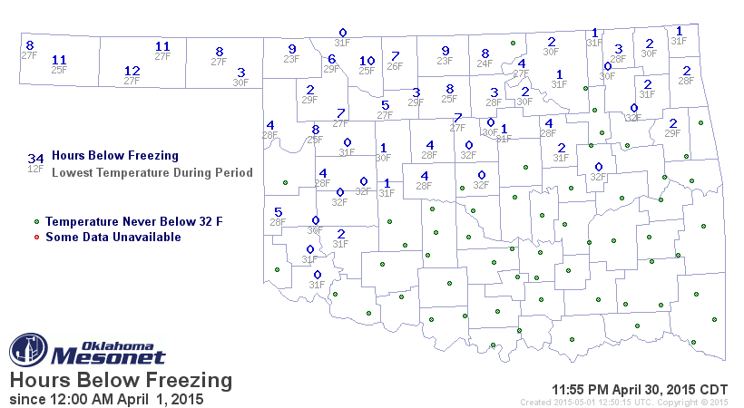
Remember when it used to freeze during April?
I gave a lot of this away yesterday, but the April monthly summary still has some
interesting stuff in it, including this map of the number of hours at or below
freezing for the month. MY KIND OF MAP!
April away!
---------------------------------------------------------------------------------
Mired in significant drought for much of the last five years, western Oklahomans
have been in desperate need of moisture. Mother Nature finally granted that
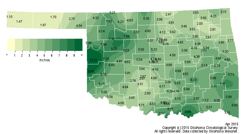
wish and provided abundant rainfall during April. Much of Oklahoma saw at least
4-6 inches of rain during the month. According to preliminary data from the
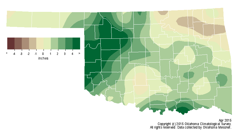
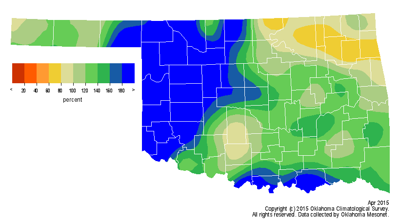
Oklahoma Mesonet, the statewide average rain total was 4.8 inches, 1.6 inches
above normal and the 17th wettest April since records began in 1895. West
central Oklahoma enjoyed its second wettest April on record with an average
total of 7.6 inches, 5.2 inches above normal. Only the northeast saw a deficit
at 0.5 inches below normal. The Oklahoma Mesonet site at Cheyenne recorded a
whopping 13.2 inches of rain for the month, their wettest April on record and
their second wettest month ever. Kenton recorded 1.1 inches for the month's
lowest total.
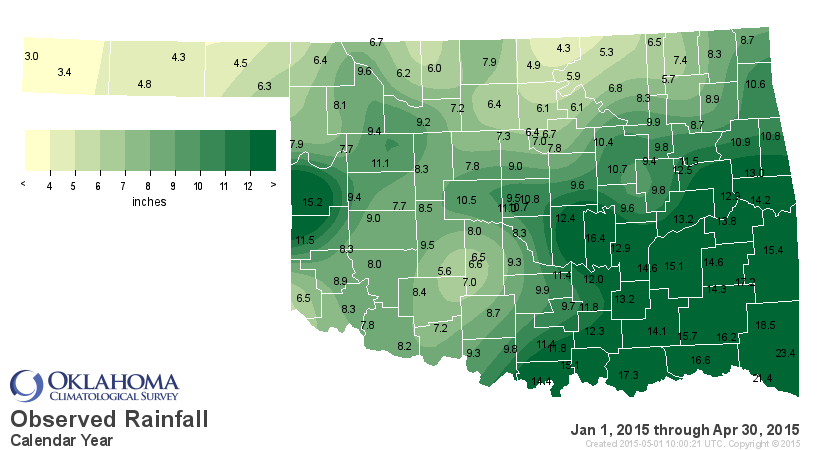
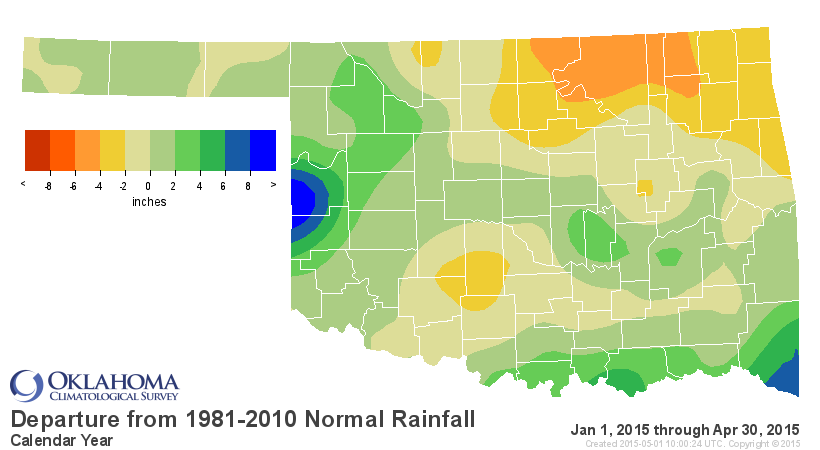
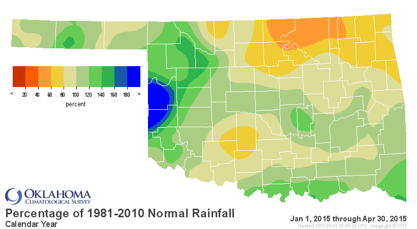
The year-to-date statewide average of 9.4 inches is now near normal with a
deficit of 0.3 inches for the January-April period. The northeast's year-to-date
deficit rose to nearly 4 inches while west central Oklahoma had a surplus of 3.3
inches.
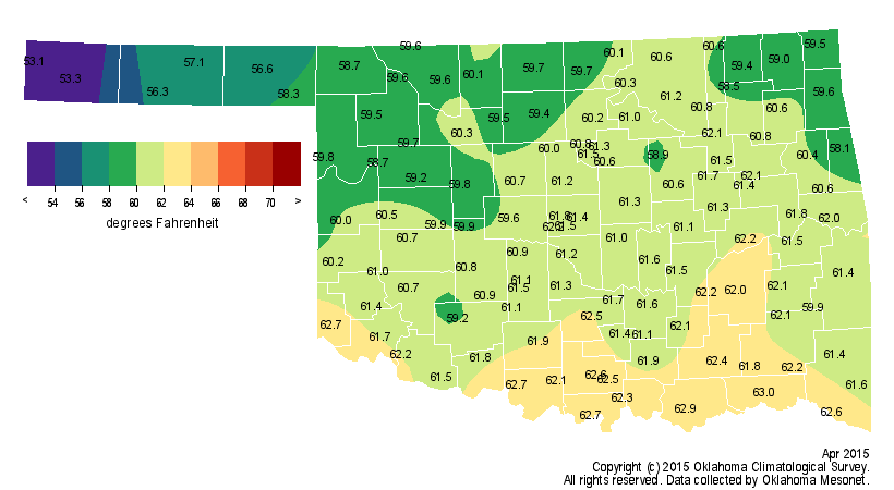
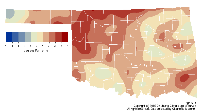
The statewide average temperature was on the warm side at 60.5 degrees, 1.2
degrees above normal to rank April as the 40th warmest on record. Hollis
recorded the highest temperature of the month with 96 degrees on the seventh.
The lowest temperature of 23 was recorded at both Buffalo and Medford on the
fourth. The January-April statewide average temperature of 46.9 degrees was 0.5
degrees below normal. Very little in the way of freezing weather occurred
during April. Most of the southeastern half of the state never dropped below 32
degrees. Guymon spent the most time below freezing at 12 hours.
At least four tornadoes touched down during April according to preliminary data
from the National Weather Service. That total could go up as more possible
twisters are investigated. Three of the confirmed tornadoes struck in far west
central Oklahoma while the other traveled 12.3 miles from near Vinita to
Bernice, injuring one person when it blew two tractor trailers over on I-40.
That tornado was rated as an EF-1. Many other instances of severe winds and
large hail were reported across the state during the stormy month.
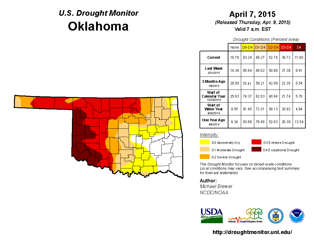
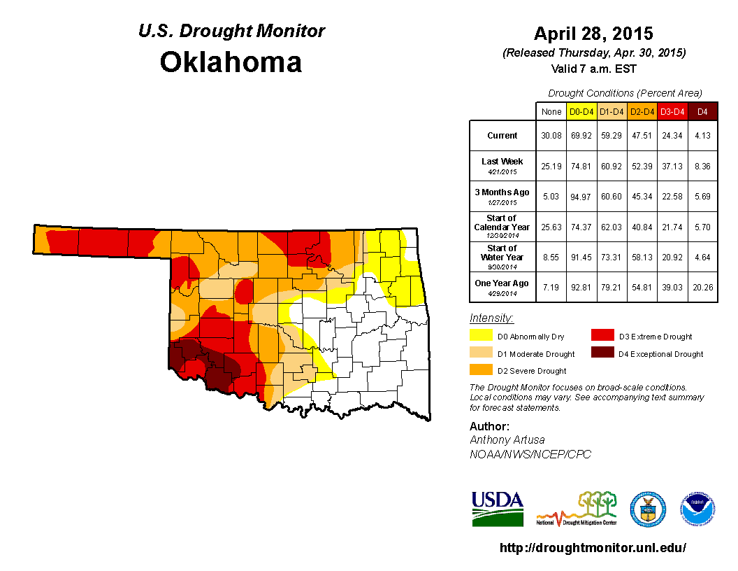
The bountiful moisture provided significant drought relief for much of the
state, and that is reflected on the U.S. Drought Monitor maps. The report from
April 7 listed 40 percent of the state in extreme-to-exceptional drought, much
of that across the western half of Oklahoma. The month's final map on the 30th
saw that amount reduced to 24 percent. The amount of the state with no drought
increased from 32 percent to 41 percent, mostly across the eastern half of the
state. The Drought Monitor?s intensity scale slides from moderate-severe-
extreme-exceptional, with exceptional being the worst classification.
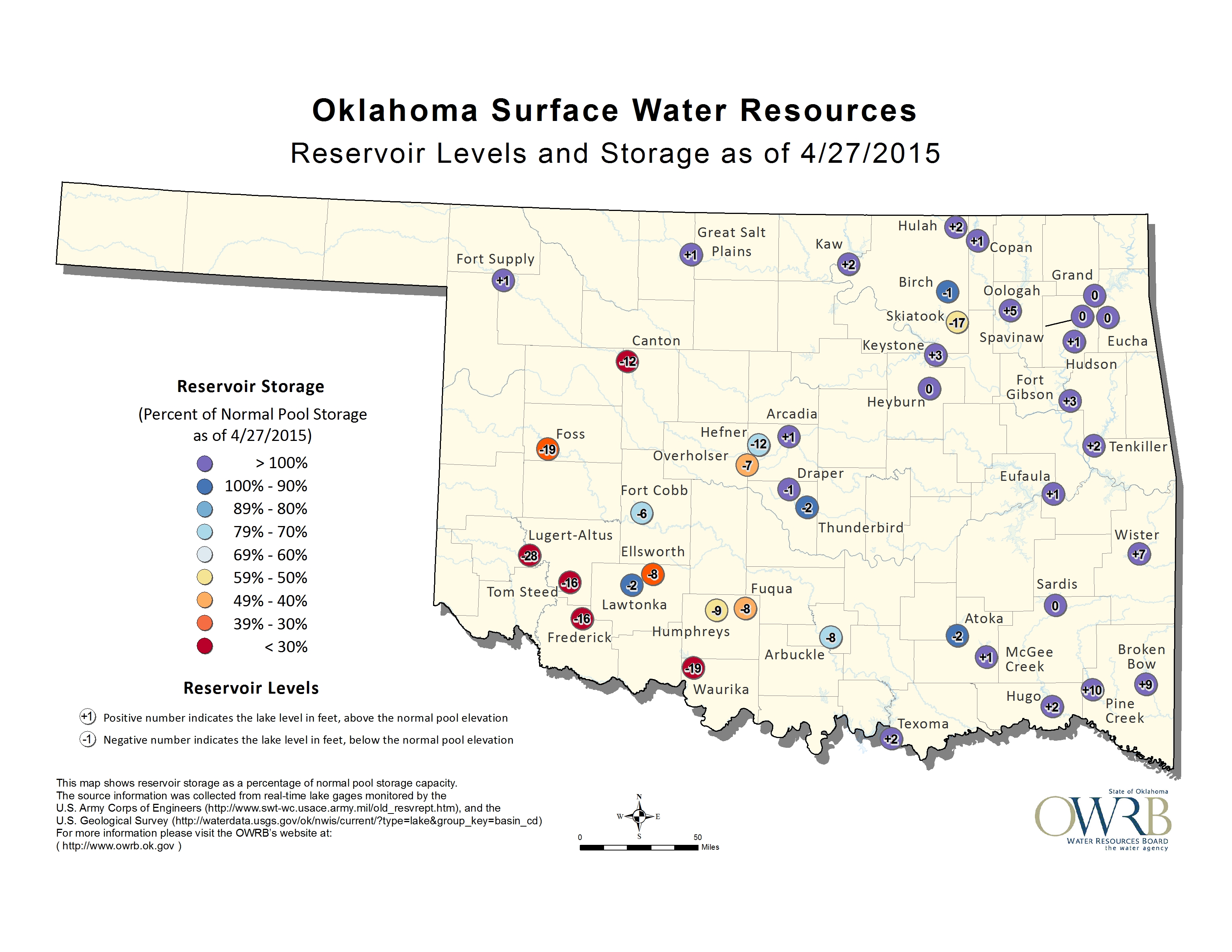
The reservoirs across western Oklahoma saw great benefits from the rains, as
did stock ponds and streams. Reservoirs that had shown alarming drops recently
rose a foot or more, including Canton, Altus-Lugert, Tom Steed and Foss.
Waurika Lake, the city of Duncan's water supply, remained 19 feet below normal
storage. Regardless of the gains, most of those lakes remain well below their
normal capacity.
(This map is a bit old)
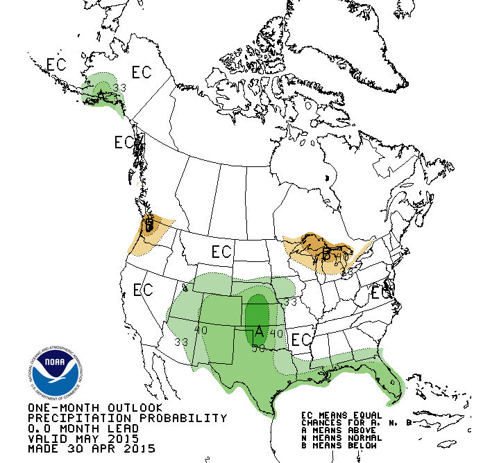
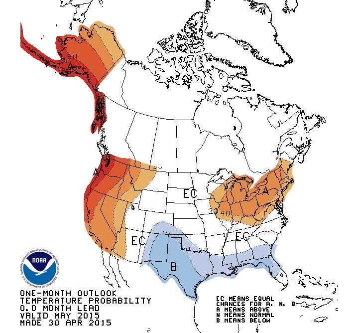
The May temperature and precipitation outlooks from the National Weather
Service's Climate Prediction Center (CPC) show great promise for further
drought relief during May. In addition to increased odds for below normal
temperatures across the southwestern one-third of the state, May's
precipitation outlook indicates increased odds for above normal precipitation,
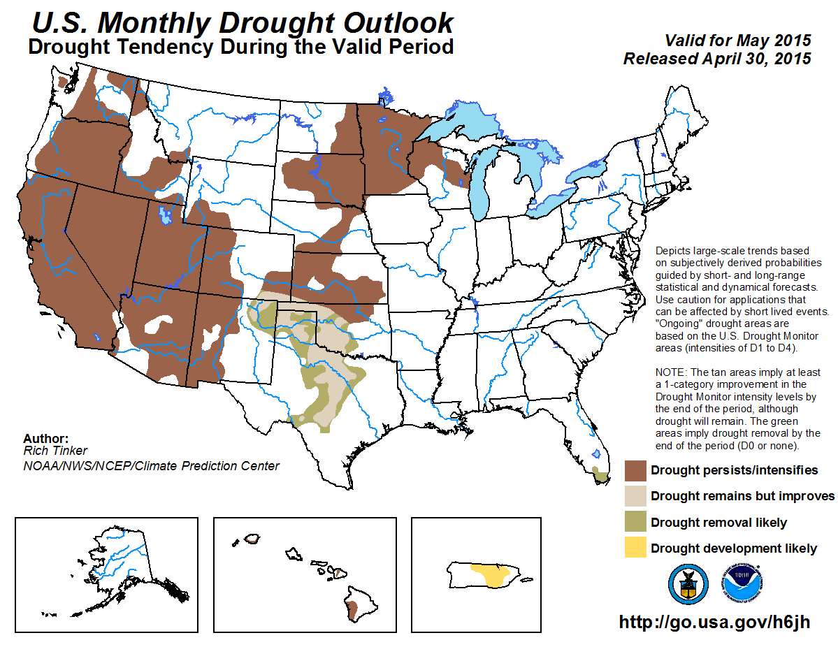
especially for the western half of the state. CPC's U.S. Monthly Drought
Outlook for May conveys those good fortunes with chances for drought
improvement and even removal across most of western Oklahoma. Drought is
expected to either persist or intensify for north central Oklahoma through the
rest of the month, however.
Gary McManus
State Climatologist
Oklahoma Mesonet
Oklahoma Climatological Survey
(405) 325-2253
gmcmanus@mesonet.org
May 1 in Mesonet History
| Record | Value | Station | Year |
|---|---|---|---|
| Maximum Temperature | 101°F | ALTU | 2002 |
| Minimum Temperature | 28°F | BOIS | 2011 |
| Maximum Rainfall | 7.70″ | PRYO | 2009 |
Mesonet records begin in 1994.
Search by Date
If you're a bit off, don't worry, because just like horseshoes, “almost” counts on the Ticker website!