Ticker for April 30, 2015
MESONET TICKER ... MESONET TICKER ... MESONET TICKER ... MESONET TICKER ...
April 30, 2015 April 30, 2015 April 30, 2015 April 30, 2015
New drought monitor map looks mighty fine!
Just look where we were three weeks ago, with 40% of the state mired in extreme-
exceptional drought, including almost all of the western half of the state.
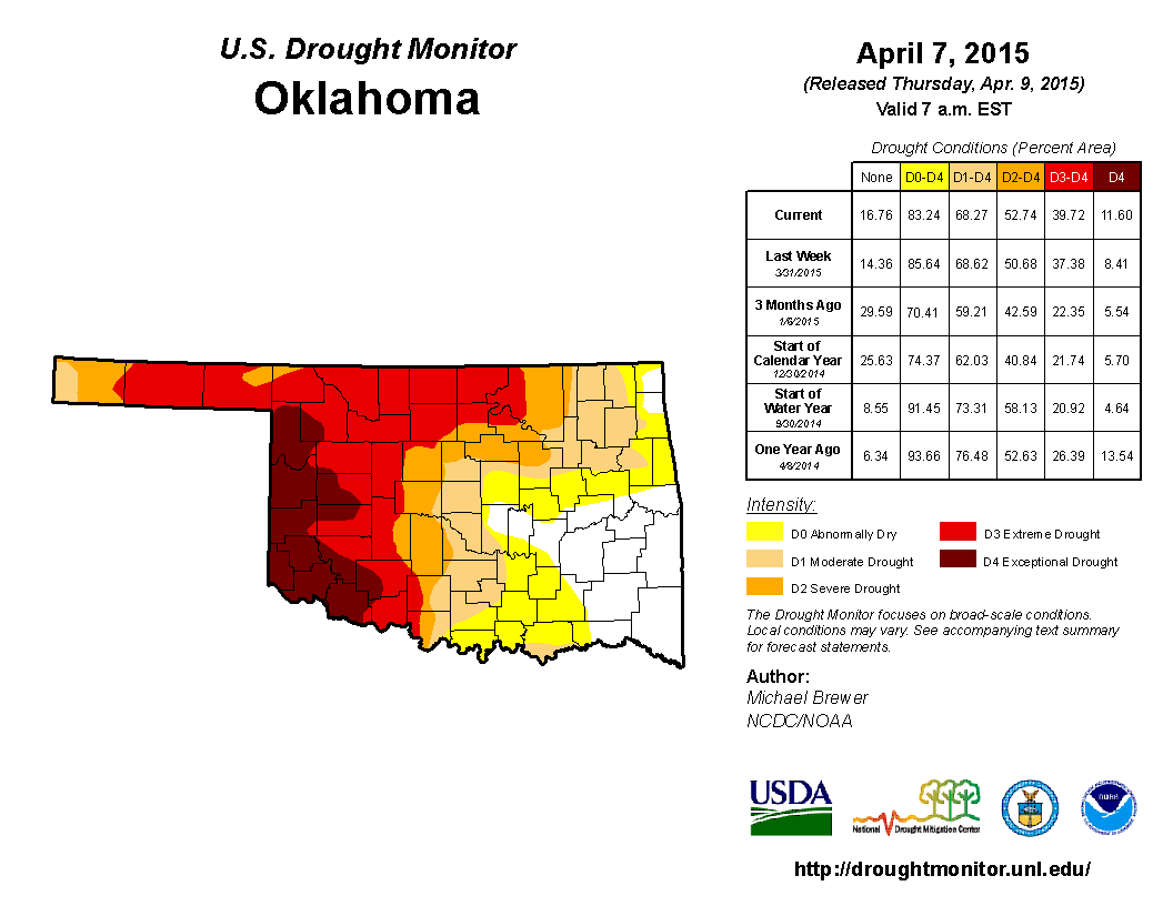
And a few toad-stranglers later, voil?!
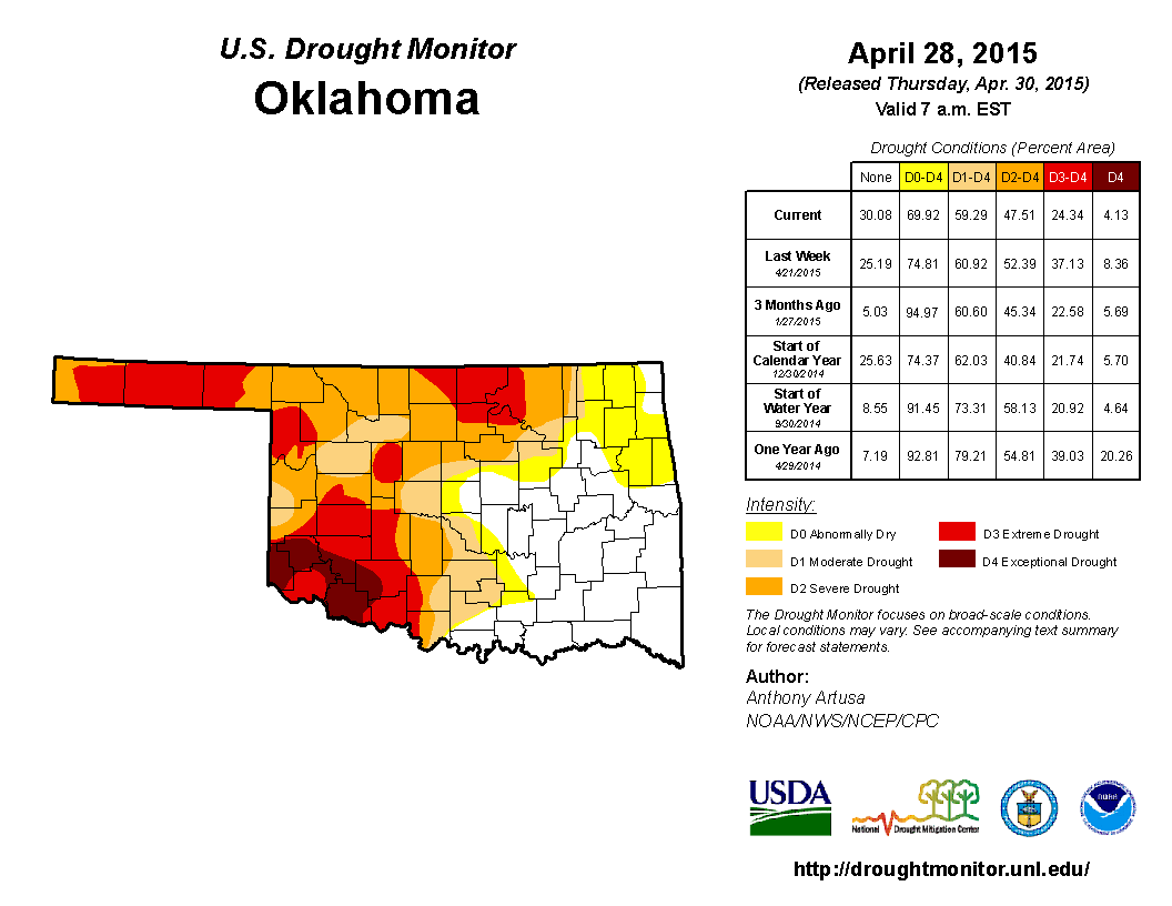
That D3-D4 coverage has dropped to only 24%, and now a large portion of WC and NW
Oklahoma is down to "only" severe and even just moderate drought. Then intensifying
drought we were so worried about across that area is now going backwards, and the
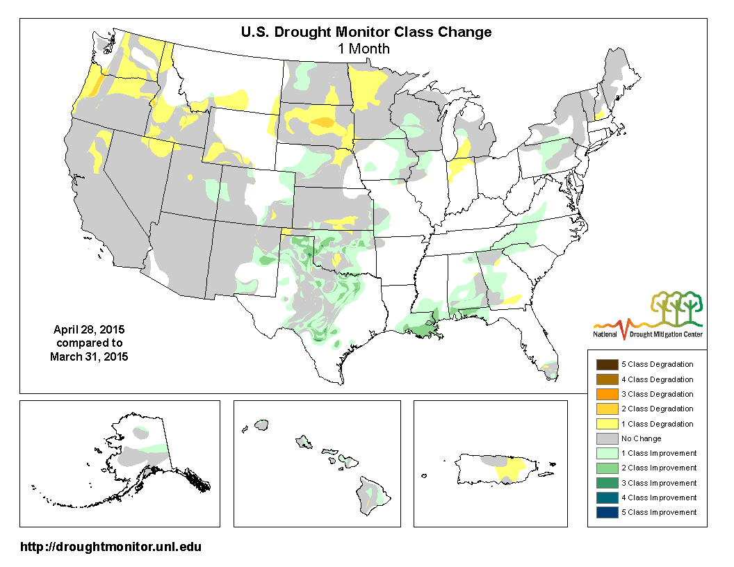
same goes for NE Oklahoma. Just look at the 4-week change map (i.e., how much did
the Drought Monitor change in 4 weeks).
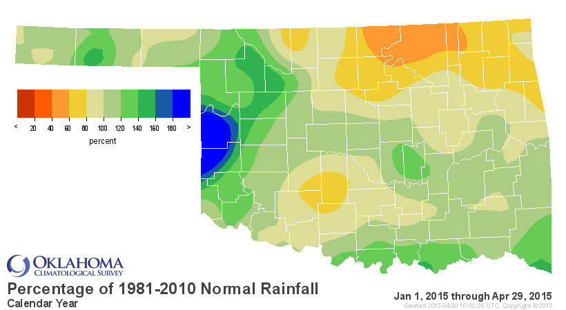
And this is the rainfall that did it. One big happy April.
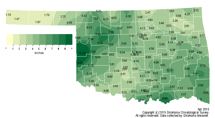
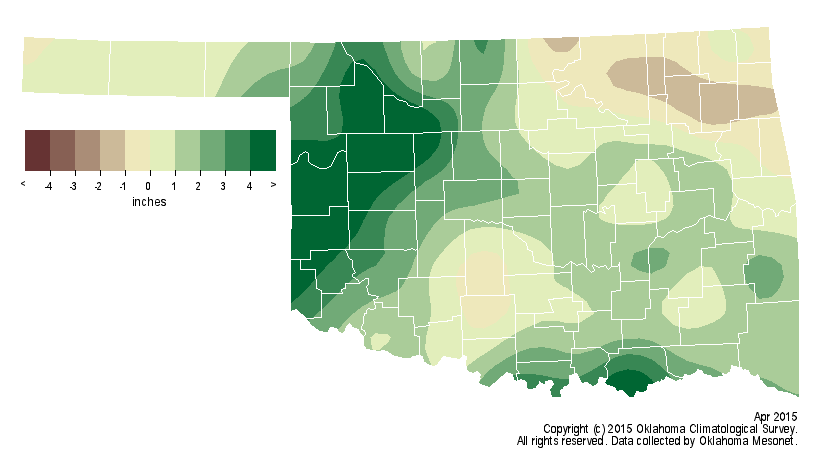
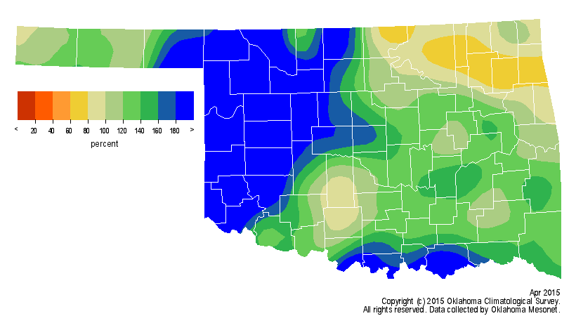
According to preliminary data from the Oklahoma Mesonet, the statewide average
rain total was 4.8 inches, 1.6 inches and the 17th wettest April since records
began in 1895. West central Oklahoma enjoyed its second wettest April on record
with an average total of 7.6 inches, 5.2 inches above normal. Only the northeast
saw a deficit at 0.5 inches below normal. Kenton recorded 1.1 inches for the
month's lowest total. The year-to-date statewide average of 9.4 inches is now
near normal with a deficit of 0.3 inches for the January-April period. The
northeast remained with a year-to-date deficit of nearly 4 inches while west
central Oklahoma had a surplus of 3.3 inches.
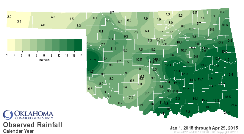
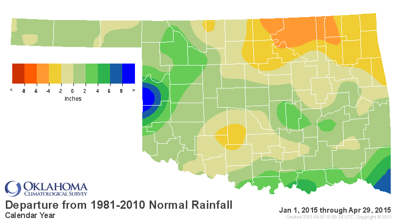
The benefits are enormous, both in greening up the crops and vegetation out
that way, but also filling up farm ponds and reservoirs. Of the five lakes that
we've been REALLY worried about that way, four of them are have had
significant gains and three of them are still rising. Unfortunately, Waurika
did not come up much at all, leaving the town of Duncan's water supply woefully
low. Canton appears to have stopped filling for the moment, but perhaps there
is more water coming down the Canadian. Tom Steed is the drinking supply for
the city of Altus. Lake Altus-Lugert is an irrigation lake.
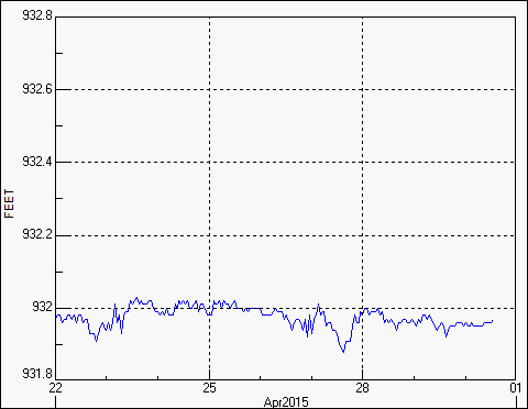

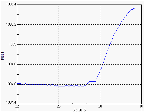

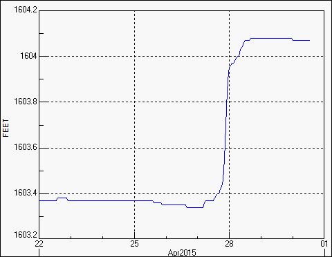
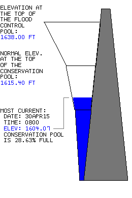
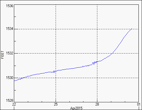
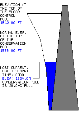
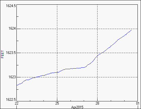
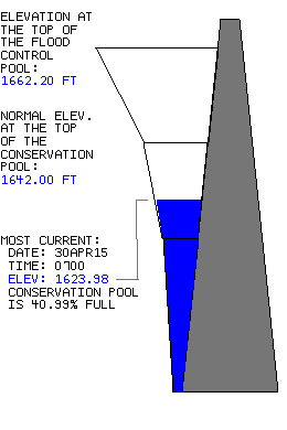
Skiatook Lake up in Osage County remains at near record low levels as well.
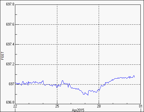
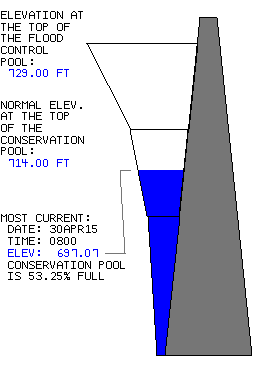
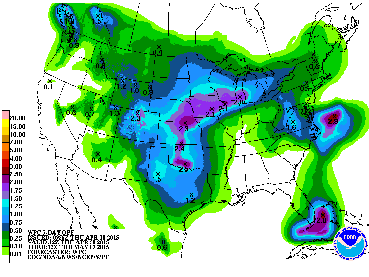
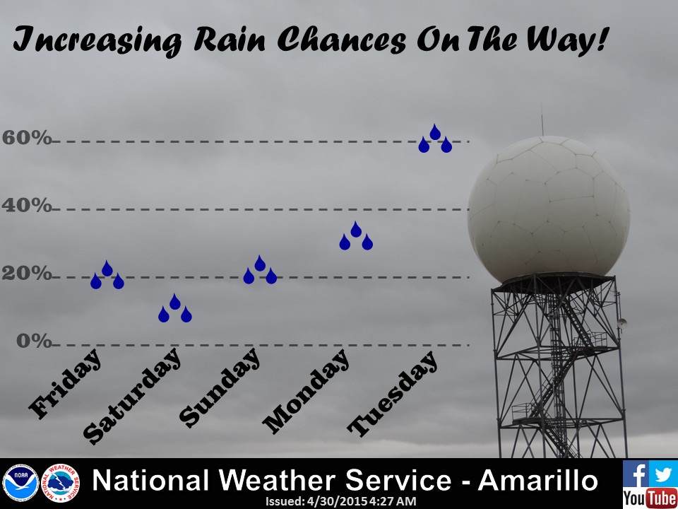
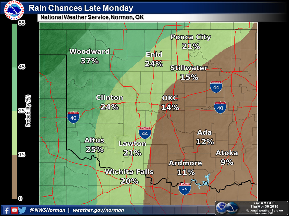
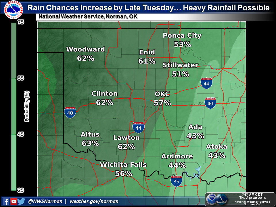
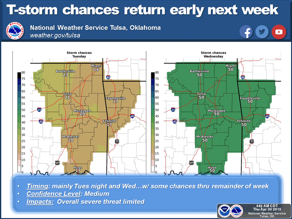
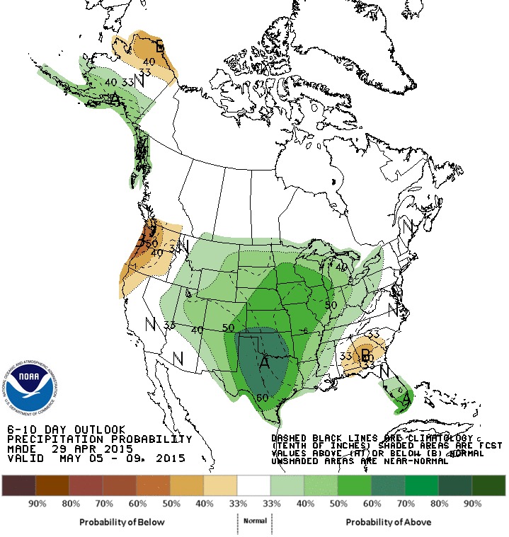
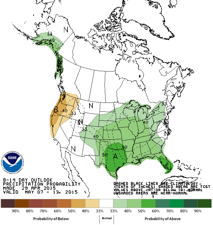
If you've missed out on the big rains, take heart...we're just now hitting the
sweet spot of the spring rainy season, and it appears more rain is on the
way. There is another storm system approaching for late in the weekend through
much of next week, and if you believe the CPC medium-range outlooks, wetter
than normal weather should be in store for us after that as well.
Drought's on the run, just in time to give us a break this summer. Or maybe we
can extend this streak into the second half of June and also July like last
year? Hey, all bets are off the table. Mother Nature has the dice.
Gary McManus
State Climatologist
Oklahoma Mesonet
Oklahoma Climatological Survey
(405) 325-2253
gmcmanus@mesonet.org
April 30 in Mesonet History
| Record | Value | Station | Year |
|---|---|---|---|
| Maximum Temperature | 96°F | BEAV | 2013 |
| Minimum Temperature | 26°F | EVAX | 2017 |
| Maximum Rainfall | 6.12″ | NOWA | 2019 |
Mesonet records begin in 1994.
Search by Date
If you're a bit off, don't worry, because just like horseshoes, “almost” counts on the Ticker website!