Ticker for March 6, 2015
MESONET TICKER ... MESONET TICKER ... MESONET TICKER ... MESONET TICKER ...
March 6, 2015 March 6, 2015 March 6, 2015 March 6, 2015
Want more snow? Let it gooooooooooo!!!

Let's be honest...the last half of February and first few days of March were
nasty. Cold, snowy/icy/rainy and downright gray for long periods of time. That
makes a nice sunny day with highs in the 50s a joy. Take yesterday. No, please,
take yesterday. Highs only rose into the low 40s, but the sun was out and all the
snow melted (or most of it).
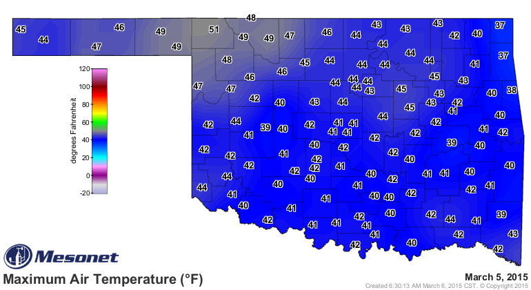
Now that same type of sunshine will be able to just heat things up with no snow
to melt.
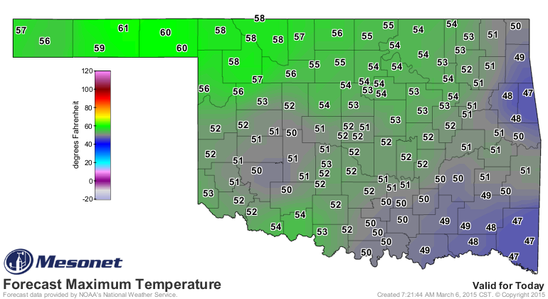
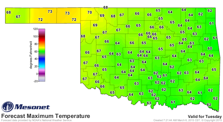
Wow, ALMOST seasonable temperatures. So we're getting closer to spring, since
climatologically speaking (astronomers be darned!), we're already there. Soon,
we should be above our seasonable norms (highs somewhere around 60 and going up
each day through early August). Check out Tuesday's forecast highs.
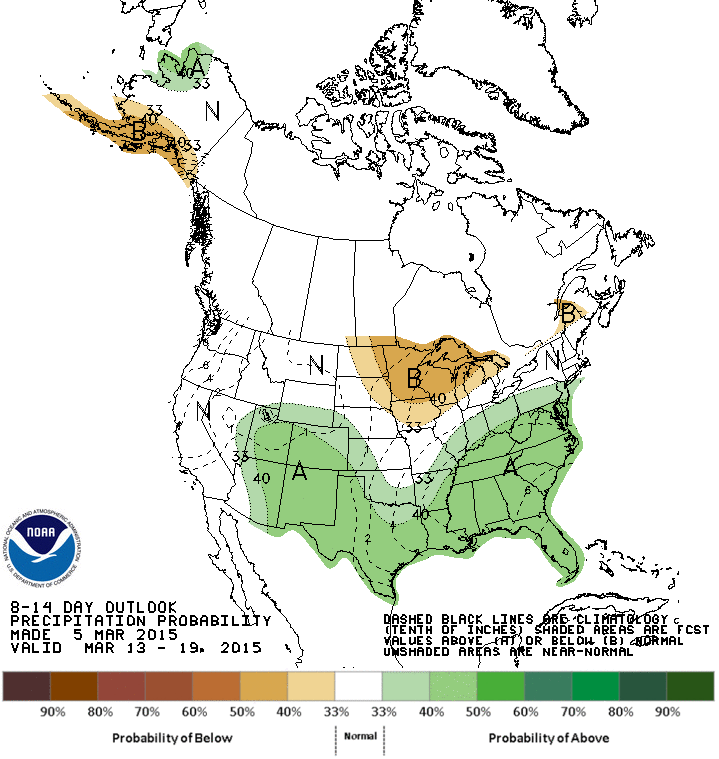
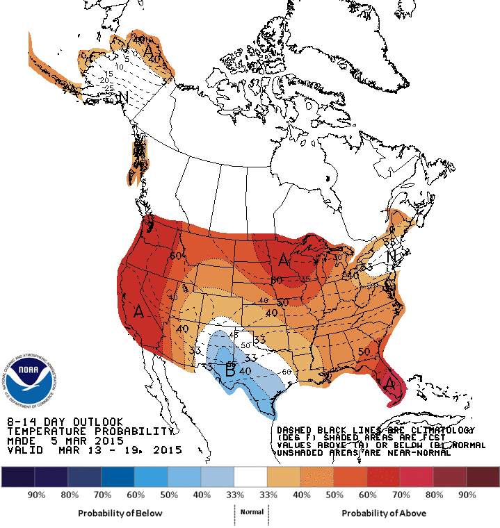
Going out even farther, all those increased odds of above normal temperatures
from Oklahoma north signal a lack of any type of arctic air spilling down this
way anytime soon. The reason for the possible cooler weather approach from the
south goes along with the increased odds of above normal precip. As we get into
the warm season, precip means cooler weather, whereas during the cool season it
can mean warmer weather, oddly enough. A really simple explanation is precip and
moisture can trap heat during the winter whereas that same type of setup can
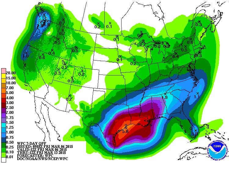
There will be a bit of a chance of moisture this weekend, but not much to bark
about, especially across the NW half of the state (SHOCKER!!). The 7-day
moisture forecast reflects that and the beginnings of another rain system by
the middle of next week, possibly.
As a shock to no one, we're gonna need a lot more rain than that, given
yesterday's bleak Drought Monitor report.
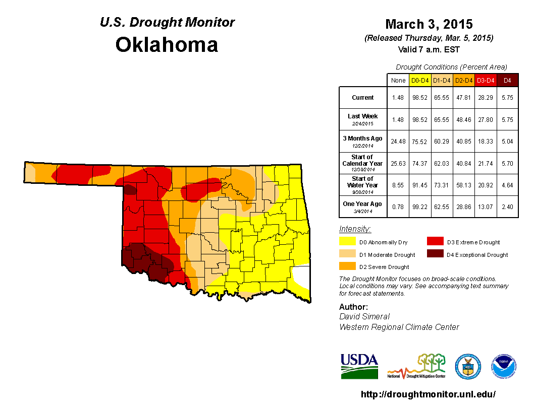
We still have 66% of the state in drought, with 48% in at least severe (D2 or
above) drought.
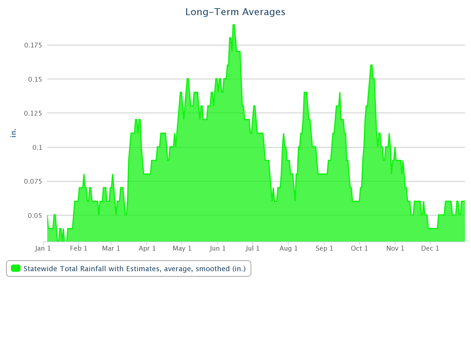
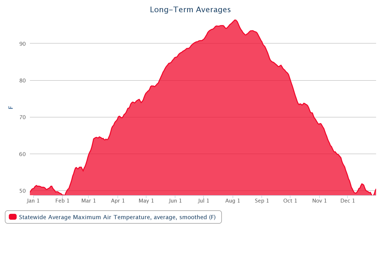
Are cold/frigid/arctic air intrusions are probably not over. March and even
early April often throws us a snowball or two. But climatologically speaking,
we're on the upswing in both temperature and moisture, as shown here by the
long-term Mesonet averages (2000-2014) for daily statewide average high
temperature and rainfall graphs.
So spring has sprung, at least climatologically and on the weather maps, for
a little while. But we had warmer periods back in January and February too, so
go figger.
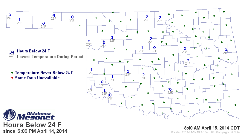
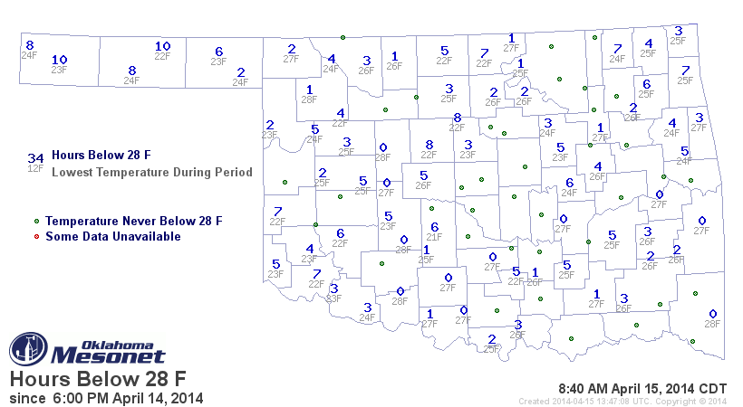
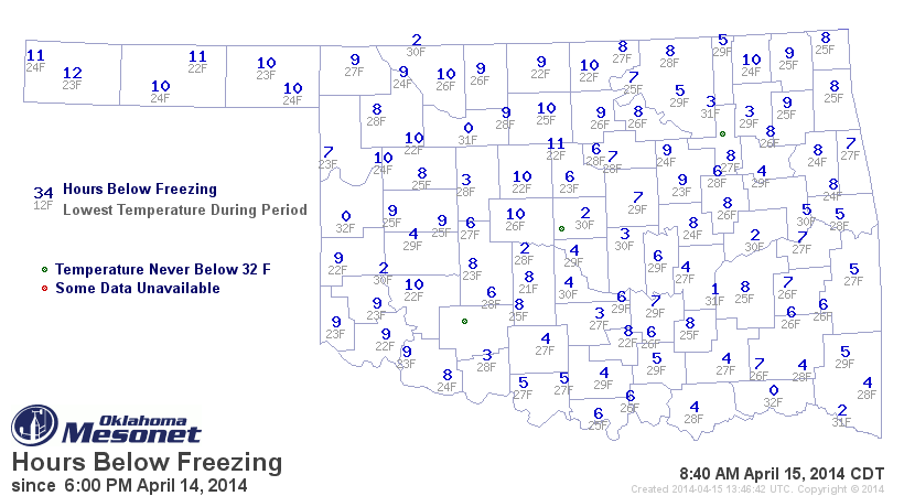
For a bit of a reality check, here are the freeze duration maps from the Ticker
April 15th of last year.
Let it snowwwwwwwwww...NO! Let it goooooooooooooo!
Gary McManus
State Climatologist
Oklahoma Mesonet
Oklahoma Climatological Survey
(405) 325-2253
gmcmanus@mesonet.org
March 6 in Mesonet History
| Record | Value | Station | Year |
|---|---|---|---|
| Maximum Temperature | 87°F | ALV2 | 2017 |
| Minimum Temperature | 9°F | KENT | 2018 |
| Maximum Rainfall | 2.10 inches | COOK | 1995 |
Mesonet records begin in 1994.
Search by Date
If you're a bit off, don't worry, because just like horseshoes, “almost” counts on the Ticker website!