Ticker for February 12, 2015
MESONET TICKER ... MESONET TICKER ... MESONET TICKER ... MESONET TICKER ...
February 12, 2015 February 12, 2015 February 12, 2015 February 12, 2015
Drought intensifies with snow end in sight
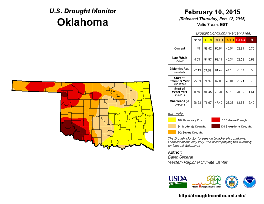
That's an ugly picture, ain't it? About 99% of the state is considered to be
at least Abnormally Dry (D0), and 65% of the state is in at least Moderate Drought
or above (D1-D4). Advances were made once again across south central into central
Oklahoma, with all of Cleveland and Oklahoma counties joining the fun in moderate
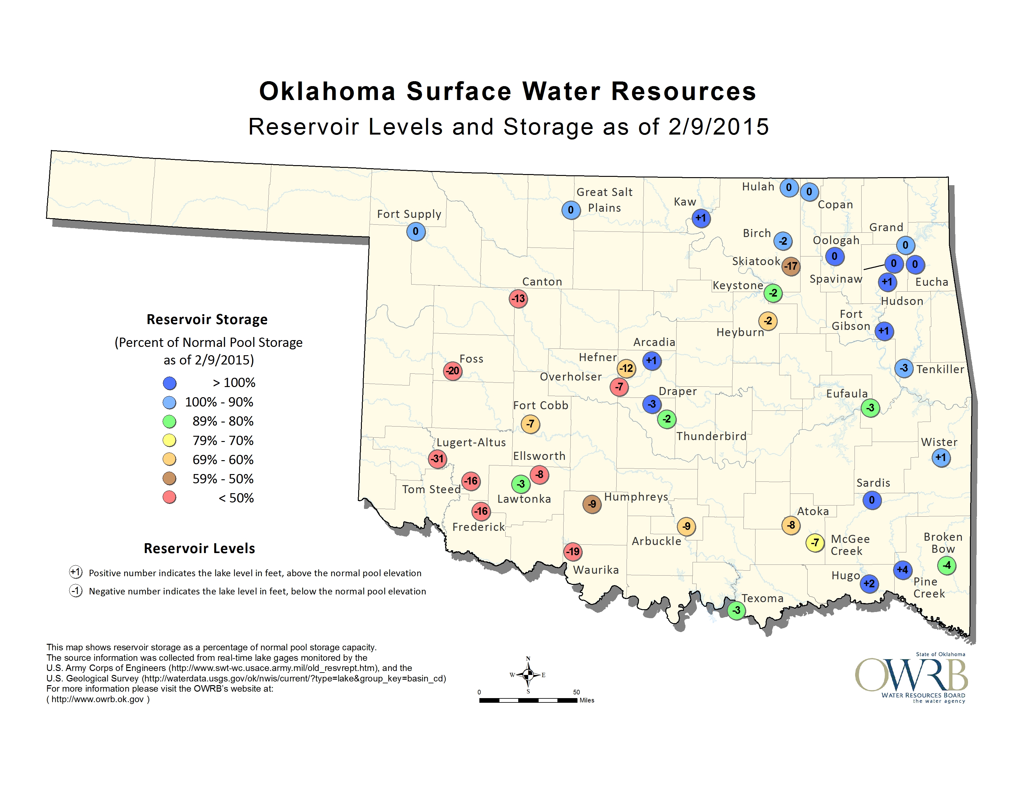
drought. Reservoir levels and deep soil moisture amounts were the key triggers
for that move to the east. The reservoir storage map from OWRB has way too many
oddly colored circles, and now Lake Hefner and Overholser are down 12 and 7 feet,
respectively. Look farther to the south and west for the real horror show, however.
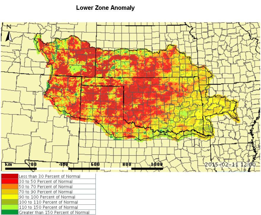
The modeled soil moisture from the Arkansas-Red Basin River Forecast Center in
Tulsa shows from less than 50 percent to even less than 30 percent of normal
across much of the western half of Oklahoma, extending up the I44 corridor into
NE OK. For the lower zone, we're talking the "next few feet" after the first
few inches of soil. This is a continuing long-term impact, just as the reservoir
levels are.
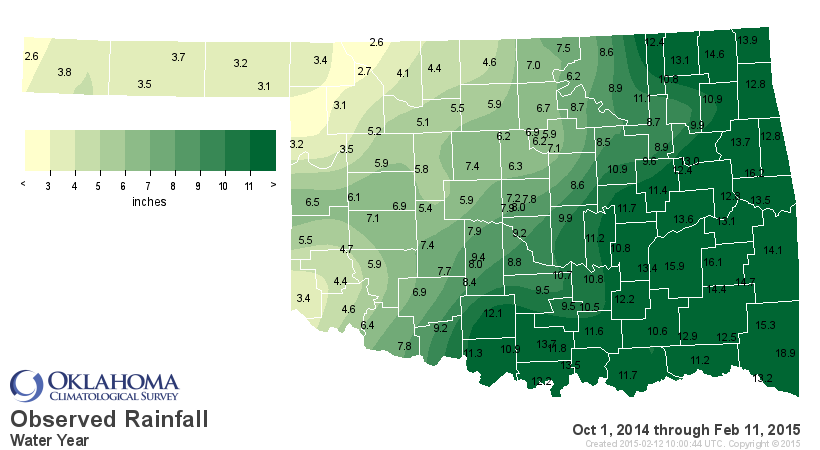
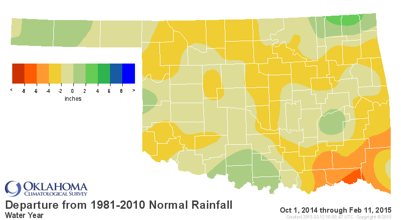
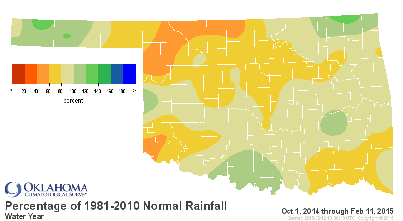
But let's not forget just plain old precipitation deficits. Looking at the water
year (the water year begins Oct. 1 and ends the next calendar year on Sept. 30)
maps we can see some good rain on the fringes in the Panhandle, SC and NE OK,
and lots of dry in the middle (especially NW OK).
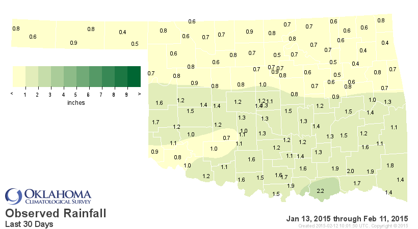
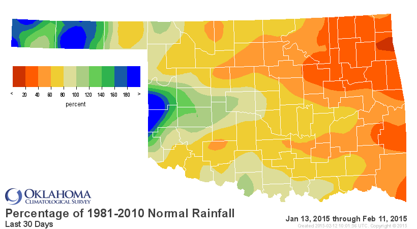
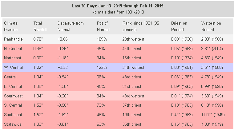
But just the last 30 days, which encompasses a very warm/dry/windy last half of
January and similar conditions in February, have been exceedingly dry, even for
the driest time of the year. This is how the drought has continued to intensify.
Don't be fooled by the above normal areas. Well received, of course, but we're
still just talking about an inch or more for those folks. We'll take it though!
But when you're talking the 35th driest such period for a January into February,
you are talking DRY!
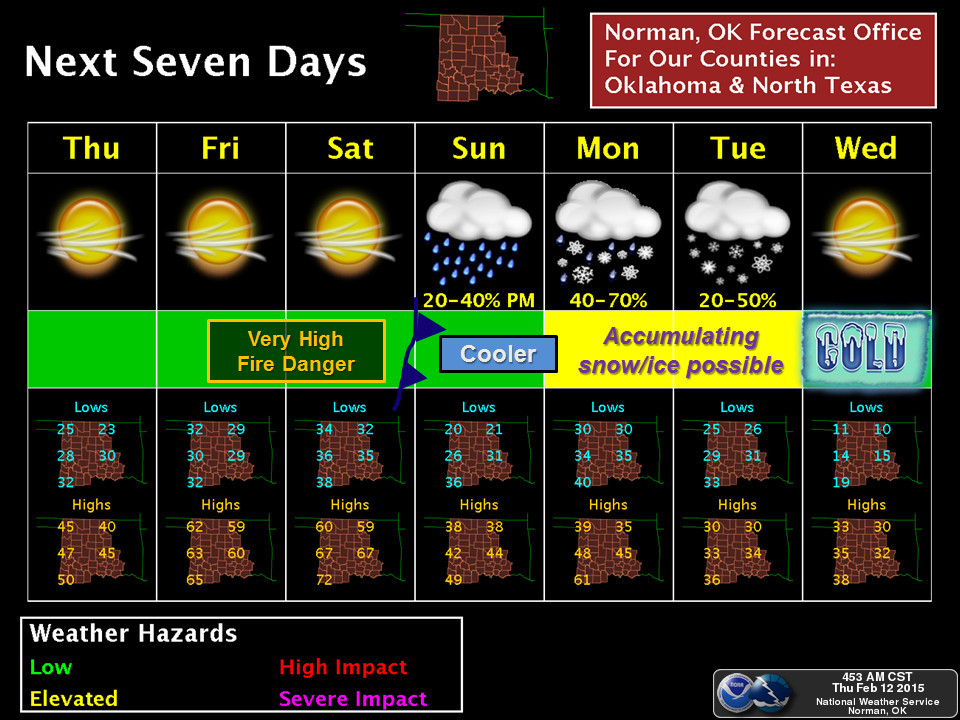
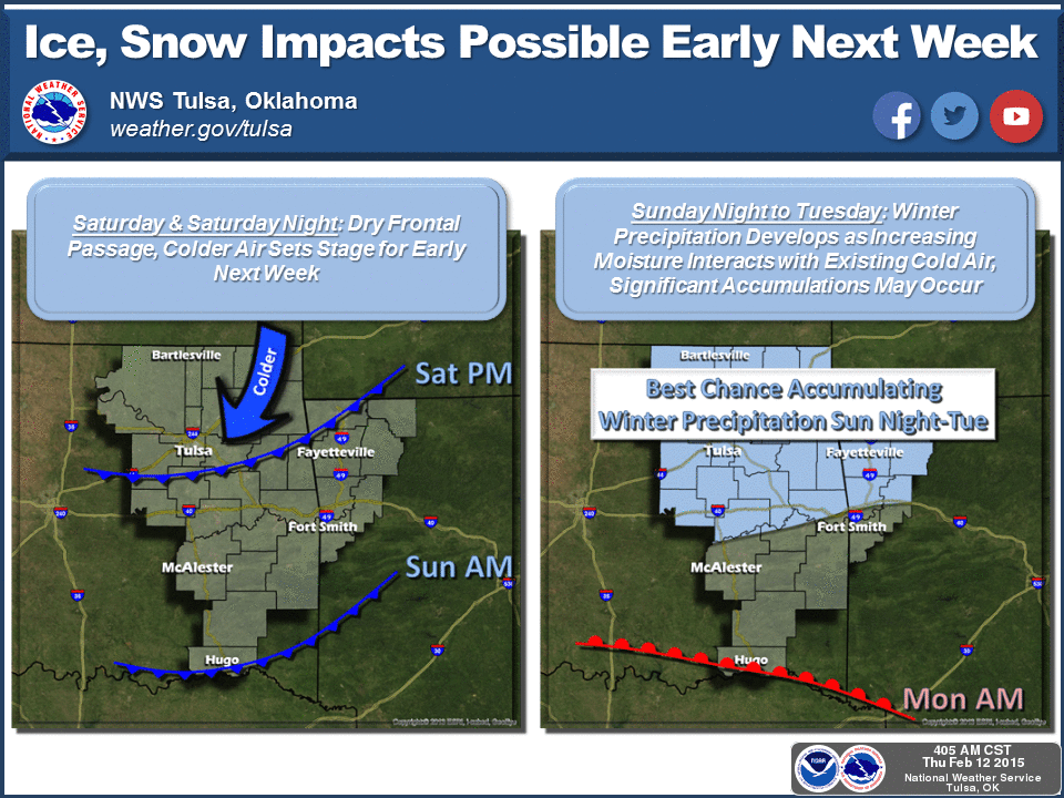
Well let's take a look ahead to our Boston-esque forecast for snow and ice (and
more importantly, moisture). Okay, we're not looking at 6 feet like Boston, but
hey, maybe 6 inches or more in some areas? How would I know, I'm a Doctor, not a
forecaster! I mean I'm a climatologist, not a forecaster. But, here are the
pics from our local NWS offices, already talking about the arctic blast for late
Saturday and again Monday and the frozen moisture that will possibly follow.
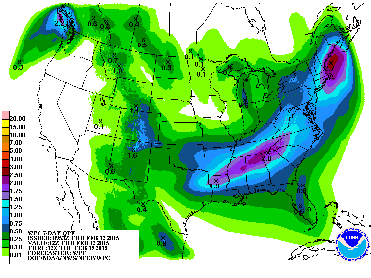
As per usual, the key will be what the computer models all start to agree upon
as we get closer, then what how the forecasters interpret those results. The
liquid equivalent amounts are not that great as we get to the west, but they
are more substantial across eastern Oklahoma. That amount of water can mean
trouble if it comes in the frozen version.
Lots of uncertainties about the weather coming up, so stay tuned. No
uncertainty about the drought, however. It's here to stay for awhile longer.
Gary McManus
State Climatologist
Oklahoma Mesonet
Oklahoma Climatological Survey
(405) 325-2253
gmcmanus@mesonet.org
February 12 in Mesonet History
| Record | Value | Station | Year |
|---|---|---|---|
| Maximum Temperature | 76°F | CAMA | 2023 |
| Minimum Temperature | -3°F | EVAX | 2025 |
| Maximum Rainfall | 1.81″ | BROK | 2020 |
Mesonet records begin in 1994.
Search by Date
If you're a bit off, don't worry, because just like horseshoes, “almost” counts on the Ticker website!