Ticker for December 16, 2014
MESONET TICKER ... MESONET TICKER ... MESONET TICKER ... MESONET TICKER ...
December 16, 2014 December 16, 2014 December 16, 2014 December 16, 2014
The Ticker's Christmas Day forecast
Straight from the offices of the Ticker Staff, we have poured over maps, data and
some other stuff and produced our official TICKER CHRISTMAS DAY FORECAST! And
that forecast is...
MOSTLY SANTA WITH A CHANCE OF PRESENTS!!
Now you didn't really think we were going to be brave enough to try and forecast
the weather for that day, did ya? Now, I said I wasn't going to give you a real
forecast, because any attempt at that is really pushing the envelope at 10 days
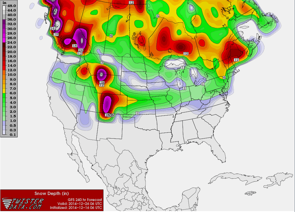
out. But, I did look at the snow depth forecast from the GFS model for the end
of Christmas Day, and that model does have a band of snow existing across
northwestern Oklahoma (graphics provided by our friends at twisterdata.com).
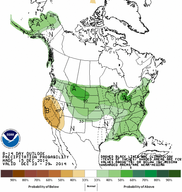
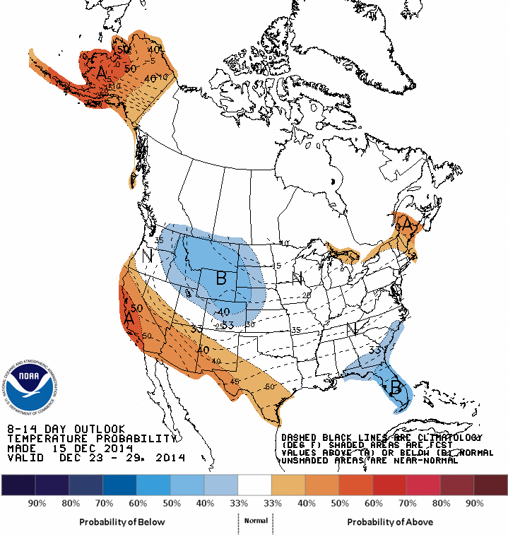
In looking at the CPC medium-range outlooks, I see they produce increased odds
of near-normal temps (with a hint of a bit of cold air to our north) across
the state, with increased odds of above normal precip across the NW. But remember
that's meant to be averaged over that whole Dec. 23-29 period. But it's definitely
not painted orange and red across the entire U.S. like it has been the past
couple of weeks.
So at least there's hope for some, in the form of a long-range forecast model,
for a sputtering of snow 10 days from now. The usual cautions apply, however.
That forecast model output will undoubtedly change, as will the forecast,
between now and Christmas. In other words, we're dealing with a fantasy-cast
for now.
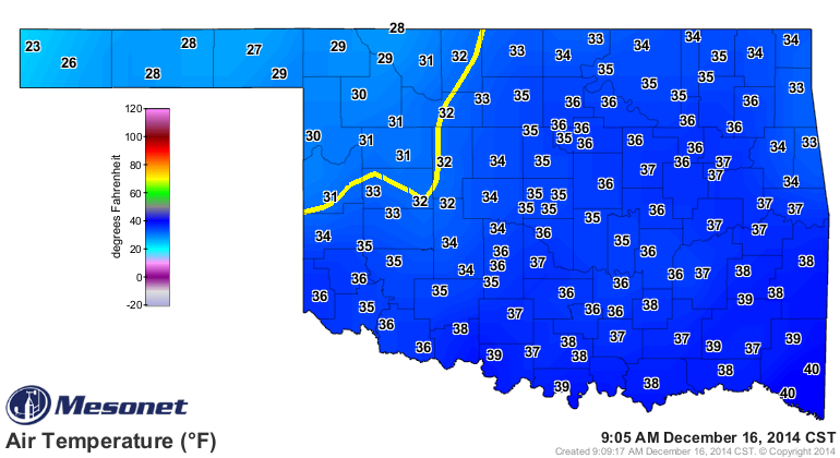
It's plenty cold this morning, however, with temperatures in the 30s, mostly.
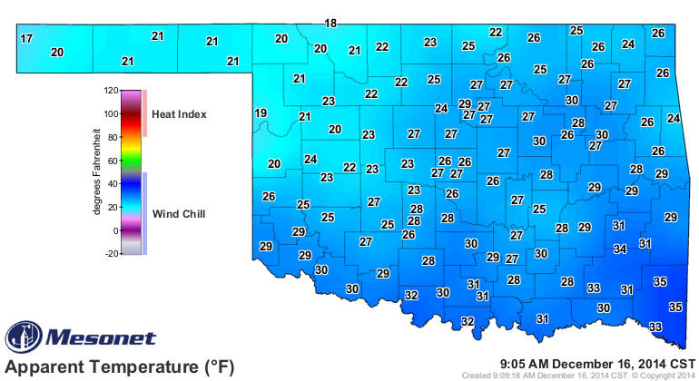
Add the winds to that and you have wind chills down into the lower 20s and 30s,
with a few teens thrown in there.
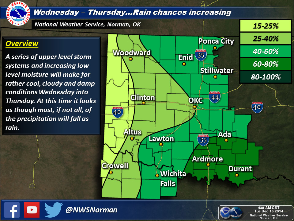
And we also have some rain to look forward to over the next few days, starting
tomorrow.
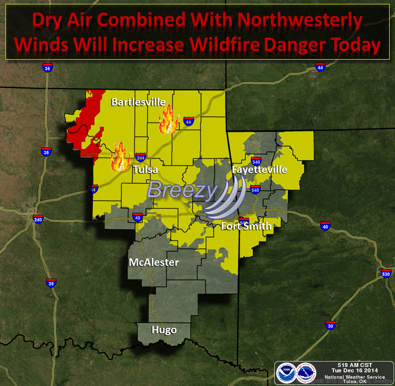
Before that, with today's winds and low relative humidity, fire danger will
be kicked up a notch.
So lots of weather (and weather changes) to go before Christmas. Still no major
arctic air showing up, at least on anything that would be accurate this far
out. Perhaps that's being saved for the New Year.
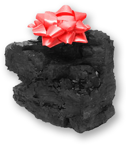
Finally, for those unfortunate souls that have lost their belief in Santa, we
have a separate forecast for you.
Partly wrong, with a chance of coal!
Gary McManus
State Climatologist
Oklahoma Mesonet
Oklahoma Climatological Survey
(405) 325-2253
gmcmanus@mesonet.org
December 16 in Mesonet History
| Record | Value | Station | Year |
|---|---|---|---|
| Maximum Temperature | 81°F | HOLL | 2016 |
| Minimum Temperature | 2°F | BEAV | 2020 |
| Maximum Rainfall | 6.23 inches | MTHE | 2001 |
Mesonet records begin in 1994.
Search by Date
If you're a bit off, don't worry, because just like horseshoes, “almost” counts on the Ticker website!