Ticker for December 15, 2014
MESONET TICKER ... MESONET TICKER ... MESONET TICKER ... MESONET TICKER ...
December 15, 2014  December 15, 2014  December 15, 2014  December 15, 2014


Mother Nature gets testy!

Well, all my hopes for a heat wave sort of fell through. I don't know about you
and where you're at, but at my home base, it was mostly cool and cloudy except
for a bit of a warm-up Saturday afternoon and for a bit on Sunday. But, the low
temperatures were well WELL above normal at times, so I guess that's better than
20s and 30s for lows (and definitely for highs). So two weeks of anticipation of
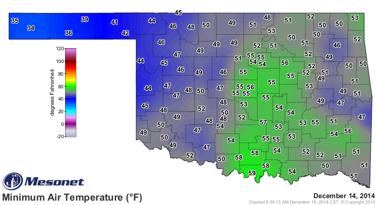
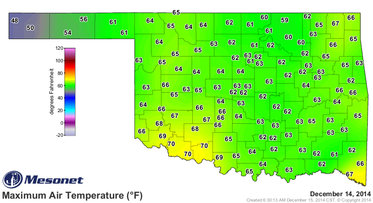
highs in the 70s and I get 50s for lows and 60s for highs. Oh well, I'll take
October'ish weather over December anytime. Yesterday's highs and lows thrown in
here for reference (and proof that some folks DID see 70).


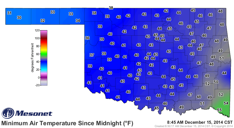
And it wasn't exactly the arctic out there this morning either.


Now we enter another week of just sort of seasonably cool mornings and afternoons,
but no big arctic outbreaks for another week, probably. Although I understand
from those forecasting types around here that there is a lot of uncertainty about
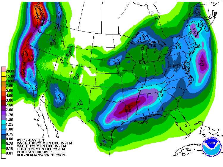
a storm system this coming weekend, it looks like mostly rain regardless.
And there will be another chance of rain mid-week as well.


Now for the testiness of Mother Nature bit...as you probably realized if you
tried to watch TV yesterday, she went and caused a bit of trouble. At LEAST
a couple of tornadoes touched down, apparently, albeit weak ones. I'd say
for now that there were two, but there could have been more. I'm always a bit
queasy about tornado stats right after the event since the numbers tend to go
up as soon as you give a count.

But let's say two and only two touched down. According to preliminary data from
the NWS, that would bring our total in Oklahoma for the year to 17. That matches
the previous minimum annual twister count of 17 set back in 1988. The strongest
2014 tornado listed was an EF-2 that struck the small town of Quapaw in Ottawa
County, killing one and heavily damaging as many as 50 structures. That stands
in stark contrast to recent years that ranked near the top for annual tornado
totals. The record of 145 is still held by 1999, but 2011 and 2010 rank with
the second- and fourth-highest totals at 119 and 103, respectively. And 2013
tied for ninth highest at 82. The annual average tornado total for Oklahoma is
approximately 56. On the bright side, if the NWS only confirms one tornado
yesterday, we'll have the lowest total on record.

Now that I wrote all of that (gasp gasp!!), I just guaranteed that they'll find
another tornado or two in yesterday's mess. Or another outbreak for Christmas
or something. But, those would be only the 25th and 26th tornadoes spotted in
Oklahoma since accurate records began in 1950. Sortofa big deal, I reckon.

Tornadoes were not the only excitement...we also saw some big hail with the
storms yesterday. The biggest I can see from preliminary reports is about
2 inches, actually two reports near Chickasha and downtown Oklahoma City.

More tranquil weather ahead, that's for sure. Be sure to tune in tomorrow when
I give my Christmas forecast! I guarantee you it will be a prognostication
exposition of mammoth proportions, of little accuracy and even less precision.

And here's a shout-out to KWTV Meteorologist Jed Castles who stopped by the
office in mid-Ticker production. It took awhile to get all the monkeys back to
typing on the typewriters to produce this thing, but hey, they work for
peanuts.

Gary McManus
State Climatologist
Oklahoma Mesonet
Oklahoma Climatological Survey
(405) 325-2253
gmcmanus@mesonet.org
December 15 in Mesonet History
| Record | Value | Station | Year |
|---|---|---|---|
| Maximum Temperature | 83°F | SEIL | 2021 |
| Minimum Temperature | 2°F | KENT | 2008 |
| Maximum Rainfall | 1.99″ | BBOW | 2001 |
Mesonet records begin in 1994.
Search by Date
If you're a bit off, don't worry, because just like horseshoes, “almost” counts on the Ticker website!