Ticker for December 3, 2014
MESONET TICKER ... MESONET TICKER ... MESONET TICKER ... MESONET TICKER ...
December 3, 2014 December 3, 2014 December 3, 2014 December 3, 2014
Cold weather haters...rejoice??
Are you like me? Sorry. Seek the help of the nearest mental health professional.
Okay, let's try that again. Are you like me...tired of winter's chill already?
That one week in November was enough to last me until March, let alone what moved
in earlier this week. Well, we might have just the thing for you, even if it
doesn't last too long. There appears to be a big weather change in the works
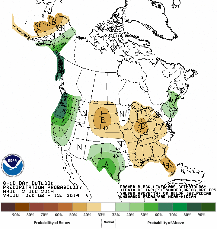
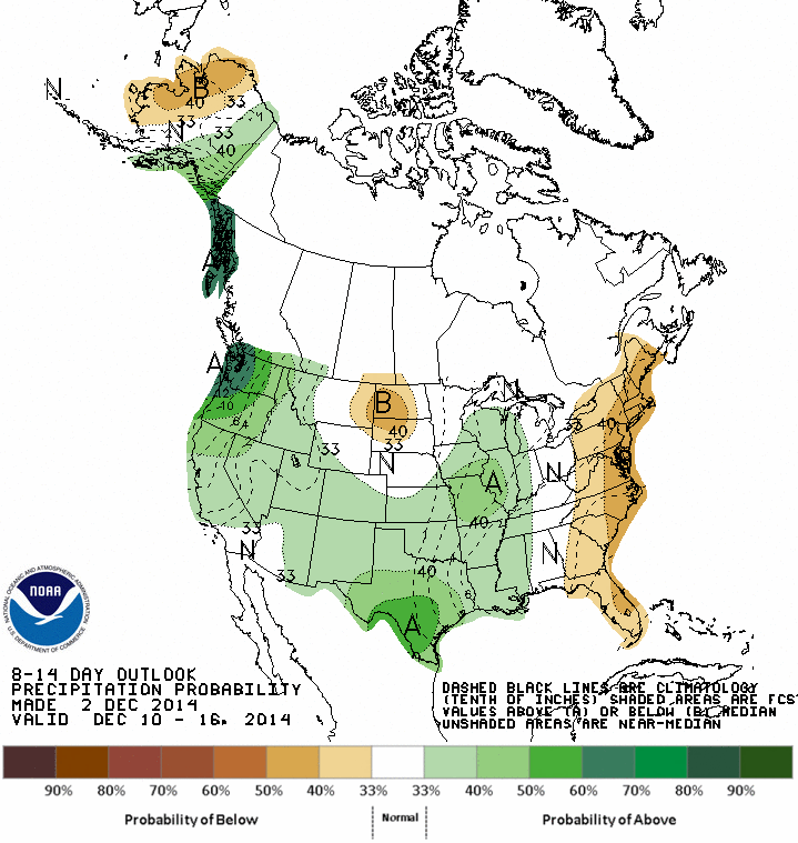
for next week and maybe even the week after that. The medium-term outlooks from
CPC give us the hint of what might headed this way.


ZOUNDS but that's a bit of alright! Come on, won't it be more fun out Christmas
shopping in that type of weather rather than this, from just a few days ago?
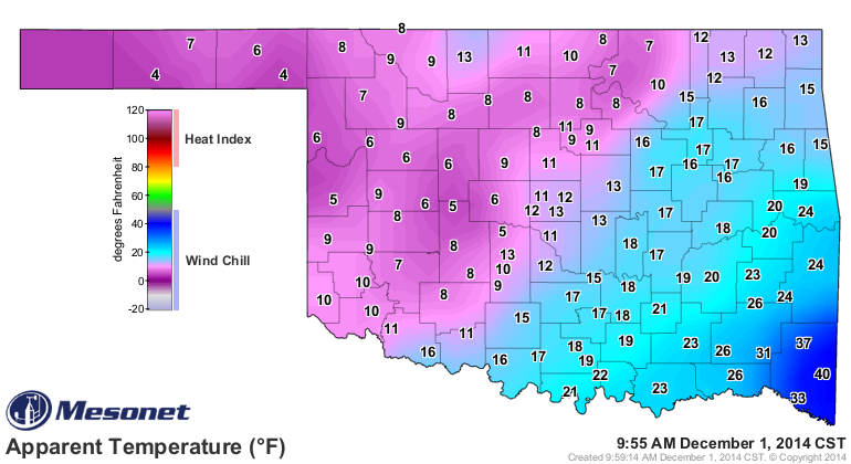
Come on, other than wearing a heavy parka, wouldn't it be more fun to do ANYTHING
with highs in the AARP range? Now notice that those maps don't tell us how
warm it will be, just that the odds of it being warmer than normal are greatly
increased. But, when you see a probability pattern like that, you know we're not
talking just a few degrees above normal. For those keeping score, however,
the normal high for mid-December in Oklahoma is somewhere between 45-55
(depending on where you live) and the normal low is around 25-35 degrees. So
any above normal during that period is gravy (and LIQUID gravy at that...not
frozen).
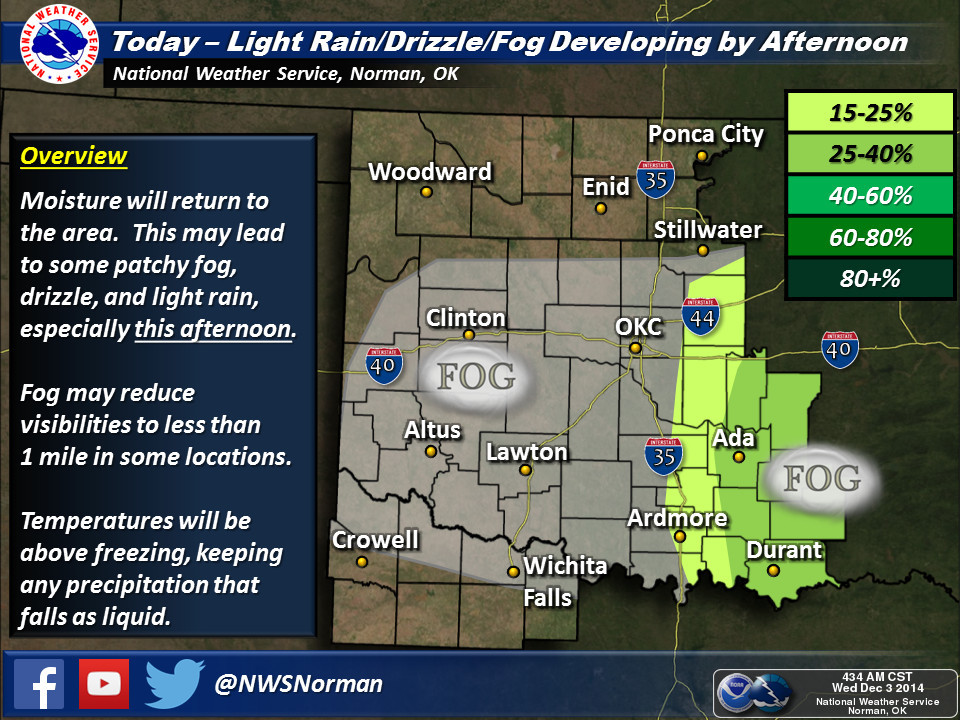
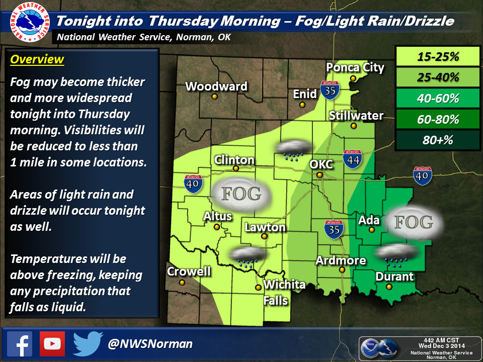
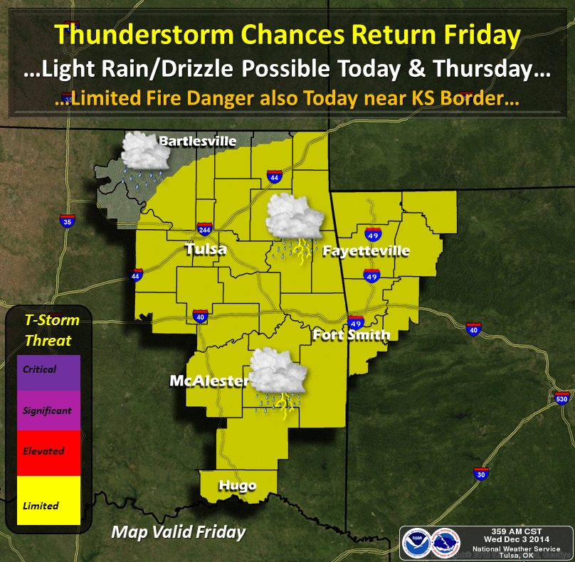
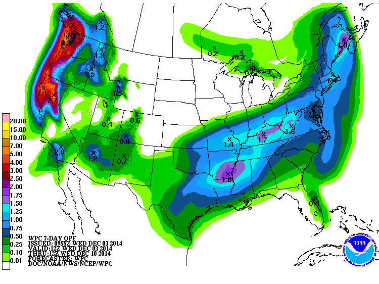
The good news is that in addition to the wet weather expected around these
parts for the next few days (as shown here by our friends at the local NWS
offices and the WPC)
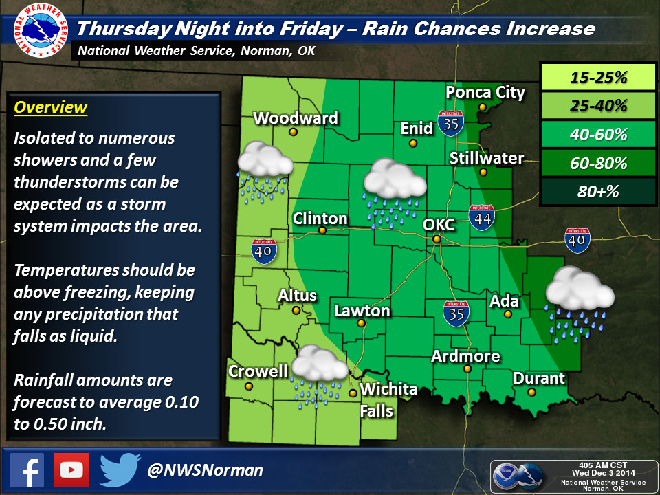
it appears that warmth next week will come with some increased rain chances as
well.
Before we get to overjoyed ('tis the season, remember) at those outlooks, let's
remember that this is the driest time of the year so being "above normal" isn't
exactly a call to build an ark. And frankly, even the next 7 days look pretty
dry out across the western half of Oklahoma, where the moisture is needed the
most.
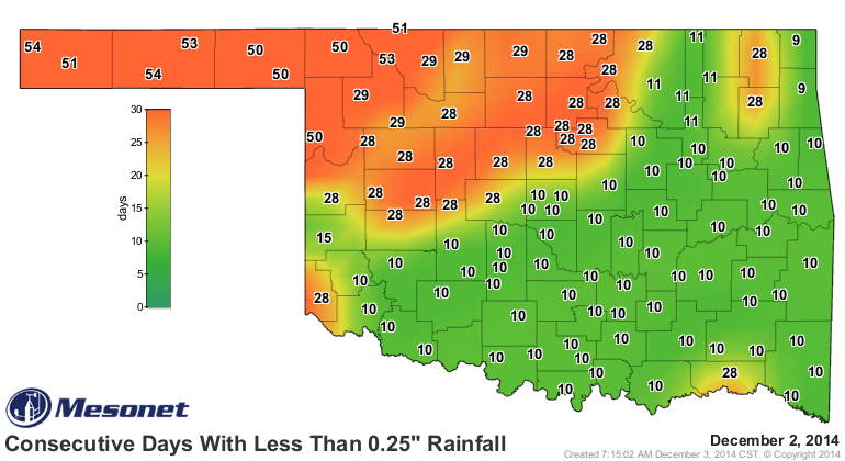
Don't believe me? Check out the days without at least a quarter-inch of
moisture map from the Mesonet. Today will mark the 55th consecutive day in some
areas.
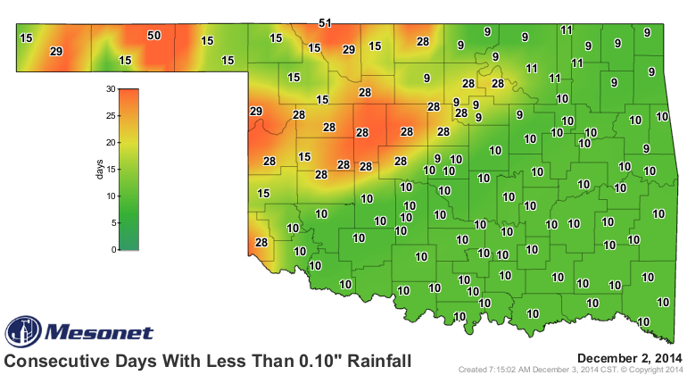
The tenth of an inch map shows the building water stress across the area.
This is where the love of warmer weather will not play in our favor. The warmth
will up the evaporation just a bit, and possibly the fire danger as well given
the proper wind and humidity conditions.
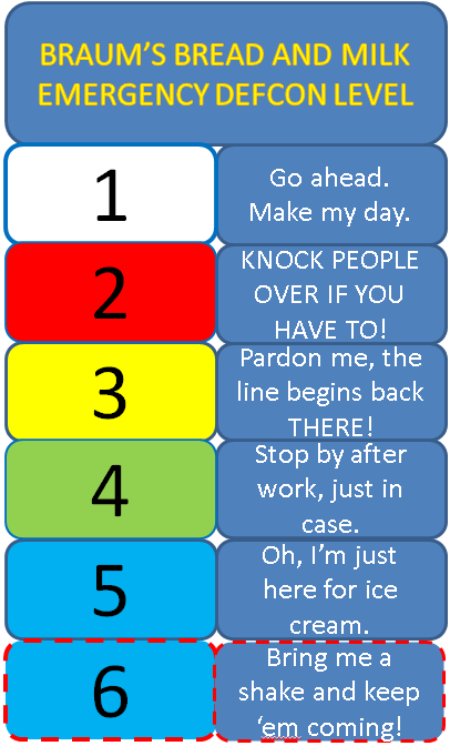
If it will help, I'll add an extra level to the OFFICIAL BRAUM'S DEFCON WARNING
SYSTEM:
By writing this, I've just doomed us to a frigid, ice-encased winter. That jet
stream will eventually buckle, just like it has the past few winters (and
mid-November, and this week) and we'll be under siege from the arctic hordes
once again.
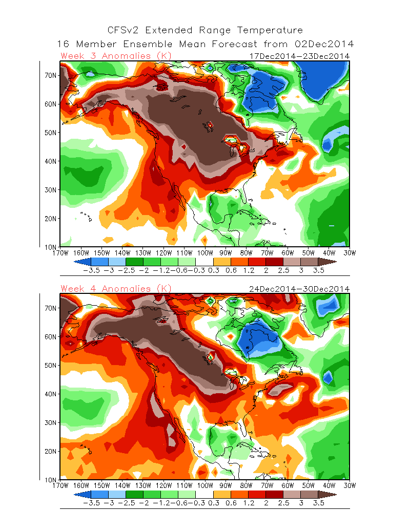
As for me, however, I'll take any warmth I can get. As a teaser, check out the
model forecasts for temperature anomalies during the final two weeks of the
season. For reference, the units are in degrees kelvin (celsius, for all intents
and purposes). But if this were to be anywhere close to accurate, Santa will
need to add some wheels to his sleigh for his stops up North.
Gary McManus
State Climatologist
Oklahoma Mesonet
Oklahoma Climatological Survey
(405) 325-2253
gmcmanus@mesonet.org
December 3 in Mesonet History
| Record | Value | Station | Year |
|---|---|---|---|
| Maximum Temperature | 84°F | DURA | 2005 |
| Minimum Temperature | 0°F | NOWA | 2006 |
| Maximum Rainfall | 1.97 inches | KETC | 2002 |
Mesonet records begin in 1994.
Search by Date
If you're a bit off, don't worry, because just like horseshoes, “almost” counts on the Ticker website!