Ticker for November 24, 2014
MESONET TICKER ... MESONET TICKER ... MESONET TICKER ... MESONET TICKER ...
November 24, 2014 November 24, 2014 November 24, 2014 November 24, 2014
So how did it go?
Remember last Thursday's rainfall forecast? Here's a reminder just in case.
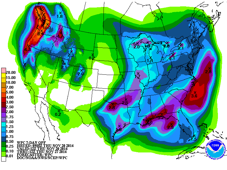
The prediction form the WPC was for nearly 3 inches in a band from south central
up through southeastern Oklahoma. That wasn't a bad shot, but it did veer a bit
farther to the west (which is a GOOD thing!). And it was even a bit of an
underestimate for some areas.
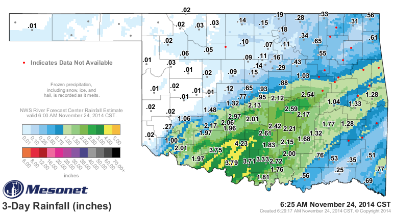
You can see from the radar overlay that there was a pretty widespread area of
at least 4 inches down around Ketchum Ranch in Stephens County, and the 2-3 inch
amounts radiated outwards from there. Definitely some nice, drought-denting
rainfall for some folks. For others, however, not so great. The NW half of the
state saw their less-than-bountiful prediction come true with most seeing less
than a tenth of an inch, if any. And far SE OK, where abnormally dry conditions
were introduced in last week's Drought Monitor, saw less than an inch as well.
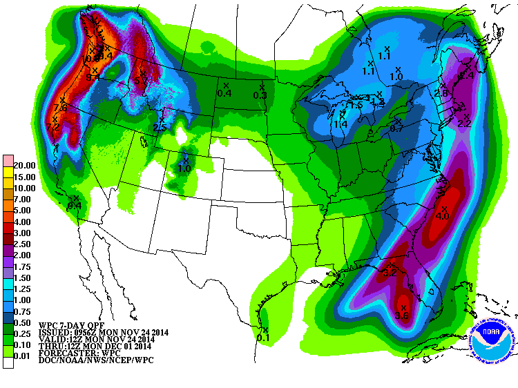
As we now enter the Thanksgiving Holiday week, our weather appears to be getting
a lot more boring. Look for a warming trend throughout the week with NO
travel problems (at least due to weather). Unfortunately, no rain either.
Gary McManus
State Climatologist
Oklahoma Mesonet
Oklahoma Climatological Survey
(405) 325-2253
gmcmanus@mesonet.org
November 24 in Mesonet History
| Record | Value | Station | Year |
|---|---|---|---|
| Maximum Temperature | 85°F | MANG | 2017 |
| Minimum Temperature | 7°F | KENT | 2003 |
| Maximum Rainfall | 5.29 inches | TALI | 1996 |
Mesonet records begin in 1994.
Search by Date
If you're a bit off, don't worry, because just like horseshoes, “almost” counts on the Ticker website!