Ticker for September 25, 2014
MESONET TICKER ... MESONET TICKER ... MESONET TICKER ... MESONET TICKER ...
September 25, 2014 September 25, 2014 September 25, 2014 September 25, 2014
One order of drought, hold the cool weather
Order up! DING DING
Did I just DING DING? Oh well, we have bigger things to worry about than my lame
attempts at writing sound effects. Namely, intensifying drought. And we start with
the cessation of widespread moisture beginning in August. The maps from the
Mesonet tell the story.
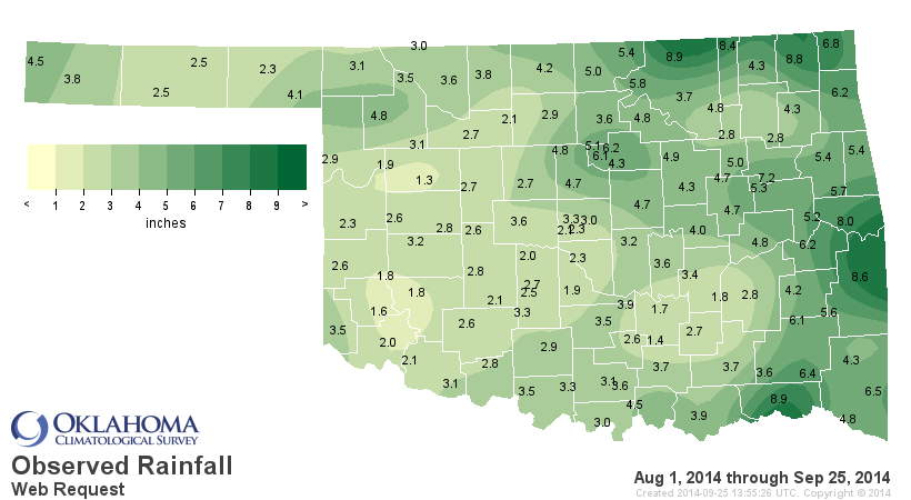
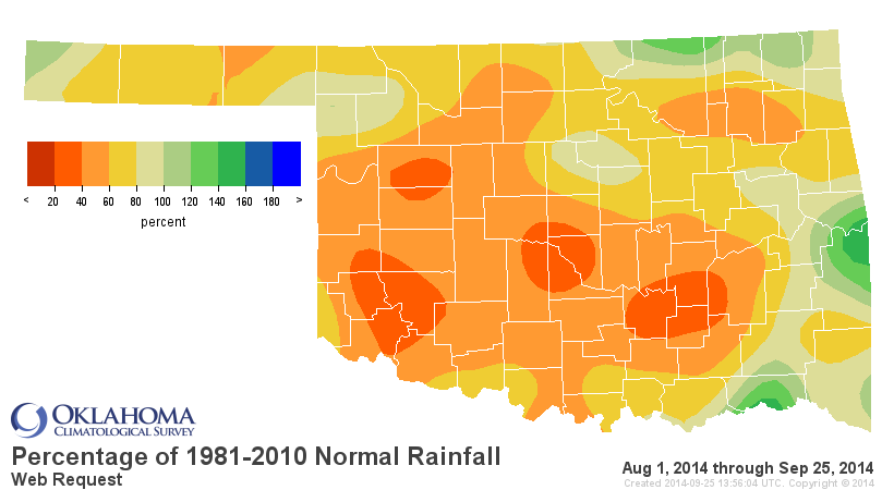
Only 1.3 inches at the Putnam Mesonet site in Dewey County, and not much better
down across SW OK with less than 2 inches in places down that way. Only parts
of far N/NE and SE OK have had above normal moisture. And Kenton in the far
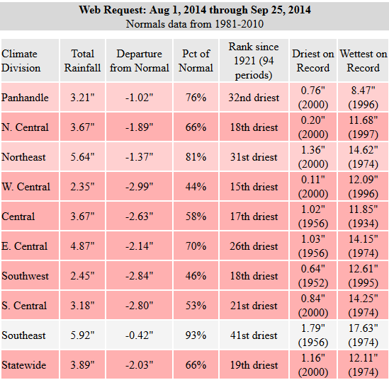
western Panhandle with 4.5 inches. The statewide average since August 1 is a
meager 3.89 inches, 2.03 inches below normal, the 19th driest Aug. 1-Sept. 25
since at least 1921. You can see from the "Driest on Record" column on the stats
figure that we're hanging out with 2000, 1956, 1952 and 1956...all periods of
significant drought. Misery loves company?
Add that rainfall to what we've seen since the beginning of the year and the
reason we're still in significant drought becomes pretty clear.
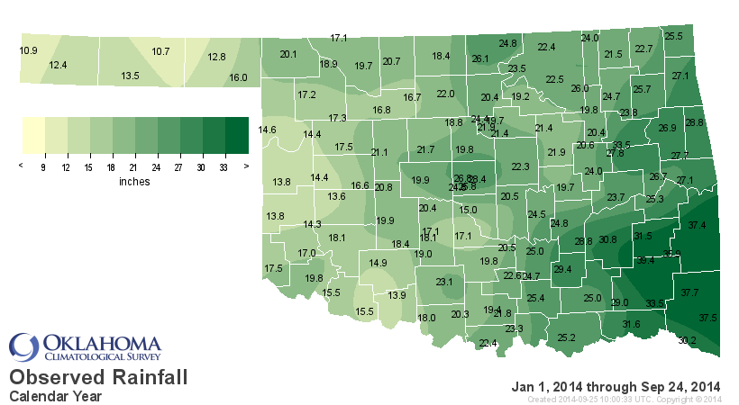
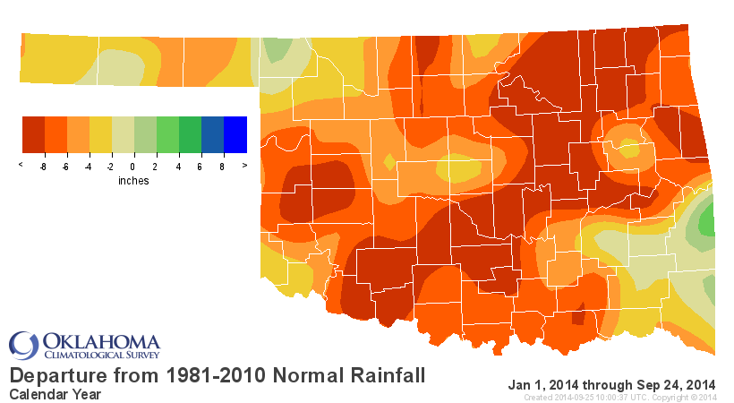

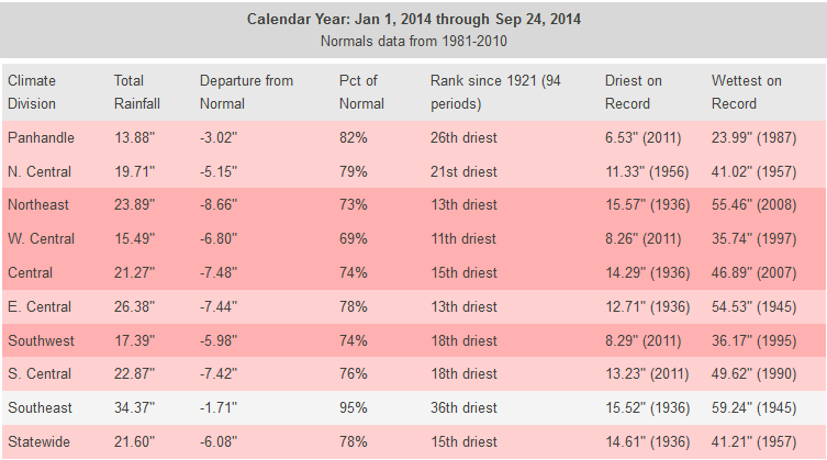
Yeesh! The 15th driest such period since at least 1921, about 6.1 inches below
normal. It's the 11th driest for west central Oklahoma.
All of that nonsense gives us this drought map.
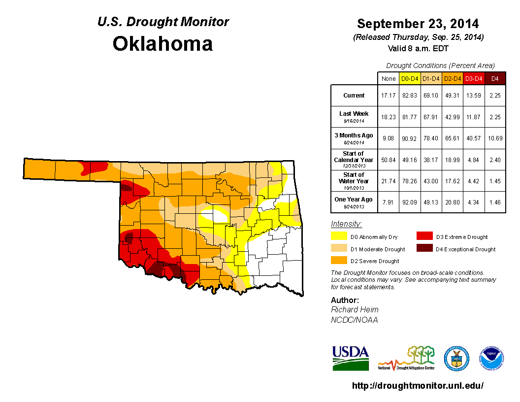
We did see the "severe" D2 drought disappear from Jackson County in SW OK and
get filled in with all "extreme" D3 drought. D2 drought also spread across
northern OK from the Enid area all the way over to Tulsa. D3 drought also
marched eastward into Woodward County. The total amount of the state in drought
now stands at 69%. One year ago only 49% of the state was experiencing drought,
so we're off to a bad start for fall.
The weather you see now is probably going to stick around awhile, and possibly
get even warmer, at least through the middle of next week. At that point we
could see a pretty good cold front with a decent chance of rain. Still a ways
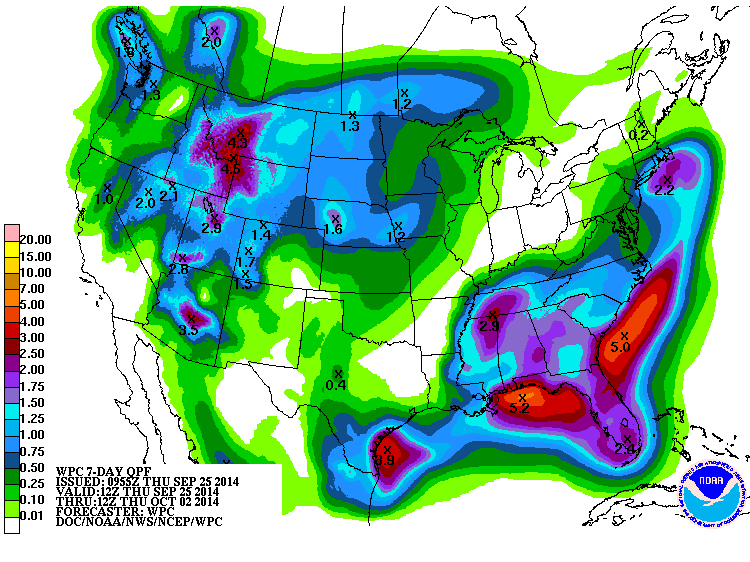
out, but at least there are signs of that occurring. The beginnings of the
rain are just starting to show up on the 7-day forecast. Nothing heavy right
now, but that could improve as the storm moves ashore in the Pacific Northwest.
The CPC is certainly showing signs of the front in their precip and temperature
outlooks for much of next week. These are for the Oct. 2-8 time frame, and they
portray probabilities of above-, below- or near-normal conditions.
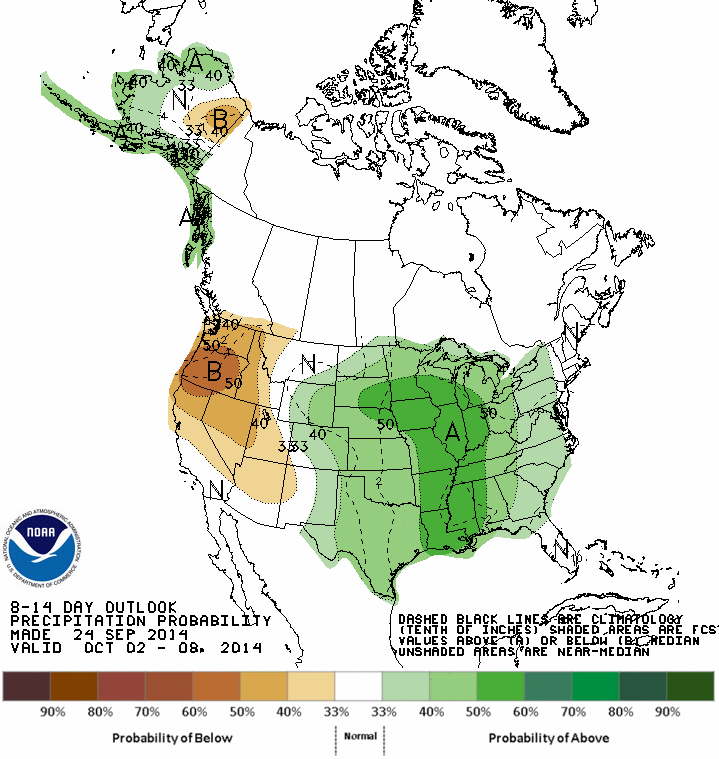
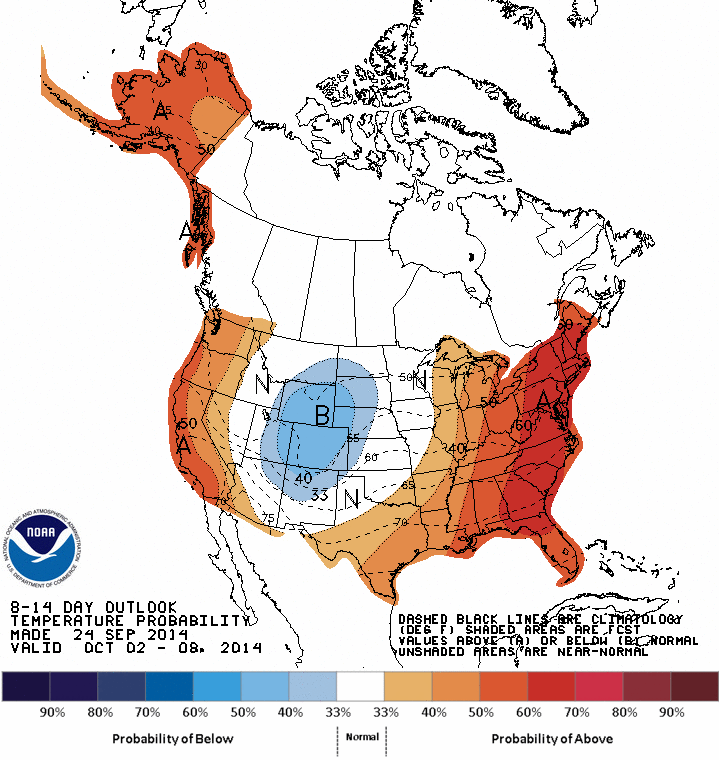
Almost 4 years to the date (Oct. 1, 2010) that we recognize as this drought's
beginning and here we are with 69% of the state in drought. Let's hope this is
our last anniversary with this drought!
Gary McManus
State Climatologist
Oklahoma Mesonet
Oklahoma Climatological Survey
(405) 325-2253
gmcmanus@mesonet.org
September 25 in Mesonet History
| Record | Value | Station | Year |
|---|---|---|---|
| Maximum Temperature | 102°F | SLAP | 2020 |
| Minimum Temperature | 29°F | BOIS | 2000 |
| Maximum Rainfall | 4.95″ | TISH | 2016 |
Mesonet records begin in 1994.
Search by Date
If you're a bit off, don't worry, because just like horseshoes, “almost” counts on the Ticker website!