Ticker for July 24, 2014
MESONET TICKER ... MESONET TICKER ... MESONET TICKER ... MESONET TICKER ...
July 24, 2014 July 24, 2014 July 24, 2014 July 24, 2014
Another week, another dent in the drought
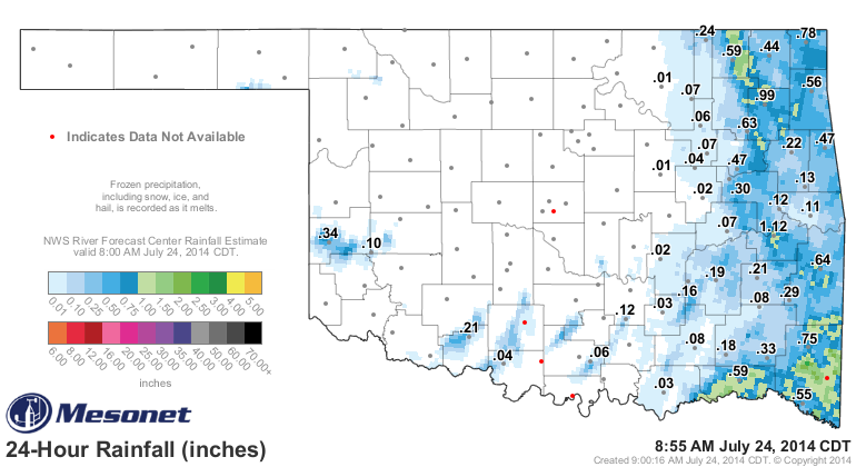
We finally got last week's cool, rainy weather reflected on the U.S. Drought
Monitor and boy, did it make a big difference. Especially in central Oklahoma,
where 3-6+ inches fell.
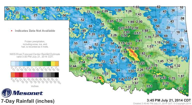
Take a look at the map and especially at the improvements across central
Oklahoma. Then compare it to the map from May 20, when drought was at its
zenith for this year.
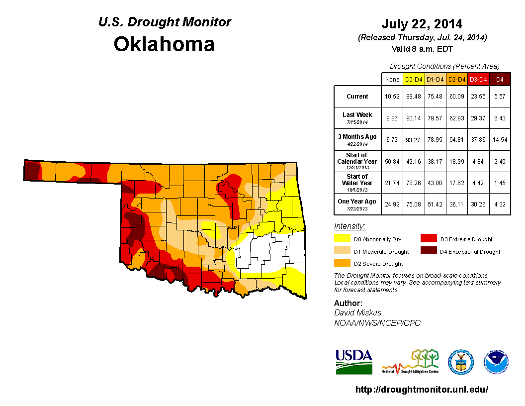

Wow, even some yeller across Oklahoma, Cleveland and Pottawatomie counties!
In two months, we've been able to whittle the amount of Extreme (D3)-
Exceptional (D4) drought down from 61% of the state to 24%. The amount of D4
drought alone has dropped from 34% to 6%. And we now have 25% of the state out
of drought completely (D-Nada and D0).
Again, this type of relief during the summer months is somewhat unusual, and
so I'm going to take credit for it. I don't know how I did it, but let's all
just agree I've done a wonderful job on the rain this year.
**DISCLAIMER: recent heat and humidity is the full responsibility of the
National Weather Service.
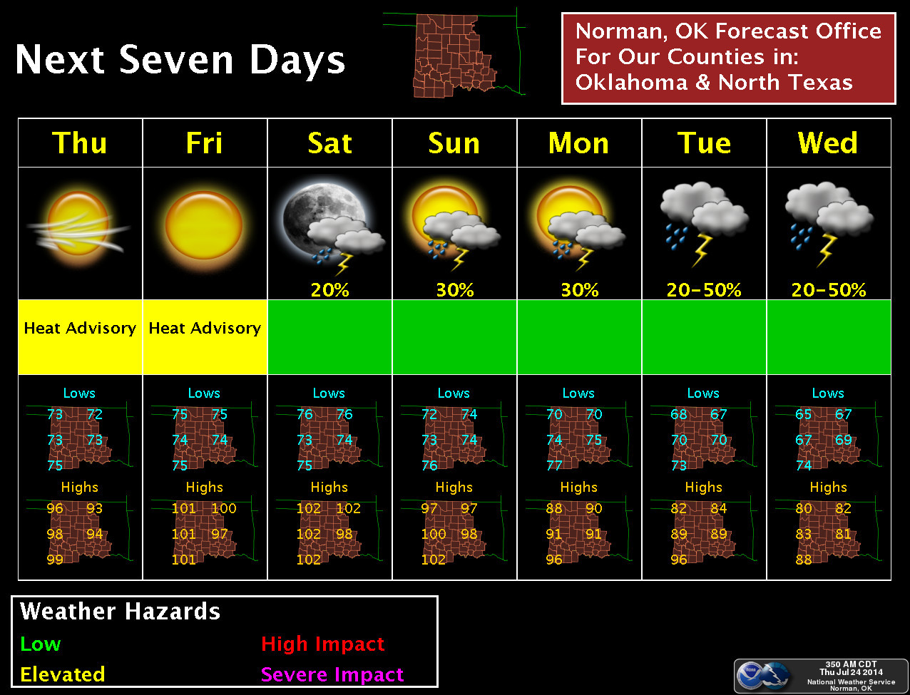
Now the bad news is that the NWS (ahem!) has dialed in even more heat and
humidity for the next few days.
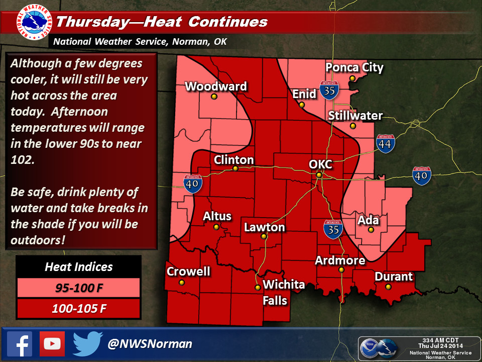
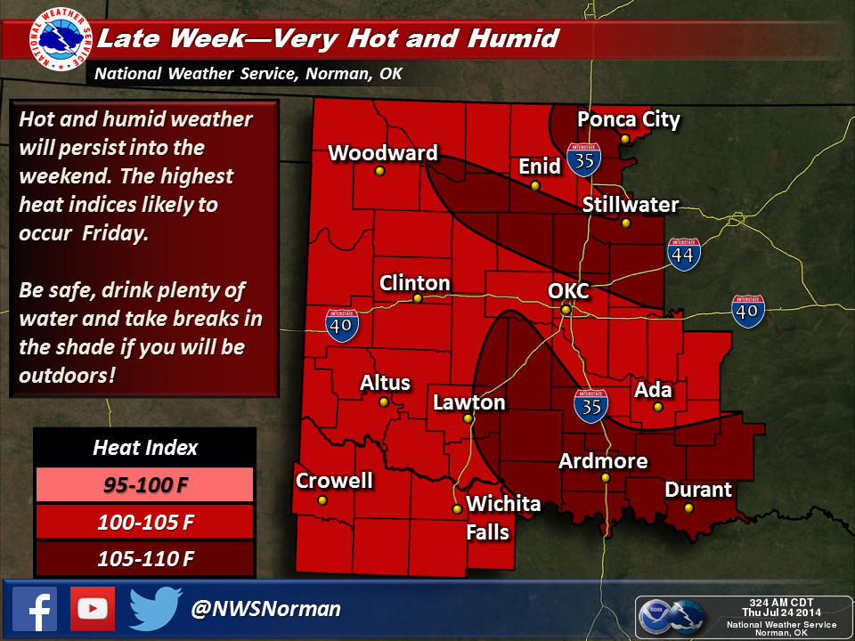
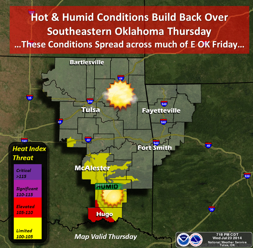
It's gonna get toasty (albeit a limp, kinda soggy toasty).

Enough so that much of the state is under a heat advisory for heat indices up
in the 105-degrees range through Friday. Parts of the northeast are even under
an "Excessive Heat Watch" through Saturday evening, meaning heat indices in
that area (Pawnee, Tulsa and Osage counties) could reach as high as 105-110
degrees.

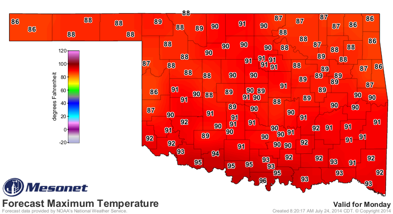
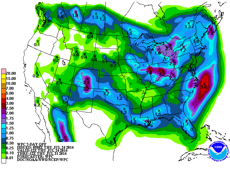
Luckily, I, myself, one Gary McManus, kind and generous State Climatologist,
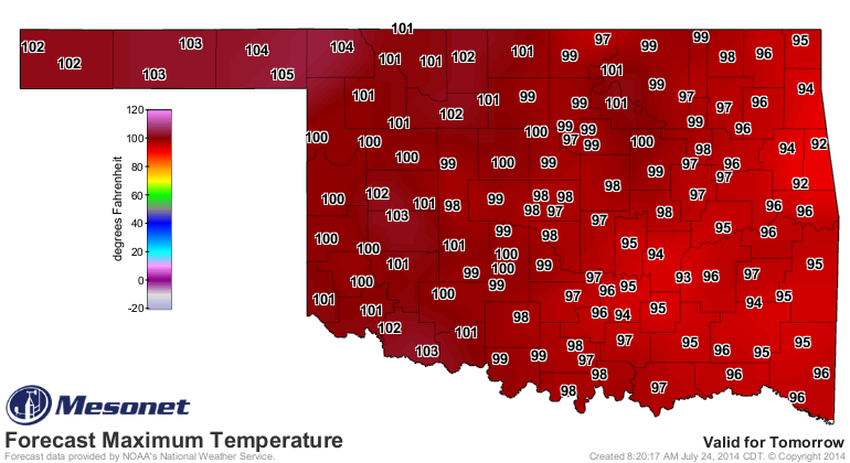
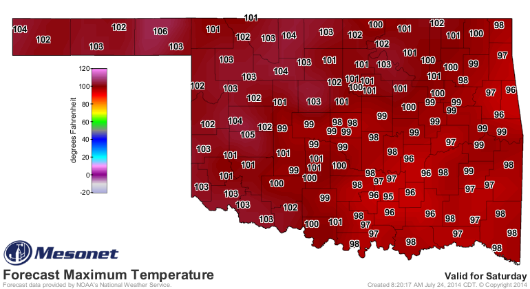
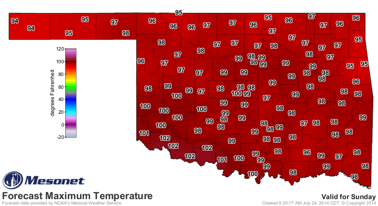
dialed up some cooler weather for next week. Now it looks like highs in the
80s (70s perhaps) are possible with some decent rains(think last week, just
without the steroids). You can see it start to show up on the forecasts for
temperature and rainfall.
Oh, what the heck. I'll come clean. I ordered the heat, AND THE CODE RED! I
missed summer. My NWS friends in Amarillo, Norman, Tulsa and Shreveport can
have credit for next week.
Can I at least take credit for last yesterday's rain??
Gary McManus
State Climatologist
Oklahoma Mesonet
Oklahoma Climatological Survey
(405) 325-2253
gmcmanus@mesonet.org
July 24 in Mesonet History
| Record | Value | Station | Year |
|---|---|---|---|
| Maximum Temperature | 110°F | MARE | 2011 |
| Minimum Temperature | 48°F | CAMA | 2019 |
| Maximum Rainfall | 4.43 inches | COOK | 2004 |
Mesonet records begin in 1994.
Search by Date
If you're a bit off, don't worry, because just like horseshoes, “almost” counts on the Ticker website!