Ticker for July 22, 2014
MESONET TICKER ... MESONET TICKER ... MESONET TICKER ... MESONET TICKER ...
July 22, 2014 July 22, 2014 July 22, 2014 July 22, 2014
A Time To Sweat
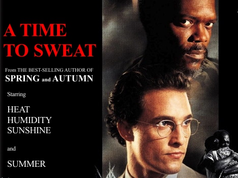
Have you ever watched "A Time To Kill" and noticed how everybody is dripping
sweat in almost every scene like they've been on a treadmill for 2 hours? That's
what I assume Mississippi is like from June through August. Well, all our praise
and glory over last week's record-cold weather has done gone and put us in the
middle of an old fashioned Mississippi style summer heat wave, courtesy of our
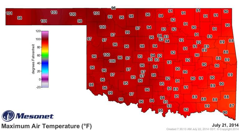
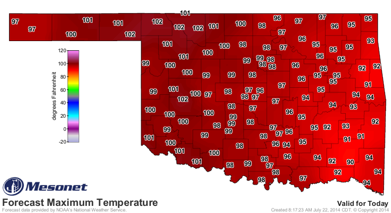
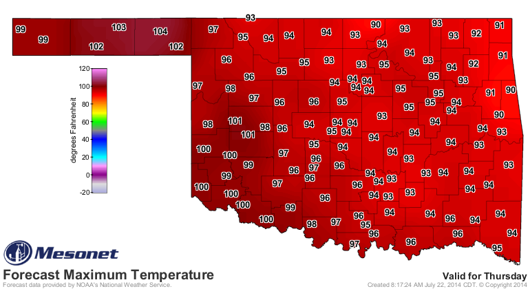
least favorite author, Mother Nature. Look at yesterday's temperatures, and
remember them fondly, because it'll get worse (today and tomorrow) before it gets
slightly better (Thursday, sorta).
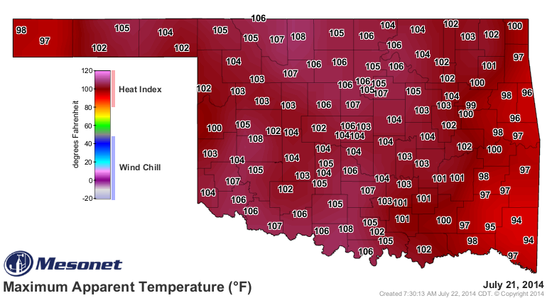
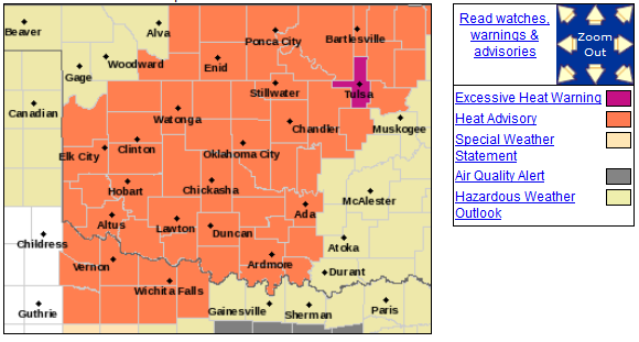
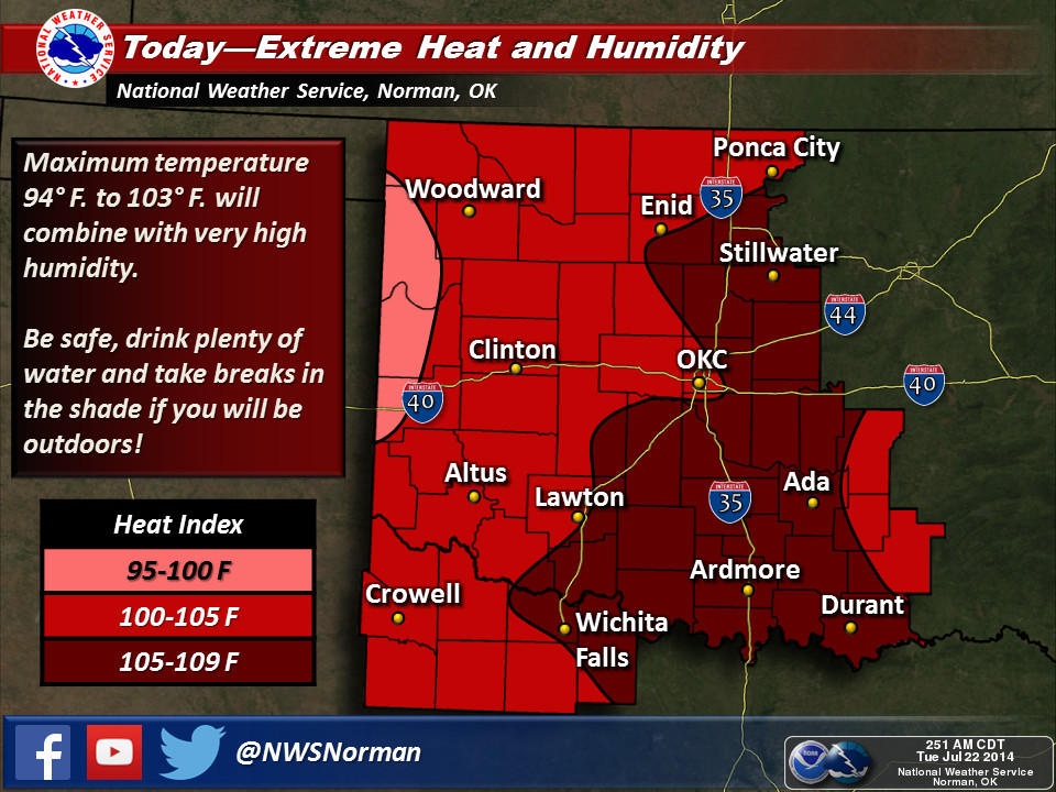
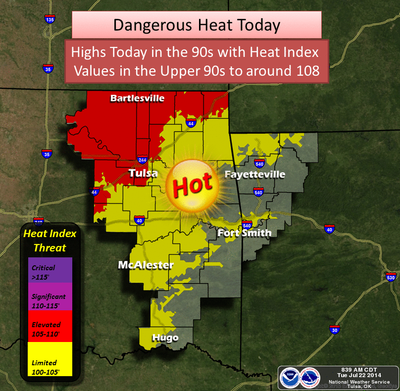
Those heat indices across the western half of the state are worthy of a heat
advisory, so that's exactly what we have now, courtesy of the NWS offices in
Tulsa and Norman. Tulsa County has even got the coveted "Excessive Heat WARNING."
Ain't they lucky?
An excessive heat warning means heat indices in the 105-110 degrees range. A
heat advisory means heat indices around 105 degrees. Don't be shocked if values
are above that 105 degrees mark today even in western Oklahoma. Here's what we
can expect for the next couple of days, courtesy of the NWS folks.

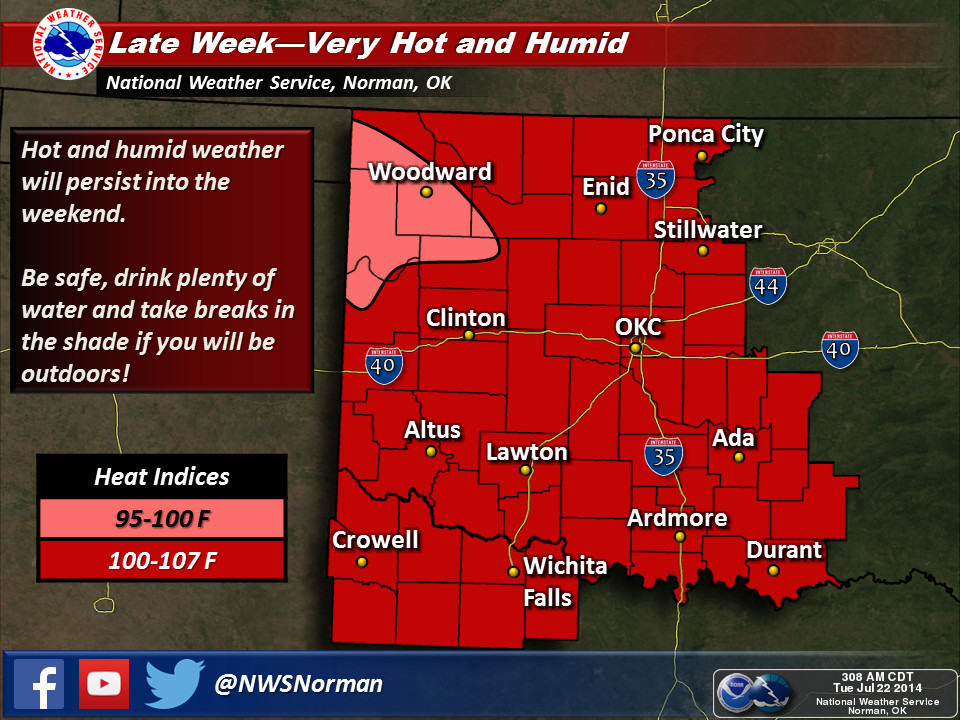

We could see a brief and slight cool-down on Thursday as a weak cold front
slides into the state. Don't expect last week's cool weather, however. More
like merely bringing us down to seasonal averages at best. And then the hottest
days appear to be hitting us this weekend. No idea if the heat indices will
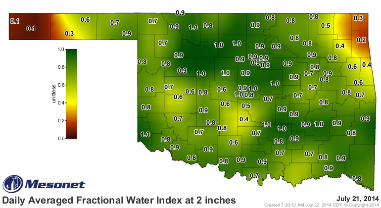
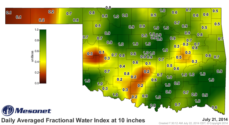
be as high, but there is a lot of moisture to be evaporated by old Sol.


As long as this supply holds out, there will be humidity. And that's only in
addition to what is being brought up from the Gulf on those southerly winds.
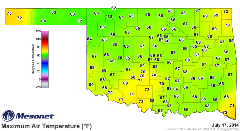
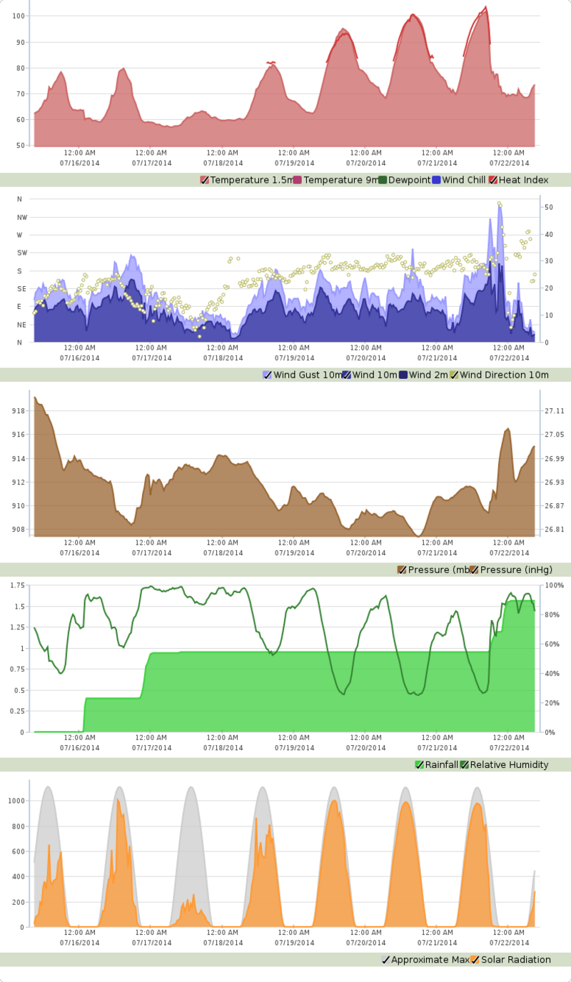
But what a change in less than a week, eh? Take our station in Hooker, for
instance. It reached a HIGH TEMPERATURE of 63 degrees on July 17th, and yesterday
it rose to 103 degrees out that way. That's like going from the middle of March
to well above July's average temperature in 5 days.
It does make for an interesting temperature trace over that period (the top
graph on this meteogram). It's a heat tsunami!
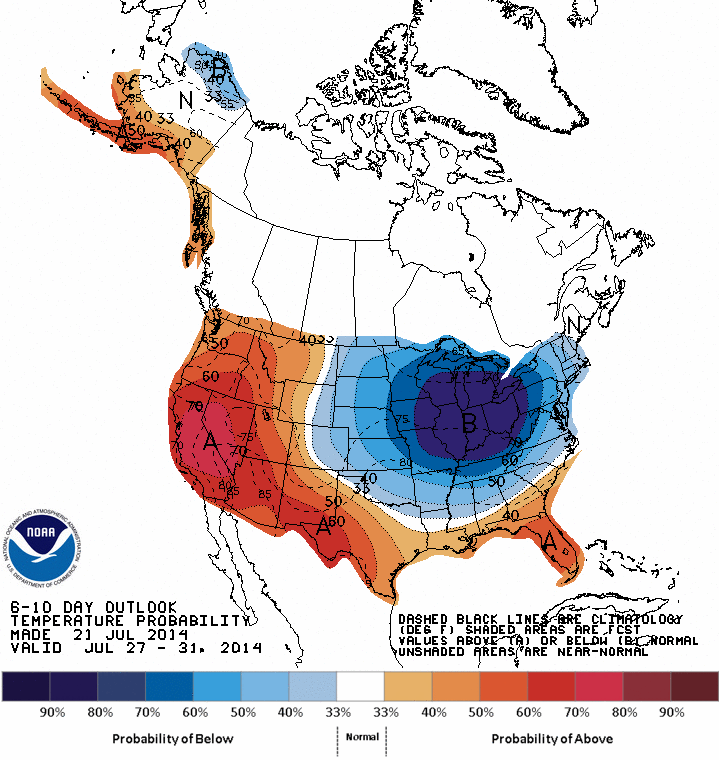
But never fear. It does look like we'll see a somewhat similar pattern from last
week build for next week as well. Not quite as cold, probably, but another big
cool trough across the eastern U.S. and a hot ridge across the west. We'll be
somewhere in between where the nicer temps and a bit of moisture are (hopefully).
Remember, these maps show probabilities, not magnitudes, of possible temperature
and precip anomalies.

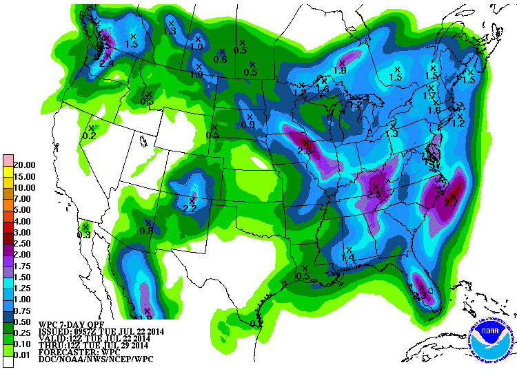
The rain is just starting to show up on the 7-day map, although some of this
is from Thursday's chances in the far east and west.
Maybe next week, we'll be starring in "A Time To Use An Umbrella."
Gary McManus
State Climatologist
Oklahoma Mesonet
Oklahoma Climatological Survey
(405) 325-2253
gmcmanus@mesonet.org
July 22 in Mesonet History
| Record | Value | Station | Year |
|---|---|---|---|
| Maximum Temperature | 112°F | GRA2 | 2018 |
| Minimum Temperature | 56°F | GOOD | 2006 |
| Maximum Rainfall | 2.75 inches | BEAV | 2015 |
Mesonet records begin in 1994.
Search by Date
If you're a bit off, don't worry, because just like horseshoes, “almost” counts on the Ticker website!