Ticker for June 24, 2014
MESONET TICKER ... MESONET TICKER ... MESONET TICKER ... MESONET TICKER ...
June 24, 2014 June 24, 2014 June 24, 2014 June 24, 2014
Here we go again! Again!
I had to add an "Again" there because I had already used that as a Ticker title.
PREPARE FOR MCS-MAGEDDON LATE JUNE 2014 (?), a day after I proclaimed "Hey,
things are going to get a bit more quiet now," or something like that. In other
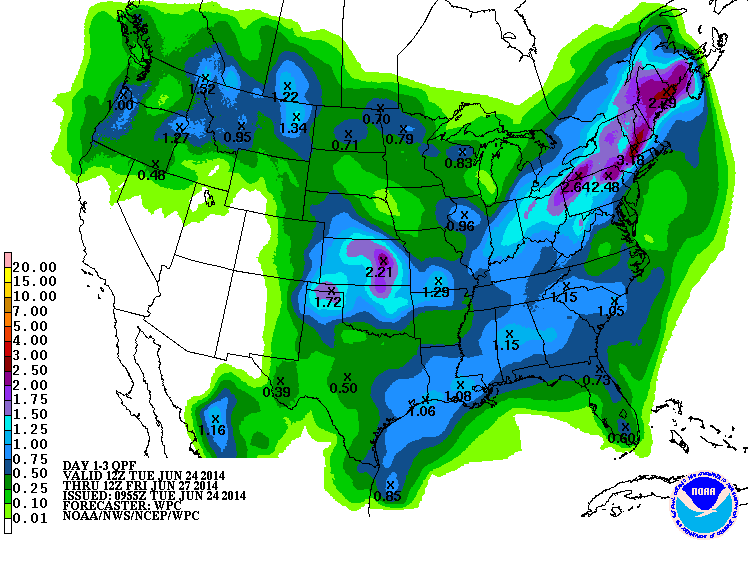
words, gobs of rain are (is??) expected today through tomorrow as we should once
again see showers and storms build up out west and march to the southeast
throughout the evening into tomorrow morning. And then the disturbance that is
going to trigger the showers tonight will move across the state tomorrow and
could bring one more chance of widespread moisture.
Cue the NWS graphics extravaganza.
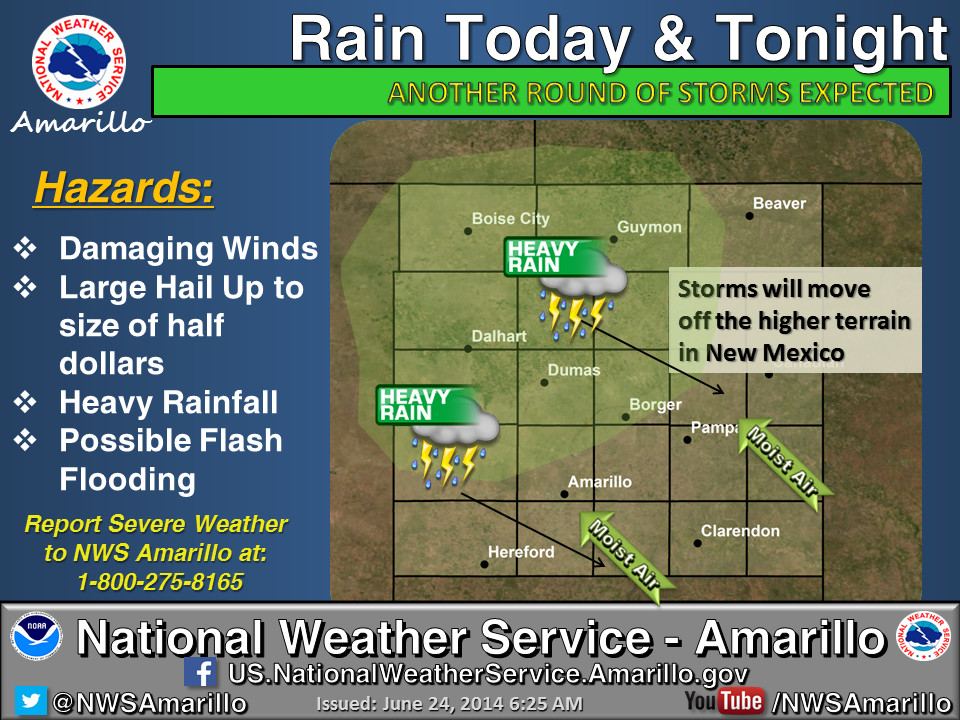

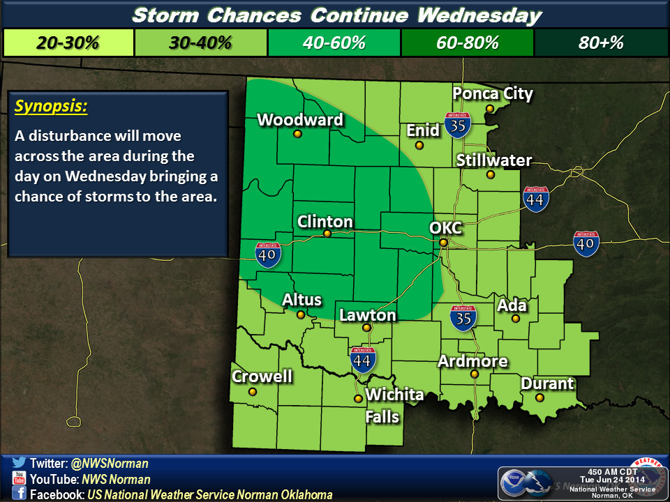
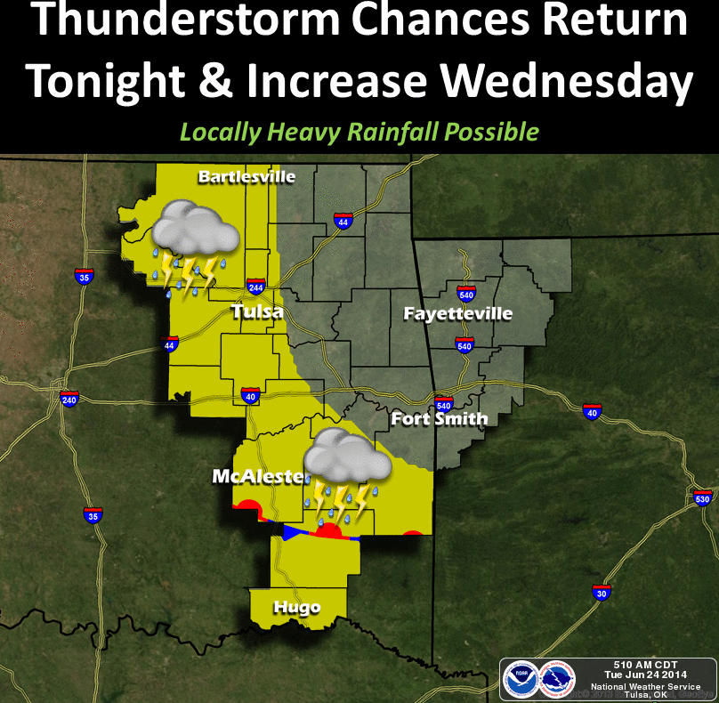
So the opportunity for localized heavy rainfall does exist, as does the
possibility of another wheat harvest disrupting widespread rainfall event.
Unfortunately, southern Oklahoma looks to be in the more minor accumulations
area. They've taken the place of western Oklahoma in the "have nots" category,
it seems.
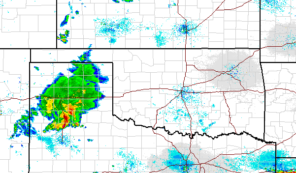
By the way, it rained a bit overnight in the far western Panhandle from the tip
of another big complex of showers and storms moving through the Texas Panhandle.
It looks like SW OK could get clipped, but the rainfall is diminishing.
I'm not sure the confidence is as high on tomorrow night's nocturnal-ish style
event, but prepare to wake up to Mother Nature's whooping and hollering.
Gary McManus
State Climatologist
Oklahoma Mesonet
Oklahoma Climatological Survey
(405) 325-2253
gmcmanus@mesonet.org
June 24 in Mesonet History
| Record | Value | Station | Year |
|---|---|---|---|
| Maximum Temperature | 108°F | HOLL | 2011 |
| Minimum Temperature | 45°F | BOIS | 2019 |
| Maximum Rainfall | 5.37 inches | FAIR | 2018 |
Mesonet records begin in 1994.
Search by Date
If you're a bit off, don't worry, because just like horseshoes, “almost” counts on the Ticker website!