Ticker for June 17, 2014
MESONET TICKER ... MESONET TICKER ... MESONET TICKER ... MESONET TICKER ...
June 17, 2014 June 17, 2014 June 17, 2014 June 17, 2014
Rain totals since May 21 continue to pile up
Although rain doesn't really "pile," but you know what I meant! And you also won't
see any pictures of double violent tornadoes on this here blog. If I've said it
once, I'll say it again ... the best way to prevent death and destruction from
tornadoes is to NOT HAVE THEM (see yesterday's Ticker). I've been watching rain
instead, and most of it has come without significant severe weather. May 21 is
still our changeover date from hot, dry and windy to wet, cool-to-sultry and still
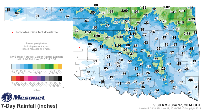
windy. The latest rainfall came across northern Oklahoma over the weekend where
some areas had up to 3.5 inches of rain, and a few days before that there was
a nice streak of rain from Ellis County down into SE OK.
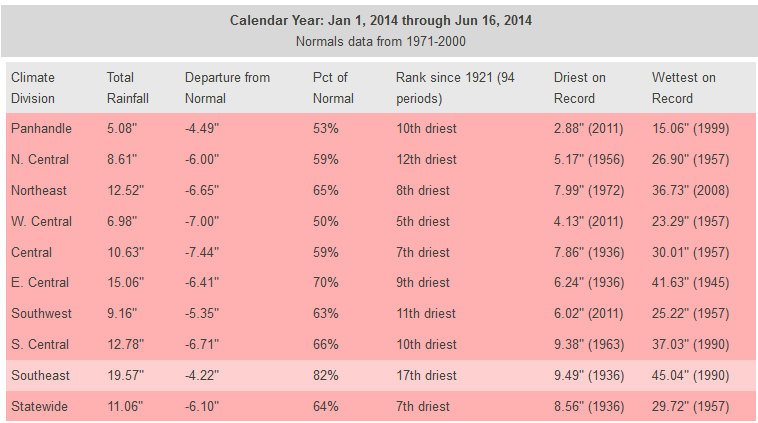
So our newest "since May 21" Mesonet maps look even better.
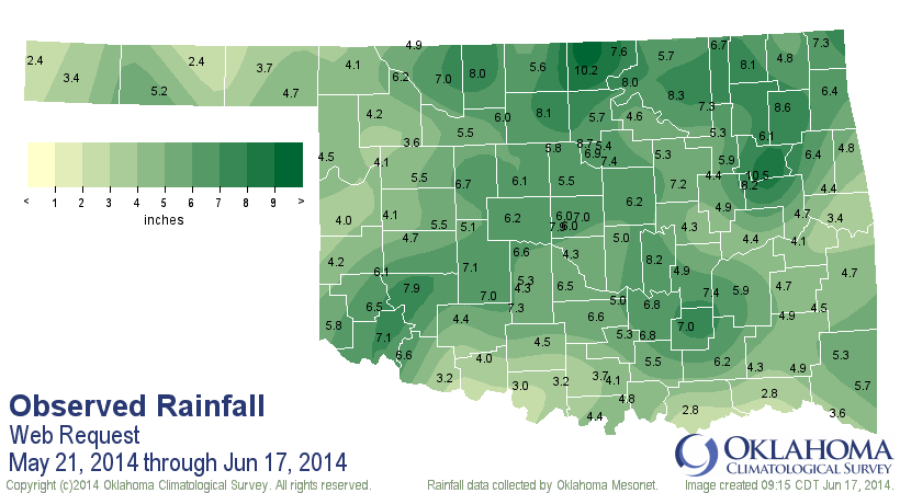
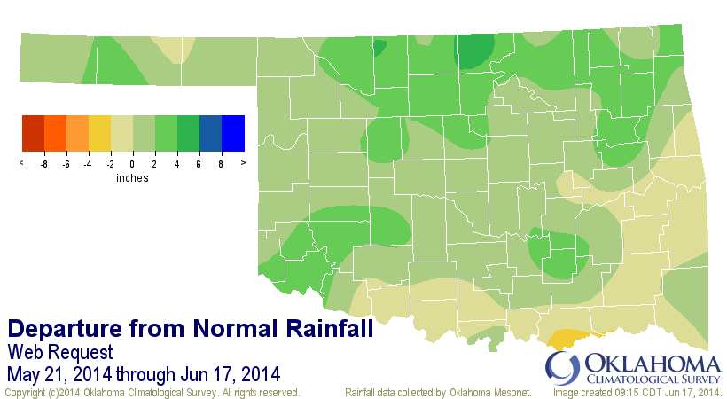
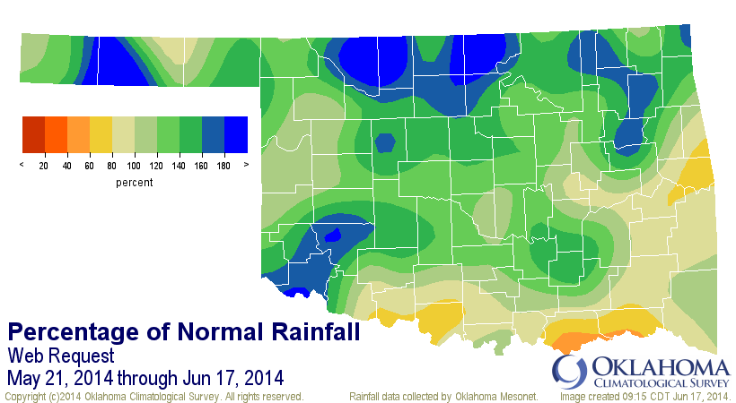
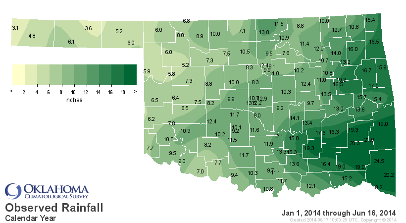
Statewide, that period is now the 24th wettest since at least 1921 with an
average of 5.49", 1.34 inches above normal (134% of normal). The area of most
concern now is southern Oklahoma, which has started to go without substantial
moisture than the northern 2/3rds of the state has seen. That's not to diminish
what long-term impacts are still showing up across the rest of the state, but
at least some of those short-term impacts, such as topsoil moisture and the
greenness of the vegetation have improved substantially.
Again, however, the long-term drought remains in full force across most of the
state, which is why those nasty colors on the Drought Monitor map aren't going
away anytime soon. Here's another look at the calendar year rainfall maps.


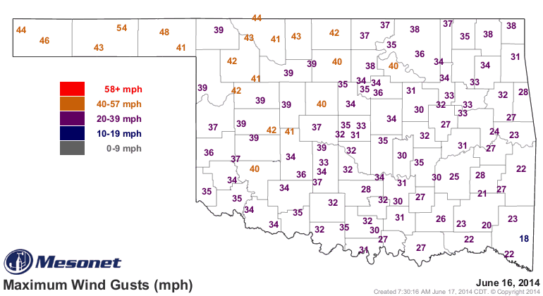
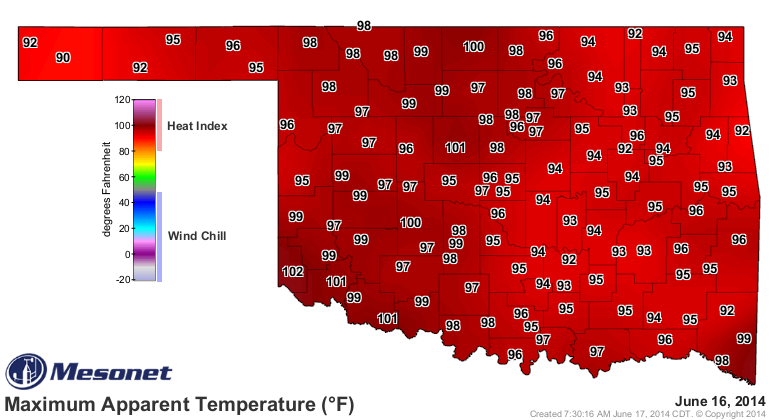
The heat and high winds are back, just like what we saw through most of May, so
a lot of that moisture in the soil is going bye-bye, not only to the atmosphere
through evaporation but also through the suddenly green plants thirsting for
moisture.
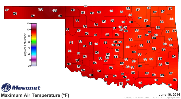
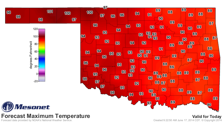
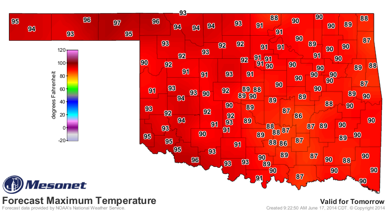
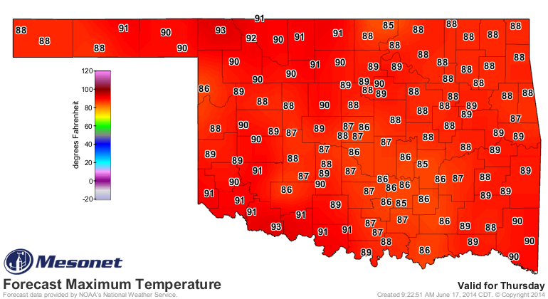
We have another couple of hot (west), sultry (east) days ahead of us before
a "somewhat cool" front moves in and brings us some manageable air and a chance
of rain. These forecast temperatures come from the NWS.
Still, another day of this? Yuck ("yech" for you northerners).
Let's finish with a flourish, another optimistic 7-day rainfall forecast,
courtesy of NOT ME (in case it doesn't pan out ... blame the Weather Prediction
Center). This is starting to look familiar though ... needs to shift to the
south!

Gary McManus
State Climatologist
Oklahoma Mesonet
Oklahoma Climatological Survey
(405) 325-2253
gmcmanus@mesonet.org
June 17 in Mesonet History
| Record | Value | Station | Year |
|---|---|---|---|
| Maximum Temperature | 114°F | GRA2 | 2011 |
| Minimum Temperature | 45°F | BEAV | 1999 |
| Maximum Rainfall | 10.49 inches | NEWP | 2015 |
Mesonet records begin in 1994.
Search by Date
If you're a bit off, don't worry, because just like horseshoes, “almost” counts on the Ticker website!