Ticker for April 30, 2014
MESONET TICKER ... MESONET TICKER ... MESONET TICKER ... MESONET TICKER ...
April 30, 2014 April 30, 2014 April 30, 2014 April 30, 2014
Somewherrrrrrrrrrrrrre, over the Dust Storm?
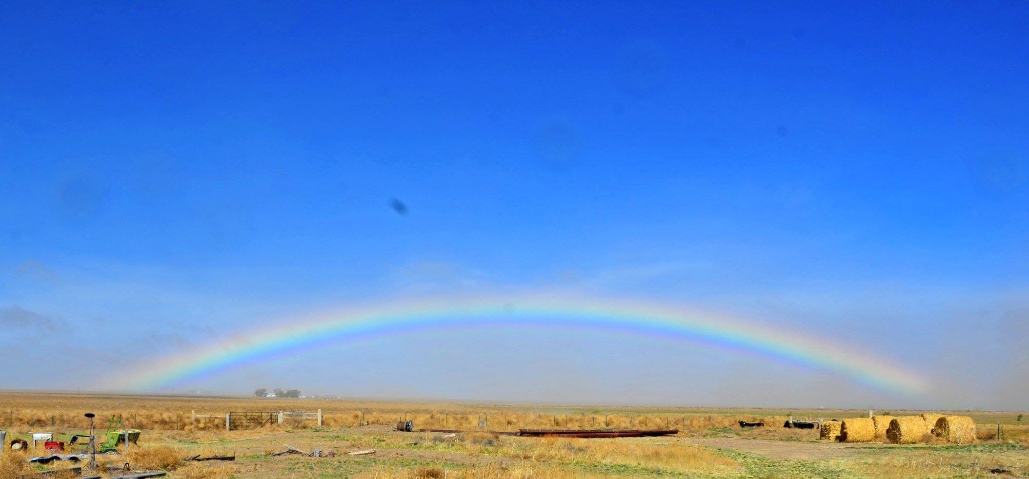
As God is my witness, I thought turkeys could fly, and I never knew dust could
cause a rainbow. But there's proof of it. This picture was taken by Oklahoma
Panhandle resident Lindsey Ogden near Felt, Oklahoma, at around 11 a.m. on Sunday,
April 27. You can see the dust is just starting to move into the area. Notice that
the dust is just starting to obscure the house in the background and more so
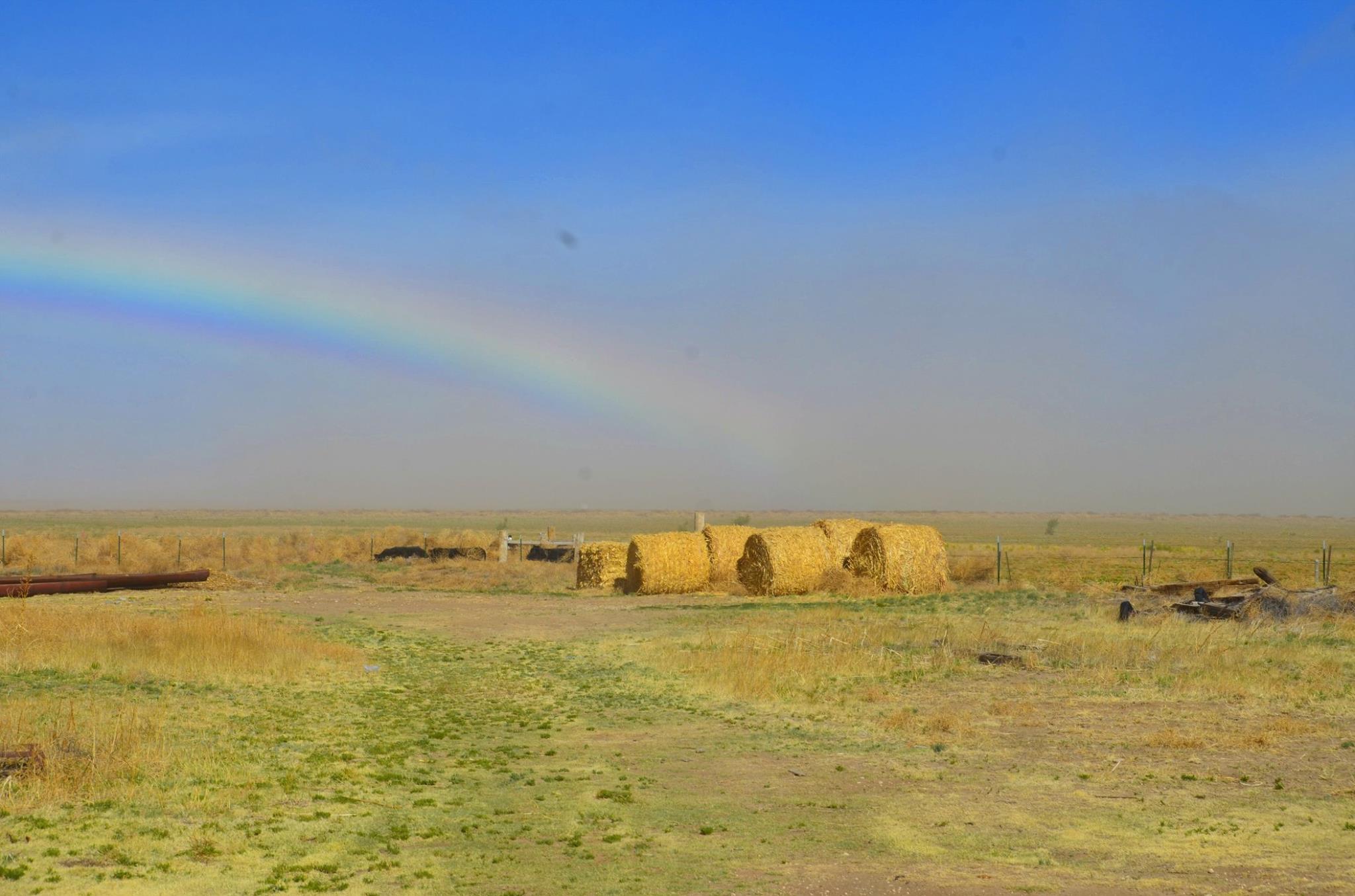
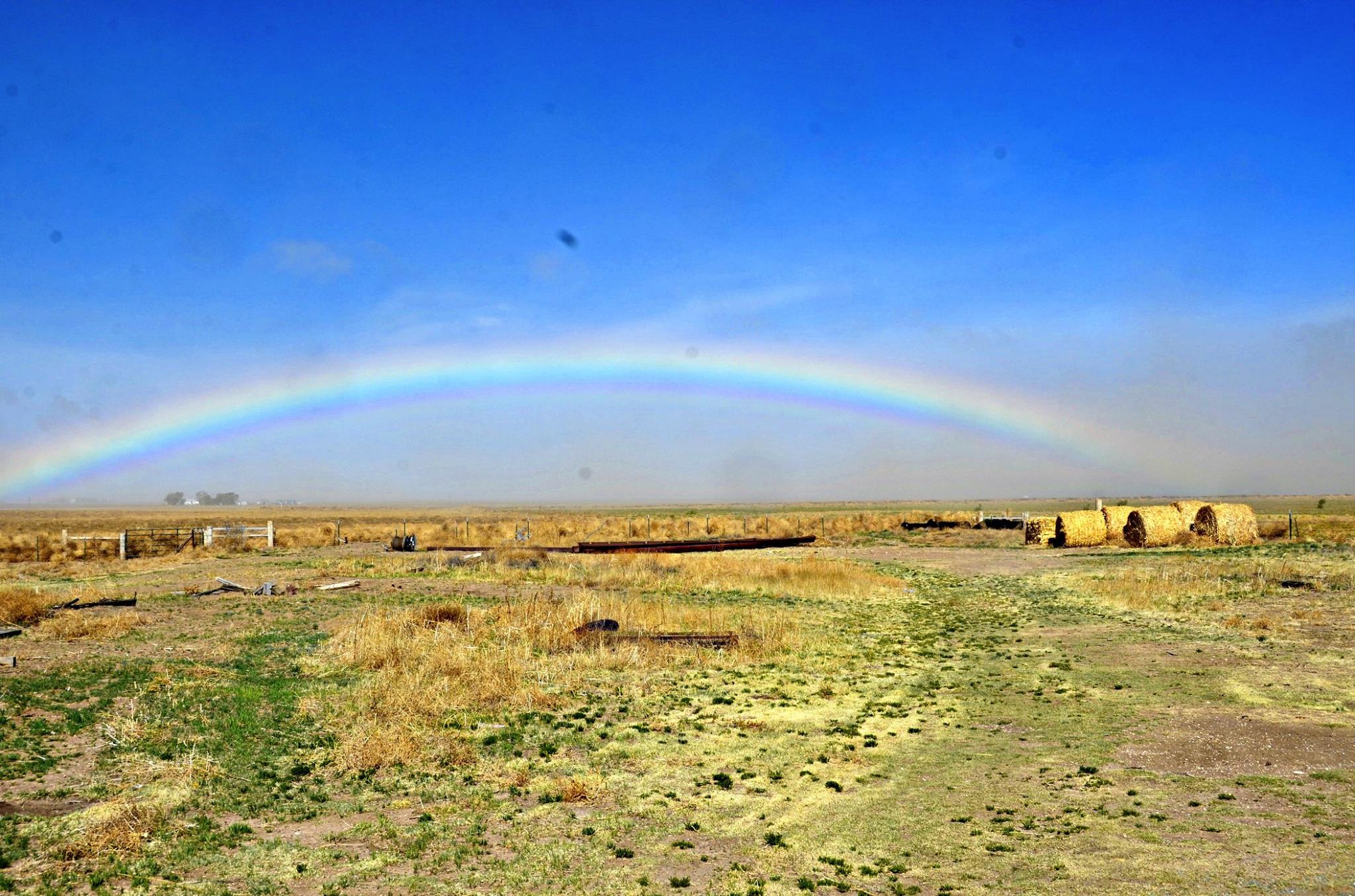
with things even more distant. Here are a couple other pictures snapped at the
same time.
I've been in close contact with our, uhhhhh, contacts (should have used
thesaurus.com) from out in the Panhandle and the word I am hearing most from
folks out that way is "desperate." The number of dust storms and windy, dry days
they are seeing this year is starting to rival that of the early Dust Bowl days.
Drought up and down the High Plains area, combined with cooler than normal
conditions, has left fields with little cover. And just like back in the Dust
Bowl days, those fields await the wind, their topsoil ready for the taking by
Mother Nature.
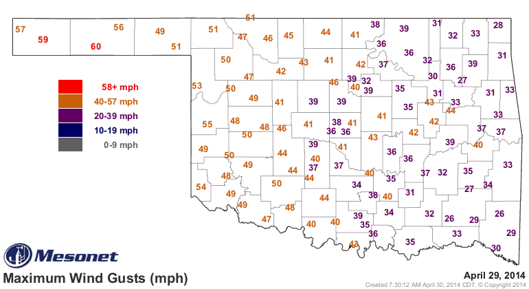
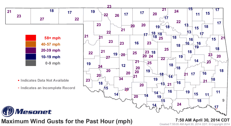
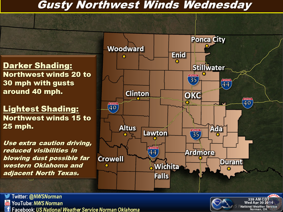
Take a look at the type of winds they experienced yesterday. The winds we had
downstate look like a breeze comparatively.
The word I got is that all travel was being discouraged in the Panhandle
yesterday. An extremely bad wreck occurred a couple of days ago near Tyrone
due to visibility down to as little as 5 feet.
http://tinyurl.com/dust-storm-wreck

Things aren't quite so bad now, although it's certainly too cold for my liking.
But at least we're not seeing the winds at gale force or above.
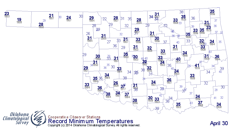
Speaking of temperatures, nobody got down to freezing, at least not at any
Mesonet site. Hooker got close at 33 degrees. Not really close to record-breaking
territory either.

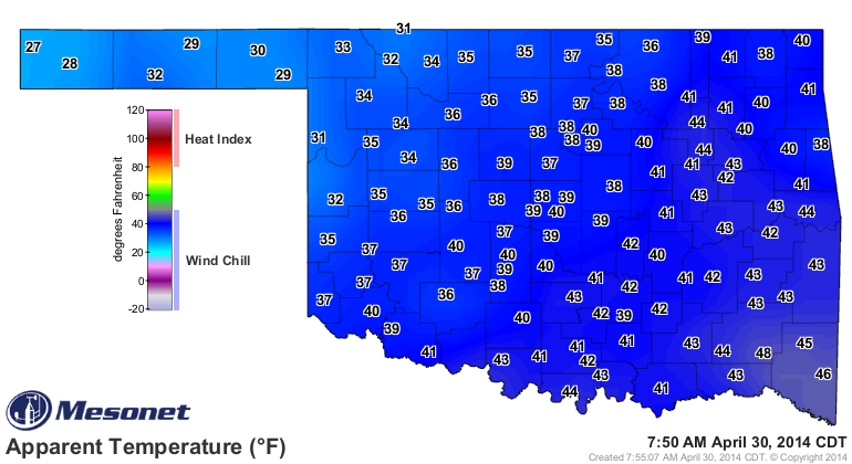
Add that wind, however, and it feels like freezing, or close to it.
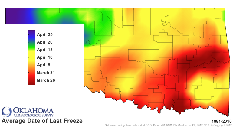
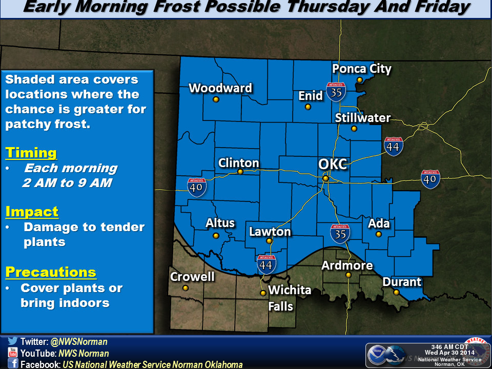
The Panhandle could see a freeze Thursday morning, but no biggie there. Still
close to the average last freeze of spring for that area, and well before the
latest spring freeze (both based on 1981-2010 data).


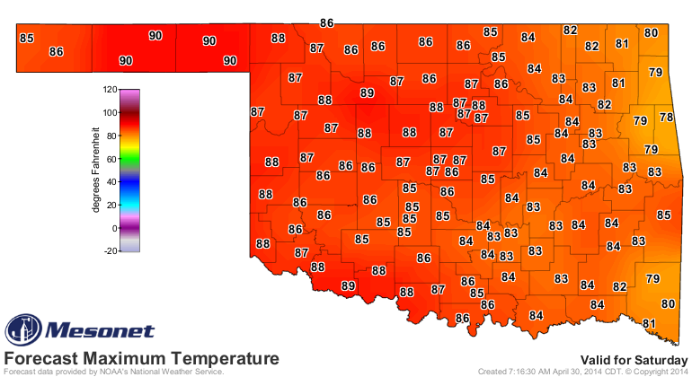
Summertime appears poised to strike later into the weekend with highs in the
80s and 90s across the state. Here's our early look at Saturday's high temps.
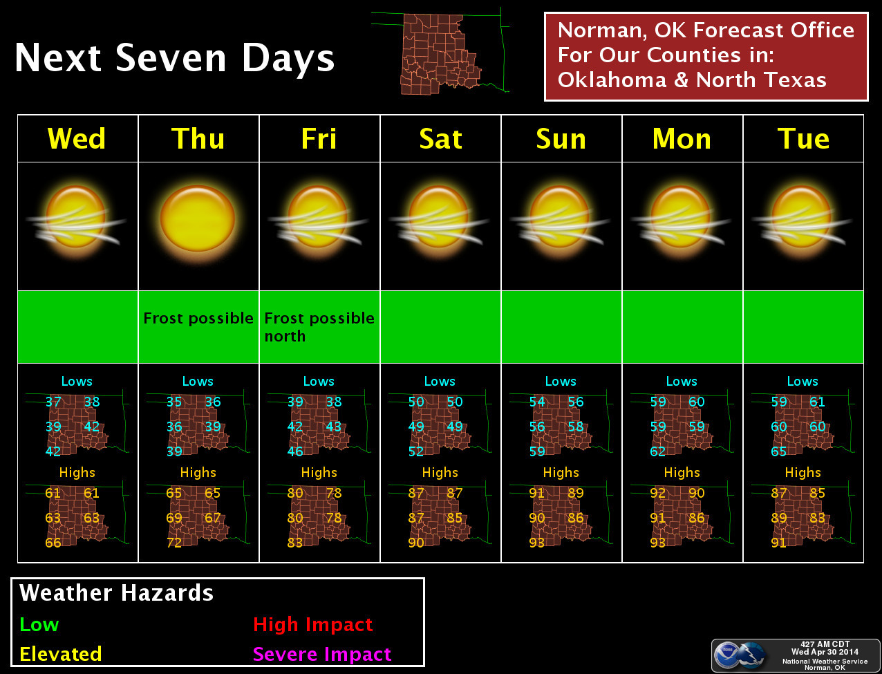
Here's an even better hint from the NWS office in Norman.
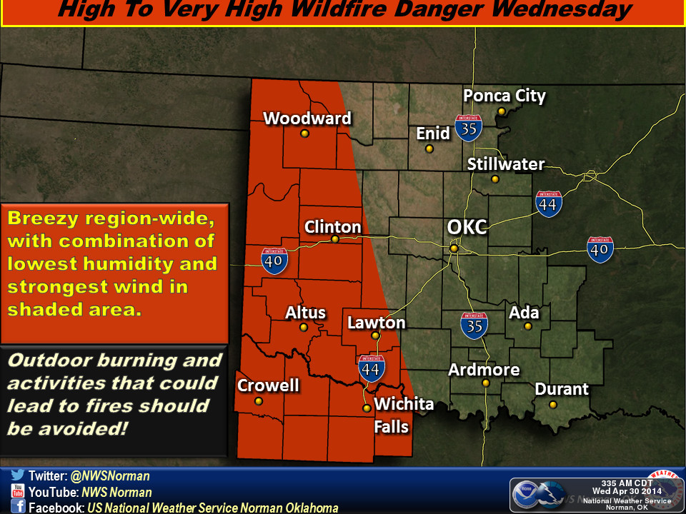
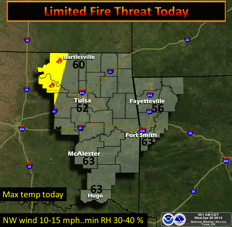
As for today, more wind, especially in western Oklahoma. Watch for gusts of up
to 40 mph out in the Panhandle again (which means more dust, no doubt, and
high fire danger).
And don't forget the threat of frost across northern Oklahoma over the next
couple of mornings.
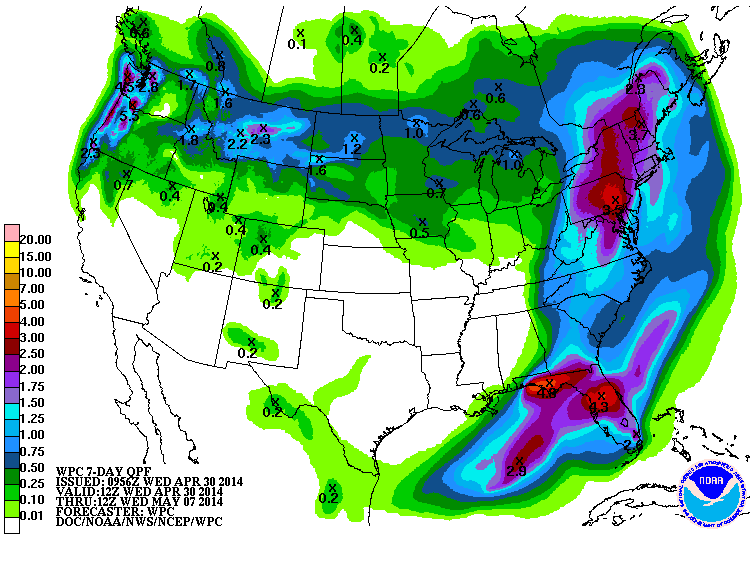
And the worst news for last, the chances for rain over the next seven days?
Zilch.
Let's hope that chances. Add those 90 degree temps to the mix coming up and
things are going to get even more desperate than they are now out west, with
or without wind (it's springtime in Oklahoma ... I'm guessing "with").
Gary McManus
State Climatologist
Oklahoma Mesonet
Oklahoma Climatological Survey
(405) 325-2253
gmcmanus@mesonet.org
April 30 in Mesonet History
| Record | Value | Station | Year |
|---|---|---|---|
| Maximum Temperature | 96°F | BEAV | 2013 |
| Minimum Temperature | 26°F | EVAX | 2017 |
| Maximum Rainfall | 6.12 inches | NOWA | 2019 |
Mesonet records begin in 1994.
Search by Date
If you're a bit off, don't worry, because just like horseshoes, “almost” counts on the Ticker website!