Ticker for April 23, 2014
MESONET TICKER ... MESONET TICKER ... MESONET TICKER ... MESONET TICKER ...
April 23, 2014 April 23, 2014 April 23, 2014 April 23, 2014
Severe weather is in the air!
In fact, there's bad weather on the rise (CCR kids ... google it). We turn today
towards the west as severe thunderstorms are possible across far western Oklahoma,
moving east through the night. All emphasis on "possible," of course. Here is the
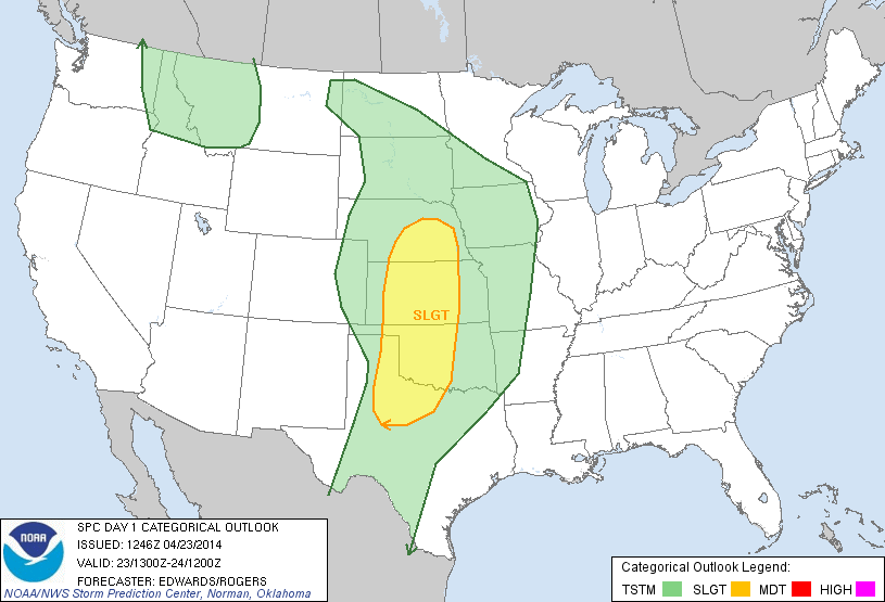
day 1 convective outlook from the Storm Prediction Center (SPC) showing the main
area of focus, as well as the categorical chances across the area for hail, severe
winds and tornadoes. Later, we'll let the local weather service offices better
pinpoint the risks and timing for us.
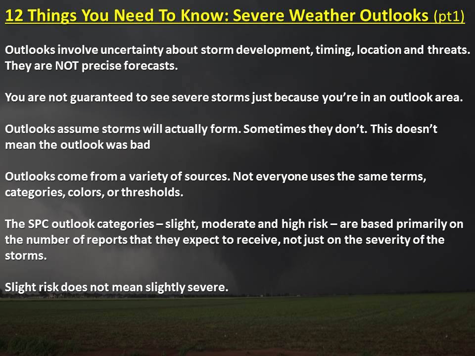
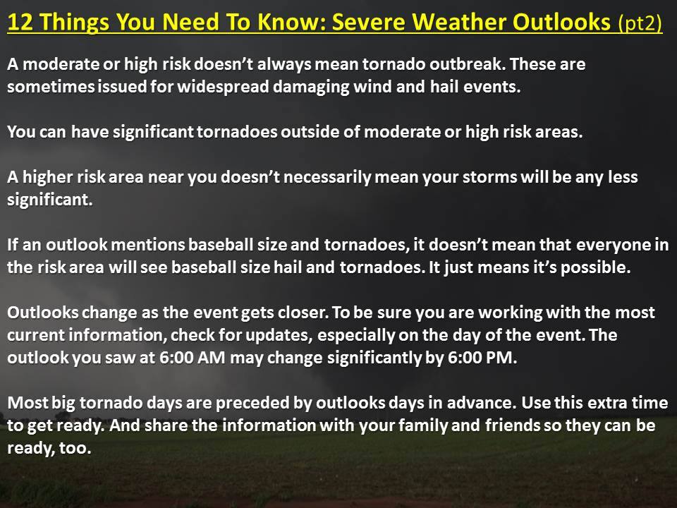
Before we look at the outlooks, here's a bit of information about outlooks and
how to use them from the Grand Poobah of severe weather warnings, NWS Norman
Warning Coordination Meteorologist Rick Smith.
Okay, onto the outlooks.
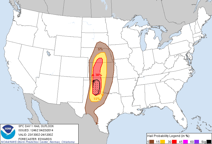
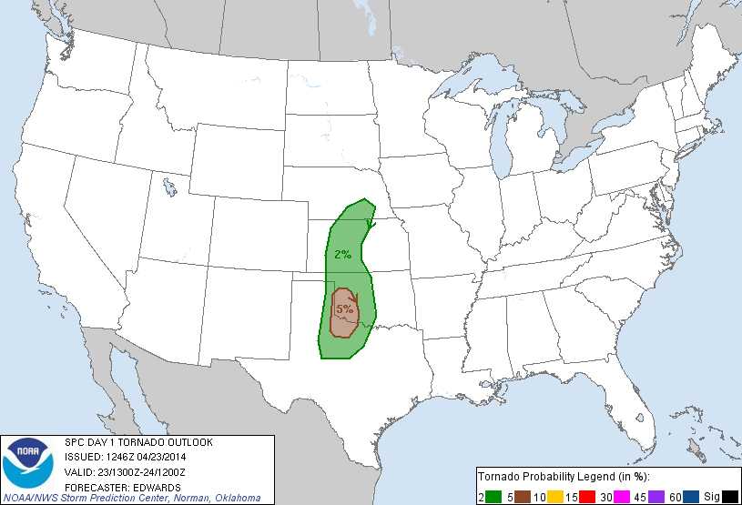
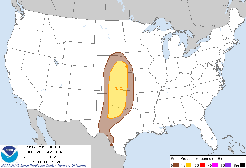
There is a slight chance for isolated tornadoes across west central and
southwestern Oklahoma, but there's a bigger chance of at least 2-inch diameter
hail (or larger) over that same area. So those together smell of isolated
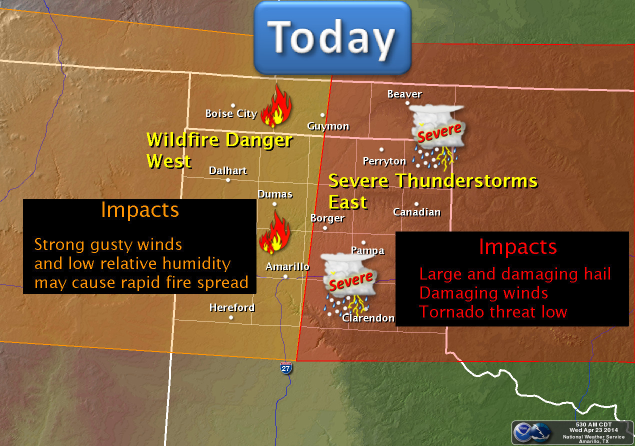
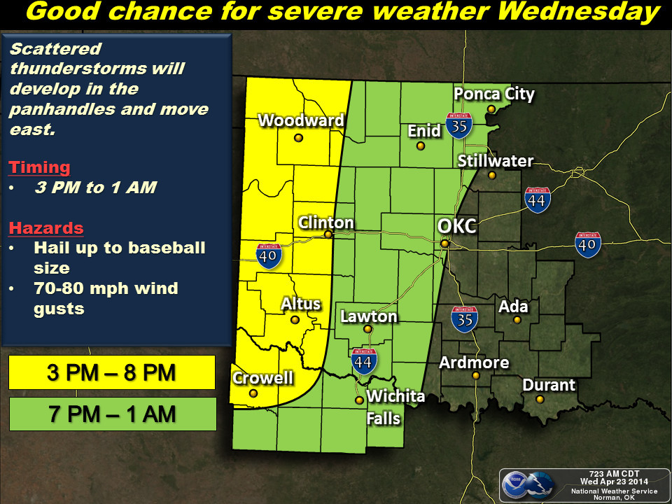
supercells. Here's what the local NWS offices in the area are saying about today's
severe weather chances.
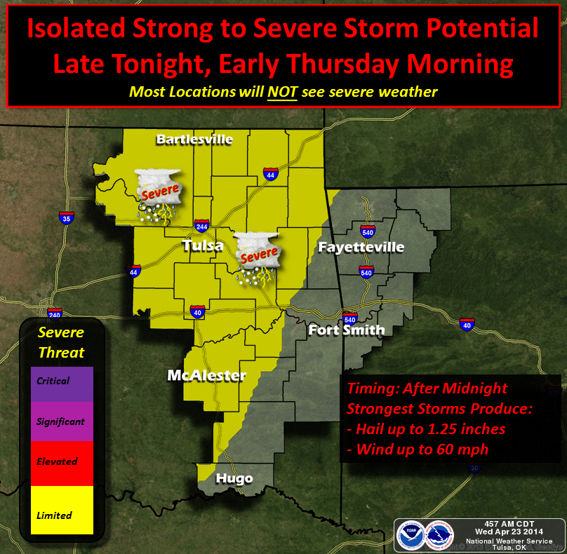
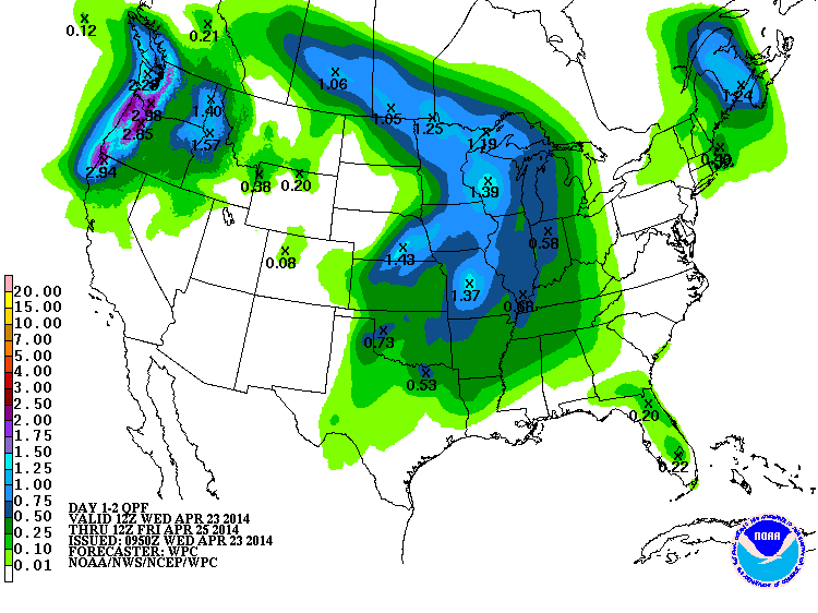
And here is the rainfall potential from those storms, at least as predicted by
the Weather Prediction Center. Remember, this is all based on where those storms
will fire and possibly move over the same area a time or two, so this is very
dodgy to say the least.
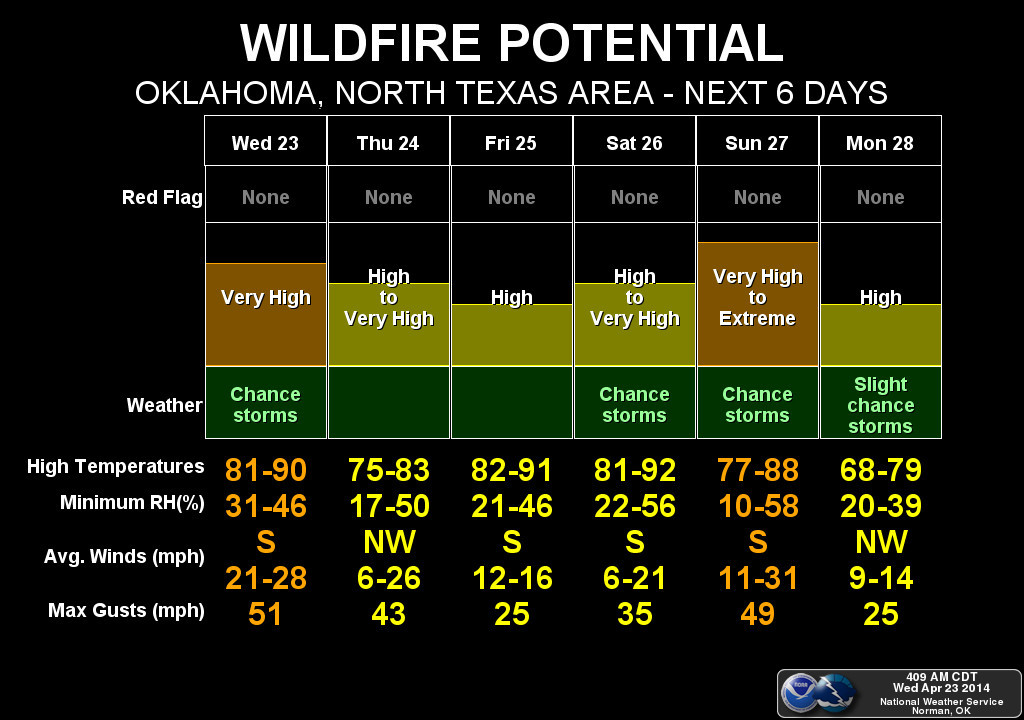
After that, we enjoy a couple of days of typical spring weather with highs in
the 70s and 80s and lots of wind. Fire danger will be high to extreme throughout
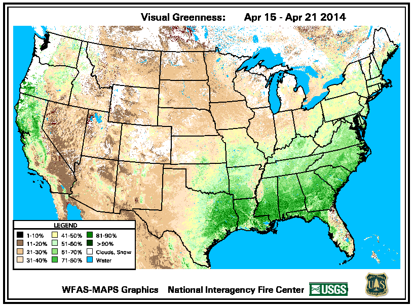
this week thanks to those conditions coupled with vegetation that has yet to
green up thanks to drought and cool weather. Don't believe me? Well, look how
NOT green it is this last week compared to what is "normal" for this time of
year (note: this does not bode well for the wheat crop) ... from the US Forest
Service based on satellite data. And the 7-day fire danger calendar from NWS
Norman.
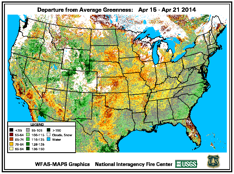
About that first satellite pic, that's not to say there isn't a lot of green
wheat out there. You can see that on the "regular" greenness map (i.e., what's
it look like right now). It's just that once you get out into that wheat, it
no longer looks so great. Too much bare ground showing through, again due to
both drought and cold weather.
Following those nice-ish couple of days, the severe weather threat kicks back up
for the weekend, and this looks like it could be more widespread significant
severe weather. The SPC shows us once again with their day 4-8 severe weather
outlook. Day 4 (D4) is Saturday, Day 5 is Sunday, so that would make Day 6
Monday, I believe (sharp as a tack!).
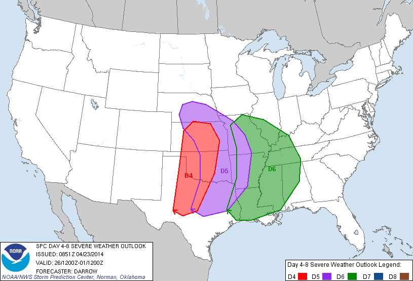
It's still a ways out there, so there is still lots of uncertainty. But here is
the SPC's thinking right now (their yelling, not mine):
"MODERATE TO EXTREME INSTABILITY SHOULD DEVELOP EAST OF THE DRYLINE
SATURDAY AFTERNOON ALONG ERN PLUME OF STEEP LAPSE RATES. STRONGLY
DIFLUENT FLOW ALOFT SHOULD ENCOURAGE VIGOROUS SUPERCELL DEVELOPMENT
FROM PORTIONS OF WCNTRL TX...NWD INTO KS. VERY LARGE HAIL AND
TORNADOES CAN BE EXPECTED WITH THIS ACTIVITY.
IT/S NOT ENTIRELY CLEAR HOW FAR EAST THE DRYLINE WILL MIX SUNDAY AS
LOWEST PRESSURES WILL REMAIN FOCUSED ACROSS THE HIGH PLAINS OF WRN
KS. MODELS MIX DRYLINE EAST OF I-35 CORRIDOR ACROSS OK BY 18Z
SUNDAY BUT THE DAY5 FORECAST WILL ACCOUNT FOR DRYLINE NOT MIXING
ACROSS THE PLAINS AS FAST AS MODELS CURRENTLY DEPICT. AS A
RESULT...SUBSTANTIAL MID-LEVEL FLOW SHOULD OVERSPREAD THE
MOIST/BUOYANT WARM SECTOR AND ANOTHER DIURNALLY-INITIATED ROUND OF
POTENTIALLY TORNADIC SUPERCELLS COULD EVOLVE."
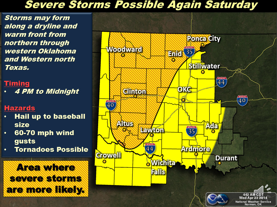
Translation? Somebody's about to seriously mess with this airport. No, wait, that
was John McClane's prediction in "Die Hard 2." Second try, watch for supercells
out west Saturday afternoon in the Panhandles region and then march east with
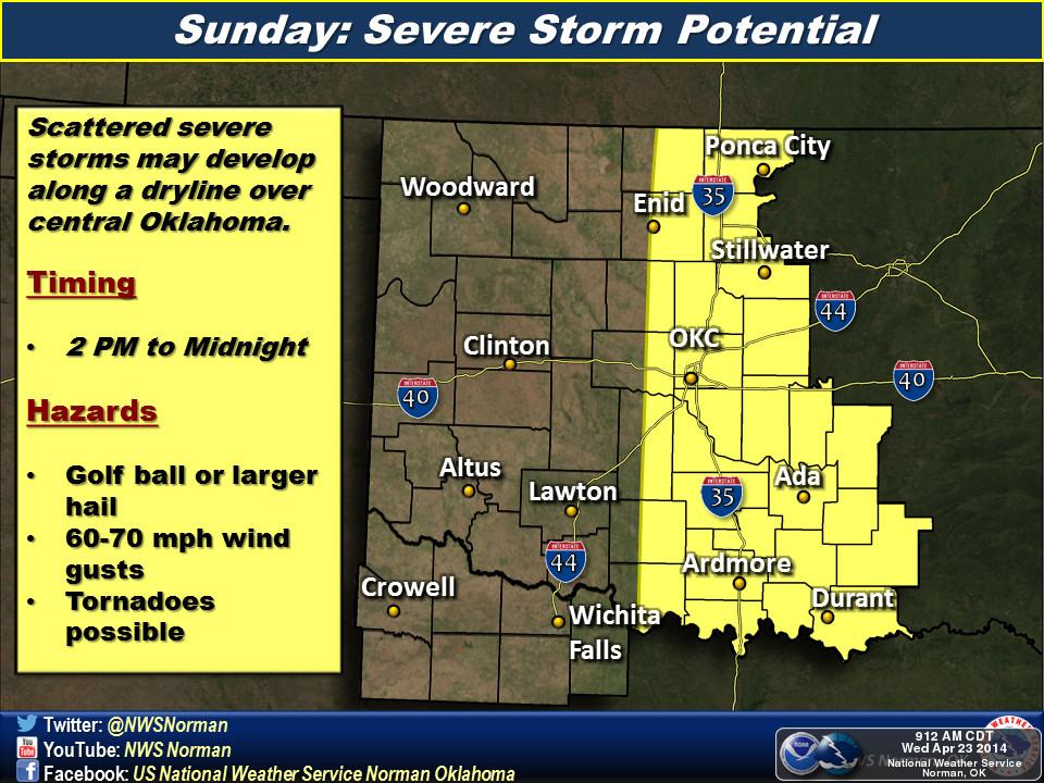
threats of tornadoes (and hail and straight-line wind, of course). Sunday, it
all depends on where that dryline is, how far it can advance before storms fire
and whatnot, so folks from western Oklahoma through the rest of the state should
keep an eye on the weather that morning. Monday, things SHOULD be east of us.
Clearing it all up with help from our friends across the hall at the NWS Norman
office:
Now while everybody else in the NWC is looking at the threats for tornadoes, I'm
licking my chops at the 7-day rainfall forecast. Yes, I'm the dullard that loses
focus in tornadoes (except when EF-5s are roaring through my neighborhood in
Moore) and thinks "how will this help the drought?". Here's the 7-day moisture
forecast from all of Mother Nature's foolishness.
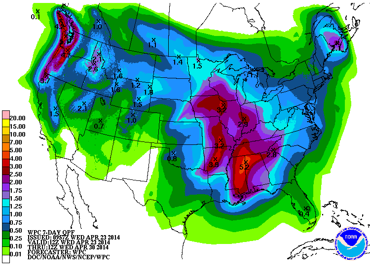
That half-inch or less forecast for SW and NW OK just ain't enough this time
of year. Normal for Altus over the next 7 days is 0.7 inches.
So there you have it, severe weather is indeed on the rise. The time to prepare
for tonight's possible severe weather was yesterday. Same for this weekend. So
do it now. Stay calm, keep your eye on the information from your local NWS office
and media outlet, and stay safe. If severe weather strikes, don't get the urge
to sneak a peek. Ignore that other CCR song:
"Doo, doo, doo, Looking out my back door."
Gary McManus
State Climatologist
Oklahoma Mesonet
Oklahoma Climatological Survey
(405) 325-2253
gmcmanus@mesonet.org
April 23 in Mesonet History
| Record | Value | Station | Year |
|---|---|---|---|
| Maximum Temperature | 97°F | HOOK | 2006 |
| Minimum Temperature | 17°F | BOIS | 2013 |
| Maximum Rainfall | 3.68″ | HOBA | 2019 |
Mesonet records begin in 1994.
Search by Date
If you're a bit off, don't worry, because just like horseshoes, “almost” counts on the Ticker website!