Ticker for April 17, 2014
MESONET TICKER ... MESONET TICKER ... MESONET TICKER ... MESONET TICKER ...
April 17, 2014 April 17, 2014 April 17, 2014 April 17, 2014
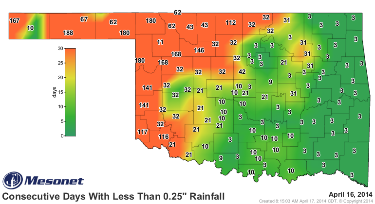
Rain, rain, glorious rain ...
We need it worse than the plains of Spain! I just made that up, if you couldn't
tell. I guess any time I see a map like this
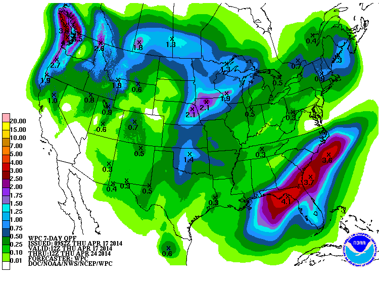
I get a bit giddy. Some of that will come today and into the night, and some
more on Easter Sunday and the Monday following, and maybe a bit more at the end
of the forecast period next Wednesday overnight into Thursday. The more that
falls today and then this weekend the better off we'll be, because those rains
out to seven days are a bit iffy, just as the forecast sometimes is. It doesn't
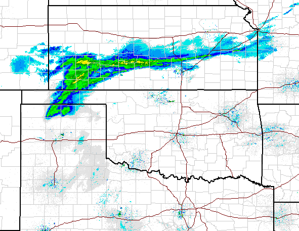
look like much out there right now, but at least there appears to be moisture
falling in the Panhandle.
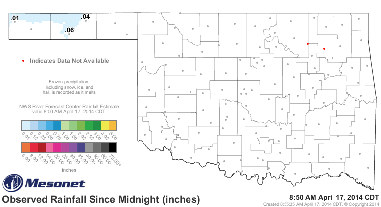
I see that Goodwell and Hooker have started to really rack up the inches (okay,
hundredths) of rain since midnight.
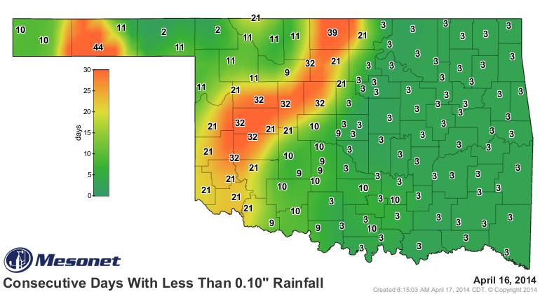
Heck, maybe they'll get enough to reset these maps??
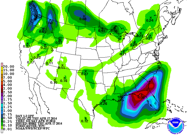
In actuality, this will just be a dust-settler. Here you can see the amounts
forecast for just this storm ... about a quarter-inch or so up in the northwest.
However, that is significant as you can tell from those previous "days without"
maps I showed you. As said previously, the Easter storm might be the best
soaker.
Every bit helps, especially when you're dealing with maps like this, the percent
of normal rainfall maps for the last 30 days, the calendar year thus far, and
since Oct. 1, 2013.
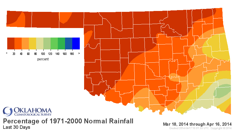
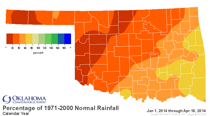
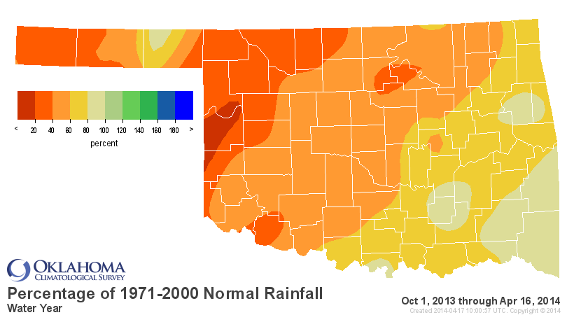
Lots of unwanted red and orange there, and it ain't even Bedlam. The statewide
average precipitation total for the year thus far is 3.34", 4.77" below normal
which ranks the period as the 4th driest since 1921.
Due to those deficits, and for the reasons we stated yesterday, we have been
asking the federal U.S. Drought Monitor author to slowly up our drought
designations over the last three months, and this week was no different.
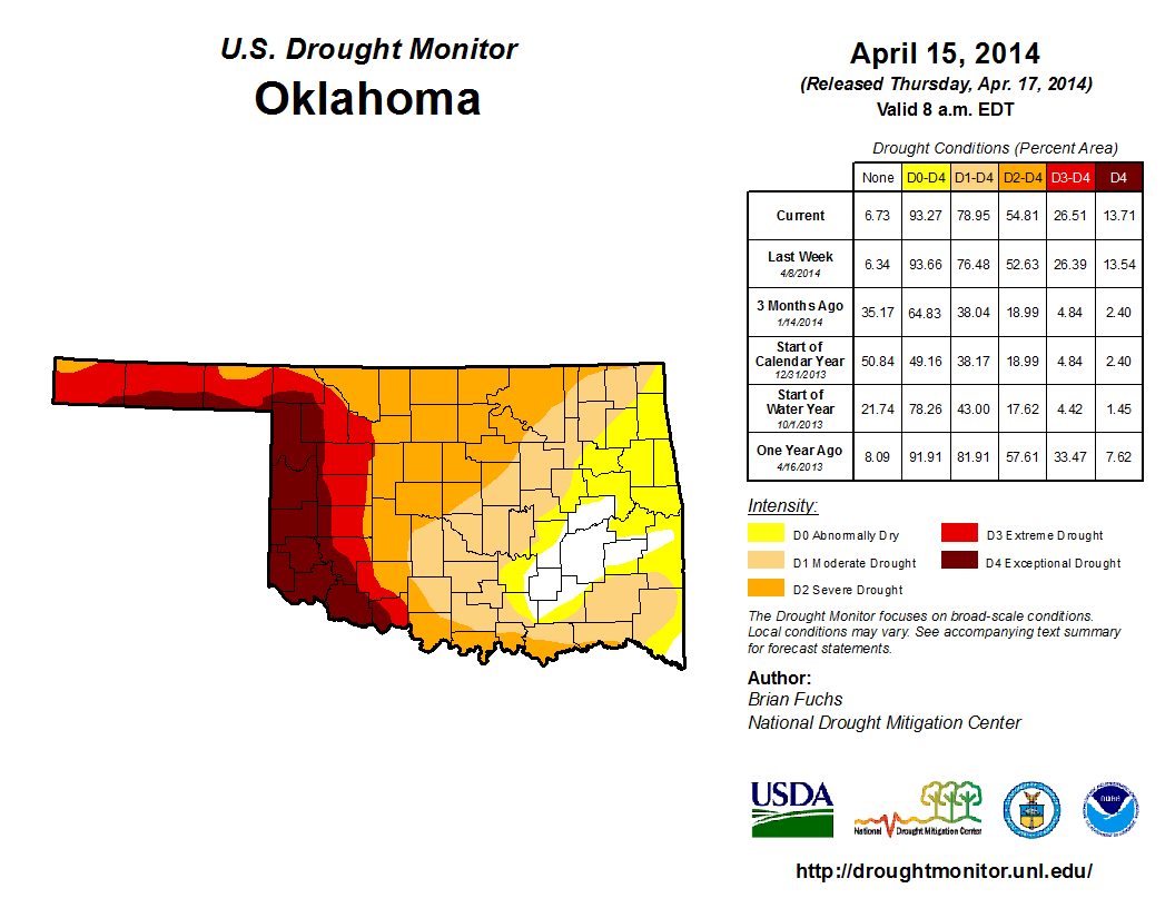
At least the differences were a bit more slight this week. The biggest change
was the intensification of moderate (D1) drought along the Red River to severe
(D2) drought, which changes the percentages slightly. We also saw a tiny sliver
of improvement down across far SE McCurtain County. Now we get to wait for
these next two storm systems and see how next week's map will change. I'm hoping
for at least some improvement across northern Oklahoma.
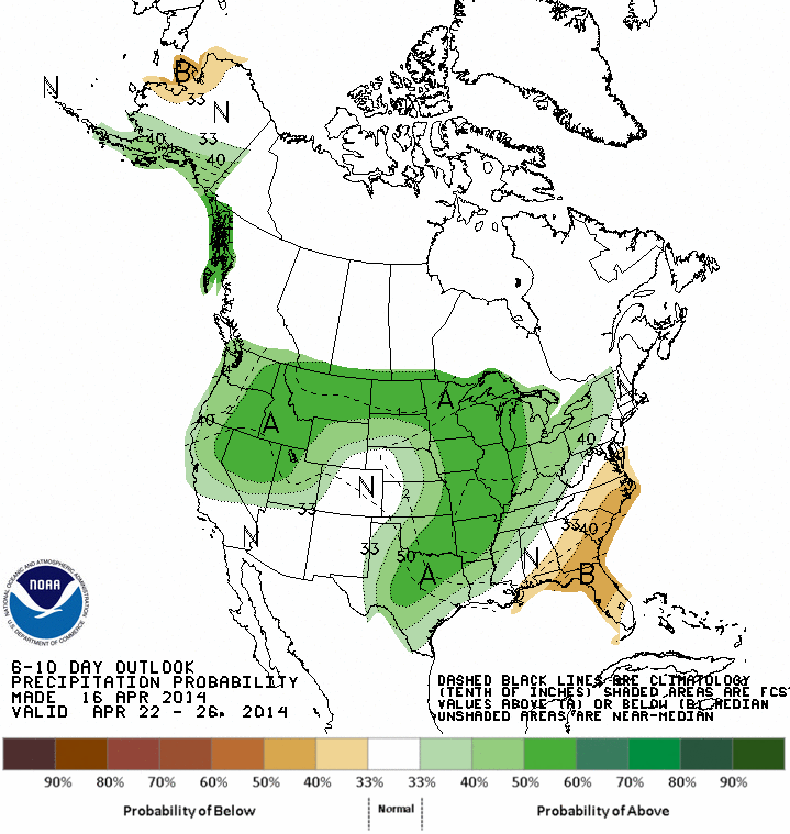
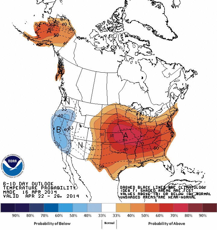
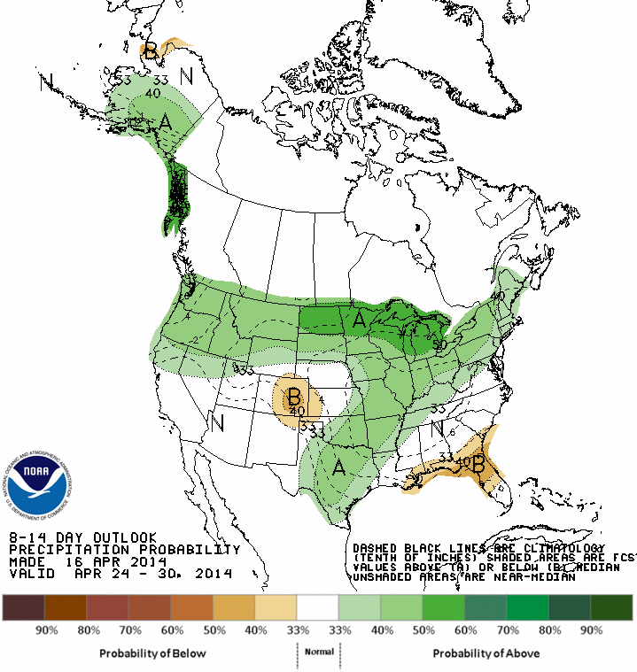
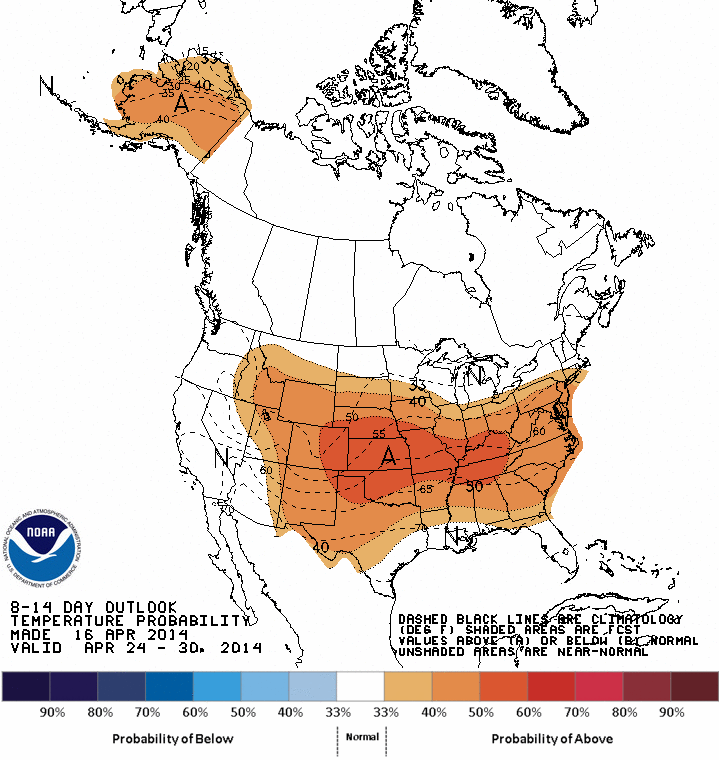
The 6-10 and 8-14 day outlooks from CPC seem to indicate we might be in for some
more warm and wet weather for the last week of the month, which would be a great
finish to a sorta dismal April thus far. Remember, these show the odds of
above-, below- or near-normal precipitation and temperature values, not
specific amounts. So the darker green does not necessarily mean that's where
the heaviest precip is expected to fall, just that the probabilities for above
normal amounts are greatest in those areas. It could be somewhat inferred that's
where the heaviest stuff will fall, but that's not always the case.
April 22-26 Outlooks
April 24-30 Outlooks
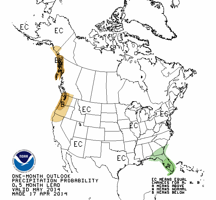
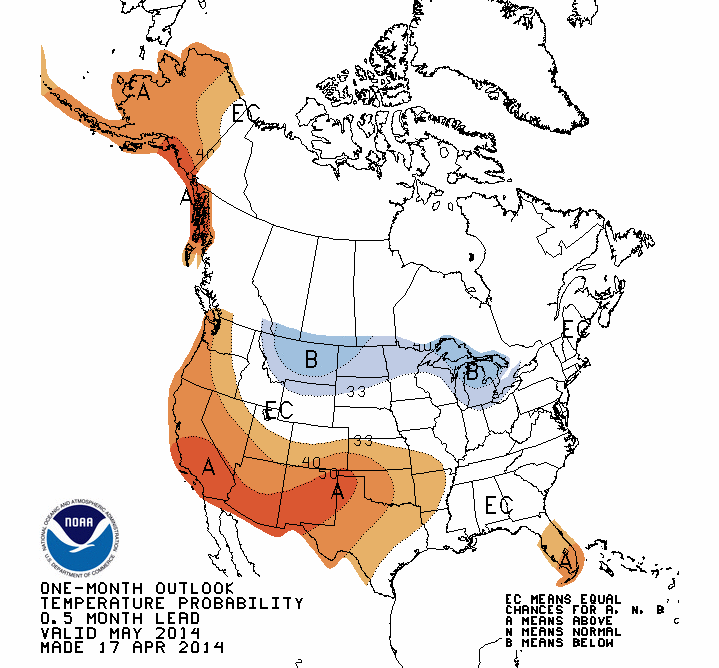
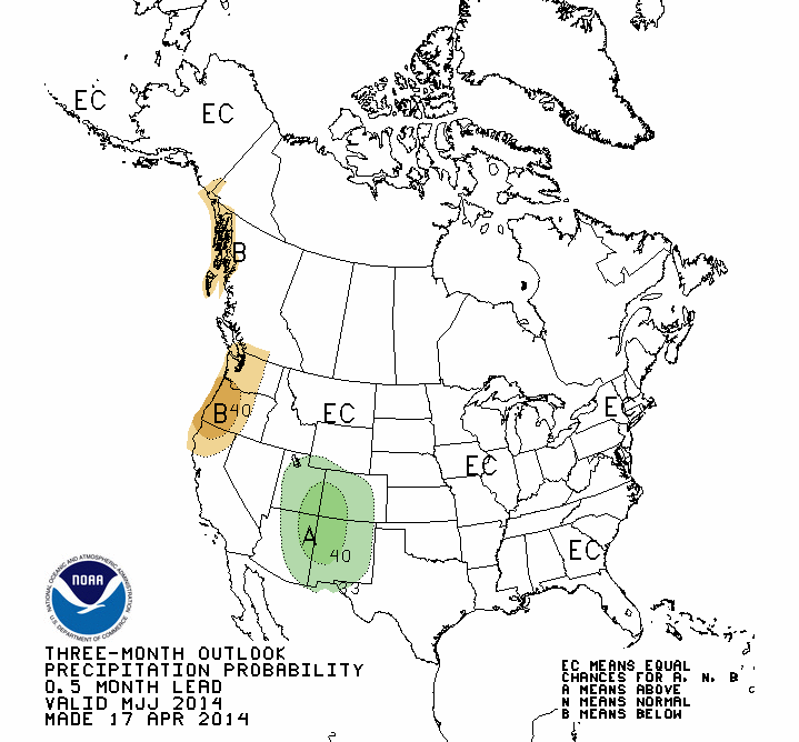
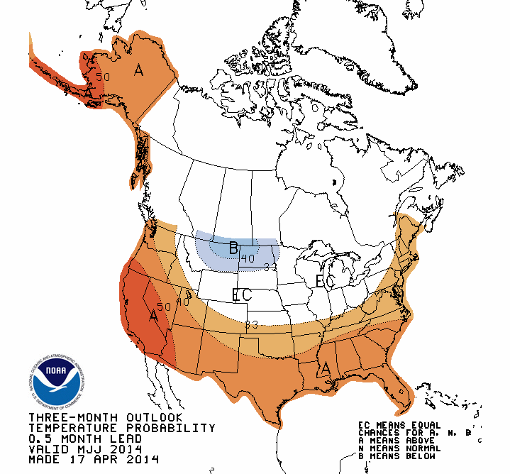
CPC also released their May and May-July outlooks this morning. The temperature
outlooks look warm for both periods and the precipitation outlooks are
non-committal. Remember, the "EC" in the precip outlooks over Oklahoma mean
"Equal Chances," meaning the forecasters see equal chances of above-, below-
or near-normal moisture amounts. IT IS NOT A FORECAST OF NORMAL!! It's basically
a punt.
May Outlooks
May-July Outlooks
Given those outlooks, the U.S. Seasonal Drought Outlook for today through the
end of July is a somewhat familiar looking picture with drought persisting
through that period across western Oklahoma, drought remaining but improving
across north central Oklahoma and drought removal with no development where
it doesn't currently exist across the rest of eastern Oklahoma.
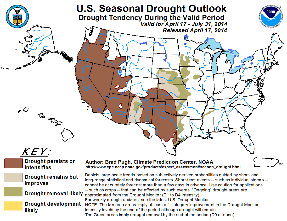
What the forecaster is basically saying there is that even with normal seasonal
rainfall amounts, the drought is too deeply entrenched to be improved at the
end of July across western Oklahoma, but enough to show at least some improvement
or removal across eastern Oklahoma. But there is a caution that if it is warmer
than normal like the seasonal outlook suggests, then drought could intensify
if we get below-normal or even normal rainfall.
I vote for rain. Who's with me??
Gary McManus
State Climatologist
Oklahoma Climatological Survey
Oklahoma Mesonet
(405) 325-2253
gmcmanus@mesonet.org
April 17 in Mesonet History
| Record | Value | Station | Year |
|---|---|---|---|
| Maximum Temperature | 102°F | GRA2 | 2006 |
| Minimum Temperature | 22°F | BOIS | 2020 |
| Maximum Rainfall | 6.57″ | MEDI | 2013 |
Mesonet records begin in 1994.
Search by Date
If you're a bit off, don't worry, because just like horseshoes, “almost” counts on the Ticker website!